Oberwiesenfeld
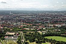
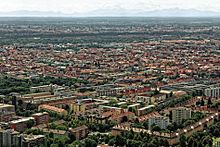
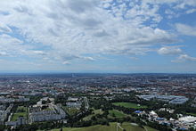
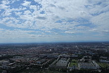
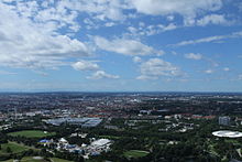
The Oberwiesenfeld is an area that lies in the area of the Munich districts Milbertshofen-Am Hart , Schwabing-West and Neuhausen-Nymphenburg and whose name is said to come from Wiesenfeldt , which was first mentioned in 1792 . The area previously served as an artillery training area , parade ground and barracks area , from 1909 it was also used as an airfield . During the Nazi era , in connection with the marshalling yard planned further north-west, there were unrealized considerations to build a new freight yard with a wholesale market hall, slaughterhouse and cattle yard, and a thermal power station. The Munich Olympic Park has been located on the northern (and largest) part of the Oberwiesenfeld since 1972 .
location
In today's urban area, the former Oberwiesenfeld can be located on the basis of larger streets as follows: Dachauer Strasse and Lothstrasse form the southern end, and Am Oberwiesenfeld / Moosacher Strasse forms the northern end . Landshuter Allee ( B 2 R / Mittlerer Ring ) represents the western edge , while Schleißheimer Strasse or Winzererstrasse and Lerchenauer Strasse form the border in the east .
Historically, parts of the Oberwiesenfeld belonged to the tax communities of Milbertshofen, Nymphenburg, Neuhausen and Schwabing. As part of the redistribution of the urban area into districts, it was assigned to the then 21st district, which was later named Neuhausen-Oberwiesenfeld - the eastern border to the Schwabing-West district was Winzererstraße, while Lothstraße formed the southern border to the Maxvorstadt district . As part of the restructuring of the Munich city districts, the entire city district of Neuhausen-Oberwiesenfeld was assigned to the city district of Neuhausen-Nymphenburg in the first phase in 1992. In the second phase, the Oberwiesenfeld was largely assigned to the district 11 Milbertshofen-Am Hart in 1996 . The area Dachauer Straße - Nymphenburg-Biedersteiner Kanal - Spiridon-Louis-Ring - Ackermannstraße - Schwere-Reiter-Straße belongs to the district 9, Neuhausen-Nymphenburg and the area Ackermannstraße - Schwere-Reiter-Straße - Infanterie-Straße - Lothstraße - Winzererstraße to District 4, Schwabing-West .
Since the name of the Olympic site was determined by the Munich City Council, the field name Oberwiesenfeld is only present in a few names:
- in opened on October 28, 2007 oberwiesenfeld the U3 Moosacherstrasse at the Lerchenauerstraße corner street,
- in the Am Oberwiesenfeld area with the street of the same name, to which an exit of the subway station leads,
- in the student quarter Oberwiesenfeld ,
- in the CSU local association CSU Neuhausen-Oberwiesenfeld and
- in the Ballpark Oberwiesenfeld on Moosacher Strasse, venue of the Munich Caribes .
- The Olympiazentrum underground station, which opened on May 8, 1972, had two places on the wall of the station with brackets (Oberwiesenfeld) until 2007.
- in the main collecting canal Oberwiesenfeld and in the rain retention basin Oberwiesenfeld.
Military site
The wasteland of the Munich gravel plain , which was located between Dachauer Strasse and Georgenschwaige (Milbertshofen) and had been used as a training area by the Bavarian electoral artillery units since 1784 , was officially designated as an "artillery experimentation area" in 1794. Farmers from Neuhausen and Feldmoching had previously used the Oberwiesenfeld for cattle farming, which was banned from 1794.
Despite an electoral decree of 1796, the practice area was not precisely delimited. In the area between Maßmannstrasse and Schwere-Reiter-Strasse there was an artillery range about 700 feet long. In 1804, the shooting range was expanded to 1,400 feet through the purchase of land. At the beginning of the 19th century, building work on the practice area began. A powder house was built in 1803, and a total of three sheds for the artillery carts followed in 1806 and 1810 . A storage shed for "artillery wood" - high-quality wood for mounting the carriage - was built in 1812. A fourth shed was built in 1816, as was a wall connecting all five buildings. In the courtyard that was created in this way, a "ball garden", ie a store for cannon balls, and a gun park were set up.
Until 1820, the artillery was the only type of troop exercising on the Oberwiesenfeld, while cavalry and infantry used the parade ground on the Marsfeld . The line tactics common in the 18th and early 19th centuries did not require targeted individual shooting, so that there were no exercises in targeted shooting. This changed after the coalition wars , so that from 1820 the Bavarian line infantry practiced target shooting on the Oberwiesenfeld.
After a new saltpeter depot was built in 1822 , the Oberwiesenfeld practice area no longer offered enough space for drills. Therefore, in 1824, the war ministry again bought neighboring land. This year the space covered an area of 168 days' work (1 day work was equivalent to 3,408 m² in Bavaria).
In 1826 the military swimming pool was opened for teaching purposes on the Nymphenburg-Biederstein Canal, which was opened to civilians for self-financing as early as the middle of the 19th century and whose location was at the level of the western part of today's Olympic Lake. The area of the swimming pool can now be recognized by a parallel row of trees that stand along the filled pool.
On May 16, 1835 around 3:30 p.m., an explosion shook the Oberwiesenfeld, the pressure wave of which, according to contemporary witness reports, shattered the windows in Türkenstrasse and covered part of the roof of the Frauenkirche . The artilleryman Stanislaus Schmitt had blown himself up with 15,000 kg of black powder in the powder tower. Nine other people who were on the site at the time of the explosion died with him. Schmitt wanted to take his own life because of bad treatment by a superior and to drag as many people as possible with him to their death. The day he had chosen for his attack coincided with a planned teaching demonstration for the cadet corps , which had only been canceled at short notice due to the commander's illness. The new powder magazine was built north of the village of Milbertshofen.

At the end of August 1850, a military camp was temporarily built on the Oberwiesenfeld due to a lack of capacity in the other barracks.
The next expansions of the Oberwiesenfeld took place in 1863 and 1864. In 1865 the practice area was about 2 km² (609 days of work). Since the artillery had a separate training area with the Lechfeld camp since 1862 and the infantry received a new firing range in Neufreimann next to the Marsfeld from 1882, the limits of the training area on the Oberwiesenfeld remained unchanged from 1865 to 1888. In 1866 the Munich armory of the Bavarian Army was relocated to Oberwiesenfeld. At the end of the 19th century, several barracks for the Bavarian army were built on Oberwiesenfeld , which made it necessary to enlarge the military area. In detail it concerned the:
- Railway barracks (built 1888/89)
- Barracks element Oberwiesenfeld (built from 1893)
- Airship barracks (built 1893-1896)
- Prinz-Leopold-Kaserne (built 1902)
Since 1898 there was also a training forge on the area of the Oberwiesenfeld. The expansion carried out in 1888/89 expanded the military area, which later became known as the Oberwiesenfeld military training area , by 94,705 hectares over the Nymphenburg-Biederstein Canal to over Moosacher Strasse. Around 1900 the military prison is said to have been relocated from the city to the Oberwiesenfeld. The artillery workshops on Oberwiesenfeld were among the largest industrial companies in Munich around the turn of the century and employed around 1,000 civilian workers .
Before 1900, a tram station was built on the southern part of the area between Dachauer Strasse and Heßstrasse - north of the administration building erected at the time of King Max II at the corner of Lothstrasse and Dachauer Strasse.
By 1923, as part of the expansion work for the pioneer and motorist barracks, the railway barracks was enlarged so that it was located on an area between Dachauer Straße and Hessstraße, which at that time ran over Schwere-Reiter-Straße to the canal, with a northern border at the level of the continuation of the Ebenauer Strasse and a southern border on the south of today's Hedwig-Dransfeld-Allee to the railway line leading from Dachauer Strasse to Heßstrasse at that time. Later than 1935, the area north of the continuation of Ebenauer Strasse to Melcherstrasse, which formerly ran south of the canal from Dachauer Strasse to Lerchenauer Strasse, was also built on. On the area between today's "Hedwig-Dransfeld-Allee" and today's Willi-Gebhardt-Ufer is the Bundeswehr administration center and the district military replacement office.
From 1919 the buildings of the Munich-Oberwiesenfeld building cooperative were erected in several construction phases in the area Saarstrasse - Deidesheimer Strasse - Ackermannstrasse - Winzererstrasse .
In 1921, in the corner area of Kanal - Lerchenauer Straße - Winzererstraße, the sports club FC Teutonia opened a soccer field that could hold up to 12,000 spectators and on which FC Bayern Munich played its games from 1923 to 1925 . In 1936 the sports field had to be given up in favor of the military.
Airfield

Since the end of the 19th century, the Oberwiesenfeld was a landing pad for balloons and airships , both military and civilian ones of the royal Bavarian army. With the increased number of aircraft , the Oberwiesenfeld was used as an airfield from 1909 . In 1909 the Reichsmilitary airship SM Zeppelin I landed there, which had passed its first "long-distance journey".
Due to the simultaneous use of the site as an airfield and parade ground, take-offs and landings took place alongside and during the cavalry exercises until a runway was laid out in 1925. In 1927 the city of Munich received the planning order for the expansion of the existing airfield into an airport “1. Order "issued and the area divided along the Nymphenburg-Biederstein Canal:
- The part to the north of the canal became the airport and
- the part south of the canal remained the parade ground in Oberwiesenfeld.
In 1929 the first buildings, initially made of wood, were built for passengers and cargo, later a new hangar was put into operation. Before it was opened, the aircraft had to be transported to the special airfield in Oberschleißheim for maintenance work . On May 3, 1931, the new handling and administration building was inaugurated by the Mayor of Munich, Karl Scharnagl , and almost 100,000 visitors attended a major flight day. This made the Oberwiesenfeld Munich's first fully-fledged commercial airport , located on the street that was then named after Otto Lilienthal and north of the canal running parallel to the canal. In 1932, around 16,000 passengers were handled in Oberwiesenfeld, and in the next five years the number of annual passengers tripled to around 40,000 passengers a year. Oberwiesenfeld Airport was replaced by Munich-Riem Airport in 1939 . In the last year of operation - 1938 - 49,156 passengers were handled on the Oberwiesenfeld. This also included the French Prime Minister Édouard Daladier (1884-1970) and the British Prime Minister Neville Chamberlain (1869-1940), who ended up there to sign the Munich Agreement . After the relocation to Munich-Riem Airport, which opened in October 1939, the area was used by the Air Force until the end of the war . This was followed by the US Army as Airfield R.74 from 1945 to 1957 , and major flight events were allowed to take place in 1954 and 1955. The subsequent private flight operations were finally discontinued in the course of the expansion of the site into the Olympic Park . The last aircraft took off in March 1968. At that time, ongoing discussions began about a new location for private pilots. The former airport building was used by American radio stations such as Radio Free Europe and Radio Liberty after the Second World War until it was demolished on August 14, 1968 . In addition to flight operations, the construction machinery trade fair (Bauma) was held annually in the southern section from 1954 to 1967 , and was organized by the Munich trade fair company from 1966. Even before the Olympic Games were awarded to Munich, the later Olympic Ice Sports Center , which was converted for boxing events in 1972, was built as an ice rink on Oberwiesenfeld between 1965 and 1967. In addition, the second pre-Olympic building was the television tower, which opened on February 22, 1968 . Shortly afterwards, in the spring of 1968, work began on expanding and redesigning the Oberwiesenfeld as the venue for the 1972 Summer Olympics.
In the north-eastern area of the site there were barracks buildings in use until 1969 at Lerchenauer Straße 115, which in November 1939 housed acceptance point 3 for officer candidates for the Air Force . From 1958 to 1969 , the anti-aircraft missile group 34 was stationed in the buildings, which were then called Kaserne München-Oberwiesenfeld . After 1969, the site with today's Olympic Village (Munich) was built .
Parade ground
Area between today's Ackermannstrasse, Winzererstrasse and Schwere-Reiter-Strasse ( Am Ackermannbogen )
To the west of the Prinz-Leopold barracks on Schwere-Reiter-Straße , the Kradschützen barracks were built from 1934, and in 1935 to the north of the Prinz-Leopold barracks and west of the Munich-Oberwiesenfeld building cooperative the Korpsnachrichten or Saar barracks. The Bavarian freedom campaign started from there in April 1945 . After the Second World War, the US Army corps news barracks and motorbike rifle barracks were initially occupied as Jensen barracks and Indiana depot, respectively . From 1955 the Bundeswehr moved in . The Indiana Depot was named Stetten-Kaserne , the Jensen Kaserne was now called Waldmann-Kaserne . To the north of the Stetten barracks, on Ackermannstrasse opposite the Spiridon-Louis-Ring, an open space was used as a gravel bus parking lot especially for events in the Olympic Park. In addition, a theater tent was erected on part of the open space from the 1980s. In 1994 the Bundeswehr cleared the Stetten barracks and in 1995 the Waldmann barracks. Subsequently, urban development planning began for the area under the name Am Ackermannbogen , including parts of the Prinz-Leopold-Kaserne, of which the two three sections are currently completed. After the construction of the first section in the north-east of the site had begun, the building of the Military Geography Department ( Milgeo ) was also given up by the Bundeswehr. In 2006/07 the former barracks buildings of the Stetten barracks were torn down, whereupon the fourth section next to the student dormitory on Schwere-Reiter-Straße - after the development plan was decided by the Munich City Council in December 2009 - was completed by 2016. The biotope at the Ackermannbogen is one of the last stocks of the Altheide of the Oberwiesenfeld.
Area between today's Ackermannstrasse and today's Olympiasee
In 1941 the Nordmolkerei (around the Deller after the long-standing operating company) was built on Winzererstrasse south of today's Olympiaberg, which was abandoned in the 1990s and built with 10 town villas between 1999 and 2002 due to the project living on Olympiaberg .
The Oberwiesenfeld was next to the Neuhofener Berg and the Luitpoldhügel one of the three large rubble dumping areas for the rubble of the houses in Munich that were destroyed in the Second World War . After 1945, a rubble hill consisting of two parts was built on the southern edge of the parade ground next to the northern dairy. Its higher part reached the height of 55 meters in 1950, where the cross that still exists today stands. This mountain of rubble was redesigned, enlarged and raised to 60 meters when the Olympic Park was built.
Between the residential blocks of the Munich-Oberwiesenfeld building cooperative and the buildings of the Nordmolkerei, the allotment garden NW 30 was laid out in 1946 , from which plots were moved to the western edge during the construction of Ackermannstrasse as a continuation of Karl-Theodor-Strasse to Schwere-Reiter-Strasse. As part of the initial planning for the development of the Nordmolkerei site, part of the allotment garden, including the associated restaurant at the Olympic Tower, was to be given up in favor of buildings along Winzererstraße.
Area northwest of Ackermannstrasse (coll. Olympiapark Süd)
After the "German Sand Track Championship" took place on the Oberwiesenfeld as a motorsport event as early as 1950, the stadium of the Association of Bavarian Motorsporters opened on March 9, 1951 on Schwere-Reiter-Straße, north of today's tram turning loop west of the small Olympic mountain, east of the railway barracks ( BBM) on a site originally belonging to the Free State of Bavaria. Sand track races were held there until 1970 and speedway races between 1958 and 1970 - nothing of the track used for this purpose has been seen since the fence was built in 2008. Since 1955 the stadium has been used as a sports field by the sports club FC Teutonia . Since the 1980s at the latest, the sports field has also been used for school sports and a section of the stadium has been converted into an urban outdoor sports area since the mid-1990s. The rampart around the site is mapped as a poor grassland as biotope M116 .
The building to the west of the BBM Stadium, originally built as a military district horse hospital, became the branch of the veterinary faculty of the Ludwig Maximilians University in the 1940s . Due to the destruction at the location on Koeniginstrasse in January 1945, the home horse hospital 105 was the location of the Institute for Animal Pathology and the Surgical Veterinary Clinic until May 1950. Between 1964 and 2009 they were the seat of today's chair for animal welfare, behavior, animal hygiene and animal husbandry, which still uses the building complex that was last expanded in 1990.
To the north of the BBM site is the open-air site, which is divided into two halves by a path running west from Spiridon-Louis-Ring. The summer tollwood has been taking place on the southern part since 1988 and the Lilalu has been taking place since 1997 , with the East-West Church of Peace, built in 1952 as a black building, located within the sub - area. In the area of the northern part, the rain retention basin on Oberwiesenfeld was built in the 1970s , which extends to the road south of the Olympiasee and, like the Olympiaberg, belongs to the M115 biotope and which is said to have been a location in a film with Georg Schimanski .
To the west of the rainwater retention basin are the buildings of the former Olympic building center , which were erected in 1968 and are still used by the Montessori school.
South of the BBM stadium, on the north-west side of today's tramway loop, the theater tent at the castle was built after 2000. Its original location was on a gravel area on Ackermannstraße opposite Spiridon-Louis-Ring, which was also used as a parking lot .
After the development of the area of the Veterinary Faculty and the area between Emma-Ihr-Strasse and the access road to the Veterinary Faculty under the name Mediendorf M 2018 had already been planned for the application for the Winter Olympics , the Stadibau Gesellschaft For the state employee housing in Bayern mbH (subsidiary of the Free State of Bavaria) a development with up to 600 apartments in several construction phases announced.
Area between Schwere-Reiter-Straße, Dachauer Straße and Nymphenburg-Biedersteiner Kanal - to the west of the South Olympiapark
This sub-area is divided into the area north and south of Hedwigs-Dransfeld-Allee.
- In the area between the Nymphenburg-Biedersteiner Canal , on the south side of which the Willy-Gebhart-Ufer represents the borough boundary between Neuhausen-Nymphenburg and Milbertshofen-Am Hart, and the Hedwig-Dransfeld-Strasse is the Bundeswehr administration center and other military uses. The listed buildings of the former barracks are located along Hedwig-Dransfeld-Allee. In terms of urban planning, this area is regulated by the development plan 1009a.
- In the area south of Hedwig-Dransfeld-Allee, in the area of today's Goethe-Institut and the state Gertrud-Bäumer-Schule, the site of the former railroad barracks up to Anita-Augspurg-Allee / Rosa-Luxemburg-Platz was redesigned by the year 2000 and other office buildings and apartments were built. On the part of the former railroad barracks in the area between Dachauer Straße, Anita-Augspurg-Allee - Rosa-Luxemburg-Platz - Emma-Ihr-Straße - Schwere-Reiter-Straße - owned by the Free State of Bavaria - is the new building for the A judicial center at Stiglmaierplatz in Munich-Maxvorstadt is planned, for which the contaminated sites discovered during the preliminary construction work - presumably from the use of the site by the US Army after the Second World War - had to be disposed of and should be completed by autumn 2022.
Area south of Schwere-Reiter-Straße (former artillery workshops and former barracks barracks)
The eastern part of the barracks in the Geviert Infanteriestraße - Barbarastraße - Elisabethstraße - Winzerer- / Lothstraße was given residential and commercial development in the 1950s and 1960s and the current area used by the Munich Federal Police Department. From this part of the former barracks, there are still listed buildings on the corner of Elisabethstrasse / Theo-Prosel-Weg and on the corner of Lothstrasse / Winzererstrasse.
The area to the east of the Schwere-Reiter-Straße - Dachauer Straße intersection, adjacent to the former road station, is viewed in terms of urban planning as different areas with different master plans.
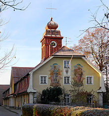
- For the area between Schwere-Reiter-Strasse, Heßstrasse and Infanteriestrasse, to which the Luitpold barracks, which have not been used by the Bundeswehr since July 2006 and which was officially abandoned on January 1, 2007, belongs, the development plan No. 1954 regulates the sub-area "Kreativfeld" planned in the "Kreativquartier München". The planned Werkbundsiedlung Wiesenfeld was planned to be built on this site. To the south of this area, between Heßstrasse and west of Infanteriestrasse, the branch church of St. Barbara (Infanteriestrasse 15), which was used as a military church between 1923 and 1945 , is located, the buildings Infanteriestrasse 7 to 9 and Heßstrasse 128a, 130/132 - including those already Reithalle München, built in 1896, belongs to - and 136. The newly constructed building of the Munich District Court (Infanteriestrasse 5) and the buildings of the State Association for Rural Development in Bavaria (LVLE) (corner of Lothstrasse / Infanteriestrasse) are next to it. The service building of the Bavarian State Office for the Environment (Heßstrasse 128) and the newly built fire station 4 (Heßstrasse 120) on the site of the demolished Center for Disaster Management are located along Heßstrasse.
- For the area between Dachauer Straße and Heßstraße, the sub-areas “Creative Laboratory”, “Creative Park” and “Creative Platform” are to be regulated in the development plan 1009b of the “Creative Quarter Munich”. Until 1920 the area was used as an artillery workshop. This use includes the listed building erected around 1910 at Dachauer Straße 102, 106/108. Around 1926 the listed Jutierhalle and the tonnage hall were built (rear part of the property at Dachauer Str. 110). Around 1928 the area was marked as "Deutsche Werke" in the city map of Munich. After the Second World War, the area was used as a business and commercial center for municipal companies. The Jutierhalle was used by the Münchner Kammerspiele between 2000 and 2003. The corner building at Dachauer Strasse / Schwere Reiter Strasse, on which a reference to the Kammerspiele was previously posted, has housed the Schwere Reiter cultural center, which can be used until September 2018, since 2008 .
The area of the former tram station, in the inner courtyard of which there were tram tracks until the mid-1980s, was originally intended to be used as a “City Business Center” in the northern part - today, this section is also to be developed as part of the creative quarter. For the southern part, an agreement between the Free State of Bavaria and the Munich municipal utilities was announced in 2010 about a use for an extension of the Munich University of Applied Sciences , whereby a turning loop for the tram Line 22 was built on part of the site.
Werkbundsiedlung Wiesenfeld
For the 100th anniversary of the German Werkbund , the Werkbund Bayern initiated the construction of a new Werkbund settlement in Munich, the city where the Werkbund was founded. It was to be built on the site of the former Luitpold barracks south of Schwere-Reiter-Strasse. On the basis of an urban planning concept by the Japanese architect Kazunari Sakamoto, it was planned to build around 500 apartments from 2007 onwards according to designs by twelve international architectural offices. On October 4, 2007, a city council resolution rejected the plan. A new urban development competition is to be announced for the site development.
Munich Forum for Islam (MFI)
On the part of the city of Munich, the then Mayor Christian Ude, as part of an on-site visit in April 2014, identified a new location for a project by the Munich Forum for Islam (MFI) (formerly known as the “Center for Islam in Europe - Munich, ZIE-M “Ongoing, board member Benjamin Idriz ) planned mosque construction on the property at Dachauer Straße 110 in the new creative quarter or, as an alternative, Dachauer Straße 120 (south of Anita-Augspurg-Allee, north adjacent to the planned justice center). As a prerequisite for an actually binding decision on the use of the property, which still has to be made by the city council, the not yet clarified proof of the financing by the association should originally be submitted by the end of 2014. According to a survey within the MFI association, the property at 110 Dachauer Strasse is considered more suitable. The deadline for providing evidence of funding was last extended to June 2016 in January 2016. The association was unable to provide proof of financing within this last period.
Olympic Park
The construction of the Olympic site was under the motto “Olympic Games in the Green”. A park landscape was laid out from the drawing board on the Oberwiesenfeld. Seven million cubic meters of earth were moved and a total of 3,100 large trees had been planted by 1972. The mountain of rubble from the Second World War was greened and transformed into an Olympic mountain. The Nymphenburg-Biederstein Canal was dammed into a lake with a maximum depth of 1.3 m. The entire Olympic Park is divided by the Georg-Brauchle-Ring into a southern part - the Olympic site with the various stadiums and the television tower - and a northern part - the Olympic Village .
Planning
- see Olympiapark (Munich) # Planned as part of the application for the 2022 Winter Games
- see Olympiapark (Munich) # Independent of the applications for the 2018 or 2022 Winter Games
literature
- Beate Freytag, Alexander Storz: Milbertshofen . Buchendorfer Verlag, Munich 2004, ISBN 3-934036-80-5 .
- Christian Lankes (Ed.): Munich as a garrison in the 19th century . Mittler, Berlin / Bonn / Herford 1993.
- see also page 55 selection of literature on the city district 9 Neuhausen-Nymphenburg on muenchen.de
Web links
Individual evidence
-
↑ City of Munich, renovation of the main collecting canal Oberwiesenfeld
City of Munich, meeting template for the renovation of the main collection canal Oberwiesenfeld,
city of Munich, meeting templates for the renovation of the main collecting canal, Oberwiesenfeld,
city of Munich, renovation of the main collecting canal, Oberwiesenfeld - ↑ a b strassenkatalog.de, rain retention basin Oberwiesenfeld
- ↑ Eva Maria Brast / Heike Theissen, “Munich Secrets 50 Exciting Stories from the Cosmopolitan City with a Heart”, ISBN 978-3-9816796-7-0
- ↑ bavarica.digitale-sammlungen.de, "The great powder explosion in Oberwiesenfeld near Munich, on May 16, 1835: A historical, faithful representation of 1835 taken from the Bavarian Volksfreund"
- ↑ Austrian National Library -Anno, German Allgemeine Zeitung September 2, 1850
- ↑ Austrian National Library -Anno, Innsbruck News March 23, 1900
- ↑ Archived copy ( memento of the original from October 29, 2017 in the Internet Archive ) Info: The archive link was inserted automatically and has not yet been checked. Please check the original and archive link according to the instructions and then remove this notice.
- ↑ a b Strunz, Köhnlechner, Lottes: Civil engineering for the structures at the XX games. Olympics Munich 1972. Engelhard-Druck, Nördlingen (without year), p. 7.
-
↑ filmothek.bundesarchiv.de :
- Neue Deutsche Wochenschau 246/1954 October 15, 1954: 12th flight day in Munich a. a. with Albert Ruesch from Switzerland , Heiner Dittmar and Albert Falderbaum
- Welt im Bild 167/1955 September 6, 1955: "Munich Air Day" and a. with Hans Knolle and Georg Bauer
- ↑ Austrian National Library -Anno, Salzburg folk ball 23 November 1939 "collection point for officer candidates three of the Air Force"
- ↑ Traditional association of the anti-aircraft rocket group 34, anti-aircraft rocket group 34 chronicle ( page no longer available , search in web archives ) Info: The link was automatically marked as defective. Please check the link according to the instructions and then remove this notice.
-
↑ a b www.filmothek.bundesarchiv.de :
- New German newsreel 39/1950 October 24, 1950 "German sand track championship" in Munich "
- Neue Deutsche Wochenschau 91/1951 October 23, 1951 “Start of the finals for the motorcycle dirt track championship” and a. with Sebastian Wiesent
- New German newsreel 116/1952 April 15, 1952 “09. Munich: dirt track race on the Oberwiesenfeld "u. a. with Joseph Seider
- Welt im Film 359/1952 April 19, 1952 “04. Sport a. Munich: dirt track race "
- Welt im Bild 41/1953 April 5, 1953 “09. Munich: dirt track race on the Oberwiesenfeld "u. a. with Albin Siegl
- New German newsreel 327/1956 May 4, 1956: “11. Munich: dirt track race on the Oberwiesenfeld "u. a. with Josef Hofmeister
- UFA-Wochenschau 378/1963 October 25, 1963: “06. Munich-Oberwiesenfeld. Dirt track race “u. a. with Manfred Poschenrieder
- Deutschlandspiegel 121/1964 October 29, 1964: “01. The dirt track race “u. a. with Kurt W. Petersen from Denmark
- ↑ Sport-Kurier born 1958: Report on the additional installation of the (smaller) speedway route within the (larger) sand track route
- ↑ LMU Institute for Animal Pathology: "History"
- ↑ Chair for Animal Welfare: History (accessed online January 10, 2012)
- ↑ Blog schimanski-drehorte.de, water reservoir
- ↑ sueddeutsche.de, "Neuhausen Olympisches Erbe" online version January 26, 2017
- ↑ www.freistaat.bayern.de, "State holdings in companies in private legal form"
- ↑ merkur.de, "Instead of Mediendorf 600 new state apartments: The sportiest settlement in town" (online version February 5, 2017)
- ↑ Münchner Merkur December 9, 2012: "Justice center will be demolished - new building for almost 200 million euros" (accessed online January 10, 2012)
- ↑ Münchner Merkur May 23, 2016: Workers encountered unknown cellars Finds of poison delay the new judicial building on Leonrodplatz
- ↑ www.sueddeutsche.de, "Neuhausen-Hoch gepokert" (online version January 26, 2017)
- ↑ Internet presence of the Federal Police Directorate in Munich ( Memento of the original from February 13, 2014 in the Internet Archive ) Info: The archive link was inserted automatically and has not yet been checked. Please check the original and archive link according to the instructions and then remove this notice.
- ↑ a b c d e Bayernviewer monument ( memento of the original from April 23, 2016 in the Internet Archive ) Info: The archive link was automatically inserted and not yet checked. Please check the original and archive link according to the instructions and then remove this notice. . Bavarian State Office for Monument Preservation; requires Java Script
- ↑ State Capital Munich, Ratsinformationssystem (RIS): Overview in Appendix 2 to Template No .: 4-20 / V 05814 in the city council meeting on May 11, 2016
- ^ Website of the regional association
- ↑ http://www.lfu.bayern.de , http://www.lfu.bayern.de/kontakt/index.htm
- ↑ sueddeutsche.de, May 17, 2010: "Schutzbunker under the Heßstrasse, the ruins of the Cold War"
- ↑ muenchen.de, new fire station 4
- ↑ City of Munich, Ratsinformationssystem (RIS): Template no .: 4-20 / V 05814 in the city council meeting on May 11, 2016 : Overview of the existing uses as of 2016 in Appendix 5 , PERSPECTIVE CANCEL / RECEIVE as of November 13, 2014 in of Appendix 4
- ↑ Süddeutsche Zeitung, print edition 3./4. November 2018
- ↑ Internet site for the forum
- ↑ Merkur-Online.de, May 2, 2014: “Islam Center on Dachauer Straße? New attempt: Mosque should go to the creative quarter " (accessed online on May 4, 2014)
- ^ Article in the print edition Münchner Merkur in the week after May 5, 2014.
- ↑ www.merkur.de, January 22, 2016: Postponement of several months Islam Center: final deadline for the mosque
- ↑ Munich Forum for Islam, June 28, 2016: "Press release: Deadline for the construction project in the creative quarter"
- ↑ www.merkur.de, June 28, 2016: "Funds are missing. Munich Islam Center: Project failed"
- ↑ www.sueddeutsche-zeitung.de, June 28, 2016: "Mosque for Munich; plans for Islamic center in Munich failed"
- ↑ Strunz, Köhnlechner, Lottes: Civil engineering for the buildings at the XX games. Olympics Munich 1972. Engelhard-Druck, Nördlingen (no year), p. 116.
Coordinates: 48 ° 10 ′ 25 ″ N , 11 ° 33 ′ 3 ″ E
