Marsfeld (Munich)


The Marsfeld is one of nine districts of the Munich district of Maxvorstadt . On December 31, 2009, 3,624 residents lived in an area of 80.4177 hectares . This results in a calculated population density of 4506.5 inhabitants per square kilometer.
geography
In the north, the Marsfeld is delimited from the St. Benno district by Nymphenburger Strasse , and in the east by Seidlstrasse from the Augustenstrasse district.
In the southwest is the Schwanthalerhöhe district, Westend district . Here is the Landsbergerstraße the border. In the southeast, the Marsfeld borders on the district of Ludwigsvorstadt-Isarvorstadt , district of St. Paul.
In the west it borders on the Neuhausen-Nymphenburg district, St. Vinzenz district. The border runs along Marsstrasse in the south and Maillingerstrasse in the north.
history
The Marsfeld was a parade ground and military area in Munich . It is named after the Roman god of war Mars based on the Roman model .
The field of Mars was north-west of the Neuhauser Tor in front of Munich's old town. The Bavarian electoral army carried out exercises in this area . Since the pastures of the village of Neuhausen were also located here, there was frequent damage to the fields, which since 1603 has repeatedly led to complaints and disputes.
The area used by the military ranged from Galgenberg (today Landsberger Straße about the height of Hackerbrücke ) in the south-east to a point where Landshuter Allee and Nymphenburger Straße meet today in the north-west. On July 4, 1803, the area was first referred to as "Marsfeld" in a cabinet order from the Elector to the Minister of Justice. In 1804 the field of Mars was marked by a boundary ditch.
The Munich execution site was relocated in 1821 from Galgenberg to a part of the Marsfeld area closer to the city (opposite the Augustiner-Keller , today Arnulfstraße 52) in order to be able to cope with the rush of onlookers. The path leading to the Marsfeld was called "Marsstrasse" from around 1820. Despite the protests of the Neuhauser farmers, the field of Mars was finally given to the military in 1853.
The city of Munich was granted right of way in 1842, in return it had to plant trees on the edge of the square. Infantry , cuirassier and medical units carried out exercises and parades on the Marsfeld , which, however, were relocated to the Oberwiesenfeld due to the unevenness of the square. As early as 1858 there were plans to build barracks on the Marsfeld. However, these were already discarded two years later due to the odor nuisance of a nearby sulfuric acid factory. After this factory was closed about 10 years later, the construction of a barracks was started in 1888 , which should replace the old Salzstadel barracks .

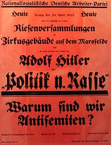
The barracks, which was continuously expanded until 1898, became the location of the kb 1st Infantry Regiment . During the First World War , there were replacement infantry troops and railway pioneers. On November 7, 1918, the crew of the Marsfeld barracks was the first to join Kurt Eisner's revolutionary march . In October 1919, the barracks were handed over to the Munich Police Department (later the Bavarian State Police ). On January 26, 1920, the cadet corps was abolished and incorporated into the Wittelsbacher Gymnasium as a real high school branch . From 1923 the facilities were used by various authorities, including the tax office and the Oberpostdirektion. Before 1933 the Marsfeld was also used by the SA and the NSDAP for marches.
Towards the end of the Second World War , the Wehrmacht seized the former barracks. In 1945 it was largely destroyed by bombing. In the 1960s, the remains were torn down and new buildings were erected. Various authorities such as the Bavarian State Criminal Police Office and the Munich Tax Offices II, III, IV and V moved into this. Marsstrasse has kept its name since 1820, as has Marsplatz , which has existed since 1890 .
From 2013, parts of the Marsfeld will be subject to urban restructuring. The area at Arnulfstrasse 60–62, formerly the Postfuhramt / “Arnulfpost”, opposite the Hackerbrücke will be partially rebuilt and the listed buildings (37,500 m²) will be renovated. Investors are also showing interest in the extensive area of the tax offices after the Free State announced the relocation of the tax authorities from Deroystraße. Together with the central bus station , the Arnulfpark and the Löwenbräugelände, the area between the old town and Neuhausen will be given a new face and, for the most part, changed to a different use.
Individual evidence
- ↑ cf. Homepage of the Wittelsbacher Gymnasium
- ↑ 75 years of the Wittelsbacher Gymnasium in Munich, anniversary publication 1981/82
- ↑ http://www.architekten24.de/projekt/art-deco-palais-muenchen/uebersicht/index.html
- ↑ http://www.abendzeitung-muenchen.de/inhalt.der-auszug-der-steuerverwaltung-wird-konkreter-finanzamt-soll-versilbert- Werden.28e34c22-bdee-41be-934a- 7ef7e1f076d2.html
Coordinates: 48 ° 8 ′ 47 ″ N , 11 ° 32 ′ 54 ″ E
