Rags
|
Rags
State capital Munich
Coordinates: 48 ° 6 ′ 38 ″ N , 11 ° 27 ′ 55 ″ E
|
|
|---|---|
| Area : | 9.22 km² |
| Residents : | 50,165 (Dec. 31, 2019) |
| Population density : | 5,439 inhabitants / km² |
| Postal code : | 80689, 81375, 81377 |
| Area code : | 089 |
|
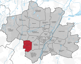
Location of the city district 20 Hadern in Munich
|
|
Hadern is the city district 20 of the Bavarian capital Munich .
location
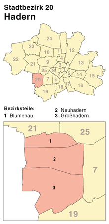
Hadern's borders run roughly along Forst-Kasten-Allee in the south, Fürstenrieder Straße in the east, Senftenauerstraße in the north and the city limits in the west. The largest cemetery in the city, the approximately 170 hectare forest cemetery , takes up almost a fifth of the 922 hectares of the district. The district borders (counted clockwise) on the urban districts Pasing-Obermenzing and Laim in the north, Sendling-Westpark in the east and Thalkirchen-Obersendling-Forstenried-Fürstenried-Solln in the south and the communities Neuried in the southwest and Planegg and Graefelfing in the west (all in the district of Munich ).
Subdivision
The Hadern district is divided into three districts: Blumenau north of the Lindau Autobahn (Ammerseestrasse), Neuhadern between the Autobahn and Würmtalstrasse and Großhadern south of the Würmtalstrasse. The Blumenau and Kleinhadern districts are located in the Blumenau district, the Neuhadern and Kurparkiedlung districts in the Neuhadern district , and the Großhadern district also contains the forest cemetery .
history
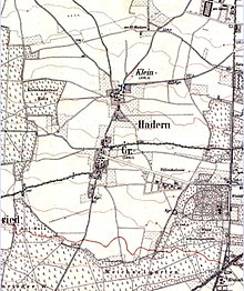
Hadern was originally a farming village and was first mentioned in the 11th century under the name Haderun . Großhadern belonged to the Benediktbeuern monastery , Kleinhadern to the Schäftlarn monastery . Between 1409 and 1425, the Hadern village court was combined with other village courts (Martinsried, Poschetsried, Neuried and Graefelfing) to form Planegg Castle.
Since the village of Großhadern was too small to form its own community when the community was formed in 1818, Kleinhadern, which was directly involved in the regional court, was added.
The municipality of Großhadern including the village of Kleinhadern was incorporated into Munich in 1938. The structures of the former rural settlement are still clearly visible in Großhadern around the old village center. In large parts of Hadern, loose single-family houses determine the urban image. From the Second World War until the 1980s, large residential complexes such as the Blumenau or the complexes on Senftenauerstrasse and in Neuhadern with a high proportion of social housing were built on the areas previously used for agriculture .
New residential buildings have been built south of the Großhadern Clinic in recent years.
traffic
Since the extension of the U6 underground line to the clinic (1993), the district has been well served by public transport. U6 stations in Hadern are Klinikum Großhadern, Großhadern, Haderner Stern and Holzapfelkreuth. Line 18 of the Munich tram ends at Gondrellplatz. Bus routes operated by the Münchner Verkehrsgesellschaft connect Hadern with the neighboring city districts and the neighboring communities of Planegg , Graefelfing and Martinsried .
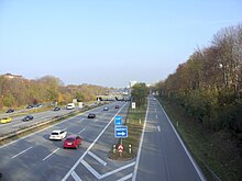
The road network is dominated by the federal motorway 96 , which divides Hadern and offers two exits (exit 37: Großhadern / Blumenau and exit 38: Laim) in Hadern. Further axes in east-west direction are Guardinistraße and Würmtal- / Waldfriedhofstraße. In the southeast, the federal highway 95 borders the city district. In a north-south direction, Fürstenrieder Straße separates Hadern from Laim or Sendling-Westpark. The Waldwiesenstrasse / Sauerbruchstrasse connect the clinic and the A 96.
economy
Hadern's largest employer is the Ludwig Maximilians University of Munich (LMU). In addition to the facilities of the LMU (especially the clinic) and those of the Augustinum, Hadern is primarily home to smaller businesses. Haderner Bräu , Munich's first organic brewery, is located on Großhaderner Straße.
Public facilities
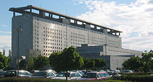
The Großhadern Clinic of the Ludwig Maximilians University in Munich is the largest hospital complex in Munich. In 1994 the LMU gene center was put into operation, and in 1999 the entire chemical-pharmaceutical faculty was relocated to Hadern. In 2004, the HighTech CampusLMU between Großhadern and Martinsried continued to expand with the start of lectures and research in the Biology II Department of the Biozentrum . In the medium and long term, the entire biological faculty and other natural science faculties and institutes are to be brought together here.
With the children's center of the Upper Bavaria district and the attached Montessori school as well as the Augustinum retirement home and the Augustinum Clinic in Munich (formerly the Augustinum Abbey Clinic ), further social institutions are located in the district.
Population structure
The social composition of the population is characterized by younger, mostly skilled workers as well as older people, especially in the older social buildings and single-family housing areas. The proportion of foreigners in Hadern is below the city average.
politics
The Hadern district committee was last elected on March 15, 2020. The distribution of seats is as follows: CSU 8, Greens 7, SPD 5, FW / ÖDP 2 and FDP 1. Of the 35,179 residents of Hadern who are entitled to vote, 17,807 exercised their right to vote, bringing the turnout to 50.6 percent.
The chair is Renate Unterberg (Greens), represented by Irmgard Hofmann (SPD) and Gabriele Radeck (CSU).
Education and culture
- Munich City Library , Hadern District Library
- Munich Adult Education Center , Hadern branch
- Culture in Hadern e. V.
- Richter Masset Gallery
- Heiglhoftheater
- History Society Hadern
The following schools can be found in Hadern:
- Elementary school at Hedernfeld
- Primary and secondary school in Blumenauer Strasse
- Senftenauer Strasse primary school
- Großhaderner Strasse primary school
- Elementary and middle school Guardinistraße
- Canisiusplatz primary school
- Lukasschule (private elementary school, secondary school and high school)
- Derksen-Gymnasium (private high school)
Religious life
The following churches are located in Hadern:
- Parish Apparition of the Lord, Blumenauer Strasse (Roman Catholic)
- Parish Corpus Christi, Senftenauerstraße (Roman Catholic)
- Parish of St. Ignatius, Guardinistraße (Roman Catholic)
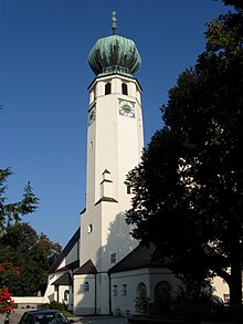
- Parish St. Canisius Canisius Course (Roman Catholic), which includes the old church St. Peter heard
- Simeonsgemeinde, Stiftsbogen, Parish: Veilchenstraße (Evangelical Lutheran)
- Reformation Memorial Church, Ebernburgstrasse (Evangelical Lutheran)
- Evangelical Free Church Congregation, Großhaderner Strasse
Sports
There are two district sports facilities in Hadern (one on Wolkerweg, one on Ludwig-Hunger-Straße on Hedernfeld).
The following sports clubs are located in Hadern:
- TSV Großhadern
- SV Sentilo Blumenau
- FC Neuhadern
- FTM Munich Blumenau
- Munich Rugby Football Club
Architectural monuments
statistics

(As of December 31, residents with main residence)
| year | Residents | including foreigners | Inhabitants per km² |
|---|---|---|---|
| 2000 | 41,689 | 7,526 (18.1%) | 4,524 |
| 2001 | 41,858 | 7,614 (18.2%) | 4,542 |
| 2002 | 42,563 | 8,051 (18.9%) | 4,618 |
| 2003 | 42,823 | 8,364 (19.5%) | 4,642 |
| 2004 | 43,396 | 8,683 (20.0%) | 4,704 |
| 2005 | 43,981 | 9,024 (20.5%) | 4,768 |
| 2006 | 44.993 | 9,218 (20.5%) | 4,878 |
| 2007 | 46,059 | 9,744 (21.2%) | 4,993 |
| 2008 | 46,385 | 9,947 (21.4%) | 5,029 |
| 2009 | 46,490 | 9,973 (21.5%) | 5,040 |
| 2010 | 46,851 | 10,076 (21.5%) | 5,079 |
| 2011 | 47,459 | 10,419 (22.0%) | 5,145 |
| 2012 | 47,949 | 10,914 (22.8%) | 5,198 |
| 2013 | 48,945 | 11,715 (23.9%) | 5,306 |
| 2014 | 49,874 | 12,587 (25.2%) | 5,407 |
| 2015 | 50,257 | 13,198 (26.3%) | 5,449 |
| 2016 | 50,567 | 13,796 (27.3%) | 5,482 |
| 2017 | 49,626 | 13,210 (26.6%) | 5,380 |
| 2018 | 49,898 | 13,598 (27.3%) | 5,410 |
| 2019 | 50.165 | 14,042 (28.0%) | 5,439 |
Source with further data
literature
- Susanne Herleth-Krentz: Hadern - time travel to old Munich . Volk Verlag, Munich 2014, ISBN 978-3-86222-155-4 .
Web links
- Hadern district - state capital Munich
- City district and district committee 20 Hadern - City of Munich
Individual evidence
- ↑ Statistical Pocket Book 2020 (PDF). Statistical Office of the State Capital Munich. Retrieved August 24, 2020.
- ^ Dieter Albrecht: The Starnberg district court. Munich 1951 (Historical Atlas of Bavaria, part of Old Bavaria, volume 3) , p. 22
- ^ Dieter Albrecht: The Starnberg district court. Munich 1951 (Historical Atlas of Bavaria, part of Old Bavaria, volume 3) , p. 39
- ↑ a b c Election of the District Committee - District 20 - Hadern . State capital Munich. Retrieved May 1, 2020.
- ↑ https://www.ris-muenchen.de/RII/BA-RII/ba_bezirksausschuesse_details.jsp?Id=229&Wahlphase=5666213
- ↑ Heiglhoftheater
- ^ Website of the Hadern History Society
- ^ Website of the FTM Blumenau association . Retrieved November 2, 2016.
- ^ Archive district information . State capital Munich. Retrieved January 6, 2019.
