Blumenau (Munich)
The Blumenau is a settlement in the district Hadern in Munich . Blumenau is also the name of the district part 20.1 of the Munich district Hadern (20).
location
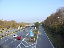
The district of Blumenau covers roughly the northern quarter of the Hadern district (20). In the north it borders on the urban districts of Pasing-Obermenzing (21) and Laim (25), in the south it is separated from the Neuhadern district by the federal motorway 96 . The city limits of Munich delimit the district of Blumenau in the west, Senftenauer Straße arched in the northeast.
The Blumenau settlement is divided into the two parts of Blumenau North and Blumenau South - separated by the Federal Motorway 96. The northern part of the settlement corresponds to the western third of the district part of the same name; there he is separated from Kleinhadern by Silberdistelstrasse . The southern part of the settlement is in the Neuhadern district.
Surname
The name of the settlement "Blumenau" was decided in 1964 by the main committee of the city council. At that time the name was already in use by the residents of Kleinhadern and refers to the numerous streets that are named after flowers. Next to the Silberdistelstraße, which today leads in the direction of Neuhadern and the motorway, you will find the Krokus-, Veilchen- and Primelstraße in Kleinhadern. The name "Blumenau" was then used for the neighboring new housing estate, although the streets and paths there are named after artists such as Xaver Terofal , Wastl Witt or Karl Flemisch , who all came from Munich or were mainly active there.
When the city districts were redistributed in 1992, the name "Blumenau" was also used for the entire northern district of Haderns, which includes Kleinhadern in addition to the Blumenau Nord settlement.
The Blumenau settlement: history and description
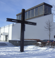
In 1963, the development of the building area began, the construction of the first building in the park residential complex in Blumenau began in 1964. In addition to a few single-family houses, there are mainly apartment blocks in Blumenau. In the center there is the parish church Apparition of the Lord , which was built between 1969 and 1970, as well as the Blumenau shopping center, which is home to around 30 shops.
To the north of the church is the elementary school on Blumenauer Straße , which is home to both a primary school and a secondary school. A 400 m² photovoltaic system has been in operation on the roof of the school since April 2003 , which feeds around 45,000 kWh per year into the Munich power grid.
Transport links

Highway
- A96 , exit Blumenau
bus
- MetroBus line 56 (to underground line U6 )
- City bus route 167
- StadtBus line 168 (to the underground line U5 and S-Bahn main line )
tram
- Tram line 18
Individual evidence
- ^ Helmuth Stahleder : From Allach to Zamilapark. Names and basic historical data on the history of Munich and its incorporated suburbs . Buchendorfer Verlag, Munich 2001, ISBN 3-934036-46-5 .
- ↑ Blumenau . muenchen.de. Retrieved February 2, 2010.
- ↑ The building history of the Blumenau parish church . erzbistum-muenchen.de. Archived from the original on November 21, 2011. Info: The archive link was inserted automatically and has not yet been checked. Please check the original and archive link according to the instructions and then remove this notice. Retrieved September 3, 2012.
- ^ Hadern solar park . solarpark-muenchen.de. Retrieved February 2, 2010.
Coordinates: 48 ° 8 ' N , 11 ° 29' E


