
Samerberg
| coat of arms | Germany map | |
|---|---|---|

|
Coordinates: 47 ° 47 ' N , 12 ° 13' E |
|
| Basic data | ||
| State : | Bavaria | |
| Administrative region : | Upper Bavaria | |
| County : | Rosenheim | |
| Height : | 700 m above sea level NHN | |
| Area : | 33.39 km 2 | |
| Residents: | 2793 (Dec. 31, 2019) | |
| Population density : | 84 inhabitants per km 2 | |
| Postal code : | 83122 | |
| Area code : | 08032 | |
| License plate : | RO , AIB , WS | |
| Community key : | 09 1 87 172 | |
| Community structure: | 78 districts | |
| Address of the municipal administration: |
Dorfplatz 3 83122 Samerberg |
|
| Website : | ||
| Mayor : | Georg Huber ( ÜPW / FW ) | |
| Location of the community Samerberg in the district of Rosenheim | ||
  |
||


Samerberg is a municipality in the district of Rosenheim , administrative district of Upper Bavaria . The seat of the municipal administration is in Törwang ; there is no district called Samerberg.
geography
Geographical location
The parts of the municipality of Samerberg, a rural region of the Chiemgau foothills of the Alps with a number of hamlets and remote farms, are located to the east of the Inn and to the east of Neubänen on a hilly high plateau, which is in the southeast by a mountain range, the Hochriesgruppe (from northeast to southwest: Riesenberg 1444 m, Hochries 1569 m, Karkopf 1497 m, Feichteck 1514 m) is flanked and falls in the west towards the Inn valley. The residential areas are at an altitude between about 600 and 750 m above sea level. NN; the largest towns are Törwang and Grainbach .
The municipality, which extends in a west-east direction over a length of about seven kilometers, borders in the south and south-west on Nussdorf am Inn , in the north-west on Neubeu , in the north on Rohrdorf and in the east on Frasdorf . In the south-east it also borders on the communities of Aschau im Chiemgau and Erl (Austria), to which there are no direct roads.
Community structure
The municipality of Samerberg has 78 officially named districts:
Neighboring communities
| Rohrdorf | ||
| Re-firing |
.svg)
|
Frasdorf |
| Nussdorf am Inn |
Erl (Austria) |
Aschau im Chiemgau |
history
Until the churches are founded
The term Samerberg goes to an important historical source of income in this region back: About the Samerberg led since the Middle Ages a mule track , over the mule trains (the Austrian: Samer ) on Saumrossen ( pack horses ) salt from Berchtesgaden , Traunstein and Reichenhall , cereals, wine and other Transported goods. In a Latin deed of donation from the provost of Berchtesgaden from the 12th century, the Samerberg is called Rossoltesperge (roughly 'Rösselsberg').
The collective term Samerberger for the inhabitants of this foothill region was already in use before 1800. In 1997 the so-called Samerbrunnen was set up in the center of Grainbach to commemorate the historical trade of the hauler ; the monument has the shape of a horseshoe-shaped horse trough, which is carved from limestone and decorated with a bronze statuette of a mule-trader with samross on a column.
As can be seen from the Indiculus Arnonis , the Roßholzen part of the community, known at the time as Hrossulza , had its own church before 798.
The Samerberg area belonged to the Munich Rent Office and the Rosenheim Regional Court of the Electorate of Bavaria and was divided into the main teams of Grainbach, Törwang, Steinkirchen and Roßholzen. In 1818 the former main teams became municipalities in the current sense.
19th and 20th centuries
Before the revolution in 1848, some tax districts of the district court district of Rosenheim, including the entire Samerberg, were subordinate to the patrimonial court of the Hohenaschau rule with its seat in Prien .
In 1969, 88% of the electorate voted in a referendum for a municipality of Samerberg with its seat in Törwang. On January 1, 1970, the new community was formed through the merger of the previously independent communities of Grainbach, Roßholzen, Steinkirchen and Törwang. The four silver diamonds in the municipal coat of arms, which have been used since 1978, stand for these former municipalities and not primarily for Bavaria.
The Samerberg attracted artists in the past. Since Karl Hermann Müller-Samerberg settled in Törwang in 1909 , over 40 other painters have painted this Bavarian landscape.
Demographics
| year | Residents | Remarks |
|---|---|---|
| 1824 | 236 | in Grainbach 158 (in 24 houses), Törwang 60 (in eleven houses), Steinkirchen ten (in one house), Roßholzen eight (in two houses) residents |
| 1846 | 1,245 | |
| 1871 | 1,140 | on December 1, 1871, in Grainbach 241 (in 51 houses), Törwang 326 (in 68 houses), Steinkirchen 293 (in 64 houses), Roßholzen 280 (in 49 houses) residents |
| 1885 | 1,159 | |
| 1933 | 1,328 | in Grainbach 316, Töwang 405, Steinkirchen 329, Roßholzen 278 residents |
| 1939 | 1,288 | in Grainbach 317, Törwang 422, Steinkirchen 305, Roßholzen 244 residents |
| 1988 | 2,018 | |
| 1991 | 2,177 | |
| 1995 | 2,319 | |
| 2005 | 2,618 | |
| 2010 | 2,670 | |
| 2015 | 2,811 | |
| 2018 | 2,814 | since 1988 796 more inhabitants, ie an increase of 39.4%. |
Parish
The Catholic population of the entire Samerberg received pastoral care from the Rohrdorf parish during the first half of the 17th century , until a parish vicar was sent to Törwang. In 1820 an older Törwang innkeeper made a foundation for the maintenance of an additional assistant priest. Törwang remained a branch of Rohrdorf. Around the middle of the 19th century, the Törwang parish with its four branches Törwang, Grainbach, Roßholzen (formerly Schilding) and Steinkirchen was responsible for a total of 81 suburbs on the Samerberg. The Törwang parish today belongs to the Rohrdorf parish association .
Former priests
- Vicars
- Johann Pichler 1572-1611
- Martin Strein 1674-1678
- Georg Katzmayr 1687-1714
- Johann Murböck 1720–1723
- Josef Niedermeier 1730–1743
- Christoph Gmachl 1764–1766
- Stephan Kirchbichler 1777–1801
- New Year's Eve Spitzer 1829–1830
- Pastor
- Josef Dürnegger 1901–1952
- HH Felix Scheurmann 1952–1965
- Alfons Vordermayer 1966–1973
- Georg Blabsreiter 1974–1997
Buildings
- Parish Church of the Assumption in Törwang
- Church of Saint Bartholomew in Roßholzen
- Church of St. Giles and Nikolaus in Grainbach
- Church of Saint Peter in Steinkirchen
- Hochriesbahn (cable car) in Grainbach to the Hochries summit
traffic
There are direct connections to the neighboring communities of Nußdorf am Inn , Rohrdorf and Frasdorf via the road network . Samerberg has stops on the DB bus line 9493 Roßholzen - Törwang - Lauterbach - Rosenheim . During the main tourist season, additional 'hiking buses' run between Rosenheim and Samerberg. The nearest train stations are in Rosenheim and Brannenburg . Törwang can be reached from the A 8 Munich - Salzburg via the Achenmühle exit. From the Rosenheim- Kiefersfelden autobahn section of the A 93 , the western municipal area with Roßholzen can be reached via the Brannenburg exit.
tourism
The area is a major tourist destination all year round.
The highest mountain on the Samerberg and at the same time the most popular hiking destination is the 1569 m high Hochries . There are well-developed walking and hiking trails and managed huts on it. The Hochrieshütte, which belongs to the DAV Rosenheim section, offers overnight accommodation. The summit area is accessible via various local hiking trails as well as the European long-distance hiking trail E4 and the Maximiliansweg , and is also connected to the valley town of Grainbach via the chairlift and cable car of the Hochriesbahn .
Another popular hiking destination is the Heuberg , where there are also managed huts available for hikers. Extensive hiking trails connect the sub-municipalities of the entire hilly municipal area, which is characterized by the landscape of the retreat moraine of a former glacier .
There is a public outdoor pool between Törwang and Grainbach. On one of the hiking trails west of Grainbach , a Kneipp water treading facility has been set up in the bed of the Achen river , which flows through the lowland at the foot of the Hochries .
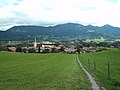
Törwang am Samerberg, in the background the Hochries

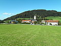
Center of Törwang with the Gasthaus and Hotel Zur Post (left in the picture)

Dorfstrasse in Grainbach with the traditional Maurer restaurant (left in the picture); the Samerbrunnen in front of their beer garden , flanked by two benches

Samerbrunnen built in 1997 in the center of Grainbach with a bronze statuette, which is supposed to remind of the historical trade of the haulier (design: Gudrun and Hans Wesner)
Rosewood

Grainbach, northern entrance to the village

Stone churches with St. Peter's branch church, seen from the east

Steinkirchen, interior of the St. Peter branch church

Oberleiten, entrance to the village, seen from the cemetery wall of the St. Peter branch church in Steinkirchen

Weickersing, southern end of the hamlet, seen from the west
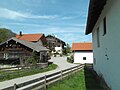
Weickersing, village with a farmhouse and chestnut

Grainbach, seen from the north

Kohlgrub, eastern outskirts of the hamlet south of Grainbach


Ortseingang15April2020.JPG&filetimestamp=20200415170709&)
17April2020.JPG&filetimestamp=20200417115026&)
FilialkircheSt.Peter.JPG&filetimestamp=20200415171743&)
VonFriedhofsmauerFilialkircheStPeter(Steinkirchen)15April2020.JPG&filetimestamp=20200415174519&)
16April2020.JPG&filetimestamp=20200416144746&)
16April2020.JPG&filetimestamp=20200416142719&)


Sports facilities
The largest sports club in the community is WSV Samerberg e. V. (Wintersportverein Samerberg) with a department for alpine skiing, cross-country skiing and tobogganing as well as other departments for football and tennis . The tennis department has a tennis facility with a clubhouse and four clay courts. The tennis courts can be rented by non-members. In winter, extensive cross- country trails are groomed in the extensive municipal area when there is sufficient snow .
Valley station of the Hochriesbahn chairlift in Grainbach, also approved for taking off-road bikes and aircraft

WSV Samerberg tennis facility in Grainbach; Building from right to left: Clubhouse, valley station of the Hochriesbahn chairlift , former Hochries flight school (vacant, 2020) Samerberg mountain rescue center

One of several launch ramps for hang-gliders on the Hochries , in the background to the left of the center of the picture the Simssee

Hang glider in front of a launch pad on the summit of the Hochries (the Kampenwand, faintly visible in the background at the top right of the picture )
Landing area for paragliders on the western outskirts of Grainbach
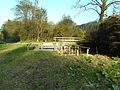
Water treading facility on a hiking and jogging path on the Achenbach, west of Grainbach


Activities that can be seen from afar unfold during the warmer season of the GSC Hochries Samerberg e. V. (Paragliding Club Hochries Samerberg). Take-off ramps for hang-gliders are available on the summit of the Hochries ; Large meadows near Grainbach at the foot of the Hochries serve as landing sites for hang-gliders and paragliders. Flight students are trained by a flight school, which has its school building in Grainbach opposite the valley station of the Hochriesbahn chairlift.
Since spring 2011, mountain bike off-road riders below the Hochries middle station have had access to an official bike park with a winding downhill off-road piste. Sports bikes can be taken with the chairlift to the middle station of the Hochriesbahn, where the downhill race track starts.
mountains


Regular events
- On the third Sunday of Advent, the traditional village Christmas takes place in Törwang on the village square.
- After Christmas, the Grainbach Trachtenverein regularly organizes farmer's theater in the ballroom of the Maurer inn in Grainbach.
- Forest festival at the Parkstüberl (at the valley station of the Hochriesbahn)
- Forest festival in the beech forest (near Törwang)
- Village square festival of the boys' association
- Village festival of the mountain riflemen and the football department of the WSV Samerberg in Törwang
- Grainbach village festival organized by the Grainbach Volunteer Fire Brigade
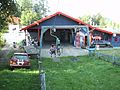
- Farmer's theater of the Trachtenverein Roßholzen at the Badwirt in Roßholzen
- Ball of the clubs in carnival (alternately at the Badwirt in Roßholzen and in the Gasthof Maurer, Grainbach)
nature
The Samerberg has significant litter meadows and spring moors . Both provide habitat for animal and plant species that are highly endangered throughout Bavaria, for example various types of orchids and gentians, the alpine butterwort, the flour primate and cotton grass. The spring moors and litter meadows are part of the Samerberg tourism concept, such as the “Samerberger Filze” nature trail and the apiary.

Fire brigades
The community of Samerberg operates a total of three volunteer fire departments. These are located in Grainbach, Törwang and Roßholzen.
Grainbach fire department
The Grainbach volunteer fire brigade has an LF8 / 6 fire fighting vehicle and a team transport vehicle (MTF).
A trailer for external helicopter load containers is also stationed there, which is operated by the flight assistant group of the Rosenheim district . This consists of specially trained flight assistants and is used, for example, in forest and wild fires, where it is necessary to take over the coordination and flight operations of the fire-fighting helicopters in order to ensure safe and effective operations. When deployed, the MTF is the transport vehicle for the flight assistant staff.
Törwang fire department
In 2018, the Törwang volunteer fire brigade added a new MLF medium fire engine to its fleet. An LF8 fire fighting group vehicle is also available. The fire brigade is also involved with several members in the flight assistant group.
Roßholzen fire department
The Roßholzen volunteer fire brigade complements the vehicle concept with a TLF 16/25 tank tender with hydraulic rescue equipment. The vehicle can therefore be used universally. In 2019, a team transport vehicle (MTF) was also put into service. The third vehicle is a logistics device trolley GW-L2, which can be loaded depending on the requirements. For this reason, it is also the official towing vehicle for the district's flight assistant group.
Personalities
Born in the church
- Albert Hartl (1904–1982), priest, SS-Hauptsturmführer in the Reichsführung SS
- Hans Stuffer (* 1961), alpine ski racer
Personalities associated with the community
- Mathias Daburger (* approx. 1700), church and landscape painter, lived for a while on Samerberg
- Karl Hermann Müller-Samerberg (1869–1946), landscape painter, lived in Törwang from 1909
- Josef Dürnegger (1869–1952), Upper Bavarian homeland researcher, 1901 to 1952 pastor in Törwang
- Elisabeth Kronseder (1890–1989), sculptor and painter
- Ernst Forsthoff (1902–1974), constitutional lawyer, had a vacation home in Törwang.
- Marie Louise Fischer , (born Kernmayr, 1922–2005), writer, lived in Untereck for a while
- Christian Doermer (* 1935), German actor and filmmaker, lives in Törwang.
- Armin Kratzert (* 1957), writer, lives in Munich and Samerberg
- Marcus Burghardt (* 1983), racing cyclist, lives in Samerberg
Others
Correspondence between Ernst Forsthoff and Carl Schmitt
On April 26, 1955, Ernst Forsthoff wrote to Carl Schmitt :
“The Samerberg is one of the most beautiful points of Upper Bavaria, still relatively least touched by civilization, and you will certainly like the landscape; especially at this time of year with the incomparable splendor of the meadows and alpine pastures. "
Heinrich Mann in Roßholzen
Heinrich Mann began his novel Between the Races in Roßholzen in 1905 .
Lake on the Samerberg (old legend)
According to an old legend, there was once a lake in the lowland west of Grainbach, through which the Achenbach flows, and which stretched to the districts of Dorfen in the west and Schöffau in the south. Due to undercutting, the lake suddenly ran out over the Steinbach in the direction of Nussdorf am Inn , where the falling water is said to have caused considerable damage.
literature
- Sebastian Dachauer : Chronicle of Brannenburg and the nearest places in the area (continued). In: Upper Bavarian Archive for Fatherland History (Historischer Verein von Oberbayern, ed.), Volume 4, Munich 1843, Section 9: Contributions to the chronicle of the parish of Rordorf , in particular pp. 254–260 ( online ).
- Hildegard Osterkammer and Franz Osterkammer: Landmarks on the Samerberg , 2009 (176 pages).
- Samerberg Tourist Office: The Bear Strategy Path: Samerberg Nature Trail , 2007 (8 pages).
- Josef Rieder: Rossoltesperge - Samerberg: Contributions to its history . Samerberg 1988 (424 pages).
- Josef Dürnegger : The Samerberg in the past and present . Facsimile reprint of the 2nd edition from 1929, Verlag H. Meißner-Druck, Oberaudorf 1985 (366 pages).
- Josef Dürnegger : 50 years of pastoral care on the Samerberg: 1901–1951 - short report , 1951 (16 pages).
Web links
- Entry on the coat of arms of Samerberg in the database of the House of Bavarian History
Individual evidence
- ↑ "Data 2" sheet, Statistical Report A1200C 202041 Population of the municipalities, districts and administrative districts 1st quarter 2020 (population based on the 2011 census) ( help ).
- ↑ http://www.bayerische-landesbibliothek-online.de/orte/ortssuche_action.html ? Anzeige=voll&modus=automat&tempus=+20111022/224426&attr=OBJ&val= 527
- ↑ Sebastian Dachauer : Chronicle of Brannenburg and the nearest places in the area (continued). In: Upper Bavarian Archive for Fatherland History (Historischer Verein von Oberbayern, Ed.), Volume 4, Issue 2, 1843, pp. 219–270, especially pp. 254–260 .
- ^ Morgenblatt for educated readers . Volume 42, No. 196 of August 16, 1848, p. 782, right column ff .
- ↑ JJ Lentner, in: Altbayerische Monatsschrift (Historischer Verein von Oberbayern, ed.). Volume 13, 1915, p. 13.
- ^ Johann Georg Krünitz, Ed .: Economic-Technological Encyclopedia, or general system of state, town, house and agriculture, and the history of art in alphabetical order . 137th part, Berlin 1824, p. 677 .
- ^ Joachim Heinrich Campe: Dictionary of the German language . Part IV: S and T . Braunschweig 1810, p. 47 .
- ↑ Johann Christoph Adelung: Grammatical-critical dictionary of the High German dialect, with constant comparison of the other dialects, but especially the Upper German . Volume III: from M – Scr . Leipzig 1798, p. 1301, right column .
- ^ Sources and discussions on Bavarian history (Historical Commission of the Bavarian Academy of Sciences, published on the orders of Maximilian II , Volume 1, Munich 1856, p. 330 ).
- ↑ Joseph Hazzi: Statistical information about the Duchy of Baiern . Volume 1, Nuremberg 1801, p. 311 .
- ↑ Sebastian Dachauer , loc. cit., No. 2, p. 260 .
- ↑ See e.g. B. Joseph von Obernberg: The Bavarian Alps with adjacent parts of Tyrol and Salzburg. Munich 1832, p. 189 .
- ^ Wilhelm Volkert (ed.): Handbook of Bavarian offices, communities and courts 1799–1980 . CH Beck, Munich 1983, ISBN 3-406-09669-7 , p. 561 .
- ^ Hans Heyn: South German painting from the Bavarian highlands , 1980.
- ↑ Adolph von Schaden : Topographical Handbook for the Isar Circle in the Kingdom of Bavaria . Munich 1824, p. 149 .
- ↑ v. Damage, loc. cit., p. 496 .
- ↑ v. Damage, loc. cit., p. 470 .
- ↑ v. Damage, loc. cit., p. 413 .
- ↑ a b Der Wittwen- und Wisenfreund - an educational magazine . Volume 23, Munich 1846, 195 .
- ↑ Royal. Bavarian Statistical Bureau: Complete list of localities of the Kingdom of Bavaria - with an alpabetic general register of places containing the population according to the results of the census of December 1, 1875 , Munich 1877, Sp. 243 ( online ),
- ↑ Bavarian Statistical Bureau, loc. cit., Sp. 255 ( online ),
- ↑ Bavarian Statistical Bureau, loc. cit., Sp. 253 ( online ),
- ↑ Bavarian Statistical Bureau, loc. cit., Sp. 251 ( online ).
- ^ Announcements of the German Alpine Club , 1887.
- ^ A b M. Rademacher: German administrative history from the unification of the empire in 1871 to the German reunification in 1990. City and district of Rosenheim (online material for the dissertation, Osnabrück 2006)
- ^ S. Sebastian Dachauer , loc. cit., p. 256 .
- ↑ Pastor with body and soul . heimatzeitung.de, article from July 3, 2010. Accessed October 29, 2013.
- ↑ http://www.hochrieshuette.de/
- ↑ Eberhard Grüger: Spätriss, Riss, Würm and Frühwürm am Samerberg in Upper Bavaria , 1978 (60 pages).
- ↑ Max Pröbstl: The Samerberg in the Ice Age: One Hundred Thousand Years at a Glance , 1982 (224 pages).
- ↑ Samerbergers maintain litter meadows - a task for the youth and the future ( memento from April 2, 2015 in the Internet Archive )
- ↑ Steffi Hermann: Elisabeth Kronseder: Sculptor and painter am Samerberg , 1983 (96 pages).
- ^ A b Correspondence between Ernst Forsthoff and Carl Schmitt (1926–1974) . Edited by Angela Reinthal, Reinhard Mußgnug and Dorothee Mußgnug, with the assistance of Gerd Giesler and Jürgen Tröger. Akademie, Berlin 2007, ISBN 978-3-05-003535-2 , p. 111 ( limited preview ).
- ↑ Sebastian Dachauer , loc. cit., p. 259 ff.

Albaching | Amerang | Aschau im Chiemgau | Babensham | Bad Aibling | Bad Endorf | Bad Feilnbach | Bernau am Chiemsee | Brannenburg | Breitbrunn am Chiemsee | Bruckmühl | Chiemsee | Edling | Eggstätt | Eiselfing | Feldkirchen-Westerham | Flintsbach am Inn | Frasdorf | Griesstätt | Großkarolinenfeld | Gstadt am Chiemsee | Halfing | Höslwang | Kiefersfelden | Kolbermoor | New building | Nussdorf am Inn | Oberaudorf | Pfaffing | Prien am Chiemsee | Prutting | Ramerberg | Raubling | Riedering | Rimsting | Rohrdorf | Rott am Inn | Samerberg | Schechen | Schonstett | Söchtenau | Soyen | Stephanskirchen | Tuntenhausen | Vogtareuth | Wasserburg am Inn
Unregulated areas in the district of Rosenheim
Rotter Forst-Nord |
Rotter Forst-Süd
Achenthal | Altmühl | Anchor | Au | Bichl | Bogenhausen | Brennbichl | Bruchfeld | Brunn | Dandlberg | Dorfen | Fragrance | Egernbach | Eiding | Deburring | Eßbaum | Fading | Friesing | Geisenkam | With pleasure | Gernmühl | Gerstland | Dig | Grainbach | Gritschen | Hartbichl | House | Hilgen | Hintersteinberg | Holzmann | Hundham | Kohlgrub | Laberg | Casual | Linden | Punch | Syphilis | Marchwies | Mitterhof | Mosses | Mühlthal | Nudlbichl | Obereck | Oberleiten | Oberschöffau | Oberstuff | Obersulzberg | Ried | Ried im Winkl | Rosewood | Sägmühl | Sattelberg | Schadhub | Schilding | Schöffau | Schwarzenbach | Schweibern | Schweinsteig | Siegharting | Sonnbach | Letters | Stampfl | Stone churches | Strass | Taxa | Thal | Törwang | Lower corner | Submit | Lower stuff | Front pit | Weickersing | Wenk | Weyer am Graben | Wiedholz | Wiesholzen | Witzenthal | Digit