
Raubling
| coat of arms | Germany map | |
|---|---|---|

|
Coordinates: 47 ° 47 ' N , 12 ° 6' E |
|
| Basic data | ||
| State : | Bavaria | |
| Administrative region : | Upper Bavaria | |
| County : | Rosenheim | |
| Height : | 460 m above sea level NHN | |
| Area : | 44.27 km 2 | |
| Residents: | 11,472 (Dec. 31, 2019) | |
| Population density : | 259 inhabitants per km 2 | |
| Postal code : | 83064 | |
| Area code : | 08035 | |
| License plate : | RO , AIB , WS | |
| Community key : | 09 1 87 165 | |
| Community structure: | 29 districts | |
| Address of the municipal administration: |
Bahnhofstrasse 31 83064 Raubling |
|
| Website : | ||
| Mayor : | Olaf Kalsperger ( CSU ) | |
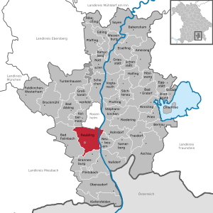
| Location of the Raubling community in the Rosenheim district | ||
  |
||

Raubling is a municipality in the Upper Bavarian district of Rosenheim .
geography
The municipality with an area of 44.27 km² is located in the foothills of the Alps , directly on the Inn and a few kilometers south of the independent city of Rosenheim . The highest point in the community, the Sulzberg at 1120 m, is in the Großholzhausen district. With a population of over 11,000, Raubling is the fifth most populous municipality in the Rosenheim district.
Community structure
Raubling has 29 districts:
|
Neighboring communities
| Kolbermoor |
Rosenheim (independent city) |
Rohrdorf |
| Bad Feilnbach |
.svg)
|
Re-firing |
| Brannenburg |
Nussdorf am Inn (pushing across the corner) |
history
Until the founding of the forerunner churches
The settlement of the Inn valley began around 2500 BC. BC, when nomads became more and more settled there, as evidenced by archaeological finds of settlement remains in the area. The sedentary lifestyle meant that more colonization began. Around 500 BC The foothills of the Alps were occupied by Celtic tribes. Even today, many names of rivers, mountains and places can be traced back to Celtic origins. 15 BC The Romans conquered the Inn valley. The area west of the Inn, to which Raubling later also belonged, was then called Raetia , the east side Norikum . Due to the influence of the Romans and their construction of roads, as in the Celtic times, many new places were created. In the fifth century the Inntal was occupied by the Germanic peoples, which resulted in the Germanic peoples and the Romans intermingling and many citizens emigrating to Italy. The Inn valley was now in the hands of the Bavarians . Indications of this are the row graves typical of Bavarians and the burial of the dead with their heads facing west. A few hundred years later, archaeological evidence was replaced by documents. Raubling was first mentioned as Rupilinga in the period from 778 to 783 when it was given to the diocese of Freising . The name itself can be traced back to the Bavarian prince Rupilo, who could have founded the village. The area was later ruled by the Count von Falkenstein . However, landlords were mostly nobility and monasteries. The count's falcon in the Raubling coat of arms still reminds of this political affiliation. With the death of the last Falkensteiner, the county fell to the Wittelsbach family . In the 14th century a dark age began in the Inn Valley: natural disasters, diseases and troop movements devastated the country. The plague was particularly severe in the 17th century; there were hardly any survivors. In Pfraundorf, for example, only seven people escaped the plague. With the expansion of the roads along the Inn and the Inn shipping, the local trade gained more and more importance. The tradition of shipping on the Inn was preserved until 1938, when the last of the timber flowed was replaced by the railroad. In 1858 one of the first railway lines was opened, the Kufstein-Rosenheim line . The municipalities of Kirchdorf, Großholzhausen, Kleinholzhausen, Pfraundorf and Reischenhart were created through a regional reform in 1818.
Name change
On June 26, 1953, the municipality of Kirchdorf am Inn was officially renamed Raubling .
Incorporations
Raubling has existed in its current form since May 1, 1978. As part of the regional reform in Bavaria at that time , the communities of Großholzhausen (with Kleinholzhausen, which was incorporated on November 22, 1864), Pfraundorf and Reischenhart and parts of the community of Pang were incorporated into the community of Raubling.
Population development
Between 1988 and 2018 the municipality grew from 9,006 to 11,485 by 2,479 inhabitants or by 27.5%.
politics
24 voluntary councilors together with the full-time mayor Olaf Karlsperger (CSU) make up the council of Raubling. After the election on March 16, 2020 , the seats of the municipal councils are distributed as follows:
| Political party | Seats |
|---|---|
| CSU | 12 |
| SPD | 2 |
| FW | 6th |
| GREEN | 4th |
traffic
The Munich – Verona railway line runs through the municipality and has a train station served exclusively by local transport at least every hour from the Meridian . Raubling is located directly at the Inntal triangle , the motorway triangle of the A 8 Munich - Salzburg and the Inntal motorway A 93 Rosenheim - Innsbruck (- Brenner ). The Federal Highway 15 led by Raubling, she was graded at 31 December 2015 St 2,363th In a few years' time, the motorway-like federal road 15n, which is currently under construction, is to meet the A 93 at the Raubling triangle that has been created by then .
Bus traffic: Raubling is connected to the regional traffic of Upper Bavaria with 6 or 7 (Wendelstein-Ringlinie, only runs between May and November) . Lines 38, 52, 9490, 9572, 9573 and 9574 have connections to Rosenheim , Kufstein , Nussdorf am Inn , Kiefersfelden , Oberaudorf , Brannenburg , Neubeu , Bad Feilnbach , Rohrdorf and Flintsbach as well as with the Wendelstein ring line between May and November Bayrischzell and Fischbachau . At the weekend there is a night line (N5) to Rosenheim and Kufstein.
economy
Due to the favorable transport infrastructure , Raubling is an important business location in the Rosenheim district . The paper mill in particular has had a strong impact on Raubling in the past. The Raublinger coat of arms takes this importance into account. In the right half you can see the former lye tower of the paper mill. Due to the sale of the then Waldhof-Aschaffenburg paper mills to the Swedish SCA and the subsequent dismantling and partial sales in the 1990s, the importance of the paper mill decreased and other companies (some from the city of Rosenheim) settled there. The paper mill was last sold by Mondi to the Heinzel Group in 2016 .
While the districts of Raubling / Redenfelden are characterized by industry, for example in the district of Großholzhausen (2004: 1200 years) the village, rural roots can still be recognized. Due to the increasing development in the economy and population (e.g. commuters to Rosenheim / Munich), however, the changes are not only affecting Raubling, but also in the other districts and are changing the original village structure permanently.
education
The following kindergartens are offered:
| in the districts | Raubling |
|---|---|
| St. Georg, cath. Kindergarten in Großholzhausen | Caterpillar's nest, Protestant kindergarten and day care center |
| Sonnenblume, Protestant kindergarten in Kirchdorf am Inn | Saint Michael, cath. kindergarten |
| Saint Nicholas, cath. Kindergarten in Pfraundorf | Dandelion, Protestant kindergarten |
The Michael-Ende-School, spread over three school buildings in Kirchdorf, Redenfelden and Raubling, has over 400 primary school students in 17 classes and almost 600 secondary school students in 16 classes. The school offers the M-Zug (intermediate educational qualification) for the network of secondary schools in the Inn Valley.
The modern Raublinger Gymnasium started its first lessons in the 1997/1998 school year. 998 students are currently being taught there by over 100 teachers in 30 classes (+ Q11 and Q12) (status: end of the 2013/14 school year).
Architectural monuments
Personalities
- Spiritual councilor Pastor Josef Sigllechner (1916–2008), pastor and founder of the parish Hl. Kreuz, as well as the kindergarten Sankt Michael (since 1991 honorary citizen of the community Raubling)
- Elisabeth von Samsonow (* 1956), philosopher and sculptor
- Hans Widera (1887–1972), business lawyer
literature
- Sebastian Dachauer : Contributions to the chronicle of several localities from the area of Brannenburg . Volume 2: The parish of Pang and the localities belonging to it . Munich 1853, pp. 31-32 ( online ).
Individual evidence
- ↑ "Data 2" sheet, Statistical Report A1200C 202041 Population of the municipalities, districts and administrative districts 1st quarter 2020 (population based on the 2011 census) ( help ).
- ↑ http://www.bayerische-landesbibliothek-online.de/orte/ortssuche_action.html ? Anzeige=voll&modus=automat&tempus=+20111022/215024&attr=OBJ&val= 522
- ↑ a b Wilhelm Volkert (Ed.): Handbook of the Bavarian offices, communities and courts 1799–1980 . CH Beck, Munich 1983, ISBN 3-406-09669-7 , p. 561 .
- ^ Federal Statistical Office (ed.): Historical municipality directory for the Federal Republic of Germany. Name, border and key number changes in municipalities, counties and administrative districts from May 27, 1970 to December 31, 1982 . W. Kohlhammer GmbH, Stuttgart / Mainz 1983, ISBN 3-17-003263-1 , p. 588 .
- ↑ http://www.kommunalwahl2014.bayern.de/tabm2187000.html
- ↑ https://raubling.de/kommunalwahl2020
- ↑ Archived copy ( memento of the original from January 2, 2016 in the Internet Archive ) Info: The archive link was inserted automatically and has not yet been checked. Please check the original and archive link according to the instructions and then remove this notice.
Web links
- Entry on the Raubling coat of arms in the database of the House of Bavarian History

Albaching | Amerang | Aschau im Chiemgau | Babensham | Bad Aibling | Bad Endorf | Bad Feilnbach | Bernau am Chiemsee | Brannenburg | Breitbrunn am Chiemsee | Bruckmühl | Chiemsee | Edling | Eggstätt | Eiselfing | Feldkirchen-Westerham | Flintsbach am Inn | Frasdorf | Griesstätt | Großkarolinenfeld | Gstadt am Chiemsee | Halfing | Höslwang | Kiefersfelden | Kolbermoor | New building | Nussdorf am Inn | Oberaudorf | Pfaffing | Prien am Chiemsee | Prutting | Ramerberg | Raubling | Riedering | Rimsting | Rohrdorf | Rott am Inn | Samerberg | Schechen | Schonstett | Söchtenau | Soyen | Stephanskirchen | Tuntenhausen | Vogtareuth | Wasserburg am Inn
Unregulated areas in the district of Rosenheim
Rotter Forst-Nord |
Rotter Forst-Süd