Albaching
| coat of arms | Germany map | |
|---|---|---|

|
Coordinates: 48 ° 7 ' N , 12 ° 7' E |
|
| Basic data | ||
| State : | Bavaria | |
| Administrative region : | Upper Bavaria | |
| County : | Rosenheim | |
| Management Community : | Pfaffing | |
| Height : | 513 m above sea level NHN | |
| Area : | 18.15 km 2 | |
| Residents: | 1759 (Dec. 31, 2019) | |
| Population density : | 97 inhabitants per km 2 | |
| Postal code : | 83544 | |
| Area code : | 08076 | |
| License plate : | RO , AIB , WS | |
| Community key : | 09 1 87 186 | |
| LOCODE : | DE ALY | |
| Community structure: | 35 districts | |
| Address of the municipal administration: |
Schulweg 1 83544 Albaching |
|
| Website : | ||
| Mayor : | Franz X. Sanftl ( Free Voters Group Sanftl ) | |
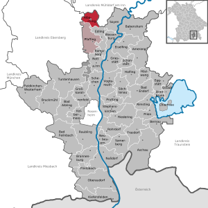
| Location of the municipality of Albaching in the district of Rosenheim | ||
Albaching is a municipality and a village in the Upper Bavarian district of Rosenheim with 1,733 inhabitants and a member of the Pfaffing administrative community . Colloquially, Albaching is also called "Oibich" [ 'ɔɪb̥ɪç ].
geography
Geographical location
Albaching is located in the foothills of the Alps around 45 km east of Munich , 30 km south of Erding , 40 km south-west of Mühldorf am Inn , 12 km north-west of Wasserburg am Inn , 38 km north of Rosenheim and 13 km north-east of Ebersberg . The nearest train station is in Forsting , a district of Pfaffing, 4 km away . The Grafing – Wasserburg railway line - the so-called Filzenexpress - is served every hour by regional trains of the Südostbayernbahn . The bus routes 855 and 9409 provide connections to Gars am Inn , Forsting, Steinhöring and to Dorfen , Haag in Upper Bavaria , Edling and Wasserburg am Inn.
Community structure
Albaching has 35 districts:
|
climate
The annual precipitation is 1039 mm and is therefore comparatively high as it falls in the upper quarter of the values recorded in Germany. Lower values are registered at 87% of the measuring stations of the German Weather Service . The driest month is February, with the most rainfall in June. In June there is 2.2 times more rainfall than in February. The seasonal fluctuations are great. Higher seasonal fluctuations are registered at only 7% of the measuring stations.
history
The name of the settlement was first documented in 808 as Alpicha (818 again as Alpihha ). In the 12th century the spellings Albichingen and Alchingen appear . The name Albaching has been in use for the parish village since 1415. A conclusive derivation of the name has not yet been successful. It could be based on the name of the river Albach, Indo-European albh for white and Old High German aha for water, which was still called Mühlbach in the 19th century and therefore may not be named after. Another theory uses the Roman gentile name Albius as the namesake, which would testify to the settlement being very early on. However, both assumptions are not scientifically proven. Albaching has always belonged to the Free County of Haag until 1804 , which in turn had been acquired by the Wittelsbachers . Albaching became an independent political municipality in the course of the administrative reforms in Bavaria in 1818.
On April 1, 1971, the previously independent municipality of Utzenbichl and parts of the area of the dissolved municipality of Rosenberg were incorporated. On May 1, 1978, the municipality of Albaching was dissolved in the course of the municipal reform and incorporated into the municipality of Pfaffing. After years of resistance and numerous negotiations, Albaching regained its independence on January 1, 1994 and has since formed an administrative partnership with the Pfaffing community.
In August 2008, Albaching celebrated its 1200th anniversary.
Architectural monuments
See: List of architectural monuments in Albaching
Soil monuments
See: List of archaeological monuments in Albaching
literature
- Albaching municipality (ed.): Albaching. Timeline. Geiger-Verlag, Horb am Neckar 2012, ISBN 978-3-86595-473-2 .
Web links
- Homepage of the Albaching community
- Entry on the coat of arms of Albaching in the database of the House of Bavarian History
- Albaching: Official statistics of the LfStat (PDF; 1.66 MB)
Individual evidence
- ↑ "Data 2" sheet, Statistical Report A1200C 202041 Population of the municipalities, districts and administrative districts 1st quarter 2020 (population based on the 2011 census) ( help ).
- ↑ Municipality of Albaching: Mayor. Retrieved May 9, 2020 .
- ↑ http://www.bayerische-landesbibliothek-online.de/orte/ortssuche_action.html ? Anzeige=voll&modus=automat&tempus=+20111021/021517&attr=OBJ&val= 46311
- ^ Wilhelm Volkert (ed.): Handbook of Bavarian offices, communities and courts 1799–1980 . CH Beck, Munich 1983, ISBN 3-406-09669-7 , p. 589 .
- ^ Federal Statistical Office (ed.): Historical municipality directory for the Federal Republic of Germany. Name, border and key number changes in municipalities, counties and administrative districts from May 27, 1970 to December 31, 1982 . W. Kohlhammer GmbH, Stuttgart / Mainz 1983, ISBN 3-17-003263-1 , p. 588 .
- ↑ StBA: Changes in the municipalities in Germany, see 1994


