
Administrative community Pfaffing
| coat of arms | Germany map | |
|---|---|---|
 Help on coat of arms |
Coordinates: 48 ° 3 ' N , 12 ° 7' E |
|
| Basic data | ||
| Existing period: | 1978– | |
| State : | Bavaria | |
| Administrative region : | Upper Bavaria | |
| County : | Rosenheim | |
| Area : | 53.54 km 2 | |
| Residents: | 5966 (Dec. 31, 2019) | |
| Population density : | 111 inhabitants per km 2 | |
| License plate : | RO , AIB , WS | |
| Association key : | 09 1 87 5184 | |
| Association structure: | 2 municipalities | |
| Association administration address : |
Schulstr. 3 83539 Pfaffing |
|
| Website : | ||
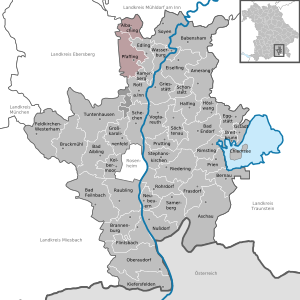
| Location of the Pfaffing administrative community in the Rosenheim district | ||
  |
||

The Pfaffing administrative community is located in the Upper Bavarian district of Rosenheim and consists of the following communities:
The administrative association is based in Pfaffing.
On May 1, 1978, the municipality of Albaching was dissolved against the will of its citizens in the course of the municipal reform and incorporated into the municipality of Pfaffing. After years of resistance and numerous negotiations, Albaching regained its independence on January 1, 1994 and has since formed an administrative partnership with the Pfaffing community.
Individual evidence
- ↑ "Data 2" sheet, Statistical Report A1200C 202041 Population of the municipalities, districts and administrative districts 1st quarter 2020 (population based on the 2011 census) ( help ).
- ^ Federal Statistical Office (ed.): Historical municipality directory for the Federal Republic of Germany. Name, border and key number changes in municipalities, counties and administrative districts from May 27, 1970 to December 31, 1982 . W. Kohlhammer GmbH, Stuttgart and Mainz 1983, ISBN 3-17-003263-1 , p. 588 .
- ↑ StBA: Changes in the municipalities in Germany, see 1994
- ↑ Fourth law to change the structure of municipalities and administrative communities of November 9, 1993 ( GVBl p. 830)
Administrative communities in the Rosenheim district
Breitbrunn a.Chiemsee | Halfing | Pfaffing | Rott a.Inn
Dissolved: Brannenburg | Eiselfing | New building | Prutting