Simssee
| Simssee | ||
|---|---|---|

|
||
| Geographical location | Alpine foothills | |
| Tributaries | Answerer Achen , Thalkirchner Achen , Labenbach , Fellbach , Angerbach | |
| Drain | Sims → Inn | |
| Places on the shore | Simssee, Krottenmühl | |
| Location close to the shore | Pietzing, Stephanskirchen | |
| Data | ||
| Coordinates | 47 ° 52 '22 " N , 12 ° 14' 22" E | |
|
|
||
| Altitude above sea level | 470.1 m above sea level NHN | |
| surface | 6.49 km² | |
| length | 5.67 km | |
| width | 1.53 km | |
| volume | 87,000,000 m³ | |
| scope | 14 km | |
| Maximum depth | 22.5 m | |
| Middle deep | 13.4 m | |
| PH value | 7.2-8.7 | |
| Catchment area | 59.5 km² | |
|
particularities |
calcareous |
|
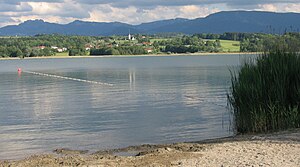
The Simssee is a lake in Upper Bavaria . It is the last remnant of Lake Rosenheim , which at the end of the Würm Ice Age extended into what is now the Simssees.
It is located 7 km east of the independent city of Rosenheim and, with a surface area of 6.49 km², is the largest lake in the Rosenheim district . The maximum depth is 22.5 m. Its drain feeds the Sims . The renewal time of the Simssees is around one and a half years. Its catchment area covers 59.51 km².
The northern part of the lake belongs to the municipality of Bad Endorf . In the south, the districts of Simssee and Baierbach of the municipality of Stephanskirchen border the lake. In the south, the districts of Ecking and Pietzing border the municipality of Riedering . In the northwest is Prutting , in the north Söchtenau .
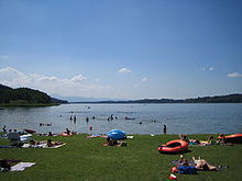
The Simssee is embedded in a gentle hilly landscape with largely untouched reed and bank areas. The circumnavigation of the lake can be done on foot or by bike (approx. 20 km). A well-developed path leads from Baierbach through moor and reed zones to Ecking. In addition to a campsite, three bathing areas, some of which are free of charge, and boat moorings for sailors offer recreational opportunities.
Nature and landscape protection areas
The Simssee is located in the Protected Landscape Area of the Simssees and its surroundings , which also includes the existing high and low moors in the silting belt of the lake and was granted protection status as early as 1963.
The south bank and its surroundings have been designated as a nature reserve south bank of the Simssees since 1993 . The protected area around the outflow of the lake has a size of 257 hectares. In their lowland forests and meadows and moors companies the southern houses silting zone many now rare plant species such as the cutting Ried . It is of great value for species and biotope protection and therefore - in addition to the entire lake area - also an FFH area .
See also
References and comments
- ↑ a b c d e f g h Documentation of the condition and development of the most important lakes in Germany: Part 11 Bavaria (PDF; 1.7 MB)
- ↑ calculated from the bank development
- ↑ protected planet
- ↑ protected planet
- ↑ 8139-371 Simsee area. (FFH area) Profiles of the Natura 2000 areas. Published by the Federal Agency for Nature Conservation . Retrieved November 24, 2017.
literature
- Anton Endrös : The Sims lake and its sea fluctuations (Seiches). Datterer, Freising 1913.


