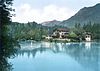
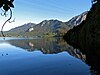
| Name of the lake
|
Area in km²
|
Administrative district
|
district
|
Municipality / city
|
Coordinates
|
image
|
comment
|
| Abtsdorfer See |
0.84 |
Upper Bavaria |
Berchtesgadener Land |
Saaldorf-Surheim |
47 ° 54 ′ 38 " N , 12 ° 54 ′ 28" E47.910556 12.907778
|

more pictures
|
LSG
|
| Aindlinger Baggersee |
0.09 |
Swabia |
Aichach-Friedberg |
Wise to death |
48 ° 31 '4 " N , 10 ° 52' 59" E48.5178833 10.8831
|
 |
Lake district 'Sander Seen' quarry ponds
|
| Alatsee |
0.12 |
Swabia |
Ostallgäu |
Feet |
47 ° 33 ′ 39 " N , 10 ° 38 ′ 22" E47.560833 10.639444
|
more pictures
|
LSG
|
| Alpsee |
0.88 |
Swabia |
Ostallgäu |
Schwangau |
47 ° 33 ′ 4 " N , 10 ° 43 ′ 25" E47.551111 10.723611
|

more pictures
|
LSG
|
| Altmuehlsee |
4.5 |
Middle Franconia |
Weissenburg-Gunzenhausen |
Muhr am See , Gunzenhausen
|
49 ° 7 '59 " N , 10 ° 43' 29" E49.133037 10.72463
|

more pictures
|
partly NSG , LSG , reservoir
|
| Ant lake |
0.04 |
Upper Bavaria |
Weilheim-Schongau |
Iffeldorf |
47 ° 47 ′ 53 " N , 11 ° 17 ′ 56" E47.79804 11.2989
|
 |
Toteissee , part of the Osterseen , NSG Osterseen
|
| Ammersee |
46.6 |
Upper Bavaria |
Landsberg am Lech |
Community-free area |
48 ° 0 ′ 0 ″ N , 11 ° 7 ′ 0 ″ E48 11.116667
|

more pictures
|
LSG Ammersee-West ; partly NSG : Seeholz and Seewiese as well as bird sanctuary Ammersee-Südufer ,
|
| Ampersee |
0.09 |
Upper Bavaria |
Fürstenfeldbruck |
Olching |
48 ° 13 ′ 51 ″ N , 11 ° 21 ′ 25 ″ E48.230734 11.357031
|
 |
LSG , quarry pond
|
| Auensee |
0.18 |
Swabia |
Aichach-Friedberg |
Kissing |
48 ° 18 ′ 44 " N , 10 ° 57 ′ 6" E48.312086 10.951589
|
 |
Quarry pond
|
| Awaiting pond |
0.02 |
Upper Bavaria |
Bad Toelz-Wolfratshausen |
Egling |
47 ° 56 ′ 21 ″ N , 11 ° 31 ′ 29 ″ E47.93921 11.52462
|
more pictures
|
artificially created pond
|
| Motorway lake |
0.17 |
Swabia |
augsburg |
augsburg |
48 ° 24 '36 " N , 10 ° 55' 40" E48.410103 10.927878
|

more pictures
|
Quarry pond
|
| Auwaldsee |
0.5 |
Upper Bavaria |
Ingolstadt |
Ingolstadt |
48 ° 45 ′ 4 " N , 11 ° 28 ′ 7" E48.75112 11.4687
|

more pictures
|
Quarry pond
|
| Bachtelsee |
0.34 |
Swabia |
Ostallgäu |
Biessenhofen |
47 ° 50 ′ 35 " N , 10 ° 39 ′ 0" E47.84317 10.64992
|

more pictures
|
LSG , reservoir
|
| Pond pond |
0.05 |
Swabia |
Kempten |
Kempten |
47 ° 43 '12 " N , 10 ° 20' 53" E47.72 10.348
|
more pictures
|
pond created for fish farming
|
| Badenburg lake |
0.06 |
Upper Bavaria |
Munich |
Munich |
48 ° 9 ′ 19 ″ N , 11 ° 29 ′ 28 ″ E48.15526 11.4911
|

more pictures
|
LSG Nymphenburg , artificial lake in the Nymphenburg Palace Park
|
| Badersee |
0.01 |
Upper Bavaria |
Garmisch-Partenkirchen |
Grainau |
47 ° 28 '24 " N , 11 ° 1' 0" E47.47324 11.01654
|
more pictures
|
|
| Bear Lake |
0.54 |
Swabia |
Kaufbeuren |
Kaufbeuren |
47 ° 51 ′ 28 " N , 10 ° 38 ′ 34" E47.85769 10.64275
|

more pictures
|
LSG , reservoir
|
| Bärnsee |
0.07 |
Upper Bavaria |
Rosenheim |
Aschau im Chiemgau |
47 ° 47 ′ 50 " N , 12 ° 20 ′ 14" E47.79733 12.33715
|
more pictures
|
LSG
|
| Quarry pond |
0.5 |
Upper Bavaria |
Ingolstadt |
Ingolstadt |
48 ° 45 ′ 1 ″ N , 11 ° 23 ′ 47 ″ E48.7503 11.39626
|

more pictures
|
Quarry pond
|
| Stretch Irsingen
|
0.15 |
Swabia |
Unterallgäu |
Türkheim |
48 ° 1 ′ 52 " N , 10 ° 37 ′ 25" E48.03109 10.62372
|
|
Quarry pond
|
| Quarry pond |
0.04 |
Swabia |
Unterallgäu |
Rammingen |
48 ° 3 ′ 57 " N , 10 ° 36 ′ 17" E48.06576 10.60479
|
|
Quarry pond
|
| Quarry pond |
0.16 |
Swabia |
Unterallgäu |
Salgae |
48 ° 8 ′ 29 ″ N , 10 ° 29 ′ 18 ″ E48.14129 10.48844
|

|
Quarry pond
|
| Quarry pond |
0.04 |
Swabia |
Unterallgäu |
Türkheim |
48 ° 3 ′ 19 ″ N , 10 ° 37 ′ 0 ″ E48.05523 10.61664
|
|
Quarry pond
|
| Quarry pond |
0.01 |
Swabia |
Unterallgäu |
Again |
48 ° 2 ′ 51 ″ N , 10 ° 41 ′ 24 ″ E48.04763 10.68993
|
|
Quarry pond
|
| Baggersee am Hart |
0.02 |
Upper Bavaria |
Freising |
Eching |
48 ° 17 ′ 27 " N , 11 ° 38 ′ 48" E48.29077 11.64654
|

more pictures
|
LSG Freisinger Moos and Echinger Gfild ,
Baggersee
|
| Bannwaldsee |
2.28 |
Swabia |
Ostallgäu |
Schwangau |
47 ° 36 ′ 2 " N , 10 ° 46 ′ 28" E47.60063 10.77455
|
more pictures
|
NSG
|
| Barmsee |
0.55 |
Upper Bavaria |
Garmisch-Partenkirchen |
Krün |
47 ° 29 ′ 56 " N , 11 ° 14 ′ 46" E47.49901 11.24612
|

more pictures
|
LSG
|
| Bayersoiener See |
0.23 |
Upper Bavaria |
Garmisch-Partenkirchen |
Bad Bayersoien |
47 ° 41 ′ 27 ″ N , 11 ° 0 ′ 20 ″ E47.69076 11.00564
|
more pictures
|
LSG
|
| Bechthaler pond |
0.01 |
Middle Franconia |
Weissenburg-Gunzenhausen |
Raitenbuch |
49 ° 1 ′ 19 " N , 11 ° 10 ′ 40" E49.02186 11.17771
|
 |
Altmühltal Nature Park , LSG
|
| Pool pond |
0.1 |
Lower Bavaria |
Straubing arch |
Wiesenfelden |
49 ° 2 ′ 23 " N , 12 ° 32 ′ 10" E49.03972 12.53602
|
 |
NSG , Bavarian Forest Nature Park
|
| Bibi lake |
0.16 |
Upper Bavaria |
Bad Toelz-Wolfratshausen |
Königsdorf |
47 ° 50 ′ 4 " N , 11 ° 28 ′ 23" E47.83451 11.47316
|
more pictures
|
Quarry pond
|
| Bichlersee |
0.01 |
Upper Bavaria |
Rosenheim |
Oberaudorf |
47 ° 40 ′ 34 " N , 12 ° 7 ′ 20" E47.67616 12.12211
|

more pictures
|
LSG protection of the Auerbach valley including Regau (am Förchenbach) and Bichlersee
|
| Biengartner Weiherplatte |
|
Middle Franconia |
Erlangen-Höchstadt |
Höchstadt an der Aisch , Gremsdorf , Weisendorf u. a. |
49 ° 39 ′ 38 " N , 10 ° 50 ′ 24" E49.66068 10.84003
|
|
NSG , lake district created for fish farming
|
| Bingstetter See |
0.2 |
Swabia |
Ostallgäu , Unterallgäu
|
Jengen , Bad Wörishofen
|
47 ° 59 '17 " N , 10 ° 38' 55" E47.98805 10.64858
|
more pictures
|
partly LSG , reservoir
|
| Birch Lake |
0.02 |
Lower Bavaria |
Dingolfing-Landau |
Dingolfing |
48 ° 38 ′ 6 " N , 12 ° 27 ′ 26" E48.63508 12.45732
|
 |
Quarry pond
|
| Birch Lake |
0.03 |
Upper Bavaria |
Dachau |
Bergkirchen |
48 ° 12 ′ 14 " N , 11 ° 25 ′ 1" E48.20384 11.41706
|

more pictures
|
Quarry pond
|
| Birch Lake |
0.02 |
Upper Bavaria |
Bad Toelz-Wolfratshausen |
Geretsried |
47 ° 52 ′ 8 " N , 11 ° 25 ′ 32" E47.86889 11.42552
|
 |
|
| Birch Lake |
0.05 |
Middle Franconia |
Nuremberg country |
Röthenbach on the Pegnitz |
49 ° 27 '24 " N , 11 ° 15' 30" E49.456667 11.258333
|

more pictures
|
Quarry pond
|
| Blaibacher See |
0.47 |
Upper Palatinate |
Cham |
Blaibach |
49 ° 8 ′ 58 " N , 12 ° 50 ′ 5" E49.14957 12.83473
|

more pictures
|
LSG , reservoir
|
| Bockstallsee |
0.02 |
Swabia |
Ostallgäu |
Halbch |
47 ° 34 ′ 25 ″ N , 10 ° 50 ′ 13 ″ E47.57361 10.83688
|

more pictures
|
NSG , reservoir
|
| Lake Constance |
536 |
Bavaria / Baden-Württemberg
( Switzerland / Austria )
|
|
|
47 ° 31 '22 " N , 9 ° 42' 3" E47.52277 9.70093
|

more pictures
|
Area information concerns the entire lake
LSG Bayerisches Bodenseeufer
|
| Böcklweiher |
0.01 |
Upper Bavaria |
Berchtesgadener Land |
Bischofswiesen |
47 ° 38 ′ 5 " N , 12 ° 57 ′ 50" E47.63464 12.96394
|
 |
FFH moors and extensive meadows near Berchtesgaden
|
| Bohemian Pond |
0.06 |
Upper Bavaria |
Munich |
Munich |
48 ° 10 ′ 27 " N , 11 ° 22 ′ 29" E48.17417 11.37484
|
more pictures
|
LSG Aubinger Lohe and Moosschwaige , two quarry ponds (0.05 and 0.01 km²)
|
| Bräuhaussee |
0.05 |
Upper Bavaria |
Weilheim-Schongau |
Iffeldorf |
47 ° 46 ′ 56 ″ N , 11 ° 19 ′ 7 ″ E47.78236 11.3187
|
|
Toteissee , part of the Osterseen , NSG Osterseen
|
| Brückelsee |
1.45 |
Upper Palatinate |
Schwandorf |
Schwarzenfeld , Wackersdorf , Neunburg vorm Wald
|
49 ° 20 ′ 23 " N , 12 ° 13 ′ 26" E49.33961 12.22392
|

more pictures
|
partly LSG , quarry pond
|
| Brückenhaussee |
0.06 |
Upper Franconia |
Bamberg |
Baunach |
49 ° 58 ′ 28 " N , 10 ° 51 ′ 34" E49.97435 10.85943
|
 |
Quarry pond
|
| Bridge Lake |
0.02 |
Upper Bavaria |
Weilheim-Schongau |
Iffeldorf |
47 ° 46 ′ 33 ″ N , 11 ° 18 ′ 19 ″ E47.77575 11.30523
|
|
Toteissee , part of the Osterseen , NSG Osterseen
|
| Buchner pond |
0.01 |
Upper Bavaria |
Bad Toelz-Wolfratshausen |
Bad Heilbrunn |
47 ° 46 ′ 37 " N , 11 ° 29 ′ 2" E47.77688 11.48396
|
more pictures
|
ND
|
| Buchsee |
0.02 |
Upper Bavaria |
Bad Toelz-Wolfratshausen |
Münsing |
47 ° 55 ′ 19 ″ N , 11 ° 22 ′ 31 ″ E47.92207 11.37541
|

more pictures
|
Geotope
|
| Buxheimer Weiher |
0.07 |
Swabia |
Unterallgäu |
Buxheim |
47 ° 59 ′ 29 ″ N , 10 ° 8 ′ 3 ″ E47.99144 10.13424
|
more pictures
|
Reservoir
|
| Chiemsee |
79.9 |
Upper Bavaria |
Traunstein |
Community-free area |
47 ° 52 ′ 15 ″ N , 12 ° 27 ′ 13 ″ E47.8709 12.45374
|
more pictures
|
LSG protection of the Chiemsee, its islands and shore areas , partly NSG mouth of the Tiroler Achen
|
| Christlessee |
0.01 |
Swabia |
Oberallgäu |
Oberstdorf |
47 ° 21 ′ 53 ″ N , 10 ° 18 ′ 5 ″ E47.36474 10.30141
|
more pictures
|
LSG , geotope
|
| Craimoos pond |
0.15 |
Upper Franconia |
Bayreuth |
Beak woad |
49 ° 49 ′ 20 " N , 11 ° 35 ′ 41" E49.82235 11.59476
|

more pictures
|
NSG , man-made lake
|
| Badger Lake |
0.02 |
Swabia |
Ostallgäu |
Bidingen |
47 ° 48 ′ 42 " N , 10 ° 42 ′ 20" E47.81172 10.70561
|
 |
|
| Degerndorfer Weiher |
0.01 |
Upper Bavaria |
Bad Toelz-Wolfratshausen |
Münsing |
47 ° 52 ′ 37 " N , 11 ° 22 ′ 45" E47.877009 11.379261
|

more pictures
|
Reservoir
|
| Deininger pond |
0.03 |
Upper Bavaria |
Munich |
Straßlach-Dingharting |
47 ° 57 ′ 58 ″ N , 11 ° 31 ′ 25 ″ E47.96602 11.52371
|

more pictures
|
LSG Southern Gleißental
|
| Deixlfurter See |
0.21 |
Upper Bavaria |
Starnberg |
Tutzing |
47 ° 55 ′ 11 ″ N , 11 ° 15 ′ 15 ″ E47.91965 11.25416
|

more pictures
|
LSG Starnberger See and areas adjacent to the west , lake group
|
| Dennenloher See |
0.2 |
Middle Franconia |
Ansbach |
Unterschwaningen , Arberg
|
49 ° 6 ′ 18 " N , 10 ° 36 ′ 57" E49.10513 10.61571
|
 |
Reservoir in the Franconian Lake District
|
| Derchinger Baggersee |
0.06 |
Swabia |
Aichach-Friedberg |
Friedberg |
48 ° 24 ′ 52 " N , 10 ° 57 ′ 30" E48.41445 10.95835
|
 |
Quarry pond
|
| Deutensee |
0.42 |
Upper Bavaria |
Weilheim-Schongau |
Steingaden |
47 ° 44 '25 " N , 10 ° 52' 14" E47.74035 10.87047
|

more pictures
|
|
| Dietlhofer See |
0.09 |
Upper Bavaria |
Weilheim-Schongau |
Weilheim |
47 ° 51 ′ 21 ″ N , 11 ° 9 ′ 35 ″ E47.85584 11.15964
|
more pictures
|
Dead lake
|
| Dragon Lake |
1.58 |
Upper Palatinate |
Cham |
Furth im Wald , Eschlkam
|
49 ° 18 ′ 49 ″ N , 12 ° 52 ′ 15 ″ E49.31354 12.87074
|

more pictures
|
LSG , reservoir
|
| Dreiburgensee |
0.08 |
Lower Bavaria |
Passau |
Tittling |
48 ° 44 ′ 39 " N , 13 ° 21 ′ 9" E48.74418 13.35253
|

more pictures
|
Reservoir
|
| Dutzendteich |
0.31 |
Middle Franconia |
Nuremberg |
Nuremberg |
49 ° 25 ′ 55 " N , 11 ° 7 ′ 4" E49.43185 11.11791
|

more pictures
|
Lake group
|
| Echinger lake |
0.13 |
Upper Bavaria |
Freising |
Eching |
48 ° 17 ′ 18 " N , 11 ° 38 ′ 5" E48.288447 11.634714
|

more pictures
|
LSG Freisinger Moos and Echinger Gfild , Baggersee
|
| Echinger reservoir |
1.12 |
Lower Bavaria |
Landshut |
Eching |
48 ° 30 '12 " N , 12 ° 2' 42" E48.5033 12.04501
|

more pictures
|
NSG bird sanctuary Middle Isar reservoirs ,
reservoir
|
| Egelsee |
0.01 |
Upper Bavaria |
Starnberg |
Andechs |
47 ° 59 ′ 46 " N , 11 ° 11 ′ 38" E47.99619 11.19382
|

more pictures
|
LSG Western part of the Starnberg district
|
| Egglburg Lake |
0.33 |
Upper Bavaria |
Ebersberg |
Ebersberg |
48 ° 5 ′ 2 " N , 11 ° 56 ′ 23" E48.08399 11.93982
|
more pictures
|
NSG bird sanctuary Eggelburger See , LSG protection of Lake Egglburg and the surrounding area , reservoir
|
| Eggstätt-Hemhofer Lake District |
3.5 |
Upper Bavaria |
Rosenheim |
Bad Endorf , Eggstätt , Rimsting
|
47 ° 54 ′ 49 " N , 12 ° 20 ′ 41" E47.9137 12.34468
|

more pictures
|
NSG , geotope , lake district with 18 individual lakes
|
| Eginger See |
0.2 |
Lower Bavaria |
Passau |
Eging at the lake |
48 ° 43 ′ 18 " N , 13 ° 16 ′ 34" E48.72153 13.27614
|

more pictures
|
Reservoir
|
| Eibsee |
1.77 |
Upper Bavaria |
Garmisch-Partenkirchen |
Grainau |
47 ° 27 ′ 20 " N , 10 ° 58 ′ 24" E47.45549 10.97328
|

more pictures
|
LSG
|
| Eichenauer See |
0.01 |
Upper Bavaria |
Fürstenfeldbruck |
Eichenau |
48 ° 9 ′ 21 ″ N , 11 ° 18 ′ 44 ″ E48.15587 11.31217
|

more pictures
|
Quarry pond
|
| Eichinger See |
0.02 |
Upper Bavaria |
Dachau |
Karlsfeld |
48 ° 13 '24 " N , 11 ° 27' 40" E48.22334 11.46107
|
more pictures
|
Quarry pond
|
| Eichsee |
0.05 |
Upper Bavaria |
Garmisch-Partenkirchen |
Largely |
47 ° 40 ′ 50 " N , 11 ° 19 ′ 56" E47.68059 11.33214
|
more pictures
|
Part of the Loisach-Kochelsee-Moore
|
| Bessee |
0.06 |
Upper Bavaria |
Rosenheim |
Eggstätt |
47 ° 55 '9 " N , 12 ° 21' 33" E47.91921 12.35921
|
 |
NSG , part of the Eggstätt-Hemhofer lake district
|
| Ice house |
0.08 |
Upper Bavaria |
Weilheim-Schongau |
Iffeldorf |
47 ° 47 ′ 3 ″ N , 11 ° 19 ′ 1 ″ E47.78423 11.31703
|
|
Toteissee , part of the Osterseen , NSG Osterseen , private
lake |
| Ice pond |
0.03 |
Middle Franconia |
Nuremberg |
Community-free area |
49 ° 25 ′ 34 " N , 11 ° 10 ′ 30" E49,426 11,175
|

more pictures
|
Reservoir
|
| Eitzenberger Weiher |
0.1 |
Upper Bavaria |
Weilheim-Schongau |
Iffeldorf |
47 ° 47 ′ 11 " N , 11 ° 21 ′ 55" E47.7864 11.36514
|

more pictures
|
Pond group consisting of: old pond, new pond and wooden pond
|
| Eixendorftalsperre |
1.01 |
Upper Palatinate |
Schwandorf |
Neunburg vorm Wald |
49 ° 20 '24 " N , 12 ° 26' 38" E49.33989 12.4439
|

more pictures
|
LSG , reservoir
|
| Elbsee |
0.21 |
Swabia |
Ostallgäu |
Aitrang |
47 ° 48 ′ 1 ″ N , 10 ° 33 ′ 11 ″ E47.80036 10.55293
|
more pictures
|
LSG
|
| Ellertshauser lake |
0.33 |
Lower Franconia |
Schweinfurt |
Stadtlauringen |
50 ° 8 ′ 56 " N , 10 ° 22 ′ 39" E50.14877 10.37762
|
more pictures
|
LSG , reservoir
|
| Emmeringer See |
0.03 |
Upper Bavaria |
Fürstenfeldbruck |
Emmering |
48 ° 11 ′ 32 " N , 11 ° 17 ′ 0" E48.19218 11.28347
|

more pictures
|
Quarry pond
|
| Engelsried lake |
0.07 |
Upper Bavaria |
Landsberg am Lech |
Red |
47 ° 53 ′ 15 " N , 10 ° 58 ′ 42" E47.8874 10.97835
|
 |
LSG , reservoir
|
| Engeratsgundsee |
0.03 |
Swabia |
Oberallgäu |
Bad Hindelang |
47 ° 26 ′ 29 " N , 10 ° 23 ′ 30" E47.4413 10.39156
|

more pictures
|
NSG
|
| Duck pond |
0.01 |
Upper Bavaria |
Munich |
Munich |
48 ° 6 '56 " N , 11 ° 33' 48" E48.11564 11.56341
|

more pictures
|
LSG Isarauen
|
| Erlabrunn bathing lake |
0.07 |
Lower Franconia |
Wurzburg |
Erlabrunn |
49 ° 51 ′ 10 " N , 9 ° 51 ′ 16" E49.85264 9.85458
|

more pictures
|
Quarry pond
|
| Erlauzwieseler See |
0.08 |
Lower Bavaria |
Freyung-Grafenau |
Waldkirchen |
48 ° 43 ′ 14 " N , 13 ° 38 ′ 20" E48.72053 13.63901
|
 |
Reservoir
|
| Erlensee |
0.05 |
Upper Bavaria |
Rosenheim |
Schechen |
47 ° 55 ′ 25 ″ N , 12 ° 8 ′ 7 ″ E47.92355 12.13521
|
more pictures
|
LSG protection of the Inn valley
|
| Erlensee |
0.02 |
Upper Bavaria |
Erding |
Taufkirchen (Vils) |
48 ° 19 ′ 18 " N , 12 ° 14 ′ 38" E48.32172 12.24381
|
|
|
| Eschach pond |
0.09 |
Swabia |
Oberallgäu |
Buchenberg |
47 ° 41 ′ 42 " N , 10 ° 11 ′ 29" E47.69503 10.19128
|

more pictures
|
LSG , reservoir
|
| Eschenauer See |
0.18 |
Upper Bavaria |
Traunstein |
Pittenhart |
47 ° 56 '42 " N , 12 ° 23' 53" E47,945 12,398
|
 |
Toteissee , part of the Eggstätt-Hemhofer lake district
|
| Eßsee |
0.08 |
Upper Bavaria |
Starnberg |
Poecking |
47 ° 58 ′ 11 ″ N , 11 ° 14 ′ 2 ″ E47.96981 11.23393
|

more pictures
|
LSG Western part of the Starnberg district
|
| Falkensee |
0.01 |
Upper Bavaria |
Traunstein |
Inzell |
47 ° 44 ′ 55 " N , 12 ° 45 ′ 58" E47.74851 12.76617
|

more pictures
|
NSG , see Falkenseebach
|
| Fasaneriesee |
0.15 |
Upper Bavaria |
Munich |
Munich |
48 ° 12 ′ 17 " N , 11 ° 31 ′ 47" E48.20463 11.52977
|

more pictures
|
Quarry pond
|
| Lazy Lake |
0.02 |
Swabia |
Ostallgäu |
Vineyards on the Forggensee |
47 ° 37 ′ 21 ″ N , 10 ° 41 ′ 49 ″ E47.62255 10.69704
|
 |
LSG
|
| Feisnitz reservoir |
0.2 |
Upper Franconia |
Wunsiedel in the Fichtel Mountains |
Arzberg |
50 ° 2 ′ 3 " N , 12 ° 10 ′ 50" E50.03413 12.18062
|
 |
LSG , reservoir
|
| Feldmochinger See |
0.2 |
Upper Bavaria |
Munich |
Munich |
48 ° 12 ′ 52 " N , 11 ° 30 ′ 54" E48.21441 11.51509
|

more pictures
|
LSG Schwarzhölzl with the area adjacent to the south and east, the Würm Canal and the area around the Baggersee in Feldmoching ,
Baggersee
|
| Ferchensee |
0.1 |
Upper Bavaria |
Garmisch-Partenkirchen |
Mittenwald |
47 ° 26 '19 " N , 11 ° 12' 49" E47.43861 11.21362
|

more pictures
|
LSG
|
| Feringa lake |
0.32 |
Upper Bavaria |
Munich |
Unterföhring |
48 ° 11 ′ 43 " N , 11 ° 40 ′ 17" E48.19522 11.67147
|

more pictures
|
Quarry pond
|
| Fichtelsee |
0.11 |
Upper Franconia |
Bayreuth |
Fichtelberg |
50 ° 0 ′ 52 " N , 11 ° 51 ′ 36" E50.01451 11.86004
|

more pictures
|
LSG , reservoir
|
| Fichtsee |
0.01 |
Upper Bavaria |
Weilheim-Schongau |
Sindelsdorf |
47 ° 42 ′ 46 " N , 11 ° 21 ′ 41" E47.71282 11.3613
|
more pictures
|
NSG , part of the Loisach-Kochelsee-Moore
|
| Fischkaltersee |
0.03 |
Upper Bavaria |
Weilheim-Schongau |
Iffeldorf |
47 ° 46 ′ 53 " N , 11 ° 19 ′ 21" E47.78133 11.32237
|

more pictures
|
Toteissee , part of the Osterseen , NSG Osterseen
|
| Floriansee |
0.08 |
Upper Bavaria |
Rosenheim |
Rosenheim |
47 ° 50 ′ 6 " N , 12 ° 8 ′ 47" E47.83502 12.14646
|

more pictures
|
LSG Innauen-Süd
|
| Fohnsee |
0.21 |
Upper Bavaria |
Weilheim-Schongau |
Iffeldorf |
47 ° 46 ′ 48 " N , 11 ° 18 ′ 50" E47.78008 11.31377
|
more pictures
|
Toteissee , part of the Osterseen , NSG Osterseen
|
| Förchensee |
0.03 |
Upper Bavaria |
Rosenheim |
Bernau am Chiemsee |
47 ° 49 ′ 39 " N , 12 ° 23 ′ 32" E47.82741 12.39225
|
 |
LSG Protection of the Chiemsee, its islands and riverside areas in the districts of Rosenheim and Traunstein as LSG ("Chiemsee Protection Ordinance") , LSG-00396.01
|
| Förchensee |
0.04 |
Upper Bavaria |
Traunstein |
Ruhpolding |
47 ° 42 ′ 28 " N , 12 ° 37 ′ 12" E47.70791 12.62007
|
 |
NSG
|
| Forggensee |
15.2 |
Swabia |
Ostallgäu |
Schwangau , Füssen , Rieden , Halch a . a. |
47 ° 36 ′ 53 " N , 10 ° 44 ′ 23" E47.61473 10.73982
|
more pictures
|
LSG , reservoir
|
| Förmitztalsperre |
1.16 |
Upper Franconia |
court |
Schwarzenbach on the Saale |
50 ° 11 ′ 46 " N , 11 ° 54 ′ 40" E50.19624 11.91124
|

more pictures
|
Reservoir
|
| Forsterweiher |
0.03 |
Upper Bavaria |
Ingolstadt |
Ingolstadt |
48 ° 45 ′ 13 " N , 11 ° 22 ′ 34" E48.753694 11.376002
|
|
|
| Frankenhofner See |
0.45 |
Swabia |
Unterallgäu |
Bad Woerishofen |
47 ° 58 ′ 30 " N , 10 ° 38 ′ 28" E47.97504 10.64116
|
 |
LSG , reservoir
|
| Frechensee |
0.12 |
Upper Bavaria |
Weilheim-Schongau |
Seeshaupt |
47 ° 48 ′ 32 " N , 11 ° 17 ′ 14" E47.80901 11.28725
|
 |
NSG Osterseen
|
| Freibergsee |
0.18 |
Swabia |
Oberallgäu |
Oberstdorf |
47 ° 22 ′ 52 " N , 10 ° 16 ′ 2" E47.38121 10.26724
|

more pictures
|
LSG
|
| Open court lakes (Baltic Sea) |
0.3 |
Lower Franconia |
Aschaffenburg |
Bald on the Main |
50 ° 5 ′ 8 ″ N , 9 ° 0 ′ 23 ″ E50.08545 9.00631
|
 |
Quarry pond , part of the Kahler Seenplatte
|
| Freigerichtseen (Westsee) |
0.2 |
Lower Franconia , Hesse
|
Aschaffenburg , Main-Kinzig district
|
Bald on the Main |
50 ° 5 ′ 4 " N , 8 ° 59 ′ 59" E50.08435 8.99983
|
 |
Quarry pond , part of the Kahler Seenplatte
|
| Freudensee |
0.07 |
Lower Bavaria |
Passau |
Hauzenberg |
48 ° 39 ′ 47 " N , 13 ° 38 ′ 6" E48.66319 13.63506
|

more pictures
|
LSG , reservoir
|
| Frickenhauser lake |
0.01 |
Lower Franconia |
Rhön-Grabfeld |
Mellrichstadt |
50 ° 24 ′ 11 " N , 10 ° 14 ′ 13" E50.40304 10.23697
|

more pictures
|
NSG , natural monument , geotope
|
| Fridolfinger See |
0.06 |
Upper Bavaria |
Traunstein |
Fridolfing |
47 ° 59 ′ 39 " N , 12 ° 50 ′ 37" E47.99426 12.84366
|

more pictures
|
Quarry pond
|
| Friedberger Baggersee |
0.18 |
Swabia |
Aichach-Friedberg |
Friedberg |
48 ° 21 '47 " N , 10 ° 57' 48" E48.36312 10.96333
|
 |
Quarry pond
|
| Frillensee |
0.01 |
Upper Bavaria |
Garmisch-Partenkirchen |
Grainau |
47 ° 27 ′ 15 ″ N , 10 ° 59 ′ 6 ″ E47.45405 10.9849
|

more pictures
|
LSG
|
| Frillensee |
0.04 |
Upper Bavaria |
Traunstein |
Inzell |
47 ° 45 ′ 59 ″ N , 12 ° 49 ′ 0 ″ E47.76631 12.8168
|
more pictures
|
|
| Froschgrundsee |
0.23 |
Upper Franconia |
Coburg |
Roedental |
50 ° 21 '4 " N , 11 ° 1' 38" E50.35101 11.02718
|

more pictures
|
Reservoir
|
| Froschhauser See |
0.16 |
Upper Bavaria |
Garmisch-Partenkirchen |
Murnau am Staffelsee |
47 ° 41 ′ 12 ″ N , 11 ° 13 ′ 31 ″ E47.68664 11.22519
|
more pictures
|
NSG
|
| Fugger pond |
0.04 |
Swabia |
Unterallgäu |
Babenhausen |
48 ° 8 ′ 2 " N , 10 ° 14 ′ 30" E48.13378 10.24158
|

more pictures
|
Reservoir
|
| Funtensee |
0.03 |
Upper Bavaria |
Berchtesgadener Land |
Schoenau upon Kings sea |
47 ° 29 '36 " N , 12 ° 56" 24 " E47.4934 12.93991
|

more pictures
|
Berchtesgaden National Park , geotope
|
| Galla pond |
0.14 |
Upper Bavaria |
Weilheim-Schongau |
Bernried on Lake Starnberg |
47 ° 51 '53 " N , 11 ° 15' 13" E47.86483 11.25373
|
 |
LSG
|
| Garching lake |
0.05 |
Upper Bavaria |
Munich |
Garching |
48 ° 15 ′ 40 " N , 11 ° 38 ′ 20" E48.26106 11.63877
|

more pictures
|
LSG Munich north ,
quarry pond
|
| Garden lake |
0.07 |
Upper Bavaria |
Weilheim-Schongau |
Seeshaupt |
47 ° 49 ′ 1 ″ N , 11 ° 18 ′ 6 ″ E47.81701 11.3016
|

more pictures
|
Toteissee , part of the Osterseen , NSG Osterseen
|
| Germeringer See |
0.03 |
Upper Bavaria |
Fürstenfeldbruck |
Germering |
48 ° 8 ′ 13 ″ N , 11 ° 20 ′ 39 ″ E48.13705 11.34407
|

more pictures
|
LSG Parsberg ,
quarry pond
|
| Goldbergsee Coburg |
0.72 |
Upper Franconia |
Coburg |
Coburg |
50 ° 16 ′ 51 ″ N , 10 ° 56 ′ 4 ″ E50.28089 10.93457
|

more pictures
|
partly NSG , reservoir
|
| Griessee |
0.09 |
Upper Bavaria |
Traunstein |
Obing |
47 ° 59 ′ 11 " N , 12 ° 26 ′ 37" E47.9863 12.4436
|
 |
NSG Seeoner Seen , part of the Seeoner Seenplatte
|
| Griesweiher |
0.016 |
Swabia |
Donau-Ries district |
Niederönenfeld |
48 ° 43 '36 " N , 10 ° 55' 39" E48.726764 10.927545
|
 |
Quarry pond
|
| Gröbensee |
0.06 |
Upper Bavaria |
Weilheim-Schongau |
Seeshaupt |
47 ° 48 ′ 44 " N , 11 ° 18 ′ 0" E47.81214 11.3
|
|
Toteissee , part of the Osterseen , NSG Osterseen
|
| Great Alpsee |
2.47 |
Swabia |
Oberallgäu |
Immenstadt |
47 ° 34 '19 " N , 10 ° 10' 59" E47.57189 10.18295
|

more pictures
|
LSG
|
| Great Arbersee |
0.08 |
Lower Bavaria |
rain |
Bavarian Eisenstein |
49 ° 5 ′ 55 ″ N , 13 ° 9 ′ 20 ″ E49.09866 13.15553
|

more pictures
|
Geotop , NSG , Bavarian Forest Nature Park
|
|
Large Bischofsweiher (Dechsendorfer Weiher) |
0.35 |
Middle Franconia |
gain |
gain |
49 ° 37 ′ 57 ″ N , 10 ° 57 ′ 7 ″ E49.63248 10.95204
|

more pictures
|
LSG , Lake Group Dechsendorfer Weihergebiet
|
| Great Brombachsee |
8.7 |
Middle Franconia |
Weissenburg-Gunzenhausen |
Pleinfeld |
49 ° 7 ′ 51 ″ N , 10 ° 56 ′ 7 ″ E49.130847 10.935173
|

more pictures
|
Reservoir , partly NSG , partly LSG
|
| Great Easter Lake |
1.17 |
Upper Bavaria |
Weilheim-Schongau |
Iffeldorf |
47 ° 47 ′ 16 " N , 11 ° 18 ′ 10" E47.78768 11.30267
|
more pictures
|
Largest lake of the Osterseen , NSG Osterseen
|
| Großwelzheim bathing lake |
0.13 |
Lower Franconia |
Aschaffenburg |
Karlstein am Main |
50 ° 3 ′ 30 ″ N , 9 ° 1 ′ 3 ″ E50.05826 9.01742
|

more pictures
|
LSG , Baggersee , part of the Kahler Seenplatte
|
| Grünsee |
0.02 |
Upper Bavaria |
Miesbach |
Schliersee |
47 ° 39 '7 " N , 11 ° 51' 59" E47.651944 11.866389
|
 |
LSG protection of the Spitzingsee and its surroundings
|
| Grünsee |
0.04 |
Upper Bavaria |
Berchtesgadener Land |
Schoenau upon Kings sea |
47 ° 30 ′ 8 ″ N , 12 ° 57 ′ 12 ″ E47.50228 12.95337
|

more pictures
|
Berchtesgaden National Park
|
| Grüntensee |
1.23 |
Swabia |
Oberallgäu |
Oy-Mittelberg , Wertach
|
47 ° 37 ′ 6 " N , 10 ° 26 ′ 58" E47.61843 10.44954
|

more pictures
|
LSG , reservoir
|
| Guggenberger See |
0.54 |
Upper Palatinate |
regensburg |
Neutraubling |
48 ° 58 ′ 43 ″ N , 12 ° 13 ′ 13 ″ E48.97858 12.2204
|
 |
Quarry pond
|
| Guggersee |
0.01 |
Swabia |
Oberallgäu |
Oberstdorf |
47 ° 19 ′ 1 ″ N , 10 ° 14 ′ 57 ″ E47.31697 10.24917
|

more pictures
|
NSG
|
| Gustavsee |
0.25 |
Lower Franconia |
Aschaffenburg |
Karlstein am Main |
50 ° 3 ′ 17 ″ N , 8 ° 59 ′ 27 ″ E50.05476 8.99091
|

more pictures
|
partly NSG , quarry pond , part of the Kahler Seenplatte
|
| Haarsee |
0.06 |
Upper Bavaria |
Weilheim-Schongau |
Weilheim |
47 ° 48 ′ 38 " N , 11 ° 13 ′ 17" E47.81062 11.22142
|

more pictures
|
LSG Hardtlandschaft and Eberfinger drumlin fields
|
| Haagsweiher |
0.01 |
Middle Franconia |
Nuremberg country |
Moist forest |
49 ° 22 ′ 51 ″ N , 11 ° 13 ′ 45 ″ E49.3807 11.22918
|

more pictures
|
The Nuremberg Reichswald bird sanctuary . Artificial lake (flood protection)
|
| Hackensee |
0.08 |
Upper Bavaria |
Miesbach |
Wooden churches |
47 ° 50 ′ 57 " N , 11 ° 38 ′ 31" E47.84907 11.6419
|
more pictures
|
|
| Hahnenkammsee |
0.23 |
Middle Franconia |
Weissenburg-Gunzenhausen |
Heidenheim |
48 ° 57 '50 " N , 10 ° 43' 13" E48.963889 10.720278
|

more pictures
|
LSG , man-made lake
|
| Hapberger pond |
0.01 |
Upper Bavaria |
Weilheim-Schongau |
Seeshaupt |
47 ° 50 ′ 48 " N , 11 ° 15 ′ 39" E47.84662 11.26084
|
 |
LSG Hardtlandschaft and Eberfinger drumlin fields
|
| Happinger See |
0.23 |
Upper Bavaria |
Rosenheim , Rosenheim
|
Rosenheim , Raubling
|
47 ° 49 ′ 0 ″ N , 12 ° 7 ′ 43 ″ E47.81661 12.12852
|

more pictures
|
LSG Inntal Süd and Innauen-Süd ,
quarry pond
|
| Happinger-Au-See |
0.12 |
Upper Bavaria |
Rosenheim |
Rosenheim |
47 ° 49 ′ 48 " N , 12 ° 8 ′ 28" E47.82994 12.141136
|
more pictures
|
LSG Innauen-Süd
|
| Lake Happurger See |
0.55 |
Middle Franconia |
Nuremberg country |
Happurg |
49 ° 28 ′ 57 " N , 11 ° 28 ′ 50" E49.4825 11.480556
|
more pictures
|
LSG , reservoir
|
| Harmating pond |
0.15 |
Upper Bavaria |
Bad Toelz-Wolfratshausen |
Egling |
47 ° 53 '10 " N , 11 ° 31' 49" E47.88609 11.53017
|

more pictures
|
LSG Großer Weiher ,
reservoir
|
| Hartsee |
0.87 |
Upper Bavaria |
Rosenheim |
Eggstätt |
47 ° 55 ′ 37 ″ N , 12 ° 22 ′ 2 ″ E47.92682 12.36714
|
 |
NSG , part of the Eggstätt-Hemhofer lake district
|
| Haslacher See |
0.40 |
Upper Bavaria |
Weilheim-Schongau |
Bernbeuren |
47 ° 45 ′ 1 ″ N , 10 ° 47 ′ 7 ″ E47.75025 10.78532
|

more pictures
|
LSG
|
| Hausler Lake |
0.01 |
Upper Bavaria |
Freising |
Hallbergmoos |
48 ° 17 ′ 26 " N , 11 ° 43 ′ 20" E48.29062 11.7221
|
 |
LSG moss landscape south of Hallbergmoos
|
| Hegratsrieder See |
0.1 |
Swabia |
Ostallgäu |
Halbch |
47 ° 37 ′ 0 ″ N , 10 ° 45 ′ 59 ″ E47.61655 10.76626
|

more pictures
|
LSG
|
| Heiligenwaldsee |
0.14 |
Middle Franconia |
Weissenburg-Gunzenhausen |
Pleinfeld |
49 ° 7 ′ 17 ″ N , 10 ° 59 ′ 18 ″ E49.12141 10.98839
|
|
Quarry pond
|
| Heimstettener See |
0.11 |
Upper Bavaria |
Munich |
Kirchheim near Munich , Aschheim
|
48 ° 9 ′ 20 " N , 11 ° 44 ′ 20" E48.15544 11.73876
|

more pictures
|
Quarry pond
|
| Herrensee |
0.03 |
Upper Bavaria |
Weilheim-Schongau |
Iffeldorf |
47 ° 46 ′ 59 ″ N , 11 ° 19 ′ 23 ″ E47.78303 11.3231
|
|
Toteissee , part of the Osterseen , NSG Osterseen
|
| Herrenwieser Weiher |
0.06 |
Swabia |
Kempten |
Kempten |
47 ° 42 ′ 56 " N , 10 ° 15 ′ 11" E47.71566 10.25317
|

more pictures
|
|
| Hinterbrühler See |
0.03 |
Upper Bavaria |
Munich |
Munich |
48 ° 5 '9 " N , 11 ° 32' 34" E48.08578 11.54273
|

more pictures
|
LSG Isarauen
|
| Hintersee |
0.16 |
Upper Bavaria |
Berchtesgadener Land |
Ramsau |
47 ° 36 '26 " N , 12 ° 51' 16" E47.60709 12.85435
|

more pictures
|
|
| Hochstraßer See |
0.18 |
Upper Bavaria |
Rosenheim |
Raubling |
47 ° 48 ′ 37 " N , 12 ° 7 ′ 58" E47.81027 12.13268
|
more pictures
|
LSG Inntal Süd ,
quarry pond
|
| Liebenstein flood reservoir |
0.88 |
Upper Palatinate |
Tirschenreuth |
Plößberg |
49 ° 48 ′ 36 " N , 12 ° 20 ′ 3" E49.8101 12.33413
|
 |
LSG , reservoir
|
| Hödenauer See |
0.04 |
Upper Bavaria |
Rosenheim |
Kiefersfelden |
47 ° 37 ′ 40 " N , 12 ° 11 ′ 28" E47.62769 12.19122
|

more pictures
|
LSG Inntal South
|
| Höglwörther See |
0.14 |
Upper Bavaria |
Berchtesgadener Land |
Anger |
47 ° 48 ′ 57 " N , 12 ° 50 ′ 33" E47.81588 12.84263
|

more pictures
|
LSG , geotope
|
| Höllensteinsee |
0.54 |
Lower Bavaria |
rain |
Viechtach |
49 ° 7 ′ 31 ″ N , 12 ° 52 ′ 6 ″ E49.12534 12.86829
|

more pictures
|
LSG , reservoir
|
| Höllsee |
0.01 |
Upper Bavaria |
Bad Toelz-Wolfratshausen |
Benediktbeuern |
47 ° 41 ′ 29 " N , 11 ° 21 ′ 29" E47.69142 11.35793
|

more pictures
|
Part of the Loisach-Kochelsee-Moore
|
| Hörsteiner See |
0.59 |
Lower Franconia |
Aschaffenburg |
Alzenau |
50 ° 3 ′ 30 ″ N , 9 ° 2 ′ 1 ″ E50.05826 9.03356
|

more pictures
|
LSG , Baggersee , part of the Kahler Seenplatte
|
| Hofstatter See |
0.58 |
Upper Bavaria |
Rosenheim |
Vogtareuth |
47 ° 54 ′ 6 " N , 12 ° 10 ′ 31" E47.90179 12.17525
|

more pictures
|
LSG protection of the Hofstätter and Rinssee lakes
|
| Hopfensee |
1.94 |
Swabia |
Ostallgäu |
Feet |
47 ° 36 ′ 1 ″ N , 10 ° 40 ′ 20 ″ E47.60033 10.67226
|

more pictures
|
LSG
|
| Hubersee |
0.01 |
Upper Bavaria |
Rosenheim |
Raubling |
47 ° 47 ′ 31 ″ N , 12 ° 2 ′ 32 ″ E47.79204 12.04213
|
 |
Natural monument
|
| Hubersee |
0.09 |
Upper Bavaria |
Weilheim-Schongau |
Penzberg |
47 ° 45 ′ 49 ″ N , 11 ° 21 ′ 3 ″ E47.76373 11.35089
|
more pictures
|
|
| Hütsee |
0.06 |
Upper Franconia |
Bamberg |
Kemmern |
49 ° 56 ′ 51 ″ N , 10 ° 52 ′ 30 ″ E49.94755 10.87488
|

more pictures
|
Quarry pond
|
| Huttlerweiher |
0.05 |
Swabia |
Ostallgäu |
Horseheads |
47 ° 40 ′ 9 ″ N , 10 ° 43 ′ 55 ″ E47.66929 10.73206
|
 |
|
| Ickinger Weiher |
0.12 |
Upper Bavaria |
Bad Toelz-Wolfratshausen |
Egling |
47 ° 56 ′ 56 ″ N , 11 ° 27 ′ 11 ″ E47.94901 11.45303
|

more pictures
|
NSG Isarauen between Schäftlarn and Bad Tölz
|
| Igelsbachsee |
0.9 |
Middle Franconia |
Weissenburg-Gunzenhausen , Roth
|
Absberg , gap
|
49 ° 9 ′ 0 ″ N , 10 ° 53 ′ 43 ″ E49.14988 10.89526
|

more pictures
|
partly NSG , LSG
|
| Ilsesee |
0.1 |
Swabia |
augsburg |
augsburg |
48 ° 16'59 " N , 10 ° 54'6" E48.28302 10.90155
|
 |
Quarry pond
|
| Ingstetter pond |
0.03 |
Swabia |
New Ulm |
Community-free area |
48 ° 15 ′ 33 " N , 10 ° 16 ′ 32" E48.25908 10.27548
|
|
ND , man-made lake
|
| Irsingener See |
0.29 |
Swabia |
Unterallgäu |
Bad Wörishofen , Türkheim , Wiedergeltingen
|
48 ° 1 ′ 17 " N , 10 ° 39 ′ 11" E48.02151 10.65305
|
 |
LSG , reservoir
|
| Isar reservoir Tölz |
0.24 |
Upper Bavaria |
Bad Toelz-Wolfratshausen |
Bad Tölz |
47 ° 46 ′ 9 ″ N , 11 ° 32 ′ 27 ″ E47.76904 11.54088
|
more pictures
|
LSG Isarauen ,
reservoir
|
| Ismaninger reservoir |
5.8 |
Upper Bavaria |
Ebersberg , Erding , Munich
|
Pliening , Finsing , Aschheim , Kirchheim near Munich
|
48 ° 13 ′ 1 ″ N , 11 ° 44 ′ 50 ″ E48.21701 11.74713
|

more pictures
|
Reservoir
|
| Jägersee |
0.04 |
Middle Franconia |
Roth |
Community-free area |
49 ° 22 ′ 20 " N , 11 ° 11 ′ 34" E49.37222 11.19267
|

more pictures
|
LSG , quarry pond
|
| Joshofner pond |
0.14 |
Upper Bavaria |
Neuburg-Schrobenhausen |
Neuburg on the Danube |
48 ° 44 '59 " N , 11 ° 13' 36" E48.74979 11.22678
|
 |
LSG , quarry pond
|
| Bare Lake |
0.12 |
Lower Franconia |
Aschaffenburg |
Bald on the Main |
50 ° 4 ′ 7 " N , 9 ° 1 ′ 14" E50.06865 9.02055
|
more pictures
|
Part of the Kahler Lake District
|
| Kainzmühlsperre |
0.17 |
Upper Palatinate |
Neustadt an der Waldnaab |
Tännesberg |
49 ° 34 ′ 30 " N , 12 ° 17 ′ 53" E49,575 12,298
|

more pictures
|
Reservoir
|
| Kaisersee |
0.05 |
Swabia |
augsburg |
augsburg |
48 ° 25 '11 " N , 10 ° 55' 5" E48.41972 10.91819
|
 |
Quarry pond
|
| Kammerweiher |
0.17 |
Upper Palatinate |
Amberg-Sulzbach |
Auerbach in the Upper Palatinate |
49 ° 41 ′ 18 " N , 11 ° 33 ′ 57" E49.68822 11.56576
|

more pictures
|
NSG , two ponds separated by a dam
|
| Karlsfelder See |
0.25 |
Upper Bavaria |
Dachau |
Karlsfeld |
48 ° 14 ′ 13 ″ N , 11 ° 28 ′ 6 ″ E48.23682 11.4683
|

more pictures
|
Quarry pond
|
| Karpfsee |
0.1 |
Upper Bavaria |
Bad Toelz-Wolfratshausen |
Schlehdorf |
47 ° 39 ′ 56 " N , 11 ° 18 ′ 25" E47.66562 11.30682
|
 |
Part of the Loisach-Kochelsee-Moore
|
| Kastenseeoner See |
0.07 |
Upper Bavaria |
Ebersberg |
Glonn |
47 ° 59 ′ 34 " N , 11 ° 49 ′ 47" E47.992693 11.829697
|
more pictures
|
LSG Toteiskessel landscape Kastenseeon
|
| Kautsee |
0.16 |
Upper Bavaria |
Rosenheim |
Bad Endorf |
47 ° 55 ′ 23 " N , 12 ° 21 ′ 18" E47,923 12,355
|
|
NSG , part of the Eggstätt-Hemhofer lake district
|
| Kieferer See |
0.03 |
Upper Bavaria |
Rosenheim |
Kiefersfelden |
47 ° 36 ′ 31 ″ N , 12 ° 12 ′ 14 ″ E47.60867 12.20377
|

more pictures
|
LSG Inntal South
|
| Kinsegger pond |
0.06 |
Upper Bavaria |
Weilheim-Schongau |
Bernbeuren |
47 ° 41 ′ 18 " N , 10 ° 44 ′ 16" E47.6882 10.73772
|

more pictures
|
|
| Kirchsee |
0.42 |
Upper Bavaria |
Bad Toelz-Wolfratshausen |
Sachsenkam |
47 ° 49 ′ 9 ″ N , 11 ° 37 ′ 9 ″ E47.81926 11.61916
|

more pictures
|
NSG Ellbach- and Kirchseemoor
|
| Kirnbergsee |
0.03 |
Upper Bavaria |
Weilheim-Schongau |
Penzberg |
47 ° 45 ′ 56 " N , 11 ° 20 ′ 55" E47.76565 11.34866
|
 |
pond created for fish farming
|
| Kitzelsee |
0.01 |
Upper Bavaria |
Ebersberg |
Moosach |
48 ° 0 ′ 46 " N , 11 ° 51 ′ 31" E48.012778 11.858611
|
 |
LSG protection of the Kitzelsee and its surroundings
|
| Little Alpsee |
0.09 |
Swabia |
Oberallgäu |
Immenstadt in the Allgäu |
47 ° 33 ′ 54 ″ N , 10 ° 12 ′ 6 ″ E47.56512 10.20175
|
 |
|
| Small Arbersee |
0.06 |
Upper Palatinate |
Cham |
Lohberg |
49 ° 7 ′ 35 ″ N , 13 ° 7 ′ 13 ″ E49.12648 13.1202
|

more pictures
|
|
| Little Brombachsee |
2.5 |
Middle Franconia |
Weissenburg-Gunzenhausen |
Absberg |
49 ° 8 ′ 4 " N , 10 ° 52 ′ 38" E49.134553 10.877151
|

more pictures
|
Reservoir
|
|
Kleiner Olchinger See (Gröbenzeller See) |
0.06 |
Upper Bavaria |
Fürstenfeldbruck |
Olching |
48 ° 12 ′ 9 ″ N , 11 ° 21 ′ 19 ″ E48.20251 11.35516
|
 |
Quarry pond
|
| Small lake |
0.2 |
Swabia |
Lindau |
Lindau |
47 ° 33 ′ 1 ″ N , 9 ° 41 ′ 12 ″ E47.5504 9.68673
|

more pictures
|
LSG Bayerisches Bodenseeufer
|
| Kleinhesseloher See |
0.09 |
Upper Bavaria |
Munich |
Munich |
48 ° 9 ′ 38 " N , 11 ° 35 ′ 47" E48.16053 11.59631
|
more pictures
|
LSG Isarauen ,
artificially created lake
|
| Klostersee |
0.07 |
Lower Franconia |
Main-Spessart |
Triefenstein |
49 ° 48 ′ 13 " N , 9 ° 36 ′ 50" E49.8037 9.61377
|
|
Quarry pond
|
| Kochelsee |
5.95 |
Upper Bavaria |
Bad Toelz-Wolfratshausen |
Kochel am See , Schlehdorf
|
47 ° 38 ′ 42 " N , 11 ° 20 ′ 24" E47.64504 11.33995
|
more pictures
|
|
| Koenigssee |
5.22 |
Upper Bavaria |
Berchtesgadener Land |
Schoenau upon Kings sea |
47 ° 33 ′ 28 " N , 12 ° 58 ′ 46" E47.55776 12.97932
|

more pictures
|
Berchtesgaden National Park
|
| Kögelweiher |
0.09 |
Swabia |
Ostallgäu |
Seeg |
47 ° 37 '24 " N , 10 ° 32' 59" E47.62325 10.54981
|

more pictures
|
LSG
|
| Koglweiher |
0.02 |
Upper Bavaria |
Bad Toelz-Wolfratshausen |
Bad Tölz |
47 ° 48 ′ 40 " N , 11 ° 35 ′ 26" E47.81104 11.59051
|

more pictures
|
|
| Koppenbergweiher |
0.01 |
Upper Bavaria |
Weilheim-Schongau |
Habach |
47 ° 44'7 " N , 11 ° 16'53" E47.73518 11.28131
|

more pictures
|
Reservoir
|
| Korbsee |
0.09 |
Swabia |
Ostallgäu |
Marktoberdorf |
47 ° 47 ′ 36 " N , 10 ° 41 ′ 39" E47.79327 10.69429
|
 |
|
| Kratzmuehlsee |
0.1 |
Upper Bavaria |
Eichstatt |
Kinding |
49 ° 0 ′ 6 " N , 11 ° 26 ′ 49" E49.00164 11.4469
|

more pictures
|
LSG in the Altmühltal Nature Park
|
| Kreutsee |
0.02 |
Upper Bavaria |
Rosenheim |
Kiefersfelden |
47 ° 37 '39 " N , 12 ° 11' 8" E47.62763 12.18552
|

more pictures
|
LSG Inntal South
|
| Krugsweiher |
0.04 |
Middle Franconia |
Nuremberg country |
Wet |
49 ° 22 ′ 14 " N , 11 ° 11 ′ 31" E49.37056 11.19201
|
more pictures
|
LSG
|
| Cow lake |
0.17 |
Swabia |
augsburg |
augsburg |
48 ° 20 ′ 18 ″ N , 10 ° 56 ′ 24 ″ E48.33831 10.94011
|
more pictures
|
Backwater arm of the Lech
|
| Laughing pond |
0.01 |
Upper Bavaria |
Weilheim-Schongau |
Seeshaupt |
47 ° 50 ′ 56 " N , 11 ° 15 ′ 17" E47.84882 11.25463
|
 |
NSG
|
| Langbürgner See |
1.04 |
Upper Bavaria |
Rosenheim |
Bad Endorf |
47 ° 54 ′ 3 ″ N , 12 ° 21 ′ 0 ″ E47.90075 12.35001
|
more pictures
|
NSG Eggstätt-Hemhofer Lake District
|
| Langsee |
0.01 |
Middle Franconia |
Nuremberg |
Nuremberg |
49 ° 28 ′ 14 " N , 11 ° 8 ′ 11" E49.47044 11.13648
|

more pictures
|
|
| Langwieder See |
0.2 |
Upper Bavaria |
Munich |
Munich |
48 ° 11 ′ 42 " N , 11 ° 24 ′ 55" E48.19504 11.41514
|

more pictures
|
LSG area around the Langwieder Autobahnsee ,
Baggersee
|
| Latschensee |
0.01 |
Lower Bavaria |
rain |
Lindberg |
49 ° 1 ′ 32 " N , 13 ° 23 ′ 52" E49.02545 13.39774
|

more pictures
|
Bavarian Forest National Park
|
| Lauser pond |
0.06 |
Upper Bavaria |
Rosenheim |
Feldkirchen-Westerham |
47 ° 56 ′ 20 " N , 11 ° 51 ′ 33" E47.938888888889 11.859166666667
|

more pictures
|
|
| Lautersee |
0.12 |
Upper Bavaria |
Garmisch-Partenkirchen |
Mittenwald |
47 ° 26 ′ 17 ″ N , 11 ° 14 ′ 7 ″ E47.43802 11.23524
|
more pictures
|
|
| Lech stage 2 - Prem |
|
Upper Bavaria , Swabia
|
Weilheim-Schongau , Ostallgäu
|
Prem , Lechbruck am See , Halch , Roßhaupten
|
47 ° 40 ′ 20 " N , 10 ° 47 ′ 5" E47.67227 10.78463
|
 |
Reservoir
|
| Lech stage 6 - Dornau |
2.04 |
Upper Bavaria |
Weilheim-Schongau |
Schongau , Peiting
|
47 ° 47 ′ 42 " N , 10 ° 53 ′ 16" E47.79505 10.88788
|

more pictures
|
Reservoir
|
| Lech level 10 - Epfach |
0.52 |
Upper Bavaria |
Landsberg am Lech |
Reichling |
47 ° 54 ′ 16 " N , 10 ° 54 ′ 51" E47.90438 10.91423
|
 |
NSG , reservoir
|
| Lech stage 22 - Unterbergen |
0.3 |
Upper Bavaria , Swabia
|
Landsberg am Lech , Aichach-Friedberg
|
Prittriching , Schmiechen
|
48 ° 14 ′ 7 " N , 10 ° 55 ′ 31" E48.23531 10.9253
|
 |
LSG , reservoir
|
| Leitgeringer See |
0.15 |
Upper Bavaria |
Traunstein |
Tittmoning |
48 ° 4 ′ 24 " N , 12 ° 44 ′ 11" E48.07343 12.73642
|

more pictures
|
|
| Lerchenauer See |
0.08 |
Upper Bavaria |
Munich |
Munich |
48 ° 11 ′ 52 " N , 11 ° 32 ′ 15" E48.19779 11.53749
|
more pictures
|
Quarry pond
|
| Lobental Reservoir |
0.03 |
Swabia |
Ostallgäu |
Halbch |
47 ° 35 ′ 11 " N , 10 ° 49 ′ 56" E47.58642 10.8322
|
 |
NSG , reservoir
|
| Lödensee |
0.1 |
Upper Bavaria |
Traunstein |
Ruhpolding |
47 ° 41 ′ 38 " N , 12 ° 35 ′ 38" E47.69388 12.59402
|

more pictures
|
|
| Loidlsee |
0.02 |
Upper Bavaria |
Miesbach |
Hausham |
47 ° 45 ′ 37 " N , 11 ° 51 ′ 38" E47.76014 11.86065
|

more pictures
|
LSG protection of the garden landscape around Miesbach
|
| Luegsteinsee |
0.01 |
Upper Bavaria |
Rosenheim |
Oberaudorf |
47 ° 38 ′ 29 ″ N , 12 ° 10 ′ 16 ″ E47.64134 12.17123
|

more pictures
|
LSG Inntal South
|
| Lugenausee |
0.06 |
Upper Bavaria |
Weilheim-Schongau |
Boing |
47 ° 45 ′ 53 " N , 10 ° 59 ′ 44" E47.76472 10.99564
|

more pictures
|
LSG
|
| Lußsee |
0.2 |
Upper Bavaria |
Munich |
Munich |
48 ° 11 ′ 54 " N , 11 ° 25 ′ 7" E48.19828 11.41849
|
more pictures
|
LSG area around the Langwieder Autobahnsee ,
Baggersee
|
| Lustsee |
0.06 |
Upper Bavaria |
Weilheim-Schongau |
Seeshaupt |
47 ° 48 ′ 37 " N , 11 ° 17 ′ 43" E47.81028 11.29524
|
|
Toteissee , part of the Osterseen , NSG Osterseen
|
| Mainparksee |
0.24 |
Lower Franconia |
Aschaffenburg |
Mainaschaff , Kleinostheim
|
49 ° 59 ′ 16 ″ N , 9 ° 4 ′ 11 ″ E49.98782 9.06964
|

more pictures
|
Quarry pond
|
| Maisinger See |
0.1 |
Upper Bavaria |
Starnberg |
Poecking |
47 ° 58 ′ 49 ″ N , 11 ° 16 ′ 51 ″ E47.98033 11.28084
|

more pictures
|
NSG Maisinger See
|
| Maistattenweiher |
0.03 |
Upper Bavaria |
Starnberg |
Tutzing |
47 ° 53 ′ 53 ″ N , 11 ° 12 ′ 19 ″ E47.89795 11.20518
|
more pictures
|
LSG
|
| Mallertshofer See |
0.06 |
Upper Bavaria |
Munich |
Oberschleissheim |
48 ° 15 ′ 53 " N , 11 ° 36 ′ 5" E48.2646 11.60152
|
more pictures
|
LSG , quarry pond
|
| Mammendorfer See |
0.04 |
Upper Bavaria |
Fürstenfeldbruck |
Mammendorf |
48 ° 12 ′ 4 " N , 11 ° 10 ′ 10" E48.20106 11.16954
|
 |
Quarry pond
|
| Mandicho Lake |
1.6 |
Swabia |
Aichach-Friedberg |
Merching |
48 ° 15 ′ 49 ″ N , 10 ° 56 ′ 6 ″ E48.26348 10.935
|

more pictures
|
Reservoir
|
| Mandlachsee |
0.01 |
Swabia |
Aichach-Friedberg |
Poettmes |
48 ° 33 ′ 9 ″ N , 11 ° 4 ′ 1 ″ E48.55258 11.06688
|
 |
Reservoir
|
| Manta Pond |
0.014 |
Middle Franconia |
Nuremberg country |
Burgthann |
49 ° 20 ′ 22 " N , 11 ° 19 ′ 38" E49.33955 11.32718
|

more pictures
|
LSG Schwarzachtal with side valleys, artificial ponds
|
| Meerhofsee |
0.12 |
Lower Franconia |
Aschaffenburg |
Alzenau |
50 ° 5 '6 " N , 9 ° 2' 34" E50.08496 9.04278
|

more pictures
|
Quarry pond
|
| Mertsee |
0.05 |
Lower Bavaria |
Rottal Inn |
Eggenfelden |
48 ° 24 '24 " N , 12 ° 45' 14" E48.40663 12.75394
|
|
Reservoir
|
| Messesee Riem |
0.02 |
Upper Bavaria |
Munich |
Munich |
48 ° 8 ′ 6 " N , 11 ° 41 ′ 29" E48.13495 11.69132
|

more pictures
|
|
| Mittersee |
0.14 |
Upper Bavaria |
Traunstein |
Ruhpolding , Reit im Winkl
|
47 ° 41 ′ 26 " N , 12 ° 35 ′ 12" E47.69061 12.58656
|

more pictures
|
|
| Mollsee |
0.02 |
Upper Bavaria |
Munich |
Munich |
48 ° 7 '29 " N , 11 ° 31' 50" E48.12466 11.5306
|

more pictures
|
Artificially created lake in Munich's Westpark
|
| Moor pond |
0.01 |
Swabia |
Oberallgäu |
Oberstdorf |
47 ° 23 ′ 43 " N , 10 ° 17 ′ 11" E47.39523 10.2864
|
more pictures
|
|
| Mooshamer pond |
0.02 |
Upper Bavaria |
Bad Toelz-Wolfratshausen |
Egling |
47 ° 54 ′ 23 " N , 11 ° 31 ′ 30" E47.90639 11.52513
|

more pictures
|
LSG Mooshamer Weiher ,
reservoir
|
| Moosschwaiger pond |
0.01 |
Upper Bavaria |
Munich |
Munich |
48 ° 9 '26 " N , 11 ° 23' 5" E48.15718 11.38478
|

more pictures
|
LSG , small group of former fish ponds
|
| Mosquito Lake |
0.03 |
Upper Bavaria |
Dachau |
Karlsfeld |
48 ° 14 ′ 50 " N , 11 ° 29 ′ 24" E48.24733 11.49011
|

more pictures
|
Quarry pond
|
| Murner lake |
0.09 |
Upper Palatinate |
Schwandorf |
Schwarzenfeld , Wackersdorf
|
49 ° 21 ′ 0 ″ N , 12 ° 12 ′ 13 ″ E49.35012 12.20349
|

more pictures
|
Quarry pond
|
| Nagler See |
0.06 |
Upper Franconia |
Wunsiedel in the Fichtel Mountains |
nail |
49 ° 58 ′ 48 " N , 11 ° 55 ′ 22" E49.97998 11.92276
|

more pictures
|
Natural monument reservoir
|
| Lake Neun |
0.03 |
Upper Bavaria |
Rosenheim |
Raubling |
47 ° 48 ′ 15 ″ N , 12 ° 8 ′ 6 ″ E47.8041 12.13502
|
|
LSG Inntal Süd ,
quarry pond
|
| New Lake |
0.09 |
Upper Bavaria |
Weilheim-Schongau |
Bernried on Lake Starnberg |
47 ° 51 '23 " N , 11 ° 16' 3" E47.85642 11.26755
|
 |
|
| Niedersonthofener See |
1.35 |
Swabia |
Oberallgäu |
Waltenhofen |
47 ° 38 '3 " N , 10 ° 15' 49" E47.63419 10.2636
|

more pictures
|
|
| Notzenweiher |
0.06 |
Swabia |
Oberallgäu |
Betzigau |
47 ° 44 ′ 25 " N , 10 ° 27 ′ 21" E47.74032 10.45592
|

more pictures
|
|
| Nussberger pond |
0.24 |
Upper Bavaria |
Weilheim-Schongau |
Seeshaupt |
47 ° 50 ′ 31 " N , 11 ° 15 ′ 33" E47.84185 11.25918
|
 |
|
| Oberegger reservoir |
0.4 |
Swabia |
Gunzburg |
Wiesenbach |
48 ° 16 ′ 12 ″ N , 10 ° 19 ′ 2 ″ E48.27007 10.31735
|
more pictures
|
NSG , reservoir
|
| Upper Gaisalpsee |
0.01 |
Swabia |
Oberallgäu |
Oberstdorf |
47 ° 25 ′ 21 ″ N , 10 ° 19 ′ 45 ″ E47.42253 10.32921
|

more pictures
|
LSG
|
| Oberhauser Weiher |
0.08 |
Upper Bavaria |
Landsberg am Lech |
Dießen am Ammersee |
47 ° 57 ′ 15 ″ N , 10 ° 59 ′ 9 ″ E47.95408 10.9859
|

more pictures
|
NSG
|
| Upper Palatinate Lake District |
8.1 |
Upper Palatinate |
Schwandorf |
Schwarzenfeld , Wackersdorf , Schwandorf u. a. |
49 ° 16 ′ 44 " N , 12 ° 9 ′ 47" E49,279 12,163
|

more pictures
|
Lake district , quarry ponds
|
| Oberrieder Weiher |
0.35 |
Swabia |
Gunzburg |
Breitenthal , Ebershausen
|
48 ° 13 ′ 31 ″ N , 10 ° 17 ′ 55 ″ E48.22527 10.29874
|

more pictures
|
Quarry pond
|
| Obersee |
0.57 |
Upper Bavaria |
Berchtesgadener Land |
Schoenau upon Kings sea |
47 ° 31 ′ 4 " N , 12 ° 59 ′ 9" E47.51766 12.98584
|

more pictures
|
Berchtesgaden National Park
|
| Obinger See |
0.31 |
Upper Bavaria |
Traunstein |
Obing |
48 ° 0 ′ 11 " N , 12 ° 25 ′ 0" E48.00313 12.41661
|
 |
|
| Ölberger Weiher |
0.03 |
Upper Bavaria |
Weilheim-Schongau |
Rottenbuch |
47 ° 43 ′ 48 " N , 10 ° 57 ′ 12" E47.72998 10.95331
|

more pictures
|
Reservoir
|
| Ofenwaldsperre |
0.03 |
Swabia |
Oberallgäu |
Sonthofen |
47 ° 31 '48 " N , 10 ° 18" 14 " E47.5301 10.3038
|
 |
Reservoir
|
| Oggenried pond |
0.01 |
Swabia |
Ostallgäu |
Irsee |
47 ° 54 '43 " N , 10 ° 33' 50" E47.912027 10.563762
|

more pictures
|
|
| Olchinger See |
0.14 |
Upper Bavaria |
Fürstenfeldbruck |
Olching |
48 ° 12 ′ 32 " N , 11 ° 21 ′ 24" E48.20899 11.35654
|

more pictures
|
Quarry pond
|
| Olympic lake |
0.09 |
Upper Bavaria |
Munich |
Munich |
48 ° 10 ′ 25 ″ N , 11 ° 33 ′ 25 ″ E48.17361 11.55708
|

more pictures
|
artificial lake
|
| Easter lakes |
2.24 |
Upper Bavaria |
Weilheim-Schongau |
Iffeldorf , Seeshaupt
|
47 ° 46 ′ 58 " N , 11 ° 18 ′ 24" E47.78265 11.30673
|
more pictures
|
NSG Osterseen ,
lake district with 23 individual
lakes |
| Eastern Breitenau Lake |
0.02 |
Upper Bavaria |
Weilheim-Schongau |
Iffeldorf |
47 ° 47 ′ 44 ″ N , 11 ° 18 ′ 0 ″ E47.79544 11.3
|
|
Toteissee , part of the Osterseen , NSG Osterseen
|
| Pagodenburger See |
0.03 |
Upper Bavaria |
Munich |
Munich |
48 ° 9 ′ 34 " N , 11 ° 29 ′ 35" E48.15936 11.49299
|
more pictures
|
LSG Nymphenburg , artificial lake in the Nymphenburg Palace Park
|
| Pelham lake |
0.71 |
Upper Bavaria |
Rosenheim |
Bad Endorf |
47 ° 56 ′ 1 ″ N , 12 ° 21 ′ 1 ″ E47.93348 12.35018
|
 |
NSG , part of the Eggstätt-Hemhofer lake district
|
| Perlsee |
0.07 |
Upper Palatinate |
Cham |
Waldmünchen |
49 ° 23 ′ 38 " N , 12 ° 42 ′ 2" E49.39377 12.70054
|

more pictures
|
Reservoir
|
| Pepper lake |
0.02 |
Upper Bavaria |
Traunstein |
Chieming |
47 ° 53 ′ 19 ″ N , 12 ° 32 ′ 7 ″ E47.888726655937 12.535369967749
|
more pictures
|
|
| Care Lake |
0.02 |
Upper Bavaria |
Garmisch-Partenkirchen |
Garmisch-Partenkirchen |
47 ° 31 '13 " N , 11 ° 4' 51" E47.52017 11.0807
|

more pictures
|
NSG , reservoir
|
| Pilsensee |
1.95 |
Upper Bavaria |
Starnberg |
Seefeld |
48 ° 1 ′ 30 " N , 11 ° 11 ′ 31" E48.02487 11.19182
|
more pictures
|
LSG Western part of the Starnberg district ,
south bank is in the NSG Herrschinger Moos
|
| Plessenteich |
0.23 |
Swabia |
New Ulm |
New Ulm |
48 ° 21 '33 " N , 10 ° 2' 54" E48.35924 10.04838
|
more pictures
|
Quarry pond
|
| Poschinger pond |
0.06 |
Upper Bavaria |
Munich |
Unterföhring |
48 ° 12 ′ 7 " N , 11 ° 38 ′ 41" E48.20188 11.64486
|
 |
Quarry pond
|
| Pucher sea |
0.06 |
Upper Bavaria |
Fürstenfeldbruck |
Fürstenfeldbruck |
48 ° 11 ′ 25 ″ N , 11 ° 14 ′ 1 ″ E48.19029 11.23358
|
 |
Quarry pond
|
| Langenprozelten pumped storage power plant |
0.12 |
Lower Franconia |
Main-Spessart |
Gemünden am Main |
50 ° 3 ′ 19 " N , 9 ° 35 ′ 16" E50.05528 9.58778
|

more pictures
|
Reservoir
|
| Warmatsgund pumped storage power plant |
0.01 |
Swabia |
Oberallgäu |
Oberstdorf |
47 ° 20 ′ 47 " N , 10 ° 15 ′ 48" E47.34651 10.26327
|
 |
Reservoir
|
| Rachelsee |
0.06 |
Lower Bavaria |
Freyung-Grafenau |
Sankt Oswald-Riedlhütte |
48 ° 58 ′ 31 ″ N , 13 ° 24 ′ 6 ″ E48.97515 13.4017
|

more pictures
|
|
| Radersdorfer Baggersee |
0.05 |
Swabia |
Aichach-Friedberg |
Kühbach |
48 ° 30 '31 " N , 11 ° 9' 36" E48.50848 11.15988
|
 |
Quarry pond
|
| Ranna Lake |
0.2 |
Lower Bavaria , Upper Austria
|
Passau , Rohrbach District (Austria) |
Wegscheid |
48 ° 34 ′ 5 " N , 13 ° 45 ′ 38" E48.56799 13.76065
|
more pictures
|
Reservoir
|
| Rappensee |
0.02 |
Swabia |
Oberallgäu |
Oberstdorf |
47 ° 17 ′ 10 ″ N , 10 ° 15 ′ 8 ″ E47.28607 10.2523
|

more pictures
|
|
| Rechenauer See |
0.025 |
Upper Bavaria |
Rosenheim |
Oberaudorf |
47 ° 38 ′ 36 " N , 12 ° 11 ′ 38" E47.6432 12.19381
|

more pictures
|
LSG Inntal Süd , quarry pond
|
| Regatta park lake |
0.15 |
Upper Bavaria |
Munich , Munich
|
Munich , Oberschleissheim
|
48 ° 14 ′ 32 " N , 11 ° 31 ′ 17" E48.24214 11.5214
|

more pictures
|
Quarry pond
|
| Regatta course Oberschleißheim |
0.31 |
Upper Bavaria |
Munich , Munich
|
Munich , Oberschleissheim
|
48 ° 14 ′ 36 " N , 11 ° 30 ′ 58" E48.24325 11.51603
|
more pictures
|
artificial lake
|
| Regener See |
0.17 |
Lower Bavaria |
rain |
rain |
48 ° 58 ′ 41 ″ N , 13 ° 9 ′ 16 ″ E48.97817 13.15445
|
 |
Reservoir
|
| Reifinger See |
0.02 |
Upper Bavaria |
Traunstein |
Grassau |
47 ° 46 ′ 26 " N , 12 ° 27 ′ 39" E47.77385 12.46074
|

more pictures
|
Quarry pond
|
| Reschbachklause |
0.01 |
Lower Bavaria |
Freyung-Grafenau |
Mauther Forst area free of parish |
48 ° 57 '49 " N , 13 ° 33" 49 " E48.96348 13.56354
|

more pictures
|
Bavarian Forest National Park , reservoir
|
| Rettenberger pond |
0.02 |
Upper Bavaria |
Weilheim-Schongau |
Iffeldorf |
47 ° 46 ′ 20 " N , 11 ° 20 ′ 36" E47.77209 11.34339
|
|
Lower pond filled in
during the construction of the A95 |
| Rescue lake |
0.01 |
Upper Bavaria |
Bad Toelz-Wolfratshausen |
Benediktbeuern |
47 ° 41 ′ 20 " N , 11 ° 22 ′ 9" E47.68884 11.36928
|
 |
Part of the Loisach-Kochelsee-Moore
|
| Riederecksee |
0.01 |
Upper Bavaria |
Miesbach |
Rottach-Egern |
47 ° 38 ′ 26 " N , 11 ° 48 ′ 33" E47.64044 11.80904
|

more pictures
|
|
|
Riederner Weiher (also Zwinkweiher) |
0.03 |
Upper Bavaria |
Weilheim-Schongau |
Sindelsdorf |
47 ° 44 '18 " N , 11 ° 21' 34" E47.73829 11.35953
|

more pictures
|
LSG
|
| Riegsee |
1.97 |
Upper Bavaria |
Garmisch-Partenkirchen |
Murnau , Spatzenhausen , Riegsee
|
47 ° 42 ′ 11 ″ N , 11 ° 13 ′ 21 ″ E47.70295 11.22245
|
more pictures
|
LSG protection of landscape areas on the Riegsee
|
| Riemer See |
0.08 |
Upper Bavaria |
Munich |
Munich |
48 ° 7 ′ 35 " N , 11 ° 42 ′ 25" E48.12631 11.70688
|
more pictures
|
artificial lake
|
| Rießersee |
0.03 |
Upper Bavaria |
Garmisch-Partenkirchen |
Garmisch-Partenkirchen |
47 ° 28 ′ 41 " N , 11 ° 4 ′ 49" E47.47798 11.08014
|

more pictures
|
|
| Rinssee |
0.4 |
Upper Bavaria |
Rosenheim |
Vogtareuth , Söchtenau
|
47 ° 54 '46 " N , 12 ° 12' 10" E47.91289 12.20272
|
|
LSG protection of the Hofstätter and Rinssee lakes
|
| Rohrensee |
0.02 |
Upper Franconia |
Bayreuth |
Bayreuth |
49 ° 55 '59 " N , 11 ° 34' 23" E49.93313 11.57292
|

more pictures
|
|
| Röthensteiner See |
0.01 |
Upper Bavaria |
Miesbach |
Rottach-Egern |
47 ° 38 ′ 22 " N , 11 ° 47 ′ 33" E47.63949 11.79245
|

more pictures
|
LSG
|
| Rohrmooser Weiher |
0.02 |
Upper Bavaria |
Weilheim-Schongau |
Seeshaupt |
47 ° 47 ′ 18 " N , 11 ° 16 ′ 29" E47.7882 11.27468
|
|
|
| Rohrsee |
0.03 |
Upper Bavaria |
Bad Toelz-Wolfratshausen |
Kochel am See |
47 ° 40 ′ 58 " N , 11 ° 21 ′ 20" E47.68287 11.35556
|

more pictures
|
Part of the Loisach-Kochelsee-Moore
|
| Rothsee |
1.6 |
Middle Franconia |
Roth |
Allersberg |
49 ° 13 ′ 13 ″ N , 11 ° 11 ′ 3 ″ E49.22021 11.184053
|

more pictures
|
Reservoir
|
| Rothsee |
0.11 |
Swabia |
augsburg |
Zusmarshausen |
48 ° 23 ′ 48 " N , 10 ° 36 ′ 52" E48.3967 10.61434
|

more pictures
|
Reservoir
|
| Rottachsee |
2.82 |
Swabia |
Oberallgäu |
Sulzberg , Oy-Mittelberg
|
47 ° 38 ′ 41 ″ N , 10 ° 23 ′ 7 ″ E47.64469 10.38534
|

more pictures
|
Reservoir
|
| Rottauensee |
0.54 |
Lower Bavaria |
Rottal Inn |
Postmünster |
48 ° 25 ′ 21 ″ N , 12 ° 53 ′ 37 ″ E48.42254 12.89357
|

more pictures
|
Reservoir
|
| Soot pond |
0.55 |
Upper Palatinate |
Neustadt an der Waldnaab |
Eschenbach in the Upper Palatinate |
49 ° 46 ′ 0 ″ N , 11 ° 47 ′ 13 ″ E49.76654 11.78698
|
 |
NSG, part of the Eschenbacher Weiherplatte
|
| Rudufersee |
0.17 |
Upper Franconia |
Lichtenfels |
Michelau in Upper Franconia |
50 ° 9 ′ 36 " N , 11 ° 7 ′ 52" E50.15997 11.13122
|
|
Quarry pond
|
| Saalachsee |
0.5 |
Upper Bavaria |
Berchtesgadener Land |
Schneizlreuth |
47 ° 42 ′ 33 " N , 12 ° 51 ′ 29" E47,70913 12,858
|

more pictures
|
Reservoir
|
| Sachensee |
0.04 |
Upper Bavaria |
Garmisch-Partenkirchen |
Wallgau |
47 ° 32 ′ 14 " N , 11 ° 17 ′ 1" E47.53724 11.28353
|

more pictures
|
Reservoir
|
| Sachsenrieder pond |
0.06 |
Swabia |
Oberallgäu |
Dietmannsried |
47 ° 50 ′ 6 " N , 10 ° 14 ′ 4" E47.83508 10.2345
|
more pictures
|
LSG
|
| Sameister pond |
0.3 |
Swabia |
Ostallgäu |
Horseheads |
47 ° 41 ′ 8 " N , 10 ° 44 ′ 40" E47.68546 10.74434
|

more pictures
|
|
| Sarching pond |
0.28 |
Upper Palatinate |
regensburg |
Barbing |
49 ° 0 ′ 35 " N , 12 ° 15 ′ 4" E49.00963 12.25119
|

more pictures
|
Quarry pond
|
| Schachensee |
0.01 |
Upper Bavaria |
Garmisch-Partenkirchen |
Garmisch-Partenkirchen |
47 ° 25 '26 " N , 11 ° 7' 11" E47.42394 11.11975
|

more pictures
|
NSG
|
| Schafirrsee |
0.11 |
Upper Bavaria |
Ingolstadt |
Ingolstadt |
48 ° 44 ′ 28 " N , 11 ° 20 ′ 1" E48.741111111111 11.333611111111
|

more pictures
|
partly SG , quarry pond
|
| Schiffhüttensee |
0.01 |
Upper Bavaria |
Weilheim-Schongau |
Iffeldorf |
47 ° 46 '26 " N , 11 ° 19' 4" E47.77382 11.31769
|
more pictures
|
Toteissee , part of the Osterseen , NSG Osterseen
|
| Schillersberger pond |
0.08 |
Upper Bavaria |
Weilheim-Schongau |
Antdorf |
47 ° 46 ′ 34 ″ N , 11 ° 16 ′ 12 ″ E47.77612 11.26987
|
photos |
Dead lake
|
| Minions pond |
0.03 |
Upper Bavaria |
Weilheim-Schongau |
Bernried on Lake Starnberg |
47 ° 51 ′ 50 " N , 11 ° 15 ′ 33" E47.86381 11.25916
|
 |
|
| Schlappoltsee |
0.01 |
Swabia |
Oberallgäu |
Oberstdorf |
47 ° 21 ′ 3 ″ N , 10 ° 13 ′ 36 ″ E47.35094 10.22666
|

more pictures
|
NSG
|
| Schliersee |
2.22 |
Upper Bavaria |
Miesbach |
Schliersee |
47 ° 43 '28 " N , 11 ° 51' 39" E47.72431 11.86077
|

more pictures
|
LSG protection of the Schliersee and its surroundings
|
| Schlingener See |
0.4 |
Swabia |
Unterallgäu , Ostallgäu
|
Bad Wörishofen , vineyards
|
47 ° 57 ′ 27 " N , 10 ° 37 ′ 56" E47.95748 10.63223
|
 |
Reservoir
|
| Castle lake |
0.27 |
Upper Bavaria |
Rosenheim |
Bad Endorf |
47 ° 54 '50 " N , 12 ° 20' 43" E47.91381 12.34537
|

more pictures
|
NSG , part of the Eggstätt-Hemhofer lake district
|
| Castle pond |
0.05 |
Swabia |
Ostallgäu |
Eisenberg |
47 ° 36 ′ 51 ″ N , 10 ° 34 ′ 51 ″ E47.61405 10.58076
|

more pictures
|
LSG , reservoir
|
| Castle pond |
0.02 |
Upper Bavaria |
Bad Toelz-Wolfratshausen |
Lenggries |
47 ° 40 ′ 31 " N , 11 ° 35 ′ 26" E47.67536 11.59048
|

more pictures
|
LSG
|
| Schmalensee |
0.23 |
Upper Bavaria |
Garmisch-Partenkirchen |
Mittenwald |
47 ° 27 '49 " N , 11 ° 15' 49" E47.4636 11.2636
|

more pictures
|
|
| Schmutterweiher |
0.25 |
Swabia |
Ostallgäu |
Horseheads |
47 ° 40 ′ 30 " N , 10 ° 45 ′ 32" E47.67494 10.75895
|

more pictures
|
LSG
|
| Schönauer Weiher |
0.02 |
Upper Bavaria |
Bad Toelz-Wolfratshausen |
Bad Heilbrunn |
47 ° 45 ′ 8 ″ N , 11 ° 27 ′ 3 ″ E47.75231 11.4508
|

more pictures
|
ND
|
| Schöngrundsee |
0.02 |
Upper Franconia |
Bayreuth |
Pottenstein |
49 ° 45 ′ 34 " N , 11 ° 24 ′ 53" E49.75949 11.41462
|

more pictures
|
NaP , reservoir
|
| Schrecksee |
0.1 |
Swabia |
Oberallgäu |
Bad Hindelang |
47 ° 26 '13 " N , 10 ° 27' 50" E47.43691 10.46383
|
more pictures
|
NSG
|
| Schwabelsberger Weiher |
0.04 |
Swabia |
Kempten |
Kempten |
47 ° 44 ′ 30 ″ N , 10 ° 17 ′ 25 ″ E47.74172 10.29027
|

more pictures
|
LSG , 3 contiguous ponds
|
| Schwabinger See |
0.03 |
Upper Bavaria |
Munich |
Munich |
48 ° 10 ′ 19 ″ N , 11 ° 35 ′ 23 ″ E48.17197 11.58981
|

more pictures
|
artificial lake
|
| Schwabweiher |
0.02 |
Upper Bavaria |
Weilheim-Schongau |
Seeshaupt |
47 ° 50 ′ 23 " N , 11 ° 15 ′ 52" E47.83985 11.26444
|
 |
|
| Schwaigsee |
0.06 |
Upper Bavaria |
Weilheim-Schongau |
Wildsteig |
47 ° 42 ′ 27 " N , 10 ° 57 ′ 20" E47.70748 10.95562
|

more pictures
|
NSG
|
| Schwaltenweiher |
0.3 |
Swabia |
Ostallgäu |
Backwood |
47 ° 38 ′ 50 " N , 10 ° 34 ′ 33" E47.64725 10.57593
|

more pictures
|
Reservoir
|
| Schwansee |
0.2 |
Swabia |
Ostallgäu |
Schwangau |
47 ° 33 ′ 29 ″ N , 10 ° 43 ′ 9 ″ E47.55802 10.7192
|

more pictures
|
|
| Schwarzenberg pond |
0.1 |
Swabia |
Oberallgäu |
Oy-Mittelberg |
47 ° 39 ′ 31 ″ N , 10 ° 27 ′ 3 ″ E47.6585 10.45073
|

more pictures
|
LSG
|
| Black pond |
0.01 |
Upper Franconia |
Wunsiedel in the Fichtel Mountains |
Weißenstadt |
50 ° 4 ′ 56 " N , 11 ° 53 ′ 29" E50.08219 11.89143
|
 |
LSG
|
| Seacht'n |
0.03 |
Upper Bavaria |
Starnberg |
Andechs |
47 ° 57 ′ 39 " N , 11 ° 12 ′ 33" E47.96083 11.20908
|

more pictures
|
LSG Western part of the Starnberg district
|
| Lake at the Lange Köchel
|
0.08 |
Upper Bavaria |
Garmisch-Partenkirchen |
Murnau am Staffelsee |
47 ° 37 ′ 50 ″ N , 11 ° 9 ′ 2 ″ E47.63061 11.15069
|

more pictures
|
LB , flooded stone excavation pit
|
| Lake in the Schönramer Moor |
0.05 |
Upper Bavaria |
Traunstein |
petting |
47 ° 53 ′ 56 " N , 12 ° 51 ′ 4" E47.89879 12.85118
|

more pictures
|
FFH area
|
| Lake in the Allacher Lohe
|
0.05 |
Upper Bavaria |
Munich |
Munich |
48 ° 11 '59 " N , 11 ° 29" 24 " E48.19959 11.4899
|

more pictures
|
NSG , quarry pond
|
| Seealpsee |
0.08 |
Swabia |
Oberallgäu |
Oberstdorf |
47 ° 23 ′ 56 " N , 10 ° 20 ′ 24" E47.39902 10.33994
|
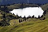
more pictures
|
|
| Seehamer See |
1.47 |
Upper Bavaria |
Miesbach |
Weyarn |
47 ° 50 ′ 54 ″ N , 11 ° 51 ′ 27 ″ E47.84833 11.85749
|

more pictures
|
Reservoir , LSG Seehamer See with Wattersdorfer Moor
|
| Seeleinsee |
0.01 |
Upper Bavaria |
Berchtesgadener Land |
Schoenau upon Kings sea |
47 ° 32 '16 " N , 13 ° 1' 47" E47.53774 13.02969
|

more pictures
|
Berchtesgaden National Park
|
| Seeon lakes |
0.78 |
Upper Bavaria |
Traunstein |
Seeon-Seebruck , Obing
|
47 ° 58 ′ 35 " N , 12 ° 26 ′ 50" E47.97648 12.44725
|

more pictures
|
NSG , lake district with 9 individual
lakes |
| Seestaller Weiher |
0.03 |
Upper Bavaria |
Bad Toelz-Wolfratshausen |
Dietramszell |
47 ° 48 ′ 53 " N , 11 ° 34 ′ 41" E47.81484 11.57819
|
 |
ND
|
| Sengsee |
0.05 |
Upper Bavaria |
Weilheim-Schongau |
Iffeldorf |
47 ° 46 ′ 33 " N , 11 ° 18 ′ 59" E47.7759 11.31643
|

more pictures
|
Toteissee , part of the Osterseen , NSG Osterseen
|
| Silver lake |
0.55 |
Upper Palatinate |
Cham |
Tiefenbach , Treffelstein
|
49 ° 24 ′ 39 ″ N , 12 ° 36 ′ 1 ″ E49.41075 12.60029
|
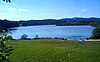
more pictures
|
Reservoir
|
| Sileisee |
0.015 |
Upper Bavaria |
Rosenheim |
Oberaudorf |
47 ° 40 ′ 31 ″ N , 12 ° 10 ′ 5 ″ E47.67528 12.16816
|

more pictures
|
LSG Inntal Süd , quarry pond
|
| Simssee |
6.49 |
Upper Bavaria |
Rosenheim |
Bad Endorf , Stephanskirchen
|
47 ° 52 ′ 35 " N , 12 ° 14 ′ 33" E47.87629 12.24255
|

more pictures
|
LSG protection of the Simsee and its surroundings ,
partly NSG south bank of the Simsee
|
| Soiernseen |
0.06 |
Upper Bavaria |
Garmisch-Partenkirchen |
Mittenwald |
47 ° 29 ′ 27 " N , 11 ° 20 ′ 58" E47.4909 11.34946
|

more pictures
|
|
| Soinsee |
0.05 |
Upper Bavaria |
Miesbach |
Bayrischzell |
47 ° 39 ′ 1 ″ N , 11 ° 57 ′ 19 ″ E47.65029 11.95514
|

more pictures
|
LSG Rotwand
|
| Sonderhamer Weiher |
0.04 |
Upper Bavaria |
Bad Toelz-Wolfratshausen |
Münsing |
47 ° 52 '14 " N , 11 ° 23' 1" E47.87053 11.38372
|

more pictures
|
Reservoir
|
| Soyensee |
0.5 |
Upper Bavaria |
Rosenheim |
Soyen |
48 ° 6 ′ 22 " N , 12 ° 12 ′ 8" E48.10606 12.20236
|

more pictures
|
LSG
|
| Spitzingsee |
0.28 |
Upper Bavaria |
Miesbach |
Schliersee |
47 ° 39 ′ 49 ″ N , 11 ° 53 ′ 7 ″ E47.66357 11.88514
|

more pictures
|
LSG protection of the Spitzingsee and its surroundings
|
| Staffelsee |
7.66 |
Upper Bavaria |
Garmisch-Partenkirchen |
Seehausen |
47 ° 41 ′ 18 ″ N , 11 ° 9 ′ 20 ″ E47.68835 11.15553
|

more pictures
|
LSG protection of the Staffelsee area ,
partly NSG Westlicher Staffelsee with adjacent moors
|
| Stallauer Weiher |
0.23 |
Upper Bavaria |
Bad Toelz-Wolfratshausen |
Wackersberg |
47 ° 45 ′ 0 ″ N , 11 ° 29 ′ 46 ″ E47.74991 11.49608
|
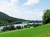
more pictures
|
Reservoir
|
| starnberger Lake |
56.36 |
Upper Bavaria |
Starnberg |
Community-free area |
47 ° 54 ′ 37 " N , 11 ° 18 ′ 44" E47.9102 11.31217
|
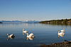
more pictures
|
LSG Starnberger See and areas adjacent to the west
|
| Bertoldsheim reservoir |
1.09 |
Upper Bavaria |
Neuburg-Schrobenhausen |
Rennertshofen |
48 ° 44 ′ 8 " N , 11 ° 0 ′ 40" E48.7355 11.01109
|

more pictures
|
LSG , reservoir
|
| Reservoir (Riedelsbach) |
0.019 |
Lower Bavaria |
Freyung-Grafenau |
Neureichenau |
48 ° 2 ′ 51 ″ N , 10 ° 41 ′ 24 ″ E48.04763 10.68993
|
|
Reservoir
|
| Freyung reservoir |
0.02 |
Lower Bavaria |
Freyung-Grafenau |
Freyung |
48 ° 48 '46 " N , 13 ° 31' 48" E48.81273 13.53001
|
 |
LSG , reservoir
|
| Gfallermühle reservoir |
0.01 |
Upper Bavaria |
Rosenheim |
Kiefersfelden |
47 ° 37 '57 " N , 12 ° 9' 50" E47.63243 12.16376
|
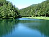
more pictures
|
LSG protection of the Mühlau-Schöffau area ,
reservoir
|
| Reservoir Oberilzmühle |
0.1 |
Lower Bavaria |
Passau , Passau
|
Salzweg , Tiefenbach , Passau
|
48 ° 36 ′ 41 ″ N , 13 ° 26 ′ 31 ″ E48.61132 13.44199
|

more pictures
|
Reservoir
|
| Stechsee |
0.08 |
Upper Bavaria |
Weilheim-Schongau |
Seeshaupt |
47 ° 48 ′ 21 ″ N , 11 ° 17 ′ 56 ″ E47.80582 11.29883
|

more pictures
|
Toteissee , part of the Osterseen , NSG Osterseen
|
| Steinberger See |
1.84 |
Upper Palatinate |
Schwandorf |
Steinberg am See |
49 ° 16 ′ 47 " N , 12 ° 9 ′ 45" E49.279722 12.1625
|

more pictures
|
Quarry pond
|
| Steinsee |
0.21 |
Upper Bavaria |
Ebersberg |
Moosach |
48 ° 1 ′ 18 " N , 11 ° 51 ′ 46" E48.02168 11.86266
|

more pictures
|
LSG Steinsee, Moosach, Doblbach, Brucker Moos and the surrounding area
|
| Stempflesee |
0.01 |
Swabia |
augsburg |
augsburg |
48 ° 20 ′ 22 " N , 10 ° 55 ′ 3" E48.33937 10.91762
|

more pictures
|
NSG , man-made lake
|
| Stocksee |
0.02 |
Upper Bavaria |
Weilheim-Schongau |
Penzberg |
47 ° 46 ′ 0 ″ N , 11 ° 22 ′ 34 ″ E47.76655 11.37611
|
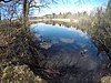 |
pond created for fish farming
|
| Strandweiher |
0.02 |
Upper Bavaria |
Weilheim-Schongau |
Penzberg |
47 ° 45 ′ 56 " N , 11 ° 20 ′ 41" E47.76546 11.34461
|
|
pond created for fish farming
|
| Streitberger Weiher |
0.06 |
Upper Bavaria |
Weilheim-Schongau |
Antdorf |
47 ° 47 ′ 2 ″ N , 11 ° 16 ′ 2 ″ E47.78389 11.26723
|
 |
artificial lake
|
| Sulzberger See |
0.33 |
Swabia |
Oberallgäu |
Sulzberg |
47 ° 40 ′ 45 " N , 10 ° 20 ′ 16" E47.67907 10.33788
|

more pictures
|
LSG , geotope
|
| Sur memory |
0.67 |
Upper Bavaria |
Berchtesgadener Land , Traunstein
|
Teisendorf , Petting
|
47 ° 52 ′ 40 " N , 12 ° 49 ′ 24" E47.87769 12.82324
|

more pictures
|
Reservoir
|
| Suttensee |
0.01 |
Upper Bavaria |
Miesbach |
Rottach-Egern |
47 ° 38 ′ 50 ″ N , 11 ° 50 ′ 19 ″ E47.64733 11.83868
|
 |
|
| Sylvensteinsee |
3.92 |
Upper Bavaria |
Bad Toelz-Wolfratshausen |
Lenggries |
47 ° 34 ′ 40 " N , 11 ° 32 ′ 28" E47.57778 11.54111
|

more pictures
|
LSG Sylvensteinsee and Upper Isar Valley ,
reservoir
|
| Tachinger See |
2.36 |
Upper Bavaria |
Traunstein |
Community-free area |
47 ° 58 ′ 14 " N , 12 ° 44 ′ 38" E47.97054 12.74378
|
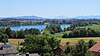
more pictures
|
LSG protection of the Waginger and Tachinger lakes and the surrounding landscape
|
| Taferlsee |
0.01 |
Lower Bavaria |
Passau |
Vilshofen on the Danube |
48 ° 36 '30 " N , 13 ° 8' 33" E48.608406 13.142486
|
 |
Vils Engtal
|
| Pigeon lake |
0.04 |
Upper Bavaria |
Traunstein |
Underweave |
47 ° 41 ′ 47 " N , 12 ° 25 ′ 36" E47.69632 12.42675
|
 |
|
| Pigeon lake |
0.03 |
Upper Bavaria |
Berchtesgadener Land |
Ramsau near Berchtesgaden |
47 ° 37 '55 " N , 12 ° 51' 51" E47.63188 12.8641
|

more pictures
|
Natural monument , geotope
|
| Taxi pond |
0.02 |
Upper Bavaria |
Munich |
Ismaning |
48 ° 12 ′ 59 " N , 11 ° 40 ′ 41" E48.21627 11.67806
|

more pictures
|
Quarry pond
|
| Tegernsee |
8.9 |
Upper Bavaria |
Miesbach |
Tegernsee |
47 ° 43 ′ 10 " N , 11 ° 44 ′ 22" E47.71931 11.73947
|

more pictures
|
LSG protection of the Tegernsee and the surrounding area
|
| Thanninger Weiher |
0.11 |
Upper Bavaria |
Bad Toelz-Wolfratshausen |
Egling |
47 ° 55 '16 " N , 11 ° 33' 31" E47.921073 11.558601
|

more pictures
|
3 ponds created for fish farming
|
| Thumsee |
0.14 |
Upper Bavaria |
Berchtesgadener Land |
Bad Reichenhall |
47 ° 43 ′ 9 ″ N , 12 ° 49 ′ 40 ″ E47.7193 12.82765
|

more pictures
|
LSG , partly NSG
|
| Tinninger See |
0.26 |
Upper Bavaria |
Rosenheim |
Riedering |
47 ° 49 ′ 28 " N , 12 ° 12 ′ 20" E47.82457 12.20557
|

more pictures
|
|
| Trausnitztalsperre |
0.37 |
Upper Palatinate |
Schwandorf |
Trausnitz |
49 ° 31 ′ 20 " N , 12 ° 16 ′ 56" E49.52228 12.2822
|

more pictures
|
Reservoir
|
| Trebgastsee |
0.07 |
Upper Franconia |
Kulmbach |
Trebgast |
50 ° 3 ′ 25 ″ N , 11 ° 32 ′ 31 ″ E50.05706 11.54204
|
 |
artificial lake
|
| Frauenau drinking water reservoir |
0.94 |
Lower Bavaria |
rain |
Frauenau |
49 ° 0 ′ 41 " N , 13 ° 20 ′ 34" E49.0115 13.3429
|

more pictures
|
Reservoir
|
| Mauthaus drinking water reservoir |
0.92 |
Upper Franconia |
Kronach |
Nordhalben , Steinwiesen , Tschirn
|
50 ° 19 ′ 45 ″ N , 11 ° 29 ′ 24 ″ E50.32903 11.48998
|

more pictures
|
Reservoir
|
| Troll pond |
0.08 |
Swabia |
Ostallgäu |
Backwood |
47 ° 39 '56 " N , 10 ° 33' 55" E47.66565 10.56529
|

more pictures
|
LSG
|
| Tüttensee |
0.11 |
Upper Bavaria |
Traunstein |
Grabenstätt |
47 ° 50 ′ 48 " N , 12 ° 34 ′ 6" E47.8467332 12.5682521
|
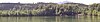
more pictures
|
LSG Tüttensee
|
| Lower Gaisalpsee |
0.04 |
Swabia |
Oberallgäu |
Oberstdorf |
47 ° 25 ′ 38 " N , 10 ° 19 ′ 21" E47.42727 10.32247
|

more pictures
|
LSG
|
| Unterschleißheimer See |
0.08 |
Upper Bavaria |
Munich |
Unterschleissheim |
48 ° 9 ′ 20 " N , 11 ° 44 ′ 20" E48.15544 11.73876
|

more pictures
|
LSG Dachauer Moos ,
quarry pond
|
| Lake of Infidelity |
0.6 |
Upper Franconia |
court |
court |
50 ° 16'53 " N , 11 ° 54'36" E50.28139 11.91004
|

more pictures
|
Reservoir
|
| Ursee |
0.02 |
Upper Bavaria |
Weilheim-Schongau |
Seeshaupt |
47 ° 49 ′ 1 ″ N , 11 ° 18 ′ 20 ″ E47.81684 11.30546
|
|
Toteissee , part of the Osterseen , NSG Osterseen
|
| Valznerweiher |
0.04 |
Middle Franconia |
Nuremberg |
Nuremberg |
49 ° 26 '17 " N , 11 ° 8' 4" E49.43794 11.13447
|

more pictures
|
|
| Vilstalsee |
0.98 |
Lower Bavaria |
Dingolfing-Landau |
Marklkofen , Reisbach
|
48 ° 34 ′ 2 " N , 12 ° 35 ′ 7" E48.56732 12.58518
|

more pictures
|
Reservoir , nature reserve
|
| Waginger See |
6.61 |
Upper Bavaria |
Traunstein |
Community-free area |
47 ° 56 ′ 17 " N , 12 ° 46 ′ 27" E47.93819 12.77428
|

more pictures
|
LSG protection of the Waginger and Tachinger lakes and the surrounding landscape
|
| Walchensee |
16.27 |
Upper Bavaria |
Bad Toelz-Wolfratshausen |
Kochel am See |
47 ° 35 ′ 41 ″ N , 11 ° 20 ′ 46 ″ E47.59459 11.34613
|

more pictures
|
LSG Walchensee ,
nature reserve Insel Sassau in Walchensee
|
| Waldschwaigsee |
0.09 |
Upper Bavaria |
Dachau |
Karlsfeld |
48 ° 13 ′ 31 ″ N , 11 ° 26 ′ 16 ″ E48.22536 11.43767
|

more pictures
|
Quarry pond
|
| Forest lake |
0.04 |
Swabia |
Lindau (Lake Constance) |
Lindenberg in the Allgäu |
47 ° 36 '11 " N , 9 ° 52' 12" E47.60292 9.86995
|
more pictures
|
LSG Waldsee near Lindenberg in the Allgäu and the surrounding area ,
reservoir
|
| Forest pond |
0.07 |
Upper Bavaria |
Bad Toelz-Wolfratshausen |
Dietramszell |
47 ° 50 ′ 44 " N , 11 ° 36 ′ 21" E47.84544 11.60592
|

more pictures
|
artificially created pond
|
| Pond in Loichingermoos |
0.12 |
Lower Bavaria |
Dingolfing-Landau |
Loiching |
48 ° 38 ′ 30 " N , 12 ° 24 ′ 55" E48.64153 12.41537
|
|
Lake district with 8 quarry ponds
|
| Weihertannensee |
0.05 |
Lower Franconia |
Aschaffenburg |
Bald on the Main |
50 ° 5 ′ 16 ″ N , 9 ° 0 ′ 13 ″ E50.08775 9.0036
|

more pictures
|
Quarry pond , part of the Kahler Seenplatte
|
| Weissensee |
1.35 |
Swabia |
Ostallgäu |
Feet |
47 ° 34 ′ 14 " N , 10 ° 38 ′ 9" E47.57056 10.63588
|

more pictures
|
|
| Weissenstadt Lake |
0.48 |
Upper Franconia |
Wunsiedel in the Fichtel Mountains |
Weißenstadt |
50 ° 6 ′ 12 ″ N , 11 ° 52 ′ 41 ″ E50.10324 11.87794
|

more pictures
|
Reservoir
|
| Weitmannsee |
0.33 |
Swabia |
Aichach-Friedberg |
Kissing |
48 ° 17 ′ 19 ″ N , 10 ° 57 ′ 3 ″ E48.28872 10.9507
|
more pictures
|
Quarry pond
|
| Weitsee |
0.64 |
Upper Bavaria |
Traunstein |
Reit im Winkl |
47 ° 41 ′ 2 " N , 12 ° 33 ′ 55" E47.68379 12.56518
|
more pictures
|
NSG
|
| Weitsee |
0.054 |
Upper Bavaria |
Traunstein |
Schnaitsee |
48 ° 3 '38 " N , 12 ° 22' 10" E48.06054 12.36952
|

|
Used as a swimming lake and for fishing.
|
| Weßlinger See |
0.17 |
Upper Bavaria |
Starnberg |
Weßling |
48 ° 4 ′ 25 ″ N , 11 ° 15 ′ 5 ″ E48.07359 11.25126
|
more pictures
|
LSG Western part of the Starnberg district
|
| Western Breitenau lake |
0.06 |
Upper Bavaria |
Weilheim-Schongau |
Iffeldorf |
47 ° 47 ′ 43 " N , 11 ° 17 ′ 47" E47.79524 11.29627
|
|
Toteissee , part of the Osterseen , NSG Osterseen
|
| West Lake |
0.01 |
Upper Bavaria |
Munich |
Munich |
48 ° 7 ′ 21 " N , 11 ° 30 ′ 42" E48.12247 11.5118
|
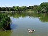
more pictures
|
Artificially created lake in Munich's Westpark
|
| Widdersberger Weiher |
0.02 |
Upper Bavaria |
Starnberg |
Herrsching am Ammersee |
48 ° 1 ′ 7 " N , 11 ° 11 ′ 46" E48.01868 11.196
|
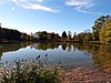
more pictures
|
LSG Western part of the Starnberg district ,
reservoir
|
| Widdumer Weiher |
0.07 |
Swabia |
Oberallgäu |
Waltenhofen |
47 ° 37 ′ 51 ″ N , 10 ° 18 ′ 14 ″ E47.63086 10.30398
|

more pictures
|
NSG
|
| Wildensee |
0.02 |
Upper Bavaria |
Garmisch-Partenkirchen |
Mittenwald |
47 ° 27 ′ 25 ″ N , 11 ° 14 ′ 17 ″ E47.45703 11.23794
|

more pictures
|
|
| Wildsee |
0.02 |
Upper Bavaria |
Weilheim-Schongau |
Wildsteig |
47 ° 40 ′ 0 ″ N , 10 ° 57 ′ 23 ″ E47.66672 10.95644
|
 |
NSG wild sea felt
|
| Windachspeicher |
0.15 |
Upper Bavaria |
Landsberg am Lech |
Hofstetten , Finning
|
48 ° 0 ′ 2 " N , 11 ° 0 ′ 30" E48.00055 11.00847
|
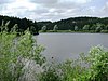
more pictures
|
LSG landscape parts around the Windach reservoir , reservoir
|
| Wöhrder See |
0.52 |
Middle Franconia |
Nuremberg |
Nuremberg |
49 ° 27 ′ 22 " N , 11 ° 6 ′ 24" E49.45624 11.10658
|

more pictures
|
Reservoir
|
| Woehrsee |
0.09 |
Upper Bavaria |
Altötting |
Burghausen |
49 ° 24 ′ 39 ″ N , 12 ° 36 ′ 1 ″ E49.41075 12.60029
|

more pictures
|
LSG Salzachtal ,
reservoir
|
| Wörther See |
0.37 |
Lower Bavaria |
Dingolfing-Landau , Landshut
|
Niederviehbach , Wörth on the Isar
|
48 ° 37 '42 " N , 12 ° 21' 41" E48.62823 12.36151
|
|
Quarry pond
|
| Woerthsee |
4.34 |
Upper Bavaria |
Starnberg |
Wörthsee , Inning , Seefeld
|
48 ° 3 '38 " N , 11 ° 10' 58" E48.06059 11.18283
|
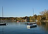
more pictures
|
LSG Western part of the Starnberg district
|
| Wössener See |
0.04 |
Upper Bavaria |
Traunstein |
Underweave |
47 ° 43 ′ 35 " N , 12 ° 28 ′ 17" E47.72648 12.47128
|

more pictures
|
Reservoir
|
| Wolfelsee |
0.01 |
Upper Bavaria |
Weilheim-Schongau |
Iffeldorf |
47 ° 46 ′ 40 " N , 11 ° 18 ′ 54" E47.77777 11.31487
|
|
Toteissee , part of the Osterseen , NSG Osterseen
|
| Lake Zell |
0.08 |
Upper Bavaria |
Neuburg-Schrobenhausen |
Neuburg on the Danube |
48 ° 42 ′ 16 " N , 11 ° 14 ′ 18" E48.7045 11.23829
|
 |
Quarry pond
|
| Zellsee |
1.0 |
Upper Bavaria |
Weilheim-Schongau |
Wessobrunn |
47 ° 51 '47 " N , 11 ° 3' 50" E47.8631 11.06375
|
 |
About 40 ponds created for fish farming
|
| Tent pond |
0.02 |
Middle Franconia |
Nuremberg |
Nuremberg |
49 ° 26 ′ 49 ″ N , 11 ° 6 ′ 35 ″ E49.44686 11.10969
|

more pictures
|
Reservoir
|


.JPG)


.JPG)


.JPG)


.jpg)
.jpg)


.jpg)


.jpg)

.jpg)


_WV1249.jpg)
.jpg)


_-_geo.hlipp.de_-_9399.jpg)


.JPG)


_-_Heimstettener_See_(03).JPG)


.jpg)


.jpg)


.jpg)


.jpg)


.JPG)


.jpg)


_2013-07-22.JPG)


_im_Herbst.jpg)


