
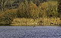
Little Brombachsee
| Little Brombachsee | |||||||||
|---|---|---|---|---|---|---|---|---|---|
.jpg) |
|||||||||
|
|||||||||
|
|||||||||
| Coordinates | 49 ° 8 '4 " N , 10 ° 52' 38" E | ||||||||
| Data on the structure | |||||||||
| Construction time: | 1975-1985 | ||||||||
| Height of the barrier structure : | 15.5 m | ||||||||
| Height of the structure crown: | 413.5 m above sea level NN | ||||||||
| Building volume: | 350 000 m³ | ||||||||
| Crown length: | 1.1 km | ||||||||
| Base width: | 8 m | ||||||||
| Slope slope on the air side : | 1: 1: 2; 1: 3 | ||||||||
| Slope slope on the water side : | 1: 1: 2; 1: 3 | ||||||||
| Data on the reservoir | |||||||||
| Altitude (at congestion destination ) | 410.6 m above sea level NN | ||||||||
| Water surface | 2.5 km² | ||||||||
| Reservoir length | 2.5 km | ||||||||
| Reservoir width | 1 km | ||||||||
| Storage space | 12.96 million m³ | ||||||||

The Kleine Brombachsee is part of the Brombachsee reservoir and one of the two barrages of the Großer Brombachsee . It is located in the Weißenburg-Gunzenhausen district in Bavaria .
geography
The reservoir is located in Middle Franconia , about 40 kilometers south-southwest of Nuremberg and 5 kilometers east of Gunzenhausen . The market village of Absberg is just above the north bank, and the village of Langlau is some distance away on the south bank . In a valley that opens to the east, the lake is framed by forests. Together with other lakes, it is part of the Franconian Lake District . The Kleine Brombachsee receives its water mainly from the west via the Brombach , after which it is named. The Brombach the artificially created - took just before it flows into the lake - after official believes Altmühl About Head of during flooding in on, Altmühltal from nearby Altmuehlsee fed.
properties
A dam in the east dams the Kleiner Brombachsee, its level fluctuates only slightly. The target is 410.6 m above sea level. NN and the water is, measured down to the level of the original brook valley, up to 13.4 meters deep. The deepest parts of the lake are even on 388- 387 m above sea level. NN , namely where sand was mined in pits for decades before the lake was flooded. The length of the shore is mentioned as 8.5 kilometers.
The Kleine Brombachsee drains into the Großer Brombachsee, the level of which fluctuates more strongly by up to 7 meters, between a storage target of 410.5 m above sea level. NN and a descent target to 403.5 m above sea level. NN .
dam
The dam with a height of up to 15.5 meters is designed as an intermediate dam to the east of the Großer Brombachsee , with a crown level of 413.5 m above sea level. NN and a length of 1.1 kilometers. To protect the barrier structure from being washed under, there is a cut-off wall below the core that extends down to the bedrock. Above the bottom outlet at the deepest point of the valley, roughly in the middle of the dam, there is an operating building. A flood relief with two hydraulically driven lifting segments is located further south in the dam.
Nature reserves
On or in the immediate vicinity of the Kleiner Brombachsee are the nature reserves of the peninsula in the Kleiner Brombachsee , Grafenmühle , Sägmühle and Brombachmoor .
art
As a result of the "Art at Brombachsee" competition, the 10-meter-long and 4-meter-high lizard by the artist Christian Rösner has been on display since 2000 on the southern bank of the Kleiner Brombachsee near the dam . It is a concrete casting that was created from a sawn wood design.
See also
literature
- Dams in the Federal Republic of Germany , Peter Franke, Wolfgang Frey, DNK - DVWK 1987, ISBN 3-926520-00-0
- Robert Karl, Thomas Liepold, Gregor Overhoff: Water for Franconia . The transition. Ed .: Bavarian State Ministry for State Development and Environmental Issues (= Water Management in Bavaria . No. 34 ). 2000, ISBN 3-910088-60-0 .
- Wasserwirtschaftsamt Ansbach (Ed.): Transition Danube-Main . Leaflet. June 2014 ( online [PDF]).
Picture gallery

Beach with a view of Absberg

Dam between the Kleiner Brombachsee (left) and the Großer Brombachsee (right); Operations building above the bottom outlet
NSG peninsula in the Kleiner Brombachsee

Christian Rösner's Lizard


Web links
- Location of Kleinem Brombachsee, Igelsbachsee and Großem Brombachsee on the BayernAtlas
- Water quality at Brombachsee
- Franconian Lake District Tourism Association
Individual evidence
- ↑ a b c Dam Kleiner Brombachsee. (No longer available online.) Ansbach Water Management Authority, archived from the original on July 20, 2015 ; accessed on August 1, 2015 . Info: The archive link was inserted automatically and has not yet been checked. Please check the original and archive link according to the instructions and then remove this notice.
- ↑ Little Brombachsee. (PDF) Contour lines from echo sounding. (No longer available online.) Ansbach Water Management Authority, formerly in the original ; accessed on August 1, 2015 . ( Page no longer available , search in web archives ) Info: The link was automatically marked as defective. Please check the link according to the instructions and then remove this notice.
