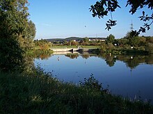
Altmühlüberleiter
| Data | |
|---|---|
| Surname | Altmühlüberleiter |
| Water type | channel |
| Country | Germany |
| state | Bavaria |
| Administrative district | Middle Franconia |
| district | Weissenburg-Gunzenhausen |
| connection | Altmühlsee → Brombach |
| Tributaries | Beibächlein , forest edge ditch |
| construction time | 1972-1981 |
| length | 8.7 km |
| - above ground | 6.0 km |
| - underground | 2.7 km |
| Tunnel diameter | 5.85 m |
| Height difference | approx. 4 m |
| Flow rate | Max. 70 m³ / s |
| Initial coordinates | 49 ° 7 '27 " N , 10 ° 44' 54" E |
| End coordinates | 49 ° 7 ′ 42 " N , 10 ° 51 ′ 11" E |
The Altmühlüberleiter is part of the Danube-Main bridge and directs water from the Altmühlsee over the Brombach into the Kleiner Brombachsee . The 8.7 km long canal crosses under the European main watershed between the Altmühl and the Rednitz catchment areas in a 2.7 km long tunnel .
geography
The canal is located around 40 kilometers southwest of Nuremberg in the Weißenburg-Gunzenhausen district in Central Franconia . It begins at the southeast end of the Altmühlsee near Gunzenhausen in the west and directs the water into the Brombach, which flows eastward into the west bay of the Kleiner Brombach .
course
The four-kilometer Überleiter West starts on an elongated Southeast Bay of the Altmühl lake and crosses first in a culvert , the Federal Straße 13 . On its somewhat winding eastern path in an open channel between Gunzenhausen in the south and its district Schlungenhof in the north, the Treuchtlingen – Würzburg railway line and the federal highway 466 cross it .
This section of the canal ends in the Spitalholz at the edge of the Graefensteinberg forest and now enters its underground. At the inlet structure , a pressure segment with an attached flap controls the water level in the west overpass and the overflow drains in the adjoining tunnel. This gravity tunnel with a diameter of 5.85 meters, which begins here, has a gradient of 0.9 ‰ and a flow capacity of 70 cubic meters per second.
After 2.7 kilometers, the canal reappears in the forest. As the east overpass , it runs a further two kilometers in an open channel, picks up the small Beibächlein from the right and ends at the overflowable cross dam at the Hühnermühle near Neuherberg , where it joins the upper Brombach from the left . This only has a catchment area of around 5 km², whereas the Altmühl has already covered a little over 500 km² of drainage area up to the departure of the Altmühl feeder into the Altmühlsee. Of the two, the main body of water is officially the Brombach, to which the Altmühlüberleiter flows.
history
The Altmühlüberleiter was built between 1972 and 1981. The east section was completed in autumn 1977. The tunnel breakthrough took place on February 13, 1978. In 1985 the canal went into operation.
use
The sole purpose of the canal is to transfer water from the more rainy Altmühltal into the less rainy Rednitz valley in order to remedy the water shortage there. To do this, it crosses under a slight gradient under the European watershed between the catchment area of the Danube with the Altmühl and that of the Rhine with the Rednitz. Of the amount of water transferred annually as part of the Danube-Main crossing , only about a sixth passes through its tunnel. The far larger share is created by five pumping stations at the locks on the southern ramp of the Main-Danube Canal across the watershed.
Hydrological data
When the dam of the Altmühlsee is reached, its water level is 415 m above sea level. NN . The target of the Kleine Brombachse at the other end is 411 m above sea level. NN . The canal, including the tunnel, is designed for a maximum discharge of 70 cubic meters per second. The above-ground sections of the bridge overhead west and overhead east are designed in a trapezoidal profile with a floor width of three meters and a slope of 1: 2 on both sides. The cross dam at the Hühnermühle, which is officially part of the Brombach, was designed with a sufficiently large overflow width for this drainage capacity. This dam backs in times before reconciliation a sufficiently high water level in the north-west of it lying wetland Brombach Moor along the Brombachs, even if the water level in the small Brombachsee is low.
The discharge values are recorded at the Gunzenhausen gauge at river kilometer 8.25. The previous high occurred on June 3, 2013 and was just under 60 cubic meters per second.
gallery
Marking of the European watershed at the western tunnel entrance
See also
literature
- Robert Karl, Thomas Liepold, Gregor Overhoff: Water for Franconia . The transition. Ed .: Bavarian State Ministry for State Development and Environmental Issues (= Water Management in Bavaria . No. 34 ). 2000, ISBN 3-910088-60-0 .
Web links
- Location of the Altmühlüberleiters on the BayernAtlas
- Description of the transition on the website of the water management office
- Altmühlüberleiter discharge measured at the Gunzenhausen gauge
- ↑ See the sub-catchment areas of the Altmühl above the Wieseth and the Wieseth on pages 99 and 105 of: Directory of brook and river areas in Bavaria - Lech to Naab river area of the Bavarian State Office for the Environment, as of 2016 (PDF; 2.9 MB)
- ↑ Directory of brook and river areas in Bavaria - Main river area, page 37 of the Bavarian State Office for the Environment, as of 2016 (PDF; 3.3 MB)


