
Altmuehlsee
| Altmuehlsee | |||||||||||
|---|---|---|---|---|---|---|---|---|---|---|---|
 |
|||||||||||
|
|||||||||||
|
|||||||||||
| Coordinates | 49 ° 7 '59 " N , 10 ° 43' 29" E | ||||||||||
| Data on the structure | |||||||||||
| Construction time: | 1976-1985 | ||||||||||
| Height above valley floor: | 5.5 m | ||||||||||
| Building volume: | 1.8 million m³ | ||||||||||
| Crown length: | 12.5 km | ||||||||||
| Data on the reservoir | |||||||||||
| Altitude (at congestion destination ) | 415 m above sea level NN | ||||||||||
| Water surface | 4.5 km² | ||||||||||
| Reservoir length | 4 km | ||||||||||
| Reservoir width | 1.7 km | ||||||||||
| Storage space | 13.8 million m³ | ||||||||||
| Particularities: | |||||||||||

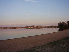
The Altmühlsee is a reservoir around 44 km (as the crow flies ) southwest of Nuremberg in the Weißenburg-Gunzenhausen district in Bavarian Middle Franconia . Along with several large lakes in the area, it belongs to the Franconian Lake District .
geography

High water peaks of the Altmühl feed the shallow water in the rather wide floodplains of the former river bed via the Altmühl feeder near the Ornbauer district of Gern . The Altmühlsee is 4 km long, up to 1.7 km wide and has an area of 4.5 km². It is 2.5 to a maximum of 3 m deep and holds up to 13.8 million m³ of water. About half a kilometer from the northern edge of the lake is the place Muhr am See , about one kilometer from the eastern bank begins the development of the town of Gunzenhausen . Some smaller places in the southwest are only a few hundred meters away from the lake. Concise is the extension to the east at the Sea Center Schlungenhof in which to pier of the MS Altmühlsee is. Furthermore, there is the flow of Altmühlberg a club house, approximately 100 land and water berths with jetty for small vehicles , a Slips Telle , a boat crane 2 t carrying capability as well as a charging station for electric boats .
Almost half of the lake area in the north-west is designated as a nature reserve, 125 hectares of which are taken up by the shallow water and island zone in Altmühlsee , which is made up of numerous individual islands. Close to the south bank of the lake is the Shepherd's Island, which covers almost one and a half hectares .
history
The building project Fränkisches Seenland , to which the Altmühlsee belongs, was decided by the Bavarian State Parliament on July 16, 1970 , on the initiative of the MP Ernst Lechner, on July 4, 1974 the tunnel construction for the Altmühlüberleiter was carried out by Minister Bruno Merk . The flooding of the Altmühlsee began in February 1985, later that year the transition to the Brombachsee began . The so-called Brombach transfer of water from the Altmühlsee, via the Altmühlüberleiter as well as the Small and Large Brombachsee, has contributed up to 25 million m³ per year to about one sixth of the Danube-Main transfer .
A special authority was created for the construction, the Nuremberg Dam Construction Authority. Since the completion of the construction work, the Altmühlüberleiter has been looked after by the Ansbach Water Management Authority (WWA Ansbach). The control of the entire water balance has been the responsibility of the district headquarters Gösselthalmühle since 2012 .
The pollution caused by microplastics in the Altmühlsee has been investigated since 2014 .
dam
The barrier structure of the Altmühlsee is a dam that completely surrounds the lake. Made of sand and clay , it is 3 to 5.5 m high and, with its crown length of 12.5 km, the longest dam in Germany . At the core of the structure is a multi-meter high cut-off wall made of 6 to 8 cm thick steel planks, which is shaken vertically into the ground up to the impermeable soil layers.
In recent years, the inflow brought sediments into the lake, which, due to the extremely low current, were deposited on the bottom and led to siltation . This resulted in a reduction in water depth and a deterioration in water quality. These sediments have been removed since September 2015, in autumn and winter.
use
The Altmühlsee is part of a water regulation system that transfers water from the water-rich river system of the Danube catchment area under the European main watershed to the less arid Regnitz - Main area. The let out lake water flows in a gentle gradient over the partly underground Altmühlüberleiter and the Kleiner Brombachsee into the Großer Brombachsee .
The lake is used intensively for tourism. The spacious landscape of the upper Altmühltal is ideal for sailing, surfing and swimming on the numerous lawns, bathing and sandy beaches. Bathing in the lake is impaired in some years by a plague of algae.
A 12.5 km long hiking and cycling path leads around the lake.
A shipping line on which the MS Altmühlsee operates connects the three lake centers ( Wald , Muhr am See and Schlungenhof ). In addition to these, there is a surfing center, a surfing and sailing school, two campsites, several restaurants and kiosks, 1,800 parking spaces and two recreation facilities on the feeder at Altmühlsee.
The Altmühlsee Run takes place on the third Saturday in July and the Altmühlsee Festival open-air theater series in the summer months .
Flora and fauna
The largest Bavarian breeding population of the rare black-headed gull is located at Altmühlsee . Other unusual breeding birds include Canada goose , teal , shoveler , pochard , little bittern , marsh harrier and Mediterranean gull .
Incidents
- On July 20, 2008, a kitesurfer had an accident at Altmühlsee in a gust of wind and broke his neck.
- On May 24, 2009, 21 catamarans overturned during a regatta in strong gusts of wind. One person was injured.
- On July 5, 2012, the surf center at Altmühlsee burned down completely. There was property damage in the millions, the residents were able to get to safety in good time.
- On March 3, 2018, a pedestrian collapsed on the unapproved ice surface of the lake. A firefighter also broke in trying to rescue. While the helper could be rescued, the pedestrian went under and drifted off. His body could only be located and recovered with sonar the following day .

Altmühlsee, aerial photo (2016)
Beach at the lake center in Wald

Sailors on the Altmühlsee

Altmühlsee with part of the Shepherd's Island
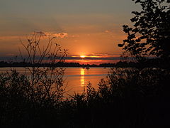
Sunset over the Altmühlsee near Muhr

Aerial view from north to south

Outlet culvert of Altmühlberg via conductor to the south-eastern end of the lake Altmühlberg

Schlungenhof harbor
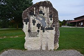
Memorial stone for the inauguration of the theme park in 1987


See also
Web links
- Location of the Altmühlsee on the BayernAtlas.
- Franconian Lake District Tourism Association
- Altmuehlsee. Retrieved March 28, 2014 .
- Altmühlsee association
Individual evidence
- ↑ Schlungenhof Lake Center
- ↑ Press report Donaukurier to the district headquarters Gösselthalmühle
- ↑ Martin Müller: Researchers find a lot of microplastics in Bavarian lakes. In: nordbayern.de. October 29, 2019. Retrieved October 29, 2019 .
- ↑ Jürgen Eisenbrand: Sediments from Altmühlsee end up in artificial basins. In: nordbayern.de. June 6, 2015, accessed July 5, 2015 .
- ↑ The sludge has to go: suction dredger active on Altmühlsee. November 6, 2018, accessed on May 20, 2019 (German).
- ↑ Altmühl and Brombachsee: challenge to algae. January 2, 2011, accessed March 28, 2014 .
- ↑ The shipping. Retrieved March 28, 2014 .
- ↑ Altmühlsee Festival
- ↑ Thomas Rödl, Bernd-Ulrich Rudolph, Ingrid Geiersberger, Kilian Weixler, Armin Görgen: Atlas of the breeding birds in Bavaria. Distribution 2005 to 2009 . Publishing house Eugen Ulmer, Stuttgart 2012
- ^ Accident report as of July 20, 2008
- ↑ Press report tz.de from May 24, 2009
- ↑ Press release surf-forum from July 5, 2009
- ^ Police report of March 4, 2018
