Brombachsee

The Brombachsee is a reservoir between Gunzenhausen and Pleinfeld in Middle Franconia in the districts of Weißenburg-Gunzenhausen and Roth , consisting of
- the Großer Brombachsee as the main lake
- its western pre-barrier Kleiner Brombachsee
- and the northwestern pre-barrier Igelsbachsee .
overview
All three lakes together have a storage space of 154 million cubic meters and a water surface of 12.1 million square meters . The Brombachsee is the heart of the Franconian Lake District , an artificial lake landscape used for tourism and water management. It is the largest lake in Franconia and the second largest reservoir in Germany by area. It is named after its drain, the Brombach .
In the course of the water regulation of the Main-Danube Canal and the water supply of the arid Northern Bavaria as well as for local recreation and tourism, the reservoirs were created from the 1970s. In the event of flooding at the Gern gauge near Ornbau , water is fed to the Altmühlsee via the Altmühl feeder. There it is temporarily stored and, if the level is exceeded, it is transferred to the Kleiner Brombachsee via the Altmühlüberleiter . From there, the water first flows over the Großer Brombachsee and the Brombach into the Swabian Rezat , at Georgensgmünd into the Rednitz and then on to Nuremberg, before reaching the Main via the Regnitz . In this way, water that would normally flow via the Altmühl into the Danube is diverted, if necessary, via the European main watershed into the river system of the Rhine-Main area. The building project was decided on July 16, 1970 by the Bavarian State Parliament on the initiative of the MP Ernst Lechner and carried out in several stages by the Nuremberg Dam Construction Office. The work was completed in the late 1990s and the entire structure was officially inaugurated on July 20, 2000.
Location, conservation and traffic
The Brombachsee is located about 30 km south of Nuremberg in the south of Central Franconia between Gunzenhausen in the west and Pleinfeld in the east. Neighboring communities are Absberg , Pfofeld , Spalt and Pleinfeld. The Great Brombachsee is about three meters lower than the two barrages. It is mostly located in the Spalter hill country .
There are five nature reserves on the Brombachsee: Brombachmoor , Grafenmühle , the peninsula in Kleiner Brombachsee , Sägmühle and the root of the Igelsbachsee .
For tourist purposes, the Brombachsee , a trimaran that is unique in Europe with its architecture and construction, runs between the Ramsberg , Absberg, Enderndorf , Allmannsdorf and Pleinfeld piers in the summer months .
Locations left
For the construction of the three reservoirs of the Brombachsee, the deserted bag mill , Birkenmühle , Furthmühle , Grafenmühle , Griesmühle , Hühnermühle , Langweidmühle , Neumühle , Scheermühle , Spagenhof , Sägmühle , Ziegelhütte , Öfeleinsmühle and a concrete plant had to be demolished. The properties and their corridors were bought up by the Bavarian state. The Langweidmühle and the Furthmühle were rebuilt in other places, the Hühnermühle, the Birkenmühle, the Neumühle, the Scheermühle and the Grafenmühle as well as the Spagenhof and Ziegelhütte were retained as part of Pfofeld, Pleinfeld and Absberg despite the lack of development. From the Birkenhof north of Absberg between the two bodies of water Igelsbach and Gänsbach , whose corridor also sank into the Großer Brombachsee, there was only a barn as early as 1962. The Mandlesmühle , abandoned because of the construction of the reservoir , today a district of Pleinfeld east of the Great Brombach, now houses the information center "Seenland - Water for Franconia" of the Ansbach water management office.
History, art, and culture
Two kilometers south of Lake Brombach went to Roman times the 14 stretch of the Upper German-Rhaetian Limes , which today for World Heritage matters.
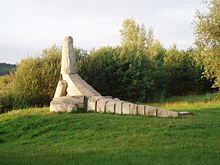
Numerous works of art were erected around the Brombachsee. Various cultural events take place in the neighboring communities throughout the year.
Web links
- Brombachsee near Ansbach water management office
- Brombachsee website
Individual evidence
- ^ History of the Brombachsee
- ↑ Location on Bavaria Atlas
- ↑ Nature reserves at Brombachsee ( Memento from September 25, 2015 in the Internet Archive )
- ↑ Limes at Brombachsee
- ^ Art at the Brombachsee


