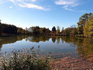
Widdersberger Weiher
| Widdersberger Weiher | ||
|---|---|---|

|
||
| Geographical location | Herrsching municipality , Starnberg district , Upper Bavaria , Bavaria , Germany | |
| Tributaries | Moosbach | |
| Drain | Moosbach → Pilsensee | |
| Places on the shore | Ariesberg | |
| Data | ||
| Coordinates | 48 ° 1 '6 " N , 11 ° 11' 45" E | |
|
|
||
| surface | 2 ha | |
| Maximum depth | 4 m | |
The Widdersberger Weiher is a reservoir in Widdersberg , a district of the municipality Herrsching am Ammersee in the district of Starnberg in Bavaria , Germany. It is around 2 hectares in size and around 4 m deep at the drainage structure. It gets its water from the Moosbach and the springs on the adjacent eastern slope.
history
The lake was created in the 16th century as a water retention basin for the mill of the Andechs monastery by Abbot Leonhard. In 1603 it was leased by the Counts of Toerring-Seefeld . Today it is privately owned and used as a drainable fish pond .
Nature and landscape protection
The ram Weiher is within the conservation area, the Western part of the district Starnberg (LSG-00542.01), which was found in 2001 under protection, as well as within the FFH area Ammersee and directing forests , which got its protection status of 2004.
literature
- Eberhard Stich: The Widdersberger Weiher. In: Fischereiverein Pilsensee-Wörthsee eV (Hrsg.): Home between the lakes. Interesting facts about the Pilsensee and Wörthsee. Self-published, Seefeld 1988, p. 22 f.
Web links
Individual evidence
- ↑ protected planet
- ↑ 7932-372 Ammerseeufer and Leitenwälder. (FFH area) Profiles of the Natura 2000 areas. Published by the Federal Agency for Nature Conservation . Retrieved November 18, 2017.
