Herrsching am Ammersee
| coat of arms | Germany map | |
|---|---|---|

|
Coordinates: 48 ° 0 ' N , 11 ° 11' E |
|
| Basic data | ||
| State : | Bavaria | |
| Administrative region : | Upper Bavaria | |
| County : | Starnberg | |
| Height : | 568 m above sea level NHN | |
| Area : | 20.88 km 2 | |
| Resident: | 10,772 (Dec 31, 2020) | |
| Population density : | 516 inhabitants per km 2 | |
| Postal code : | 82211 | |
| Area code : | 08152 | |
| License plate : | STA, WOR | |
| Community key : | 09 1 88 124 | |
| LOCODE : | DE HR5 | |
| Community structure: | 10 parts of the community | |
| Address of the municipal administration: |
Bahnhofstrasse 12 82211 Herrsching am Ammersee |
|
| Website : | ||
| First Mayor : | Christian Schiller ( independent ) | |
| Location of the municipality of Herrsching am Ammersee in the Starnberg district | ||
Herrsching (officially: Mr. Ching a.Ammersee ) is a municipality and its main town in the Upper Bavarian district of Starnberg .
geography
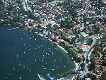
The place Herrsching is about 40 kilometers southwest of Munich in the Fünfseenland on the east bank of the Ammersee below the Andechs monastery with the Andechs monastery church .
Parts of the community
The municipality has 10 parts of the municipality (the type of settlement is indicated in brackets ):
- Breitbrunn ( Kirchdorf )
- Ellwang ( wasteland )
- Herrsching am Ammersee ( parish village )
- Lochschwab ( village )
- Mühlfeld (village)
- Intoxication ( hamlet )
- Ried ( good )
- Wartaweil (village)
- Wasach (wasteland)
- Widdersberg (Kirchdorf)
Waters
story
Until the 19th century
The geological formation of the Fünfseenland originated in the last ice age, the so-called Würme Ice Age, which ended an estimated 10,000 years ago. In the direction of flow of the glaciers, the high lateral moraines were created, such as the Andechser ridges and the underground excavations for the later lakes. The water level of the Ammersee was about 30 m higher than at present, so the lake reached from Grafrath in the north to Weilheim. The silting up and the digging of the Amper not only lowered the water level, but also separated the Wörthsee and the Pilsensee.
The first traces of a settlement date from the Bronze Age (up to 1200 BC), ceramics and broken fragments were found below Widdersberg and east of the current archaeological park in Herrsching. The typical burial mounds from the Hallstatt period were leveled at the beginning and middle of the 20th century. Traces from Roman times (15 BC to 400 AD): The foundations of a Roman drying oven, a stone house and a number of coins were found in Herrsching. A Roman tombstone from the second half of the 2nd century AD is protected in the outer wall of the Church of St. Michael in Widdersberg. Individual Roman traces, i.e. coins or shards, were also found in various sub-areas of the current municipal area.
From the early Middle Ages (400–788 AD) only graves were found in Herrsching and Breitbrunn before a tuff chamber grave with human skeletal remains was uncovered during expansion work on the communal cemetery. Further investigations by the State Office for Monument Preservation revealed that it was an early medieval aristocratic grave from the Merovingian era and the almost completely preserved foundation of an early Christian church from the 7th century. The site was opened in 1996 in the form of an archaeological park with aristocratic graves, a reconstructed church and replicas.
In 776 Herrsching was first documented as Horscaninga when the noble Huosier family donated it to Schlehdorf Monastery . It is probably based on the documented Bavarian personal name Horscman ('settlement des Horscman'), which carries the Old High German horsc 'cheerful'.
In 1098, "Preitbrunnen" (Breitbrunn) was first mentioned in a document. In the middle of the 16th century, Duke Albrecht V built a castle in what is now the Mühlfeld district .
Herrsching remained a fishing and farming village until the 19th century, when it began to develop into an excursion and holiday destination.
20th century
In 1903 Herrsching received a rail connection to Munich. Today tourist day trips and longer stays are an essential source of income. In 1889, the painter Ludwig Scheuermann built a castle in the Wilhelminian style on the lakeshore, where he celebrated artist festivals with his friends in the summer. The Scheuermann-Schlösschen became the property of the municipality in 1934. After it served as a refugee accommodation in the post-war period, it was renovated and now serves as a cultural center for concerts and exhibitions as well as a wedding palace under the name Kurparkschlößchen.
In the district of Wartaweil, the Villa Bräustedt property was transferred to the NSDAP Reich Treasurer Franz Xaver Schwarz and later to the Herrschingen Finance School due to “tax debts” during the Nazi era . At that time it was used as a “rest home for working people” and as a rest home for the NSV . After the Second World War it was used as accommodation for refugees, pregnant women and as a maternity, infant and children's home. The founders were Luise Silverberg and Gertrud Thyssen . Their business was financed by domestic pregnant women and employees as well as welfare (daily allowance). No “ anti-social elements” should be included there. Many children were born there and put up for adoption. Gertrud Thyssen “knew the Americans' preference for babies,” as reported in the Sonntagspost by Süddeutscher Verlag in 1957. Since Starnberg wanted to end the rental for the home, negotiations in the Bavarian state parliament that the Wartaweil children's and infant home would be run by the Brotherhood Salem eV for a short time. In 1966 it was used by the state of Bavaria as an extension of the state finance school.
resident
Between 1988 and 2018, the municipality grew from 8,017 to 10,702 by 2,685 inhabitants or 33.5%. The population has been growing since the second half of the 20th century: Around 1940 there were still around 2,500 inhabitants, in 1950, due to the influx of refugees, 4229. In 2013 there were 10,714 inhabitants (including second residences) in Herrsching am Ammersee, 1,644 of them in Breitbrunn and 437 in Widdersberg.
As of December 31, 2013, the proportion of foreigners was 1,309 (12.22%). A total of 83 nationalities live in the municipality of Herrsching.
In order to better integrate newcomers, an integration meeting (Herrschinger Welcome Day) is held annually by the community.
Incorporations
On January 1, 1972, due to the regional reform in Bavaria, the municipality of Widdersberg and on January 1, 1978 the municipality of Breitbrunn am Ammersee were incorporated. Since the incorporation of Breitbrunn, Herrsching has had two street names, Seestrasse and Kapellenstrasse, twice, which leads to problems with mail delivery and emergency medical calls.
politics
Mayor
The first mayor of the community is Christian Schiller (non-party). He was elected to office in 2008 as the successor to Christine Hollacher (Free Voters). In the local elections on March 15, 2020, Schiller was re-elected with 61.17% of the vote.
Municipal council
|
Local council election Herrsching am Ammersee 2020
Turnout: 61.9%
% 40 30th 20th 10
0
33.7
26.9
16.6
12.7
10.1
Gains and losses
compared to 2014
% p 10 8th 6th 4th 2
0
-2 -4 -6 -8th -10 −8.6
+8.9
+3.3
−3.3
−0.4
|
After the local elections in 2002, 2008, 2014 and 2020, the following distribution of seats in the local council resulted:
| year | CSU | SPD | Green | FDP | BGH / FW | FBU | WBW | total | WB in% |
|---|---|---|---|---|---|---|---|---|---|
| 2020 | 8th | 3 | 7th | 2 | 4th | 0 | 0 | 24 | 61.9 |
| 2014 | 10 | 4th | 4th | 3 | 3 | 0 | 0 | 24 | 54.5 |
| 2008 | 9 | 3 | 3 | 2 | 4th | 3 | 0 | 24 | 71.2 |
| 2002 | 6th | 3 | 2 | 1 | 3 | 3 | 2 | 20th | 66.7 |
BGH / FW = Bürgergemeinschaft Herrsching / Free Voters FBU = Free Citizens Union WBW = Voters' Association Breitbrunn-Widdersberg
Partner communities
Herrsching has two partner communities:
-
 Ravina in Italy, a fraction in the area of the city of Trento
-
 The city of Chatra in West Bengal, India . The association “India Aid” maintains contact with Chatra in particular.
coat of arms
|
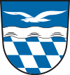
Blazon : “ Divided by a silver-colored wave bar ; above in blue a flying silver seagull, below the Bavarian diamonds . "
This coat of arms has been used since 1954. |
|
| Explanation of the coat of arms: The seagull and the wave bar refer to the location of the municipality on the Ammersee. The proximity to the lake has shaped community life over the centuries. Herrsching was mentioned as early as 776 as a fishing settlement owned by the Schlehdorf monastery. Since the 19th century, the attractive lakeside location near the state capital has become increasingly important for tourism. The Bavarian diamonds in the lower part of the coat of arms remind that the Wittelsbachers, as Bavarian dukes, exercised the land and feudal rule in the municipality of Herrsching since the Andechser died out (1248). The community has had the addition of the name, which refers to the location on the Ammersee, since 1954. |
Architectural monuments
Notable buildings by Herrsching:
- Kurpark and Kurparkschlösschen (Scheuermann-Schlösschen)
- Finance school Herrsching : The finance school - now a university for the public service / finance department - is by far the largest building complex in Herrsching. It is not centrally located and is also hidden behind trees and therefore only visible when approaching directly. The groundbreaking for the monumental main building took place on September 21, 1935. The initiator of the project was the NSDAP functionary based in Herrsching and then State Secretary in the Reich Ministry of Finance, Fritz Reinhardt . The buildings were used for military hospitals during and after the Second World War, from the mid-1950s again for the training of tax officials and until 1972 also as a customs school . This educational institution is one of the most important facilities for Herrsching.
- Mühlfeld Castle
- St. Martin Church , Herrsching
- St. Nicholas Church , Herrsching
- Church of the Redeemer , Protestant Church in Herrsching
- St. Michael , Widdersberg
- Cemetery : The cemetery was designed and implemented by Roderich Fick around 1926. It is characterized by the simple exterior, with the funeral hall next to a small pond. In this cemetery there are buried: Roderich Fick, Rudi Schuricke . At the edge of the cemetery is the Archaeological Park.
- Herrsching station
Transport, infrastructure, tourism

Herrsching is 15 km south of the Inning am Ammersee motorway exit on the A 96 from Lindau to Munich.
On July 1, 1903, took the Royal Bavarian State Railways , the local railway Pasing-Herrsching with the station Herrsching into operation. Herrsching has been connected to the Munich S-Bahn network since 1972 ; the S 8 line runs from Herrsching via Munich to Munich Airport . Various buses run from the train station, including: to Andechs Monastery and Weilheim .
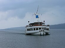
The ships of the Bayerische Seenschifffahrt dock in Herrsching . The ships operate from the end of March to mid-October and connect the northern, southern and western banks. Are started z. B. Stegen to the north, Utting to the north-west, the Breitbrunn district to the north and Dießen to the south-west . Herrsching is also the namesake for the “ Herrsching ” driven by paddle wheels , which is the largest ship on the Ammersee with a length of 54 m and a capacity of around 400 passengers. The ship was put into service in 2002 and replaced the motor ship of the same name , which was christened in 1956 and offered space for around 240 passengers. Other current ships on the Ammersee are the " Diessen " , which is also driven by paddle wheels, and the motor ships " Augsburg " and " Utting ".
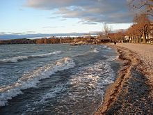
The longest lake promenade in Germany runs along the Ammersee from Herrsching, on which you can stroll for around ten kilometers ; the many hiking and cycling trails (e.g. to Wessobrunn ) or to Lake Starnberg are recommended for more sporty guests .
On the Ammersee you can surf and sail, there are numerous swimming opportunities and a boat rental.
While gastronomy and tourism are also extremely important economic elements, the municipality of Herrsching today also attracts freelancers and service providers, artists, artist agencies and publishers.
Clubs (selection): D'Herrschinger Wildschütz'n, Sportfreunde Breitbrunn, Morgenstern Schützengesellschaft, TC Herrsching and TSV Herrsching . The volleyball players of TSV Herrsching play since the 2014/15 season in the First Bundesliga.
education
All senior civil servants in the Bavarian financial administration are completing their training in the finance department at the University of Applied Sciences in Bavaria, Herrsching, which is housed in an imposing building from the 1930s.
Another educational institution is the House of Bavarian Agriculture in Herrsching . Originating from the former farmer's school of the Bavarian Farmers' Association (the oldest rural folk high school in southern Germany, founded on November 30, 1948 ), it is now an open conference center for people from rural areas for personal and professional further education. It also houses the valuable agricultural history library in Herrsching with over 20,000 volumes.
Until the move to Garching in 1966, Herrsching was home to the branch office of the Commission for Low Temperature Research of the Bavarian Academy of Sciences, founded by Walther Meißner in 1946 , where Robert Doll and Martin Näbauer discovered river quantization in 1961 .
Sports
- TC Herrsching tennis club
- TSV Herrsching e. V.
Personalities
- Rainer René Graf Adelmann von Adelmannsfelden (* 1948), lawyer
- Arno Assmann (1908–1979), actor
- Hans Baur (1897–1993), Hitler's chief pilot; lived in Widdersberg
- Uli Baur (1956–2018), journalist
- Martin Benrath (1926–2000), actor
- Thilo Bode (* 1947), environmentalist, founder and managing director of Foodwatch , previously a manager at Greenpeace , grew up in Herrsching
- Helene Böhlau (1856–1940), writer, buried in Widdersberg
- Trude Brück (1902–1992), painter, lived in Herrsching
- David Coverdale (* 1951), singer Deep Purple from 1973 to 1976
- Thomas Darchinger (* 1963), actor
- Thorwald Dethlefsen (1946–2010), esotericist and author
- Holm Dressler (* 1949), TV producer and director, in Herrsching since 1984
- Wolfgang Döbereiner (1928–2014), astrologer and publisher
- Michael Dürsch (* 1957), rower
- Roderich Fick (1886–1955), architect, lived and worked in the "Alte Mühle", Mühlfeld from 1920 to 1955
- Helmut Hammerschmidt (1920–1998), broadcast director
- Rudolf Hanauer (1908–1992), lawyer and politician ( CSU ), President of the Bavarian State Parliament (1960–1978), until his election as a member of the state parliament from 1946 to 1954, lived in Herrsching until 1992
- Thomas Heinemann (* 1958), director and author
- Camilla Horn (1903-1996), actress
- Edgar Knoop (* 1936), painter, object artist and photographer
- Hanns Erich Köhler (1905–1983), caricaturist
- Clemens Kuby (* 1947), documentary filmmaker and author
- Dieter Kühn (1935–2015), writer, attended elementary school in Herrsching
- Christian Morgenstern (1871–1914), poet: his widow Margareta lived in Breitbrunn from 1919 until her death in 1968.
- Burkard Freiherr von Müllenheim-Rechberg (1910–2003), diplomat and author, survivor of the sinking of the Bismarck
- Christoph Müller (* 1950), diplomat, ambassador of the Federal Republic of Germany
- Hanns Christian Müller (* 1949), theater director
- Wolfgang von Nostitz (* 1940), German politician (Bündnis 90 / Die Grünen) and lawyer
- Ruth Paulig (* 1949), co-founder of the party the Greens in Bavaria 1979, member of the Greens in the Bavarian state parliament 1986-1994, 1998 to 2008
- Alfred Ploetz (1860–1940), physician
- Dagmar Ploetz (* 1946), translator
- Eberhard Puntsch (1926–2015), non-fiction author and Member of the Bavarian State Parliament (FDP) from 1978 to 1982, born in Dresden, lived in Herrsching
- Max Reinhard (1896–1978), cultural advisor for the city of Munich from 1935 to 1945
- Fritz Reinhardt (1895–1969), State Secretary in the Reich Ministry of Finance
- Simone Rethel (* 1949), actress
- Matthias Röhr (* 1962), guitarist, member of the rock band Böhse Onkelz under the nickname Gonzo , has lived with his family in Herrsching since the beginning of 2012
- Ludwig Scheuermann (1859–1911), painter, builder of the Scheuermann-Schlößchen
- Otto Schnitzenbaumer (1922–2012), building contractor, former owner of Schloss Wartaweil
- Rudi Schuricke (1913–1973), singer, actor, lived from 1955 to 1973 in Herrsching, owner of the former Hotel Seespitz
- Sabine Thomas , author and television presenter
- Uwe Timm (* 1940), writer, lived with his family in Herrsching
- Klaus Wennemann (1940–2000), actor
- Harald Winter (* 1953), artist
- Fritz Winter (1905–1976), painter
- Franz Wördemann (1923–1992), journalist and non-fiction author
- Oluf Zierl (October 5, 1932 - September 14, 2002) lived in Herrsching. He was a well-known travel journalist, also known by the nickname "Harley Pope".
- Maximilian Ritter von Zottmann (1882–1966), Major General , Bavarian Max-Joseph-Ritter (Battle of Arras April 9, 1917)
literature
- Upper Bavaria - western part. Polyglot travel guide
- Upper Bavaria. Baedeker Allianz travel guide, Ostfildern 2010, ISBN 3-8297-1126-3
- Rolf Wünnenberg: 1200 years of Herrsching. 776-1976. Herrsching 1977
- Thomas Kraft (Ed.): Herrsching at the time of Christian Morgenstern. Pictures of cultural life between 1870 and 1920 Ed. for the cultural association Herrsching e. V., Herrsching 2006, ISBN 3-936179-19-0
- Hans Radl (photo documentation), Municipality of Herrsching (ed.): Herrsching in the course of time, St. Ottilien 1983
- Hans Radl (photo documentation), Municipality of Herrsching (ed.): Herrsching memories from past days, St. Ottilien 1986
- Hans Radl (photo documentation), Municipality of Herrsching (ed.): Herrsching without a past, no future, St. Ottilien 1990
- Gustl Empfenzeder: History of the Ammerseeheimat. , St. Ottilien 1978
- Gustl Empfenzeder: Herrschinger Hefte, 1972 to 1976
- Ekkehart Krauth: Herrsching a. Ammersee, from prehistory and early history. St. Ottilien 2005
- Förderverein Südbayerisches Schifffahrtsmuseum e. V. (Ed.): Von Ammersee and Amper. , Munich 1993
- Herrsching am Ammersee (Ed.): Herrsching . Sutton Verlag 2013. ( excerpt )
Web links
Individual evidence
- ↑ Genesis online database of the Bavarian State Office for Statistics Table 12411-001 Update of the population: municipalities, reference dates (last 6) (population figures based on the 2011 census) ( help ).
- ↑ Directory of the municipalities, administrative communities and community-free areas in Bavaria as of January 1, 2018 - Citizen Service. Retrieved March 3, 2021 .
- ^ Municipality of Herrsching am Ammersee in the local database of the Bavarian State Library Online . Bayerische Staatsbibliothek, accessed on September 9, 2019.
- ↑ http://www.veh-ev.eu/home/vehevinf/public_html/?p=1485 Association of former home children eV
- ↑ Minutes of the Bavarian State Parliament, 99th meeting of May 10, 1966 / ref, p. 3746
- ↑ Wilhelm Volkert (Ed.): Handbook of the Bavarian offices, municipalities and courts 1799–1980 . CH Beck, Munich 1983, ISBN 3-406-09669-7 , pp. 576 .
- ^ Federal Statistical Office (ed.): Historical municipality directory for the Federal Republic of Germany. Name, border and key number changes in municipalities, counties and administrative districts from May 27th, 1970 to December 31st, 1982 . W. Kohlhammer, Stuttgart / Mainz 1983, ISBN 3-17-003263-1 , p. 591 .
- ↑ Posse - double street names: emergency doctors and patients wander through Herrsching , Süddeutsche Zeitung , February 15, 2019
- ^ Danger from double street names , across from BR , February 21, 2019
- ↑ https://www.herrsching.de/Rathaus/B%C3%BCrgermeister
- ↑ https://okvote.osrz-akdb.de/OK.VOTE_OB/Wahl-2020-03-15/09188124/html5/Buergermeisterwahl_Bayern_117_Gemeinde_Gemeinde_Herrsching_aAmmersee.html
- ↑ https://okvote.osrz-akdb.de/OK.VOTE_OB/Wahl-2020-03-15/09188124/html5/Gemeinderatswahl_Bayern_116_Gemeinde_Gemeinde_Herrsching_aAmmersee.html
- ↑ Entry on the coat of arms of Herrsching am Ammersee in the database of the House of Bavarian History
- ^ Robert Bopp: 100 years of the Pasing - Herrsching railway line. From the Royal Bavarian Local Railway to the S-Bahn line 5 . Germering 2003, ISBN 3-00-011372-X , p. 37, 46 .
- ^ Website of the University of Applied Sciences for Public Administration and Justice, Finance Department in Herrsching
- ↑ Archived copy ( Memento from November 19, 2004 in the Internet Archive )
- ↑ Gonzo: The official and authorized biography of Matthias Röhr . Autobiography written with co-authors Dennis Diel and Marco Matthes, Hannibal Verlag , Höfen , 1st edition, November 2019. P. 343 f.


