Krugsweiher
| Krugsweiher | ||
|---|---|---|

|
||
| Krugsweiher | ||
| Geographical location |
District of Nürnberger Land
|
|
| Drain | Gauchsbach | |
| Data | ||
| Coordinates | 49 ° 22 '14 " N , 11 ° 11' 31.2" E | |
|
|
||
| Altitude above sea level | 348 m above sea level NHN | |
| surface | 3.5 ha | |
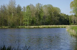
The Krugsweiher are a chain of ponds near Feucht in the Middle Franconian district of Nürnberger Land in Bavaria .
location
The uppermost Krugsweiher begins about 1.2 kilometers southwest of the center of the market town of Feucht a little after the outskirts and the motorway immediately after the sewage treatment plant at an altitude of 350 m above sea level. NHN , from here on the chain extends over a distance of about 0.8 kilometers approximately west to the last at about 347 m above sea level. NHN Geologically speaking, they are located in the area of a large sand dune on the Sandstone Keuper.
Except for the westernmost, they are all in the municipality of Feucht; the latter, on the other hand, is in the neighboring community of Markt Wendelstein in the district of Roth near the district of Röthenbach near St. Wolfgang . Part of the area is part of the landscape protection area protection of the landscape in the area of the district of Roth - Southern Central Franconian Basin east of the Swabian Rezat and the Rednitz with foreland of the Middle Franconian Jura (LSG Ost) .
description

The chain of ponds comprises nine individual ponds, which together cover an area of around 3.5 hectares. In the course of the construction of the high-speed line Nuremberg – Ingolstadt – Munich through the Nuremberg Reichswald , the former fish ponds were renatured and ecologically upgraded. In 2013, Deutsche Bahn had to redesign the existing water bodies and their overgrown surroundings in a natural way to compensate for the land consumption.
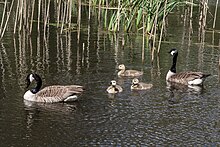
The Krugsweiher and the adjacent area are now a valuable habitat for many, sometimes very rare, plants and animals. Biologists found various types of amphibians , dragonflies and bats here . In addition, numerous water birds have breeding grounds here or stop when they pass through. Swamp and aquatic plants that have become rare have also settled in the region.
The pond mussels , which have become rare, were also found when fishing in autumn ; they are an indicator of fairly clean water, their presence shows that the pond ecosystem is intact. Grass carp , tench and roach are fished .
The Gauchsbach passes the ponds on their south side, only the last and most westerly on its north-west side. At its western edge there is a retention barrier, at which the Gauchsbach-Leitgraben has branched off to the right of the stream since the 1840s . The guide ditch itself is a structural monument , the associated earthworks a ground monument . He dined further down, in Röthenbach b. St.W., if necessary, lock water into the Ludwig-Danube-Main Canal . In the Bavarian map series of 1864 no dammed ponds are recorded there, but a small swamp area. The two western ponds were probably built as sand pits during the founding period between 1880 and 1910. At first nothing changed in this respect until the 1950s. A measuring table from 1952 also only shows the two western ponds. The chain of ponds was only created by large amounts of sand removed from the creek bed for the construction boom that began in the late 1950s and early 1960s, by flooding , renaturing and later stocking the fishing industry .
use
Some ponds have been used for the biological clarification of the Feucht sewage treatment plant since the early 1980s .
Today, the area is a local recreation area and is the responsibility of the market town of Feucht, which had panels set up in 2013 to provide information about the rich flora and fauna . In the summer of 2016, the hiking trail “Hiking around the Krugsweiher and the Jägersee” was opened, which leads from the town center in Feucht around the Krugsweiher and the nearby Jägersee .
In 2012, the shooting of swans made headlines. Due to its small area, the area was struck to the nearest hunting ground by law, so hunting was legally permissible. A complaint to the Higher Hunting Authority was unsuccessful.
Individual evidence
BayernAtlas ("BA")
Official online waterway map with a suitable section and the layers used here: The Krugsweiher with surroundings
General introduction without default settings and layers: BayernAtlas of the Bavarian State Government ( notes )
- ↑ a b c Altitude queried with the background layer aerial photo (right click) on August 8, 2016.
- ↑ The area of the lake measured with the background layer aerial photo , accessed on August 8, 2016.
- ↑ Length measured on the official map background layer , accessed on August 8, 2016.
- ↑ Geology according to the Geological Map 1: 500,000 layer , accessed on August 8, 2016.
- ↑ Location of the administrative boundaries according to the relevant layers, accessed on August 8, 2016.
- ↑ Architectural and ground monument according to the so-called layers, accessed on August 8, 2016.
Other
- ↑ "Information boards on flora and fauna at the Krugsweiher" , article on www.nordbayern.de from November 19, 2013, accessed on August 6, 2016.
- ↑ Map excerpt from Bayernatlas Klassik
- ↑ "Hiking around the Krugsweiher and the Jägersee" (PDF, 1.8 MiByte) Illustrated hiking trail description at www.feucht.de , accessed on August 6, 2016.
- ↑ "Orphaned pond: hunter shoots swan pair" , article on www.nordbayern.de from January 4, 2012, accessed on August 6, 2016.
- ↑ "Dead Swans: Complaint" , article on n-land.de , accessed on August 6, 2016.
- Information boards on site

