
Inzell
| coat of arms | Germany map | |
|---|---|---|

|
Coordinates: 47 ° 46 ' N , 12 ° 45' E |
|
| Basic data | ||
| State : | Bavaria | |
| Administrative region : | Upper Bavaria | |
| County : | Traunstein | |
| Height : | 693 m above sea level NHN | |
| Area : | 45.35 km 2 | |
| Residents: | 4826 (Dec. 31, 2019) | |
| Population density : | 106 inhabitants per km 2 | |
| Postal code : | 83334 | |
| Area code : | 08665 | |
| License plate : | TS, LF | |
| Community key : | 09 1 89 124 | |
| LOCODE : | DE IZL | |
| Community structure: | 51 districts | |
| Address of the municipal administration: |
Rathausplatz 5 83334 Inzell |
|
| Website : | ||
| Mayor : | Hans Egger | |
| Location of the municipality of Inzell in the Traunstein district | ||
  |
||

Inzell is a municipality in the southern district of Traunstein in the administrative district of Upper Bavaria . The parish village of the same name is the main town of the municipality and a recognized climatic health resort . The place is known for the Federal Center for Roller Skating and Speed Skating .
geography

Geographical location
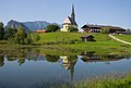
Inzell lies in a wide valley floor in the Chiemgau Alps , which is framed by the Rauschberg , the Zinnkopf , the Teisenberg and the Staufen mountain range . In the local area of Inzell, the Rote Traun begins at the confluence of the Großwaldbach and Falkenseebach (Maderbach) rivers . Inzell is also known as the “gateway to the Berchtesgadener Land district ”. The reason for this is the Zwing , a narrow mountain range between Inzell and Weißbach , which separates the Chiemgau from the Berchtesgadener Land district.
Neighboring communities
The municipality is bordered by the municipalities of Ruhpolding and Siegsdorf (both districts of Traunstein) in the west, Markt Teisendorf and the municipality of Anger in the north and northeast , the municipality of Piding in the east, the town of Bad Reichenhall in the southeast on Hochstaufen and the municipality of Schneizlreuth in the south ( all districts of Berchtesgadener Land).
Community structure
There are the following districts:
|
|
history

After the establishment of the St. Zeno monastery near Reichenhall, Archbishop Conrad of Salzburg handed over “to St. Zeno and his friars the estate and the forest of Inzella ”. As early as 1195, after the church of St. Michael was built, Inzell became an independent parish and court market when it was separated from Vachendorf . The seat of Hofmark, Inzell Castle, fell victim to secularization and was demolished in 1811. Inzell became an independent political municipality in the course of the administrative reforms in Bavaria in 1818 . As can already be seen in the coat of arms, mining and the smelting of ores were an important source of income for the village of Inzell. First was the Hochstaufen long on Inzeller Kienberg, the northern slope of the and of 1665 to almost 150 years Rauschenberg , lead and zinc mined. The ore was melted in the current district of Schmelz .
The municipality part Ramsen was reclassified with effect from December 1, 1996 from the western neighboring municipality Ruhpolding to Inzell.
politics
Municipal council
Since the local elections on March 2, 2008, with a turnout of 66.0 percent , the seats in the municipal council have been distributed as follows:
| Political party | CSU | SPD / Independent | Citizens for Inzell | Forum active | OBIC * | total | |
| 2008 | Seats | 7th | 3 | 3 | 2 | 1 | 16 |
| Share of votes | 40.9% | 18.1% | 20.4% | 14.7% | 5.9% | 100% |
The local election on March 16, 2014 , with a turnout of 66.2 percent, led to the following result:
| Political party | CSU | SPD | Citizens for Inzell | Boy list | OBIC * | total | |
| 2014 | Seats | 6th | 4th | 4th | 1 | 1 | 16 |
| Share of votes | 36.0% | 24.1% | 26.3% | 8.8% | 4.7% | 100% |
* Open citizen list Inzell-Chiemgau
The first mayor is also a member of the municipal council.
mayor
The professional first mayor is Hans Egger (citizen of Inzell). He has been in office since May 1, 2014. On March 15, 2020, he was elected for a further six years in the first ballot with 88.5% of the vote. In the local elections in 2014 , he was elected successor to Martin Hobmaier (CSU) with a share of 62.0% of the vote.
coat of arms
|
|
Blazon : "A silver mallet and a silver miner's hammer crossed in red, above a silver fish." |
| Justification for the coat of arms: The silver fish is taken from the coat of arms of the Augustinian provostry of St. Zeno, the crossed miner's tools are reminiscent of the mining industry in the past. |
population
Population development
Between 1988 and 2018, the municipality grew from 3,722 to 4,835 by 1,113 inhabitants or 29.9%.
| Population development in the municipality of Inzell | |||||||||||||||
| year | 1840 | 1871 | 1900 | 1925 | 1939 | 1950 | 1961 | 1970 | 1987 | 1991 | 1995 | 2005 | 2010 | 2015 | |
| Residents | 980 | 936 | 1060 | 1464 | 1671 | 2413 | 2315 | 3007 | 3736 | 4065 | 4097 | 4327 | 4490 | 4622 | |
religion
The majority of citizens belong to the Roman Catholic Church (around 73%). This value is higher than that of the Traunstein district and Upper Bavaria. The area of the community is supplied by the parish Inzell-Weißbach. In addition to the parish church of St. Michael in the center there are two other Catholic churches (Church of Our Lady in the Niederachen district and the subsidiary church of St. Nicholas in Einsiedl) as well as several chapels.
10% of the population are members of the Evangelical Lutheran Church. The modern Christ Church is located in the district of Oed. The ev.-luth. Parish Inzell belongs to the parish of Ruhpolding.
Approx. 16% of the population are without or other denomination.

Catholic parish church St. Michael

Evang. Christ Church
Filial church St. Nikolaus in Einsiedl


Architectural monuments
Soil monuments
Economy and Infrastructure
According to official statistics, there were 872 people in employment subject to social security contributions in 2009, 268 of them in manufacturing, 308 in trade and transport, and a total of 296 in other economic sectors (with agriculture and services). There were three in manufacturing and 13 in construction. In addition, there were 71 farms in 2007 with an agricultural area of at least 2 hectares each.
traffic
The federal highway 306 runs through Inzell and the federal highway 305 as part of the German Alpine Road . The closest connection to the federal motorway 8 is AS Siegsdorf (10 km north).
education
The following educational institutions exist in Inzell:
- Catholic kindergarten St. Michael
- Elementary school (primary and secondary school) with 186 students in 11 classes (school year 2010/11). The pupils of the 7th and 9th grade attend the school in Ruhpolding.
- Since 1969 there has also been the municipal “Cajetan-Adlgasser Sing- und Musikschule Inzell”.
- Critical Academy , an educational institution of IG Metall
Sports

An ice skating and speed skating rink was built on the Frillensee from 1959 to 1960 , before the world-renowned sporting and tourist winter operations were initiated from 1963 to 1965 with the construction of the natural ice stadium with ice rink and ice hockey rink. In 1965, the Inzell ice stadium was built in place of the natural ice stadium as the second artificial ice rink in Germany . Qualifying runs for the ice speedway world championship have also taken place there since the 1960s.
In June 2008, the International Ice Skating Union announced that Inzell had been awarded the contract to host the 2011 World Single Distance Championships. The prerequisite for this, however, is the construction of a speed skating hall, which had been planned for several years. Construction of the new hall began in autumn 2009.
The new ice rink was opened in time for the 2011 World Championships. The ice rink is called Max Aicher - Arena . The Ice Speedway World Cup Grand Prix of Germany took place there in March 2014.
Personalities
Sons and daughters of the church
- Anton Cajetan Adlgasser (1729–1777), composer and court organist at Salzburg Cathedral
- Johannes M. Höck (1902–1995), Benedictine abbot of Ettal and Scheyern, council father
- Michael Höck (1903-1996), clergyman
- Ludwig Schwabl (1921–2007), member of the Bavarian SPD state parliament
- Robert Hältner (* 1950), crime writer
- Regine Mösenlechner (* 1961), ski racer
- Rudolf Jeklic (* 1965), speed skater
- Thomas Dufter (* 1966), Nordic combined athlete
- Matthias Öttl (* 1992), soccer player
Personalities who have worked on site
- Rudolf Lenz (1920–1987), Austrian film actor (Förster vom Silberwald) . Grave site at the Inzell cemetery
- Günter Traub (* 1939 in Schweinfurt), speed skater, world record holder
- Erhard Keller (* 1944 in Günzburg), speed skater, Olympic participant, two Olympic victories
- Monika Pflug (* 1954 in Munich), speed skater, Olympic participant, Olympic champion
- Peter Wirnsberger (* 1958), ski racer
- Armin Bittner (* 1964), ski racer (married to Regine Mösenlechner )
- Günther Bauer (* 1972 in Schleching), ice speedway driver, Vice World Champion 2003
- Anni Friesinger (* 1977), speed skater
- Siegfried Walch (* 1984), local politician
Web links
Individual evidence
- ↑ "Data 2" sheet, Statistical Report A1200C 202041 Population of the municipalities, districts and administrative districts 1st quarter 2020 (population based on the 2011 census) ( help ).
- ^ Community Inzell in the local database of the Bayerische Landesbibliothek Online . Bayerische Staatsbibliothek, accessed on October 3, 2018.
- ↑ a b District Office Traunstein (ed.): Special Official Gazette for the District of Traunstein . No. 40, November 27, 1995, pp. 154-155 .
- ↑ Mayor / Lord Mayor in municipalities belonging to the district (as of May 1st, 2020). (xlsx) Bavarian State Office for Statistics, accessed on June 20, 2020 .
- ^ Entry on the coat of arms of Inzell in the database of the House of Bavarian History
- ↑ a b Official municipality statistics
- ↑ Inzell elementary school

Altenmarkt an der Alz | Mountains | Chieming | Engelsberg | Fridolfing | Grabenstätt | Grassau | Inzell | Kienberg | Kirchanschöring | Marquartstein | Nussdorf | Obing | Palling | Petting | Pittenhart | Reit im Winkl | Ruhpolding | Schleching | Schnaitsee | Seeon-Seebruck | Siegsdorf | Staudach-Egerndach | Surberg | Tacherting | Taching at the lake | Tittmoning | Traunreut | Traunstein | Trostberg | Overseas | Unterwössen | Vachendorf | Waging am See | Wonneberg
Unregulated areas: Chiemsee | Waginger See