
Vachendorf
| coat of arms | Germany map | |
|---|---|---|

|
Coordinates: 47 ° 51 ' N , 12 ° 36' E |
|
| Basic data | ||
| State : | Bavaria | |
| Administrative region : | Upper Bavaria | |
| County : | Traunstein | |
| Management Community : | Mountains | |
| Height : | 581 m above sea level NHN | |
| Area : | 9.96 km 2 | |
| Residents: | 1812 (Dec. 31, 2019) | |
| Population density : | 182 inhabitants per km 2 | |
| Postal code : | 83377 | |
| Primaries : | 0861, 08661.08662 | |
| License plate : | TS, LF | |
| Community key : | 09 1 89 161 | |
| LOCODE : | DE VA2 | |
| Community structure: | 17 districts | |
| Address of the municipal administration: |
Hauptstrasse 15 83377 Vachendorf |
|
| Website : | ||
| Mayor : | Rainer Schroll ( SPD / UUB) | |
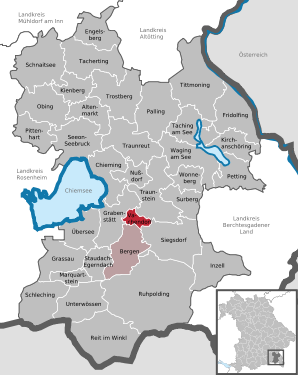
| Location of the municipality of Vachendorf in the Traunstein district | ||
  |
||

Vachendorf is a municipality in the Upper Bavarian district of Traunstein and a member of the Bergen administrative community .
geography
Vachendorf is located in the planning region of southeast Upper Bavaria in the Chiemgau .
Community structure
17 districts:
There are the districts Haslach and Vachendorf.
history
Until the church is planted
The village of Vachendorf was first mentioned in the Breves Notitiae in 790. The first documentary evidence of the parish of Vachendorf took place between 1188 and 1191. Vachendorf belonged to the Burghausen Rent Office and the Traunstein Regional Court of the Electorate of Bavaria . The municipality Vachendorf originated with the community edict in Bavaria in the year 1818th
Administrative community
In 1978, Vachendorf entered into an administrative partnership with the neighboring municipality of Bergen, but has remained an independent municipality.
Incorporations
On May 1, 1978, a small part of the dissolved community of Haslach with a little more than 100 inhabitants at that time was incorporated.
Population development
Between 1988 and 2018 the municipality grew from 1,504 to 1,847 by 343 inhabitants or 22.8%.
- 1961: 849 inhabitants
- 1970: 980 inhabitants
- 1987: 1481 inhabitants
- 1991: 1564 inhabitants
- 1995: 1726 inhabitants
- 2000: 1729 inhabitants
- 2005: 1805 inhabitants
- 2010: 1849 inhabitants
- 2015: 1827 inhabitants
politics
Local elections in Bavaria 2014 :
- Mayor: Rainer Schroll ( SPD ); he was re-elected on March 15, 2020 with 87.8% of the vote.
- Mayor: Herbert Bischof (UW)
- Mayor: Agnes Göhle ( SPD )
The municipal tax income amounted to 550 T € in 2007, of which the trade tax income (net) amounted to 80 T €.
Architectural monuments
Soil monuments
Economy and Infrastructure
Economy including agriculture and forestry
According to official statistics, there were nine employees at the place of work in the field of agriculture and forestry, 86 in the manufacturing sector and 17 in trade and transport. In other economic sectors 45 people were employed at the place of work subject to social security contributions. There were a total of 532 employees at the place of residence subject to social security contributions. There were two companies in the manufacturing sector and three in the construction sector. In addition, in 1999 there were 32 farms with an agriculturally used area of 750 hectares, of which 171 were arable land and 579 were permanent green areas.
education
There are the following institutions (status: 2014):
- Kindergartens: 60 kindergarten places
- Crèche: 15 crèche places
- Elementary schools: elementary school with four classes
Personalities
The best-known representative of Vachendorf is the native Traunsteiner and overall winner 2006 and 2007, Tobias Angerer , who competed for the SC Vachendorf in the cross-country skiing world cup .
Web links
- Entry on the coat of arms of Vachendorf in the database of the House of Bavarian History
Individual evidence
- ↑ "Data 2" sheet, Statistical Report A1200C 202041 Population of the municipalities, districts and administrative districts 1st quarter 2020 (population based on the 2011 census) ( help ).
- ↑ http://www.bayerische-landesbibliothek-online.de/orte/ortssuche_action.html ? Anzeige=voll&modus=automat&tempus=+20111109/203146&attr=OBJ&val= 581
- ^ Federal Statistical Office (ed.): Historical municipality directory for the Federal Republic of Germany. Name, border and key number changes in municipalities, counties and administrative districts from May 27, 1970 to December 31, 1982 . W. Kohlhammer GmbH, Stuttgart / Mainz 1983, ISBN 3-17-003263-1 , p. 593 .

Altenmarkt an der Alz | Mountains | Chieming | Engelsberg | Fridolfing | Grabenstätt | Grassau | Inzell | Kienberg | Kirchanschöring | Marquartstein | Nussdorf | Obing | Palling | Petting | Pittenhart | Reit im Winkl | Ruhpolding | Schleching | Schnaitsee | Seeon-Seebruck | Siegsdorf | Staudach-Egerndach | Surberg | Tacherting | Taching at the lake | Tittmoning | Traunreut | Traunstein | Trostberg | Overseas | Unterwössen | Vachendorf | Waging am See | Wonneberg
Unregulated areas: Chiemsee | Waginger See