Teisenberg
| Teisenberg | ||
|---|---|---|
|
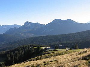
View from the Schneid to the Stoißer Alm, behind the Staufen , on the left in the background the Untersberg |
||
| height | 1333 m above sea level NHN | |
| location | District of Berchtesgadener Land and District of Traunstein , Bavaria | |
| Mountains | Chiemgau Alps | |
| Dominance | 5.6 km → Angerstein | |
| Notch height | 421 m ↓ Inzeller Höhe | |
| Coordinates | 47 ° 48 '20 " N , 12 ° 46' 6" E | |
|
|
||
| rock | Flysch | |
| particularities | northernmost 1000 meter in the German Alps | |
The Teisenberg , a mountain between Inzell ( district of Traunstein ) and Teisendorf and Anger (both in the district of Berchtesgadener Land ), in the border area to the state of Salzburg , is the northernmost thousand of the German Alps and belongs to the Chiemgau Alps . Its highest point is called Schneid and is 1333 m high. At the top, the Teisenberg is flattened and rounded, has wooded slopes and offers a view of the Northern Limestone Alps , which tower above it here by around 500 meters, and in very clear weather even as far as the Bavarian Forest . In addition, there are deep views of the Högl and the Austrian capital Salzburg .
Below the summit at 1270 m is the Stoißer Alm, popular with hikers and mountain bikers . It is open all year round and is usually managed from May 1st to the end of October. The Bäcker Alm is also located on the Teisenberg at an altitude of 1067 m , which is also open from May to October.
Routes
The DAV section Teisendorf looks after five routes up to the Teisenberg. The summit can be reached in 1½ - 2 hours.
- File riding - large tile stone - cutting
- Seiberstadt - the shortest way to the Stoißer Alm / summit
- Neukirchen / Lochmühle - joins the path from Seiberstadt at 1000 m
- Hub - possible via Achterhütte or Schneid
Numerous smaller paths and forest roads offer the opportunity to determine the tours yourself. Other well-known paths are the Klostersteig and the Zigzag Path .
Web links
- DAV section Teisendorf over the Teisenberg
- Stoißer Alm . In: Agricultural and cultural heritage database . Society for Agricultural History
- Teisenberg.de - information portal
Individual evidence
- ↑ Freimoser, M. (1972): On the stratigraphy of the southeast Bavarian flysch zone. - In: Bavarian Geological State Office (ed.): Geologica Bavarica, Vol. 66. The Flysch Zone in Bavaria: 7-91, Munich (Bavarian Geological State Office)


