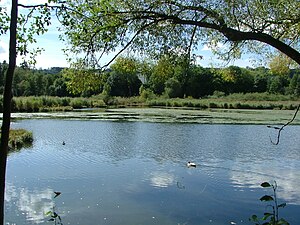
Schwabelsberger Weiher
| Schwabelsberger Weiher | ||
|---|---|---|

|
||
| Schwabelsberger Weiher | ||
| Geographical location | Bavaria | |
| Data | ||
| Coordinates | 47 ° 44 '32 " N , 10 ° 17' 21" E | |
|
|
||
| Altitude above sea level | 705 m above sea level NN | |
| surface | 4.6 | |
The Schwabelsberger Weiher are three ponds of different sizes and connected with smaller secondary ponds in the Thingers district in Kempten (Allgäu) . The three ponds do not have their own names, but are referred to as upper, middle and lower ponds according to their location in the drainage chain. The biotope is surrounded by the Mariaberg recreational area and lies at the foot of the Mariaberg. In 1995 the Schwabelsberger Weiher were designated as a landscape protection area.
The three ponds together take up a water area of about 4.6 hectares , which is distributed over the individual ponds.
The nature reserve has a size of 18.86 hectares. The ponds are eutrophic flat ponds with silting vegetation.
Schwabelsberg was the name of a castle and a lordship owned by the Princely Monastery of Kempten , which was first mentioned in 1368. In times of war and emergency, e.g. B. after the destruction of the monastery in the Thirty Years War in 1632, the convent of the prince abbey resided there. The Franciscan Sisters expelled from the monastery of St. Anna also stayed here for a short time. Parts of the castle complex with the Church of St. Anna have been preserved opposite the ponds east of Heiligkreuzer Straße; they are now a listed building.
The dammed ponds already existed as fish ponds in the 17th century, but they were much larger then than they are today. After secularization in 1803 , they were sold and no longer maintained. It was not until 1907 that the pond system was restored and made home to rare plants and animals. After 1980 the water was largely silted up and threatened to dry up after it was filled up.
In 1982 the city acquired the area and transformed the ponds and their surroundings into a lively landscape and nature park. The dam wall, dams, tributaries and the outlet structure were renovated at that time, a circular path with information boards was laid out and an observation tower was built. In 1993 the first road tunnel for frogs and toads in Kempten was built on one of the ponds, and four years later a wild apiary was built. At the turn of the millennium, a rare species of wood ant was settled.
The CDDA code is 395998. The SGD ID is LSG-00490.01.
Individual evidence
- ↑ Lorenz Müller, E. Dörr: The ponds of the Schwabelsberg estate between Kempten and Heiligkreuz. In: Announcements of the natural science working group Kempten (Allgäu). 8th year, December 1964, volume 2, p. 13ff.
- ↑ Land use plan of the city of Kempten (Allgäu) with an integrated landscape plan. Reason, June 18, 2009 , p. 204
- ↑ http://www.kempten.de/de/schwabelsberger-weiher-1.php
- ↑ Kempten City Law - Ordinance of May 2, 1995 (PDF; 14 kB)
- ↑ a b Bavarian State Office for the Environment - Green List of Landscape Protection Areas in Swabia - as of December 31, 2010 (PDF; 277 kB)
- ↑ Franz-Rasso Böck , Ralf Lienert , Joachim Weigel: Century views of Kempten 1900-2000. Verlag Tobias Dannheimer / Allgäuer Zeitungsverlag, Kempten 1999, ISBN 3-88881-035-3 , pp. 256f.
- ↑ EUNIS -Site factsheet for LSG "Schwabelsberger Weiher"
