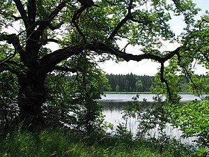
Oberhauser Weiher
| Oberhauser Weiher | ||
|---|---|---|

|
||
| Geographical location | Landsberg am Lech district | |
| Tributaries | Coutmillegraben | |
| Drain | Hauser Bach | |
| Places on the shore | Oberhausen | |
| Data | ||
| Coordinates | 47 ° 57 '15 " N , 10 ° 59' 9" E | |
|
|
||
| Altitude above sea level | 668 m | |
| surface | 8.55 ha | |
| length | 300 m | |
| width | 400 m | |
| scope | 1.13 km | |
The Oberhauser Weiher is a still water body with 8.55 hectares of water in the area of the municipality of Dießen am Ammersee in the Upper Bavarian district of Landsberg am Lech .
The pond is located in a moraine landscape south of the Oberhausen district in the foothills of the Alps .
Originally, the pond was artificially dammed for the operation of a mill in Oberhausen at an unknown time.
The Oberhauser Weiher has been a nature reserve since 1986 .
The pond feeds the Hauser Bach , a tributary of the Windach .
Web links
Individual evidence
- ↑ M. Aquinata Schnurer OP: Home book of the market in Dießen a. Ammersee . Ed .: Markt Dießen a. Ammersee. Dießen am Ammersee 1976, p. 215 .
