
Betzigau
| coat of arms | Germany map | |
|---|---|---|

|
Coordinates: 47 ° 44 ' N , 10 ° 23' E |
|
| Basic data | ||
| State : | Bavaria | |
| Administrative region : | Swabia | |
| County : | Oberallgäu | |
| Height : | 728 m above sea level NHN | |
| Area : | 29.28 km 2 | |
| Residents: | 2939 (Dec. 31, 2019) | |
| Population density : | 100 inhabitants per km 2 | |
| Postal code : | 87488 | |
| Area code : | 0831 | |
| License plate : | OA | |
| Community key : | 09 7 80 114 | |
| LOCODE : | DE EZI | |
| Community structure: | 33 parts of the community | |
| Address of the municipal administration: |
Rotkreuzstrasse 2 87488 Betzigau |
|
| Website : | ||
| First Mayor : | Roland Helfrich ( non-partisan voter group Betzigau / voter group Hochgreut ) | |
| Location of the municipality of Betzigau in the Oberallgäu district | ||
  |
||


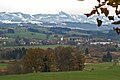
Betzigau is a municipality in the Swabian district of Oberallgäu .
Geography and community structure
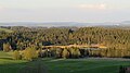
There is only the Betzigau district .
There are 33 officially named parts of the municipality (the type of settlement is given in brackets ):
|
|
|
Betzigau is close to the Munich – Lindau railway line .
Leiterberg is the second largest district in the municipality.
history
Until the church is planted
The place was first mentioned in 1238 as Bezzingowe . Betzigau belonged to the prince monastery of Kempten for a long time . Since the Reichsdeputationshauptschluss and the secularization in 1803 the place belongs to Bavaria. In the course of the administrative reforms in the Kingdom of Bavaria , today's municipality was created with the municipal edict of 1818 .
see also ruined castle Balts stone , castle ruins Schöneberg
Population development
From 1988 to 2008, Betzigau grew by 440 inhabitants or around 19%. Between 1988 and 2018 the municipality grew from 2320 to 2926 by 606 inhabitants or by 26.1%.
The following figures refer to the territorial status on May 25, 1987.
| Population development | ||||||||||||||
|---|---|---|---|---|---|---|---|---|---|---|---|---|---|---|
| year | 1840 | 1900 | 1939 | 1950 | 1961 | 1970 | 1987 | 1991 | 1995 | 2000 | 2005 | 2010 | 2015 | 2016 |
| Residents | 1092 | 1265 | 1319 | 1747 | 1648 | 1803 | 2280 | 2499 | 2637 | 2775 | 2830 | 2747 | 2845 | 2876 |
politics
Mayor is Roland Helfrich (non-partisan voter group Betzigau / voter group Hochgreut).
The municipal tax revenue in 1999 was the equivalent of € 1,160,000, of which the trade tax income (net) was € 193,000.
coat of arms
|
|
Blazon : “Split; in front divided by red and blue, behind in silver a red-armored black bear. "
Ministerial resolution of 9 September 1958 |
Architectural monuments
Soil monuments
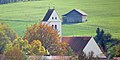
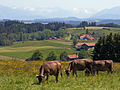
Betzigau
Betzigau from the northwest

Captain pleased

Hochgreut (920 m)

High shoulder (941 m)

Kaisersmad
Ladder Mountain 70
Notzenweiher

Schönberg ruins

stone
Unterhalden


Economy and Infrastructure
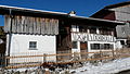
Economy including agriculture and forestry
In 1998 there were seven employees in agriculture and forestry, 297 in manufacturing and 163 in trade and transport at the place of work. In other areas of the economy 51 people were employed at the place of work subject to social security contributions. There were a total of 861 employees at the place of residence subject to social security contributions. There were two companies each in manufacturing and construction. In addition, there were 98 farms in 1999 with an agricultural area of 2138 ha.
education
The following institutions exist (as of: 1999):
- Kindergartens: 125 kindergarten places with 112 children
- Elementary schools: one with 16 teachers and 292 students
Sons and daughters of the church
- Alf Setzer (* 1956), sculptor
- Klaus Schäfer (* 1958), Catholic priest and hospital chaplain
- Michael Schwarzmann (* 1991), racing cyclist
Web links
Individual evidence
- ↑ "Data 2" sheet, Statistical Report A1200C 202041 Population of the municipalities, districts and administrative districts 1st quarter 2020 (population based on the 2011 census) ( help ).
- ↑ Members of the municipal council May 2020 to 2026. Betzigau municipality, accessed on May 30, 2020 .
- ^ Betzigau community in the local database of the Bavarian State Library Online . Bavarian State Library, accessed on August 15, 2019.
- ^ Entry on the coat of arms of Betzigau in the database of the House of Bavarian History

Altusried | Bad Hindelang | Balderschwang | Betzigau | Blaichach | Bolsterlang | Buchenberg | Burgberg im Allgäu | Dietmannsried | Durach | Fishing in the Allgäu | Haldenwang | Immenstadt im Allgäu | Arbors | Missen-Wilhams | Obermaiselstein | Oberstaufen | Oberstdorf | Ofterschwang | Oy-Mittelberg | Rettenberg | Sonthofen | Sulzberg | Waltenhofen | Weitnau | Wertach | Wiggensbach | Wildpoldsried
Unregulated areas:
Kempter Wald