
Lauben (Oberallgäu district)
| coat of arms | Germany map | |
|---|---|---|

|
Coordinates: 47 ° 47 ' N , 10 ° 18' E |
|
| Basic data | ||
| State : | Bavaria | |
| Administrative region : | Swabia | |
| County : | Oberallgäu | |
| Height : | 666 m above sea level NHN | |
| Area : | 8.4 km 2 | |
| Residents: | 3439 (Dec. 31, 2019) | |
| Population density : | 409 inhabitants per km 2 | |
| Postal code : | 87493 | |
| Area code : | 08374 | |
| License plate : | OA | |
| Community key : | 09 7 80 125 | |
| Community structure: | 16 parts of the community | |
| Address of the municipal administration: |
Dorfstrasse 2 | |
| Website : | ||
| Mayor : | Dietmar Markmiller ( Independent Community Citizen ) | |
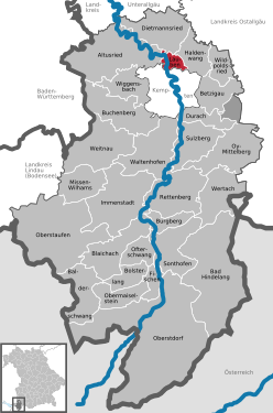
| Location of the municipality of Lauben in the Oberallgäu district | ||
  |
||

Lauben is a municipality in the Swabian district of Oberallgäu .
.jpg)

geography
The municipality consists only of the district arbors.
Lauben has 16 officially named parts of the municipality (the type of settlement is given in brackets ):
|
history
Until the church is planted
The place was first mentioned in 1220 under the name Lobun . Lauben belonged to the Prince Abbey of Kempten . Since the Reichsdeputationshauptschluss and the secularization of 1803 the place belongs to Bavaria. In the course of the administrative reforms in Bavaria , today's municipality was created with the municipal edict of 1818 .
20th century
In 1909 today's company Käserei Champignon Hofmeister was founded.
Population development
- 1961: 1183 inhabitants
- 1970: 1847 inhabitants
- 1987: 2757 inhabitants
- 1991: 2809 inhabitants
- 1995: 2988 inhabitants
- 2000: 3103 inhabitants
- 2005: 3288 inhabitants
- 2010: 3365 inhabitants
- 2015: 3456 inhabitants
Between 1988 and 2018, the community grew from 2,773 to 3,478 by 705 inhabitants or 25.4%.
politics
mayor
Mayor since May 1, 2020 is Dietmar Markmiller (independent community citizen); he was elected on March 15, 2020 with 87.52% of the vote without a counter-candidate. His predecessor was Berthold Ziegler (Independent Community Citizen) from May 2002 to April 2020; before that, until 2002, Hans Kerber (also an independent community citizen) was at the head of the community.
Municipal council
The election on March 15, 2020 had the following result:
- Independent municipality citizens: 8 seats (49.02%)
- CSU : 5 seats (34.30%)
- Citizens Club Lauben-Heising: 3 seats (16.67%).
The turnout was 61.63%.
coat of arms
The coat of arms description reads: “Split; at the front divided by red and blue, at the back in silver three slanting green leaves. "
The coat of arms was adopted by resolution of the municipal council and the approval of the Interior Ministry on July 7, 1961.
tax income
The gross tax revenue in 2015 was € 4.918 million, the net tax revenue was € 2.763 million. The gross trade tax income amounted to € 2.156 million.


Architectural monuments
Economy and Infrastructure
Economy including agriculture and forestry
The globally active company Käserei Champignon Hofmeister GmbH & Co. KG in the Heising district is economically important .
In 1998 there were four in the field of agriculture and forestry, 621 in the manufacturing sector and 75 in the trade and transport sector at the place of work. In other economic sectors 141 people were employed at the place of work subject to social security contributions. There were a total of 1106 employees at the place of residence subject to social security contributions. In the manufacturing industry (as well as mining and quarrying of stones and earth) there were eleven companies, in the construction industry six companies. In addition, in 1999 there were 22 farms with an agricultural area of 576 ha.
education
The following facilities exist (as of 06/2015):
- Kindergarten / crèche with a total of 16 supervisors and 118 children
- Primary school with 9 + 3 teachers and 120 students in 6 classes (1st, 1st / 2nd combined, 2nd, 3rd, 3rd / 4th combined and a 4th class)
Web links
- Entry on the coat of arms of Lauben (Oberallgäu district) in the database of the House of Bavarian History
Individual evidence
- ↑ "Data 2" sheet, Statistical Report A1200C 202041 Population of the municipalities, districts and administrative districts 1st quarter 2020 (population based on the 2011 census) ( help ).
- ^ Community Lauben in the local database of the Bavarian State Library Online . Bavarian State Library, accessed on August 15, 2019.

Altusried | Bad Hindelang | Balderschwang | Betzigau | Blaichach | Bolsterlang | Buchenberg | Burgberg im Allgäu | Dietmannsried | Durach | Fishing in the Allgäu | Haldenwang | Immenstadt im Allgäu | Arbors | Missen-Wilhams | Obermaiselstein | Oberstaufen | Oberstdorf | Ofterschwang | Oy-Mittelberg | Rettenberg | Sonthofen | Sulzberg | Waltenhofen | Weitnau | Wertach | Wiggensbach | Wildpoldsried
Unregulated areas:
Kempter Wald