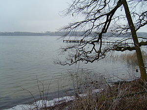
Woerthsee
| Woerthsee | ||
|---|---|---|

|
||
| Geographical location | Upper Bavaria | |
| Tributaries | Auinger Bach, Bulachbach , Günteringerfeld Bach, Mühlgraben | |
| Drain | Inninger Bach → Amper → Isar → Danube → Black Sea | |
| Islands | Wörth | |
| Places on the shore | Steinebach , Walchstadt , Bachern , Schlagenhofen | |
| Data | ||
| Coordinates | 48 ° 3 '29 " N , 11 ° 10' 42" E | |
|
|
||
| Altitude above sea level | 562 m above sea level NN | |
| surface | 4.34 km² | |
| length | 3.7 km | |
| width | 1.66 km | |
| volume | 63,630,000 m³ | |
| scope | 9.9 km | |
| Maximum depth | 34.0 m | |
| Middle deep | 14.7 m | |
| PH value | 8.3 | |
| Catchment area | 26.35 km² | |
The Wörthsee , formerly Ausee , is located in the northern district of Starnberg in Upper Bavaria , about 25 km southwest of Munich , and is framed in the north by four districts of the municipality of Wörthsee and in the west by two places in the municipality of Inning . It is one of the lakes in the Fünfseenland ( Ammersee , Wörthsee, Weßlinger See , Pilsensee , Starnberger See ) in Upper Bavaria. The mean water level of the lake, which is located in its own basin, is around 27 m higher than that of the Ammersee to the west. Its catchment area is small, depending on the source it is given with an area of 17 or 26.35 km². The lake area is divided between the municipalities of Wörthsee (northeast) and Inning (southwest); a small part in the southeast belongs to the municipality of Seefeld am Pilsensee. Most of the shore is privately owned and is not accessible. There are a total of five larger bathing areas on the lake. The lake is owned by Count Cajetan zu Toerring-Jettenbach .
history
The lake gets its name from the 12 hectare island of Wörth , which is located in it. The Middle High German Werth means island or bank location. The island is popularly called Mouse Island .
Like the other lakes in the Bavarian Alpine Foreland , the Wörthsee was created through the exaration of a foreland glacier. It forms a branch basin of the Isar-Loisach glacier . When the ice age glacier melts, the Wörthsee basin initially forms part of a peripheral drainage system, which comes from the Pilsensee towards the Ampermoos via the Inninger Bach and leaves the tongue basin in Grafrath .
Hydrology
The Wörthsee is considered to be one of the most beautiful and cleanest Bavarian bathing lakes, although it only has a slow water exchange. It takes about eight years for its water to renew itself. Only 0.3 m³ of water flows off it per second, which can still only be compensated for to a small extent by its inlets. Mainly groundwater flows into it, which explains its low water level fluctuations.


