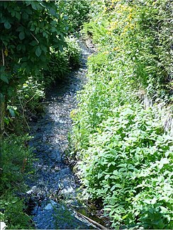
Bulachbach (Wörthsee)
| Bulachbach | ||
|
Bulachbach in Steinebach |
||
| Data | ||
| Water code | DE : 164392 | |
| location | Starnberg District , Upper Bavaria , Bavaria , Germany | |
| River system | Danube | |
| Drain over | Wörthsee → Inninger Bach → Amper → Isar → Danube → Black Sea | |
| origin | near Schuifeld (municipality of Wörthsee) 48 ° 5 ′ 7 ″ N , 11 ° 13 ′ 11 ″ E |
|
| Source height | 577 m above sea level NHN | |
| muzzle | in the Wörthsee coordinates: 48 ° 4 ′ 19 ″ N , 11 ° 11 ′ 51 ″ E 48 ° 4 ′ 19 ″ N , 11 ° 11 ′ 51 ″ E |
|
| Mouth height | 560 m above sea level NHN | |
| Height difference | 17 m | |
| Bottom slope | 5 ‰ | |
| length | 3.4 km | |
| Communities | Woerthsee | |
The Bulachbach is an approximately 3 km long tributary of the Wörthsee in Upper Bavaria .
course
The Bulachbach arises in a low moor area between Gut Schluifeld and the A96 federal motorway . It flows in a south-westerly direction over a length of 1.3 km through the Schuifelder Moos nature reserve , which it drains. The Bulachbach finally flows through the Steinebach district of the municipality of Wörthsee, partly open, partly piped, and flows into the Wörthsee at its northeast end.

