Höllsee
| Höllsee | ||
|---|---|---|

|
||
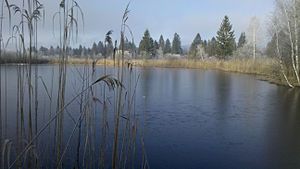
| View over the Höllsee in west direction | ||
| Geographical location | Bavaria , Germany | |
| Drain | Trift Canal → Loisach → Isar → Danube → Black Sea | |
| Location close to the shore | Benediktbeuern | |
| Data | ||
| Coordinates | 47 ° 41 '29 " N , 11 ° 21' 28.5" E | |
|
|
||
| Altitude above sea level | 601 m | |
| surface | 0.91 ha | |
| length | 125 m | |
| width | 93 m | |

|
||
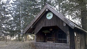
| Fishing hut on the east bank of the Höllsee | ||
The Höllsee is a small mineral lake in the Loisach-Kochelsee moors . It drains via the Trift Canal . It is only fed by the inflow of smaller trenches and groundwater. There is a fishing hut on its east bank.
The Höllsee is located near the Prälatenweg when coming from Benediktbeuern, but access to the shore is not signposted and can only be reached via a meadow.
Other small lakes in the Loisach-Kochelsee moors are Eichsee , Rohrsee , Fichtsee , Rettensee and Karpfsee .
