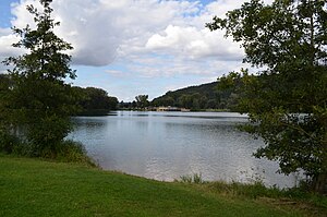
Kratzmuehlsee
| Kratzmuehlsee | ||
|---|---|---|

|
||
| The south bank of the Kratzmühlsee | ||
| Geographical location | Upper Bavaria , near Kinding | |
| Drain | to Altmühl | |
| Places on the shore | Pfraundorf | |
| Data | ||
| Coordinates | 49 ° 0 '4 " N , 11 ° 26' 50" E | |
|
|
||
| Altitude above sea level | 367 m above sea level NN | |
| surface | 10 ha | |
| length | 680 m | |
| width | 310 m | |
| scope | 1.66 km | |
The Kratzmühlsee is a small swimming lake in the market town of Kinding in the Upper Bavarian district of Eichstätt . The lake is near Pfraundorf , between the state road 2230 in the west and the Altmühl running east . It is developed as a bathing lake, there is also a fishing area. On the other side of the Altmühl is the hamlet of Kratzmühle with a campsite.
The Kratzmühlsee, together with the Kratzmühle Technology Museum, is a starting point on the Altmühltal Panorama Trail (stage 10 Kinding– Beilngries , No. 9). The Altmühltal cycle path also leads along there.
Individual evidence
- ^ Eva Krötz: Altmühltal-Panoramaweg: From Gunzenhausen to Kelheim. 15 stages. with GPS data. Bergverlag Rother GmbH, Munich 2015, ISBN 978-3-7633-4470-3 , p. 117 ( online ).
