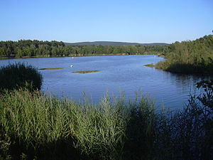
Großwelzheim bathing lake
|
Großwelzheimer bathing lake Weißsee |
||
|---|---|---|

|
||
| The Großwelzheimer bathing lake | ||
| Geographical location | Aschaffenburg district , Bavaria | |
| Data | ||
| Coordinates | 50 ° 3 '29 " N , 9 ° 1' 1" E | |
|
|
||
| Altitude above sea level | 107 m above sea level NN | |
| surface | 12 ha | |
The Großwelzheimer bathing lake , also called Weißsee or Weilsee , is a lake near Karlstein am Main in the district of Aschaffenburg in Lower Franconia . It is a quarry pond and was built as an open-cast lignite mine and later became a gravel pit .
description
The Großwelzheimer bathing lake is located in the Großwelzheimer fir forest between Karlstein and Kahl am Main , on the boundary of the eponymous place Großwelzheim . The lake with a water surface of about 12 hectares belongs to the Kahler Seenplatte . The federal highway 8 runs along the south-western bank and behind it lies the natural monument Langer See . To the west, behind the railway line, is the Hörsteiner See , and there is a campsite right by the Großwelzheimer bathing lake. The Weiß gravel works is still in operation at the Ostend .
See also
Web links
Individual evidence
- ^ Map of the Alzenau district
- ↑ Bavaria Atlas of the Bavarian State Government ( notes )

