Langbürgner See
| Langbürgner See | ||
|---|---|---|

|
||
| Geographical location | Bavaria , Germany | |
| Tributaries | from Thaler See | |
| Drain | to the Schloßsee → Ischler Achen → Alz | |
| Islands | Robinson Island | |
| Location close to the shore | Bad Endorf | |
| Data | ||
| Coordinates | 47 ° 53 '59 " N , 12 ° 21' 19" E | |
|
|
||
| Altitude above sea level | 530.36 m above sea level NN | |
| surface | 1.04 km² | |
| length | 1.59 km | |
| width | 1.205 km | |
| volume | 9.09 million m³ | |
| scope | 9.3 km | |
| Maximum depth | 37.3 m | |
| Middle deep | 9.1 m | |
| PH value | 8.3 | |
| Catchment area | 28.9 km² | |
The Langbürgner lake is the largest of about one square kilometer area of the 18 lakes in the nature reserve Eggstätt-Hemhofer Lake District northwest of Chiemsee and located in the eastern district of Rosenheim .
Geographical location
The bay-rich Langbürgner See is located about one kilometer north of the westernmost bay Aiterbacher Winkel of the Chiemsee and a good kilometer southeast of the village of Hemhof von Bad Endorf . The lake area belongs entirely to Bad Endorf, but the neighboring municipality of Breitbrunn am Chiemsee borders the lake for a long time in the northeast and east, and the municipality of Rimsting in the south . The eponymous hamlet of Langbürgen is less than 150 meters from the shoreline on the Breitbrunn municipal area. The Langbürgner See lies in the south of the nature reserve established in 1939, which is one of the oldest in Bavaria and which also includes the surrounding area far beyond the edge of the lake.
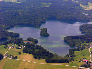
The only island in the lake extends 300 meters long from west to east, is a maximum of 50 meters wide and has an area of around 1.2 hectares and is often called Robinson Island today.
Emergence
The Langbürgner See was created more than 10,000 years ago at the end of the Würm Ice Age , the most recent glaciation phase in Central Europe. At that time, the Chiemsee glacier and the Inn glacier slowly retreated behind their northernmost glacier front, which still protruded to the north over the area of today's lake district . The ice-collapsing landscapes typical of the Alpine foothills remained within their terminal moraines . Together with other characteristic dead ice holes and moraine walls , the Langbürgner See today forms the heart of the Hemhof-Eggstätter Lake District nature reserve , which is part of the “Ur-Chiemsee”. The Simssee only a few kilometers to the west is the last remnant of the largely drained former Rosenheimer See , which was created by the Inn glacier at the same time.
The lake in the north near Hartmannsberg


