Dreiburgensee
| Dreiburgensee | ||
|---|---|---|

|
||
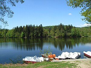
| The Dreiburgensee from the east bank, pedal boats in the foreground | ||
| Geographical location |
Bavarian forest
|
|
| Tributaries | Edtbach , Langbach | |
| Drain | Kleine Ohe → Gaissa | |
| Location close to the shore | Passau | |
| Data | ||
| Coordinates | 48 ° 44 '38 " N , 13 ° 21' 9" E | |
|
|
||
| Altitude above sea level | 434.42 m | |
| surface | 8.31 hectares | |
| length | 670 m | |
| width | 290 m | |
| volume | 156,000 m³ | |
| Maximum depth | 4.2 m | |
| Middle deep | 1.88 m | |
The Dreiburgensee , formerly called Rothauer See , Rottauer See and Rothaumühlweiher, is located 2.5 km northwest of Tittling in the Bavarian Forest . It is named after the surrounding Dreiburgenland with Saldenburg Castle , Englburg Castle and Fürstenstein Castle . It was first mentioned in 1703. It had been created shortly before as a fish breeding pond for Field Marshal Lieutenant Max Josef Graf von Tauffkirchen zu Guttenburg, the owner of the Englburg.
description
The dammed lake has an area of 8.31 hectares and is maximally 4.2 meters deep. With a volume of 156,000 m³, the average depth is 1.88 meters. The main tributary Edtbach flows into the northern tip of the lake. The lake reaches its greatest depth in the southwest near the outlet of the Kleine Ohe . The lake has a length of 700 m and a maximum width of 200 m. He is entirely in the municipality of Tittling. The municipality boundary to Thurmansbang and the district boundary between the district of Passau and the district of Freyung-Grafenau runs on the west bank of the lake. On its south side is the state road from Tittling to Thurmansbang, around the lake there is a circular path that is popular all year round with two children's playgrounds and a barefoot path . In summer the lake is a well-known bathing place with restaurants, hotels, sunbathing lawns and boat rental, in winter you can ice-skate and curling . The embankment forms the dam. The Bavarian Forest Museum Village , the largest open-air museum in Germany, is located in the southwest, directly on the lake .
In 1973 the holiday hotel Dreiburgensee with around 350 beds was opened on the west bank of the lake. Because of the good example of landscape-bound building, its owner Georg Höltl received the environmental medal of the Bavarian State Ministry for Regional Development and Environmental Issues in 1975 and the Federal Cross of Merit in 1976 .
On the east bank are the Tauer family's Hotel Seehof, which opened in 1972, with around 50 beds and the Waldlerhaus-style Hotel Dreiburgensee-Ost, which was newly built in 1983. In 1981, due to the increasing formation of blue-green algae, the municipalities and the state decided to rehabilitate the lake by building a fully biological sewage treatment plant in Saldenburg .
Beavers have been living near the lake for a few years . In September 2009 the beaver dam was destroyed by the Dreiburgenland fishing association because of alleged fear for the fish population of the Dreiburgensee.
See also
literature
- Ulrich Pietrusky, Donatus Moosauer: The Bavarian Forest - rediscovered in flight , Morsak Grafenau Verlag, 1985, ISBN 3-87553-228-7
Individual evidence
- ↑ Tittling community, Dreiburgensee
- ^ Bavarian State Office for Water Management: Directory of the lakes in Bavaria. Munich, 1982, part 1 text, p. 206
- ↑ Fish saved, but biotope destroyed ; Retrieved September 28, 2009.
