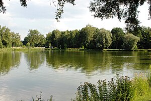
Taxi pond
|
Taxi pond ice pond |
||
|---|---|---|

|
||
| Geographical location |
Bavaria
|
|
| Places on the shore | Ismaning | |
| Data | ||
| Coordinates | 48 ° 12 '58.2 " N , 11 ° 40' 41" E | |
|
|
||
| Altitude above sea level | 490 m above sea level NN | |
| surface | 2 ha | |
| length | 190 m | |
| width | 125 m | |
| Maximum depth | 2 m | |
The Taxetweiher or Eisweiher Ismaning is a quarry pond in Ismaning . The pond's name probably comes from the area in which the pond is located today, which is referred to on historical maps as "Schinder-Daxet".
Today the pond is a local recreation area and bathing water.
Web links
Commons : Eisweiher (Ismaning) - Collection of images, videos and audio files
