Pond pond
| Pond pond | ||
|---|---|---|

|
||
| Bachtelweiher below the Lenzfrieder mountain ridge with a view of the Allgäu Alps in the background. | ||
| Geographical location | Bavaria | |
| Tributaries | Bachtelbach | |
| Drain | Bachtelbach → Iller | |
| Data | ||
| Coordinates | 47 ° 43 '12 " N , 10 ° 20' 53" E | |
|
|
||
| Altitude above sea level | 707 m above sea level NN | |
| surface | 4.6 ha | |
| length | 300 m | |
| width | 160 m | |
| Maximum depth | 3.8 m | |
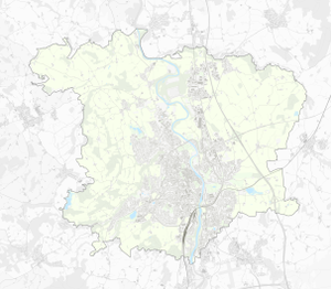
The Bachtelweiher (formerly also Dolderweiher ) is a pond in the district of Sankt Mang in Kempten (Allgäu) , through which the Bachtelbach flows from east to west. The pond has a length of 300 m, a width of 160 m and a maximum water depth of 3.8 m. The Einöde Bachtelmühle is around 550 meters west of the Bachtelbach.
The pond was created in the 13th century by the Kempten prince abbey as a fishing water.
When a railway line was built between 1852 and 1853 from Kempten to Munich , the pond was cut by a dam in the north, over which the railway line has been running ever since. Back then, the pond was also used for fish farming and for operating the Bachtelmühle. In 1951 a bathing establishment was built at the pond; Today there is still a staircase next to the lawn in the west. A heavily frequented circular path leads around the Bachtelweiher, which can also be used with wheelchairs. To the west of the pond there has been the Bachtelweiher garden for decades with mini golf, children's play area, petting zoo, beer garden and year-round gastronomy.
Due to the intensively used meadows all around, the Bachtelweiher was the most nutrient-polluted standing water in the Allgäu . To improve the water quality, on the advice of BUND , the city built a flood basin above the pond in 1998 and renatured the Bachtelbach. In the north of the pond there are large areas of reed. Traces of beavers feeding on trees and bushes are observed. The Bachtelweiher was desludged in the outlet area in 2002 and a monk was installed to drain off deep water . The pond is to be desludged from 2020 as part of the "Bachtelweiher Initiative".
Individual evidence
- ^ Nicki Miller: Allgäu bathing lakes & ponds. AVA Verlag Allgäu, Kempten 2002, ISBN 3-936208-29-8 , p. 34.
- ↑ Holidays in the Allgäu - Bachtelweiher ( Memento of the original from June 30, 2013 in the Internet Archive ) Info: The archive link was inserted automatically and has not yet been checked. Please check the original and archive link according to the instructions and then remove this notice. , accessed February 19, 2013
- ^ Heinrich Uhlig: Sankt Mang. History of an Allgäu community. Verlag des Heimatpflegers von Schwaben, Kempten (Allgäu) 1955, p. 362.
- ↑ Der Bachtelweiher (Kempten im Oberallgäu) , accessed on February 19, 2013
- ↑ Bund Naturschutz in Bayern eV: Bachtelweiher , accessed on February 19, 2013

