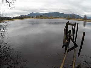
Förchensee (Bernau am Chiemsee)
| Förchensee | ||
|---|---|---|

|
||
| Förchensee | ||
| Geographical location | District of Rosenheim , Bavaria , Germany | |
| Drain | Lower Förchengraben → Chiemsee | |
| Location close to the shore | Bernau am Chiemsee | |
| Data | ||
| Coordinates | 47 ° 49 '39.4 " N , 12 ° 23' 31.2" E | |
|
|
||
| Altitude above sea level | 519 m | |
| surface | 3.13 ha | |
| length | 240 m | |
| width | 200 m | |
| volume | 13,000 m³ | |
| Maximum depth | 0.8 m | |
| Middle deep | 0.415 m | |
The Förchensee (from Förche = trout) is a natural lake in the municipality of Bernau am Chiemsee around 2200 meters northeast of the center and 540 meters from the southern shore of the Chiemsee . The course of the lake takes place today northeast over the Untere Förchengraben , while the course on historical maps took place northwest to the Chiemsee.
