Taubensee (Kössen / Unterwössen)
| Pigeon lake | ||
|---|---|---|

|
||
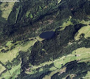
| Orthophoto with the pigeon lake in the center of the picture | ||
| Geographical location | Municipalities of Kössen ( Tyrol , Austria) and Unterwössen ( Upper Bavaria , Germany) | |
| Drain | none | |
| Data | ||
| Coordinates | 47 ° 41 '46 " N , 12 ° 25' 37" E | |
|
|
||
| Altitude above sea level | 1138 m | |
| surface | 3.6 ha | |
| length | 320 m | |
| width | 150 m | |
| scope | 780 m | |
The Taubensee , formerly also Daubensee , is a 3.6 hectare lake with no outflow on the border between Germany and Austria in the area of the municipalities of Kössen (corresponds to the cadastral municipality of the same name ) and Unterwössen ( district Oberwössen). The state border runs through the longitudinal axis of the lake and divides it into two roughly equal parts. With a water level of 1,138 meters above sea level , it is one of the highest lakes in Germany.
The lake, also known as the "Eye of the Chiemgau ", can only be reached on foot and by mountain bike via some mountain hiking trails from Kössen, Schleching , Reit im Winkl and Unterwössen and Oberwössen .
Its name can probably be traced back to the crabs that can still be found in the lake today , which are regionally known as "Daupn". At the beginning of May the lake is dominated by numerous frogs .
See also
Individual references, footnotes
- ↑ a b c d Bayernviewer ( Memento of the original from March 4, 2016 in the Internet Archive ) Info: The archive link was inserted automatically and has not yet been checked. Please check the original and archive link according to the instructions and then remove this notice.
- ^ Repertory of the topographical atlas sheet Reichenhall , 1840, p. 111
- ↑ http://www.taubensee.at/artikel.php?catid=2
