Riederecksee
| Riederecksee | ||
|---|---|---|

|
||
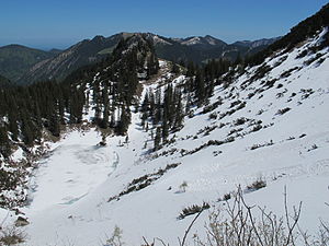
| Frozen Riederecksee in May 2012 | ||
| Geographical location | Bavarian Prealps , Rottach-Egern | |
| Location close to the shore | Munich | |
| Data | ||
| Coordinates | 47 ° 38 '24.1 " N , 11 ° 48' 31.5" E | |
|
|
||
| Altitude above sea level | 1460 m above sea level NN | |
| surface | 1.1 ha | |
| length | 155 m | |
| width | 89 m | |
| scope | 406 m | |
The Riederecksee is a lake in the Bavarian Prealps . It is located southeast below the Plankenstein in the municipality of Rottach-Egern . The Risserkogel is to the southwest of the lake, and the snow soils to the southeast of the lake . The Schreistein is located northeast of the Riederecksee . On the saddle east of the lake between Schreistein and Schneeböden, the Hettlage- Marterl stands in memory of a son of the Munich merchant family who died in this area. The lake has no inflows and outflows.
See also
Web links
Commons : Riederecksee - collection of images
