Gunz
| Gunz | ||
|
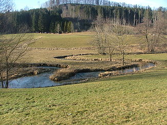
Meander of the Eastern Günz south of Ronsberg |
||
| Data | ||
| Water code | EN : 1158 | |
| location | Germany , Bavaria | |
| River system | Danube | |
| Drain over | Danube → Black Sea | |
| origin | at Lauben (confluence of the east and west Günz) 48 ° 3 ′ 56 ″ N , 10 ° 18 ′ 6 ″ E |
|
| Source height | 575 m above sea level NHN | |
| muzzle | in the Danube near Günzburg Coordinates: 48 ° 27 '44 " N , 10 ° 16' 32" E 48 ° 27 '44 " N , 10 ° 16' 32" E |
|
| Mouth height | 440 m above sea level NHN | |
| Height difference | 135 m | |
| Bottom slope | 2.5 ‰ | |
| length | 55 km | |
| Catchment area | 710 km² | |
| Discharge at the Waldstetten A Eo gauge : 594 km². Location: 14.8 km above the mouth |
NNQ (12.12.1991) MNQ 1955–2006 MQ 1955–2006 Mq 1955–2006 MHQ 1955–2006 HHQ (12.08.2002) |
2.13 m³ / s 3.55 m³ / s 8.37 m³ / s 14.1 l / (s km²) 65.4 m³ / s 111 m³ / s |
| Small towns | Gunzburg | |
|
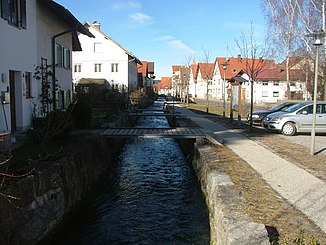
Upper course of the Eastern Günz in Obergünzburg |
||
The Günz is an approximately 55 km long right tributary of the Danube in the Upper Swabian Alpine foothills in Bavaria .
Surname
The name is said to be derived from the Indo-European "* gheu" - "pour" - meaning "water-rich river".
course
The Günz arises near Lauben in the Unterallgäu district from the confluence of the Western and Eastern Günz and flows mainly towards the north. It flows into the Danube from the right at Günzburg and drains 710 km² and is the longest brook system in Bavaria.
The Günz glacial period , one of the main Alpine icing periods , is named after her.
Source rivers
Western Gunz
The western Günz is 19 km long and rises west of Obergünzburg in the municipality of Untrasried. It flows through Ottobeuren . In Westerheim it crosses under the federal motorway 96 and then merges with the Eastern Günz at Lauben.
- Tributaries of the western Günz
- Bücklingsbach (right)
- Rohrwegbach (left)
- Moosmühlbach (right)
- Schweinwaldbach (left)
- Boschachbach (right)
- Geisbach (right)
- Schinderbächlein (left)
- Schwelk (right)
- Krebsbach (left)
Eastern Gunz
The 17 km long Eastern Günz rises in Günzach . It flows in a northerly direction through Obergünzburg , then runs parallel to the state road 2012 to Markt Rettenbach and crosses under the A96 at Erkheim . At Lauben the eastern and western Günz flow together.
- Tributaries of the Eastern Günz
- Tobelbach (left, sometimes viewed as the upper course)
- Wifelsbach (left)
- Salabach (right)
- Stockerbächlein (right)
- Riedbach (right)
Tributaries of the Günz
- Klosterbeurener Bach (left)
- Auerbach (left)
- Reutegraben (left)
- Haselbach (right)
- Schildbach (left)
- Schwarzbach (left)
- Hausener Bach (left)
- Rohrbach (left)
- Schnierbach (right)
- Kötz (left)
- Winterbach (right)
- Denzinger Bach (right)
- Bubesheimer Bach (left)
- Riemgraben (right)
Places on the Günz
|
|
ecology
Some of the fish in the Günz are contaminated with PFC and should therefore not be consumed.
See also
Web links
Individual evidence
- ^ German Hydrological Yearbook Danube Region 2006 Bavarian State Office for the Environment, p. 111, accessed on October 4, 2017, at: bestellen.bayern.de (PDF, German, 24.2 MB).
- ^ Joseph Schnetz, River names of Bavarian Swabia, 1st issue, Verlag Dr. C. Wolf & Sohn, Munich, 1950
- ↑ Brochure about the natural diversity in Swabia. Government of Swabia, accessed January 19, 2016 .
- ^ Frickenhausen: Chemicals: Contaminated fish discovered in the Günz. In: augsburger-allgemeine.de . August 31, 2019, accessed August 31, 2019 .


