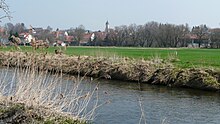
Deisenhausen
| coat of arms | Germany map | |
|---|---|---|

|
Coordinates: 48 ° 15 ' N , 10 ° 20' E |
|
| Basic data | ||
| State : | Bavaria | |
| Administrative region : | Swabia | |
| County : | Gunzburg | |
| Management Community : | Krumbach (Swabia) | |
| Height : | 507 m above sea level NHN | |
| Area : | 11.66 km 2 | |
| Residents: | 1470 (Dec. 31, 2019) | |
| Population density : | 126 inhabitants per km 2 | |
| Postal code : | 86489 | |
| Area code : | 08282 | |
| License plate : | GZ, KRU | |
| Community key : | 09 7 74 124 | |
| LOCODE : | DE DSE | |
| Community structure: | 6 parts of the community | |
| Association administration address: | Rittlen 6 86381 Krumbach (Swabia) |
|
| Website : | ||
| First Mayor : | Bernd Langbauer (Deisenhausen voter group) | |
| Location of the municipality of Deisenhausen in the district of Günzburg | ||
Deisenhausen is a municipality in the Bavarian-Swabian district of Günzburg and a member of the administrative community Krumbach (Swabia) .
geography
The municipality is located in the Donau-Iller region on the Günz River .
There are six officially named parts of the municipality (the type of settlement is given in brackets ):
- Deisenhausen ( parish village )
- Underbeach (parish village)
- Oberbleichen ( Kirchdorf )
- Nordhofen ( village )
- End ( wasteland )
- Kiesberg (wasteland)
There are the districts Deisenhausen, Oberbleichen and sub-bleaching.
history
Until the churches are founded
Deisenhausen was before 1800 rule and belonged to St. Jakob living in the imperial city of Augsburg . Upper bleaching and lower bleaching belonged to different patrician families. Since the peace treaties of Brno and Pressburg in 1805, the place belonged to the newly created Kingdom of Bavaria . In the course of the administrative reforms in the Kingdom of Bavaria, the municipal edict of 1818 created the municipalities of Deisenhausen, Oberbleichen and Unterbleichen.
Incorporations
On January 1, 1977, the previously independent municipalities of Oberbleichen and Unterbleichen were incorporated .
Population development
- 1961: 1067 inhabitants
- 1970: 1140 inhabitants
- 1987: 1321 inhabitants
- 1991: 1379 inhabitants
- 1995: 1439 inhabitants
- 2000: 1464 inhabitants
- 2005: 1538 inhabitants
- 2010: 1491 inhabitants
- 2015: 1476 inhabitants
Between 1988 and 2018 the municipality grew from 1,342 to 1,472 by 130 inhabitants or 9.7%.
politics
The municipal council has twelve members. In the 2020 local elections , the Deisenhausen electorate (52.5%) and the Bleichen electoral list (47.5%) each had six seats.
Mayor has been Bernd Langbauer (Deisenhausen voter group) since May 1, 2020; he was elected on March 15, 2020 with 83.8% of the vote. His predecessor Norbert Weiß (* 1957, old voter group) was in office from May 1996 to April 2020 for 24 years.
coat of arms
Blazon : Split; in the front in pewter cut divided by black and silver, in the back in red two crossed pilgrim sticks, each with a silver pilgrim shell on top and bottom.
Architectural monuments
- Catholic parish church of St. Stephan
Soil monuments
Economy and Infrastructure
Economy including agriculture and forestry
According to official statistics, there were 51 employees at the place of work in the manufacturing sector and 78 in the trade and transport sector. In other economic areas, 16 people were employed at the place of work subject to social security contributions. There were a total of 534 employees at the place of residence subject to social security contributions. There were two companies in the manufacturing sector and four in the construction sector. In addition, in 1999 there were 40 farms with an agricultural area of 825 ha, of which 449 ha were arable land.
education
The following institutions exist (as of: 1999):
- Kindergartens: 50 kindergarten places with 59 children
- Elementary schools: one with ten teachers and 199 students
Personalities
- Johann Baptist Mayer (1803-1892), textile entrepreneur.
- Gerd Müller (* 1955), politician (CSU), Federal Minister for Economic Cooperation and Development since 2013, grew up in Unterbleichen.
- Meike Pfister (* 1996), ski racer, lives in Deisenhausen.
- Eduard Rüber (1804–1874), German architect and Bavarian construction officer, who is considered the builder of numerous train station buildings in Bavaria.
- The extensive Spaun family comes from Deisenhausen.
See also
Web links
Individual evidence
- ↑ "Data 2" sheet, Statistical Report A1200C 202041 Population of the municipalities, districts and administrative districts 1st quarter 2020 (population based on the 2011 census) ( help ).
- ^ First Mayor Deisenhausen. Deisenhausen community, accessed on June 6, 2020 .
- ↑ Deisenhausen community in the local database of the Bavarian State Library Online . Bayerische Staatsbibliothek, accessed on August 30, 2019.
- ↑ a b c Federal Statistical Office (ed.): Historical municipality directory for the Federal Republic of Germany. Name, border and key number changes in municipalities, counties and administrative districts from May 27, 1970 to December 31, 1982 . W. Kohlhammer, Stuttgart / Mainz 1983, ISBN 3-17-003263-1 , p. 774 .
- ^ Entry on the Deisenhausen coat of arms in the database of the House of Bavarian History


