Ingelheim am Rhein
| coat of arms | Germany map | |
|---|---|---|

|
Coordinates: 49 ° 58 ' N , 8 ° 3' E |
|
| Basic data | ||
| State : | Rhineland-Palatinate | |
| County : | Mainz-Bingen | |
| Height : | 110 m above sea level NHN | |
| Area : | 73.33 km 2 | |
| Residents: | 35,193 (Dec. 31, 2019) | |
| Population density : | 480 inhabitants per km 2 | |
| Postcodes : | 55218, 55262, 55263 | |
| Primaries : | 06132, 06130 , 06725 | |
| License plate : | MZ , BIN | |
| Community key : | 07 3 39 030 | |
| City structure: | 10 districts | |
City administration address : |
Fridtjof-Nansen-Platz 1 55218 Ingelheim am Rhein |
|
| Website : | ||
| Lord Mayor : | Ralf Claus ( SPD ) | |
| Location of the city of Ingelheim am Rhein in the Mainz-Bingen district | ||
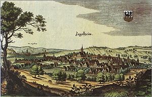
Ingelheim am Rhein is a large town in the Mainz-Bingen district in Rhineland-Palatinate and has been the seat of the district administration of this district since 1996 . It is classified as a medium-sized center according to state planning .
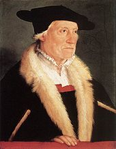
Since the second half of the 8th century, the Ingelheimer Kaiserpfalz was located there , which temporarily served the emperors and kings as a place of residence and government until the 11th century. This was followed by the rule of the Counts of Ingelheim in Ober-Ingelheim and the heyday of the Ingelheimer Oberhof in the late Middle Ages , the processes of which are testified by the Ingelheimer Haderbücher . The city's best-known son was Sebastian Münster , author of Cosmographia . He was born in Nieder-Ingelheim, and his portrait was featured on the penultimate version of the 100 D-Mark note. The city gained national fame through the pharmaceutical company Boehringer Ingelheim, founded by Albert Boehringer in Nieder-Ingelheim in 1885 .
Ingelheim itself was only elevated to a town in 1939 . The previously independent communities Frei-Weinheim , Ober-Ingelheim and Nieder-Ingelheim were merged. In this context, the area around the train station in Nieder-Ingelheim was determined to be the city center, in which today's inner city developed in the post-war years. Ingelheim is known as the “red wine town” due to the predominant cultivation of red wine.
geography
The city is located in the southwest of Germany , in the north of Rheinhessen , at the so-called Rhine knee and approx. 15 kilometers west of the Rhineland-Palatinate state capital Mainz. The Rhine forms the northern border of the city and the border with the state of Hesse . The city belongs to the western Rhine-Main area . To the south, the urban area extends into the Selztal with the two districts of Ober-Ingelheim and Großwinternheim. The Selztal lies between Mainzer Berg and Westerberg . Nieder-Ingelheim hugs the northwest corner of the Mainz mountain. Frei-Weinheim is located north on the Rhine, the Sporkenheim district southwest of Frei-Weinheim. At the foot to the north of the Westerberg lies the Ingelheim-West district. In the east are the districts of Heidesheim (with its districts Heidenfahrt and Uhlerborn ) and Wackernheim .
The lowest point in the urban area is the Rhine port in the north at 80.8 m above sea level. NHN near Frei-Weinheim. The two highest points are the Mainzer Berg at 247.8 m above sea level. NHN and the Westerberg at 247.5 m above sea level. NHN . They are offshoots of the Rheinhessen plateau. The north-south extension of the urban area is 7.9 kilometers, the east-west extension 5.0 kilometers. Nearby larger cities are the state capitals Mainz and Wiesbaden to the east, Bad Kreuznach to the south-west and Worms to the south-east .
Geology and waters
The urban area of Ingelheim belongs to the Mainz Basin . The soils in this area are determined by tertiary limestone layers, in the Rhine plain near Frei-Weinheim and Nieder-Ingelheim the soil is sandy with limestone sands and limestone sand dunes, mainly north of the motorway along Konrad-Adenauer-Strasse, but also south of the motorway route and within the Boehringer Ingelheim factory premises. There is also a small deposit in the area of the Griesmühle. These earth formations are under nature protection according to the Rhineland-Palatinate state maintenance law. Their damage or removal is considered an irreparable interference with nature and the landscape. Urban development in areas with lime sands is therefore excluded or is only approved in very special exceptional cases. Two such exceptional cases were the construction of Konrad-Adenauer-Strasse from the Autobahn route to Rheinstrasse and the day-care center on Sporkenheimer Strasse. The subsoil also consists of Oligocene, clay and marl, which were created when slowly sweeping out an arm of the sea. The pine forest in the Nieder-Ingelheim district, which was mainly located in what is now the area of the Ingelheim-West district, has been largely displaced over the last few centuries, first by fruit and asparagus cultivation and then by building construction.
Coming from the south of Schwabenheim , the Selz flows through the urban area in a northerly direction across the urban area and flows into the Rhine at Frei-Weinheim. The Ikasee is located in Nieder-Ingelheim between the motorway and the flower garden. Since the Frei-Weinheim district is located directly on the Rhine, Ingelheim is a port city .
Nature reserves
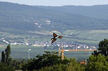
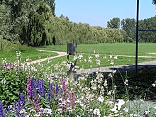
There are a total of six nature reserves around Ingelheim: in the northwest of the urban area the Sandlache reserve , which is bordered by the largest reserve Ingelheimer Dünen und Sande in the south . In the northeast, directly on the Rhine, lies the Fulder Aue – Ilmen Aue nature reserve and southwest of the city is the northern foothills of the Westerberg . To the east, the slopes of the Mainzer Berg on Heidesheimer Weg are protected. West of the Großwinternheim district is the so-called garden meadow on the banks of the Selz nature reserve.
Land use
The city has a total area of 73.33 km². The largest part of the urban area is mainly used for agriculture with wine and fruit growing with 65.4%. Settlement and traffic areas have a share of 22.9% including the associated open and operational areas. Due to the Rhine, Ingelheim has 5.9% water surface. A small forest area common for Rheinhessen corresponds to 5.2% and other areas to 0.6%. In addition, the city of Ingelheim has a 1200 hectare urban forest in the Hunsrück, which, however, is not part of the city.
| Share of usage of the urban area | ||||
|---|---|---|---|---|
| Agriculture | 32.62 km² | |||
| Building and traffic areas | 11.43 km² | |||
| water | 2.93 km² | |||
| Forest | 2.58 km² | |||
| Other use | 0.30 km² | |||
City structure and neighboring communities
| local community | Distance (km) |
|---|---|
|
|
5.7 |
|
|
6.6 |
|
|
9.5 |
|
|
16 |
|
|
5.5 |
|
|
6.6 |
|
|
7.8 |
|
|
6.3 |
|
|
3.6 |
|
|
12.5 |
|
|
7.7 |
The urban area is divided into ten districts. The four founding villages of 1939 Nieder-Ingelheim , Frei-Weinheim , Ober-Ingelheim and Sporkenheim were merged to form the town of Ingelheim am Rhein. Ingelheim-West is the youngest part of the city to emerge as part of the development west of the Boehringer factory premises in the 1960s. In 1972 Großwinternheim was incorporated as part of the regional reform at the time . The districts of Frei-Weinheim and Ingelheim-West have steadily grown together since the city merger since the 1960s, as have the districts of Nieder-Ingelheim with Ober-Ingelheim and Nieder-Ingelheim with Ingelheim-West. Ingelheim-West and Ober-Ingelheim as well as Frei-Weinheim and Nieder-Ingelheim are structurally separated. Separated from the rest of the city area, Sporkenheim and Großwinternheim have retained their village character. On July 1, 2019, the local parishes of Wackernheim and Heidesheim am Rhein with the districts of Uhlerborn and Heidenfahrt were incorporated into the city of Ingelheim. Großwinternheim, Heidesheim and Wackernheim are designated as local districts , which therefore have a local advisory board and a local councilor.
Ingelheim's Rhineland-Palatinate neighboring communities are the city of Bingen in the west, the community-free community Budenheim to the east and the state capital Mainz, to the south-west the community community Gau-Algesheim with the local communities Schwabenheim, Bubenheim, Nieder-Hilbersheim, Appenheim and the city of Gau-Algesheim. The city of Gau-Algesheim is the closest to the neighboring communities, as a commercial area of Gau-Algesheim borders directly on the Ingelheim-West district. The Hessian communities Geisenheim, Oestrich-Winkel and Eltville are separated from Ingelheim by the Rhine and can be reached via a ferry connection . There is no bridge over the Rhine near Ingelheim. The next upstream is the Schiersteiner Bridge near Mainz, downstream the Südbrücke in Koblenz .
climate
The city is located in the temperate climate zone. The average annual temperature is 9.8 ° C. The warmest months are July and August with an average of 18.0 and 18.5 ° C, the coldest January with an average of 1.0 ° C. Most precipitation falls in June and August with an average of 64, the least in March with an average of 31 millimeters. Like all of Rheinhessen, Ingelheim is also protected from the weather by the Hunsrück , Taunus , Odenwald and Donnersberg . Therefore, the average annual rainfall is only 560 millimeters.
|
Monthly average temperatures and precipitation for Ingelheim am Rhein
Source:
|
||||||||||||||||||||||||||||||||||||||||||||||||||||||||||||
history
prehistory
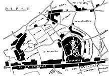
The name Ingel is possibly derived from a Franconian named Ingilo who settled here. Settlements and farms were then given the name of their master. The ending -heim , which is typical for Rheinhessen, also goes back to the Frankish period, probably 5th or 6th century AD. The place name is in documents of later times as Ingilinhaim , Ingilinheim (782), Ingilenhaim , Engelheim , Hengilonheim , Engilonheim (822), Engilinheim (826), Hingilinheim (855), Ingilunheim (874), Ingulinheim (889), Ingelesheim ( 891), Ingelenheim (940), Anglia sedes (1051), Ingilheim and Ingelnheim (1286). The addition to the name on the Rhine has been used since the city was granted city rights in 1939. A distinction has been made between Nieder- and Ober-Ingelheim since 1269.
Finds of hand axes suggest that the area around Ingelheim was already settled in the Paleolithic about 50,000 years ago. After the Roman conquest , the area served to supply the Roman troops and the population of what was then Mogontiacum . Due to its proximity to Mainz, massive destruction followed in the third and fourth centuries, which led to the end of the vicus and all villae .
History of the villages
middle Ages
From the 5th century the Ingelheim area was settled by the Franks . During this time, today's Ober-Ingelheim developed into a village as one of the first Ingelheim settlements. The closer region around Ingelheim was later known as Ingelheimer Reich, from the 14th century onwards as Ingelheimer Grund. The Ingelheim empire gained supraregional importance with the decision of Charlemagne to develop a royal estate of the Merovingians into an imperial palace, which later became Nieder-Ingelheim. Karl's first documented stay dates from 774. In total, he stayed three to four times in Ingelheim. His successor was his son Ludwig the Pious . He stayed in Ingelheim much more often, at least ten times. He also died in Ingelheim, presumably on one of the Rhine meadows near Ingelheim. In the Middle Ages, the imperial palace served as a base for many other German kings and emperors of the Hohenstaufen, Ottonian and Salier families. Under Otto I , the imperial palace had its second heyday after it had long been neglected. During the time of the Salier kings, who preferred Mainz as the bishopric, the Ingelheim Palatinate was little used for a long time. Under the successor Friedrich I. Barbarossa a number of renovations took place in the imperial palace. He expanded the Palatinate as a fortified imperial castle. Between the 8th and 10th centuries, a total of nine Ingelheim synods were held in this Palatinate.
From the 13th century, a slow decline began, which ended in Nieder-Ingelheim's political insignificance. In the 14th century, the end of the Ingelheim Empire was finally sealed with the multi-stage pledging of the area. This increased the importance of Ober-Ingelheim . The noble families who formerly belonged to the administration of the Imperial Palatinate, including the later Counts of Ingelheim, lived there. The place received a city fortification in the 13th century.
The Ingelheimer Oberhof in Ingelheimer Grund , as the area was called after the 14th century, has been an appeal body for surrounding lay judges for centuries. Emperor Karl IV pledged the Ingelheimer Grund again in 1356, this time to the city of Mainz and in 1375 with the imperial city of Oppenheim and other imperial places to the elector Ruprecht I of the Palatinate for life. On May 1, 1376, the elector paid homage and the Ingelheimer Grund actually became part of the Electoral Palatinate. He transferred the pledge to his son Ludwig, who paid 100,000 guilders for it.
Modern times
In 1488 Ingelheim's most famous son, the cosmographer Sebastian Münster , was born. He was co-author of the most widely read book of the 16th to 17th centuries, along with the Bible, the Cosmographia , a historical-geographical description of the world. In the middle of the 16th century there were witch trials in Ingelheimer Grund with the result that three women were burned. In the 17th century, the great influence of the Electoral Palatinate on the judiciary in the Electoral Palatinate areas prevented further trials.
The Thirty Years' War and the War of the Palatinate Succession largely spared the fabric of the two Ingelheim towns. However, the prosperity fell significantly in these centuries. Usable remnants, mainly columns of the now ruined imperial palace, were removed for the construction of Heidelberg Castle. After the peace treaty between Münster and Osnabrück in 1648 ( Westphalian Peace ), the Ingelheimer Grund was converted from the old imperial pledge into territory of the Electorate of the Palatinate. The year 1680 meant the end of the Oberhof in Ober-Ingelheim, which was replaced by the Electoral Palatinate Court Court . In 1666, the plague raged for eight months in Ingelheimer Grund, which killed a large part of the population.
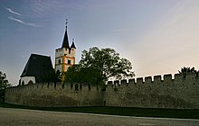
The Heidelberg electors introduced the Reformation in Ingelheimer Grund in 1556 . First Lutheran under Ottheinrich , from 1565 radically reformed under Friedrich III . The change of the Wittelsbach branches with different denominations resulted in a coexistence and often a conflict of the denominations Catholic, Lutheran and Calvinist-Reformed in the 17th century. The use of the churches and their income by pastors and for school lessons was particularly controversial. After an ordinance of 1698 on the common use of the churches ( Simultaneum ) had not brought any denominational peace, in the religious declaration of 1705 churches and church property were divided between Catholics and Reformed. The Catholic parish of Nieder-Ingelheim received St. Remigius, the Protestant parish received the ruins of today's hall church in the Kaiserpfalz . In Ober-Ingelheim the Reformed got today's castle church, the Catholics (like the numerically few Lutherans) had to build their own church in Ober-Ingelheim, St. Michael. Jesuits built a missionary estate in Nieder-Ingelheim around 1737. The mission continued after the dissolution of the order until the secularization of the church property in the French period. The manor's library consisted of 336 works.
At the end of the 18th century, French revolutionary troops occupied Ingelheim; the Ingelheim area served them as a billeting and supply area during the siege of Mainz. In the Peace of Campo Formio in 1797 it was decided that the area on the left bank of the Rhine of the Holy Roman Empire fell to France . Thus the Ingelheimer Grund was French. This also ended the special status of the reason, which had lasted for a whole millennium.
The Napoleonic period from 1804 onwards brought the Ingelheimer places in the newly created canton Oberingelheim in the Donnersberg department , which now belonged to France, a major push in modernization. A modern administration was introduced, the Ingelheim nobility had to leave the place and a modern property culture was established. After the Battle of the Nations near Leipzig , the French withdrew again, the Prussians and their allies crossed the Rhine in 1814, thereby ending French supremacy in this area. In 1816, after provisional Bavarian-Austrian administration, the Ingelheim villages fell to the Grand Duchy of Hesse (Hessen-Darmstadt) as the province of Rheinhessen . The canton of Oberingelheim initially remained, but was dissolved in 1835 and incorporated into the Bingen district. The former Hessian district court in Neuweg is evidence of the Hessian administrative period. Ingelheim citizens also took part in the revolution of 1848/49 . During the stay of the future emperor and then Prince Wilhelm I on June 12, 1849 as commanding officer of the "Army of Operations in Baden and in the Palatinate" near Ingelheim, he barely escaped an assassination attempt. The result was that Hessian and later Prussian troops were forcibly quartered in the Ingelheim towns.
The 1860s brought industrialization, the evidence of which can still be seen in Nieder-Ingelheim in particular. On October 17th, the railway line between Mainz and Bingen was inaugurated and Nieder-Ingelheim got a train station, which at that time was already called Ingelheim. The line was operated by the Hessian Ludwig Railway. Of the many industrial companies of the 19th century, only the family company Boehringer Ingelheim remains. Ingelheim survived the Prussian-Austrian War (Hessen-Darmstadt, like Hessen-Kassel, was on the Austrian side) in 1866 unscathed, but was occupied by Prussian troops, but this situation was over again in mid-1866.
The new national spirit of the empire created in 1871 was also well received in the Ingelheim area. The Bismarck Tower on the Westerberg in the Ober-Ingelheim area is a testament to this . In 1911 the railway line between Frei-Weinheim and Partenheim went into operation, the so-called Zuckerlottche (Selztalbahn) . It was in operation until 1985. After the First World War , which claimed 288 war victims, the Ingelheim villages were also affected by the French occupation on the left bank of the Rhine . In 1925 there were initial discussions about merging the villages of Ober-Ingelheim and Nieder-Ingelheim to form the city of Groß-Ingelheim, which, however, failed due to the resistance of the Nieder-Ingelheim population.
National Socialism and urban elevation
After Adolf Hitler came to power in 1933, the National Socialists deposed all local politicians and replaced them with their own. As in other German cities and towns, parts of the population were persecuted in the Ingelheim villages. First communists were eliminated, which then culminated in the persecution of Jewish citizens via dissenters, Sinti, Roma, Jehovah's Witnesses, Social Democrats and separatists. On March 9, 1933, the houses of opponents of the regime were searched for the first time by the SA and SS . In 1935, regulations to ward off Jewish influence were ordered almost simultaneously in the Ingelheim towns, which, among other things, prohibited the immigration of Jews into the communities and the use of community facilities. Visits from Jews were not welcome, they were marked with signs. The Ober-Ingelheim synagogue was destroyed in the November pogroms in 1938 . 73 Jewish fellow citizens from the Ingelheim towns were deported to concentration camps by the end of the war.
On April 1, 1939, the previously independent communities of Frei-Weinheim , Nieder-Ingelheim and Ober-Ingelheim were united by the Reich Governor Jakob Sprenger to form the city of Ingelheim am Rhein. At first, the councilors from Ober-Ingelheim were opposed to the merger; at one of the deliberations on July 28, 1938, they initially saw no advantages of the merger, but rather financial burdens. Nevertheless, Jakob Sprenger issued the merger in December under the following wording:
“On the fertile northern edge of the Rhenish hill country, Ober-Ingelheim and Nieder-Ingelheim, well-known for the hard work of their winemakers, have long been protected by a mighty imperial palace. These communities have gradually grown together with the village of Frei-Weinheim on the banks of the Rhine. In the seventh year of the reign of our Fuehrer and Reich Chancellor Adolf Hitler, the time has come to unite these localities into a vigorous community. The new city should go towards a new, larger future for the benefit of the German people and for the benefit of their workers and farmers. Based on the German municipal code of January 30, 1935, I therefore determine what follows: 1. The municipalities of Ober-Ingelheim, Nieder-Ingelheim and Frei-Weinheim in the Bingen district are merged into a new municipality with effect from April 1, 1939. 2. I give this community town rights and name it Stadt Ingelheim am Rhein. 3. The existing local law remains in force in its previous area of application until September 30, 1939, unless it is changed earlier. 4. The apartment or stay in the communities of Ober-Ingelheim, Nieder-Ingelheim and Frei-Weinheim is deemed to be an apartment or stay in the city of Ingelheim am Rhein. 5. The term of office of the honorary mayors, councilors and councilors of the communities of Ober-Ingelheim, Nieder-Ingelheim and Frei-Weinheim ends on March 31, 1939. I reserve the right to appoint the mayor of Ingelheim. The councilors and municipal councils of the city of Ingelheim am Rhein are appointed by the responsible authorities on April 1, 1939.
Darmstadt, December 14, 1938. The Reich Governor in Hesse Sprenger Gauleiter of Hesse-Nassau "
| Country | Administrative unit | Affiliation |
|---|---|---|
|
|
Electoral Palatinate | 1648-1797 |
|
|
Department of Mont-Tonnerre | 1797-1804 |
|
|
Department of Mont-Tonnerre | 1804-1816 |
|
|
Province of Rheinhessen | 1816-1871 |
|
|
Grand Duchy of Hessen-Darmstadt | 1871-1918 |
|
|
People's State of Hesse | 1918-1933 |
|
|
People's State of Hesse | 1933-1945 |
|
|
||
| French zone of occupation | 1945-1946 | |
| Rhineland-Palatinate | 1946-1949 | |
|
|
Rhineland-Palatinate | since 1949 |
Franz Bambach (NSDAP) was appointed the first mayor after the town was raised. Shortly after the city was raised, the area between Bahnhofstrasse and Binger Strasse was decided as the future city center.
At the end of the Second World War , Ingelheim was spared major destruction thanks to the later executed Volkssturm commander Hermann Berndes , who refused to defend the city against the advancing US Army (Army of the United States of America) in March 1945. In the course of the war there were only a few stray bombs and targeted fighter-bomber attacks. On March 20, 1945, the war for Ingelheim was over when the 90th Division of the US Army, coming from the southwest, took the town almost without a fight. There was greater resistance at the intersection of Neuweg and Aufhofstrasse, where an anti-tank barrier had been erected but was no longer closed. Two German soldiers died there. American artillery fire killed three civilians in Ober-Ingelheim before the US division penetrated. Ingelheim had around 600 dead to complain. Many refugees from the bombed Mainz required increased housing construction in Ingelheim. On June 10, French occupation troops replaced the US troops.
post war period
After 1946 Ingelheim became part of the newly created state of Rhineland-Palatinate . The city belonged to the district of Bingen until 1969. On January 15, 1947, the democratically elected parties voted for the merger of the formerly independent towns to continue to form the town of Ingelheim am Rhein.
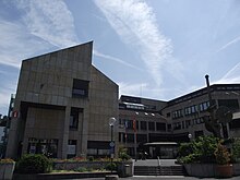
Due to the industrialization and the war refugees, housing construction increased in the 1950s. The formerly rural villages Nieder- and Ober-Ingelheim grew together almost completely by the middle of the 20th century. The post-war period in Ingelheim was characterized by growth and development of a city-wide identity. Since the still young city, due to its amalgamation of different villages, did not in fact have a city center in the beginning, this center was only developed in the decades after the Second World War in the area of the train station of the Nieder-Ingelheim district. When the city was founded in 1939, the intersection of Binger Strasse and Bahnhofstrasse, which is close to the train station, was designated as the urban center. With the relocation of the city administration in 1982, thus avoiding the chronic lack of space that had existed in the old town hall since 1939, near the train station, the first major step in the development of the city center was taken. In addition, a shopping center (market center) was built in the immediate vicinity of the New Town Hall , giving this complex the name Neuer Markt.
In 1969 the district of Mainz-Bingen was created, into which the district of Bingen was merged. The district town was initially Mainz. On April 22, 1972, the southern neighboring village of Großwinternheim was incorporated. The district still has a local advisory council and mayor today. In 1973 the city was given the status of a large district city through a change in the municipal code of Rhineland-Palatinate. The head of the city administration and chairman of the city council received the title of Lord Mayor.
In 1996 the seat of the district administration was moved from Mainz to Ingelheim. The renovation of the area around the train station in 2003 marked the beginning of the next development step in Ingelheim city center, the core project of which, the Neue Mitte shopping center , opened in November 2011. The demolition of the Marktzentrum shopping center on Neuer Markt began in 2014 . The kING culture and event hall (see cultural institutions ) and the new Ingelheim further training center have been built on this site . The lower Bahnhofstrasse and the Binger Strasse have been converted into a traffic-calmed area. Smaller construction projects such as the renovation of the old Karlspassage and the area around Friedrich-Ebert-Platz emerged.
In connection with the municipal reform in Rhineland-Palatinate, the incorporation of Heidesheim and Wackernheim was discussed from 2012. Negotiations in this regard were initially rejected by the city council in early 2012, but in June 2013 it was unanimously decided to negotiate with these municipalities. In December, the Rhineland-Palatinate Ministry of the Interior decided to suspend the law on the forced merger of Budenheim with the community of Heidesheim to form the community of Budenheim in order to give the city of Ingelheim and the community of Heidesheim the chance of incorporation. This had to come into effect by 2019, otherwise the law on the formation of the Budenheim Association would have come into force.
In a referendum on November 8, 2015, the people of Ingelheim voted 71.31% yes-votes for the incorporation of the local community of Heidesheim into Ingelheim. A referendum in Heidesheim, which ended on October 11, 2015, resulted in 94.13% approval. On January 28, 2016, the municipal council in Wackernheim also voted for incorporation into Ingelheim. Both communities were incorporated on July 1, 2019.
population
Religions

In 2008, 35 percent of the population were Protestant and 33 percent Catholic, 26 percent were non-denominational, and there is no information about one percent. The six Catholic parishes belong to the deanery of Bingen in the diocese of Mainz . The five Protestant parishes of the Evangelical Church in Hesse and Nassau belong to the Ingelheim deanery of the Mainz provost. In addition, there is an Evangelical Free Church congregation of Baptists , a free religious congregation and a congregation of Jehovah's Witnesses in Ingelheim .
In Ingelheim there is an Islamic community that initially had its prayer rooms in a former commercial building on Bahnhofstrasse in Ober-Ingelheim. The Fatih Sultan Camii with a cultural center opened in 2008.
Until 1942 there was a Jewish community in Ingelheim , the formation of which dates back to the 16th century. Around 1850 there were around 200 Jews living in Ober-Ingelheim, in 1933 there were still 134 in Ober- and Nieder-Ingelheim. In 1840/41 a synagogue with significant architectural history was built in Stiegelgasse and inaugurated on August 27, 1841. It was destroyed during the November pogroms in 1938 . Numerous Jewish residents perished in the Holocaust after being deported to the concentration camp . There has been no Jewish community in Ingelheim since the Second World War.
Population development
At the beginning of industrialization , the population of the individual villages, especially in Nieder-Ingelheim, grew steadily until the city was founded in 1939. After the Second World War , many refugees from the surrounding bombed-out cities (Mainz, Bingen) also settled in Ingelheim, which was almost undestroyed at the time. The population increased in the post-war period from 1945 with 11,348 inhabitants to 15,078 inhabitants in 1955.
The foreign share of the population is (as of 2014) 2392 people. Of these, 347 are of Turkish and 356 of Polish origin, making up the largest proportion. 189 Bosnian, 154 Italian and 124 Serbian people. The remaining proportion of citizens of foreign origin is 1222.
| year | Nieder-Ingelheim | Ober-Ingelheim | Frei-Weinheim | Großwinterheim | total |
|---|---|---|---|---|---|
| 1815 | 1,360 | 1,738 | 192 | 677 | 3,967 |
| 1834 | 2.130 | 2,371 | 439 | 797 | 5,737 |
| 1861 | 2,352 | 2,673 | 606 | 811 | 6,442 |
| 1900 | 3,435 | 3,402 | 838 | 7,675 | |
| 1905 | 3,435 | 3,402 | 838 | 814 | 8,489 |
| 1910 | 3,852 | 3,479 | 882 | 8,213 | |
| 1933 | 5,157 | 4.116 | 1,183 | 10,456 | |
| 1939 | 5,526 | 4,309 | 1,200 | 11,035 |
|
|
politics
City administration
Since 1982 politics has been directed in the new town hall on Fridtjof-Nansen-Platz, formerly Neuer Markt . Before that, the seat of the city administration was the old town hall in Nieder-Ingelheim. The New Town Hall was expanded and modernized by the end of 2017 as part of the redesign of the New Market. Among these, departments were also relocated to a new extension on Gartenfeldstrasse opposite. The tourist information is now located in the wine cellar.
City council
Weighted result
The city council in Ingelheim consists of 40 members, who were elected in a personalized proportional representation in the local elections on May 26, 2019 , and the full-time Lord Mayor as chairman. Due to the peculiarities of the Rhineland-Palatinate electoral system in local elections (personalized proportional representation), the percentage of votes shown in the graph are shown as “weighted results”, which only reflect the voting behavior in arithmetic. With 18,114 citizens entitled to vote, the turnout was 65.6%. The SPD became the strongest parliamentary group with 13 seats, followed by the CDU with 11 seats. Further distribution of seats in the city council:
| Political party | Seats |
|---|---|
| Social Democratic Party of Germany | 13 |
| Christian Democratic Union of Germany | 11 |
| Alliance 90 / The Greens | 8th |
| Free voters | 4th |
| Free Democratic Party | 2 |
| The left | 1 |
| Alliance worth living in Heidesheim eV (BLH) | 1 |
In the 2014 election, the CDU and SPD received 12 seats, followed by the Greens (5 seats), Free Voters (3 seats), List Klose (5 seats) and the FDP (1 seat). In addition, in the districts of Großwinternheim, Heidesheim and Wackernheim there is a local advisory board with a local board . The main urban policy projects for the next few years are the development of Ingelheim's inner city, the incorporation of the neighboring towns of Heidesheim and Wackernheim and the improvement of the infrastructure.
List of (lord) mayors
While the number of inhabitants did not exceed the mayor's office between 1939 and 1972, the mayor's office has existed since 1972 . Nominations for the office of mayor can be submitted by parties , groups of voters and individual applicants. On August 28, 2011, the previous mayor Ralf Claus (SPD) was elected full-time mayor, and he took office on January 16, 2012. In the local elections on May 26, 2019, he was confirmed with 55.60% of the vote. The full-time mayor, who was elected by the city council, has been Eveline Breyer (CDU) since March 1, 2012.
| Surname | Political party | function | Reign |
|---|---|---|---|
| Period of National Socialism (1939–1945) | |||
| Franz Bambach | NSDAP | mayor | 1939-1945 |
| Allied administration (1945–1949) | |||
| Georg Schick | Non-party | Mayor under US control | April – June 1945 |
| Georg Rückert | SPD | Mayor under US control | 1945-1948 |
| Until the regional reform (1949–1972) | |||
| Heinz Bruhne | SPD | mayor | 1949-1956 |
| Heinz Kühn | Ingelheim | mayor | 1957-1966 |
| Hans-Ulrich Oehlschlägel | SPD | mayor | 1966-1972 |
| After the territorial reform (since 1972) | |||
| Hans-Ulrich Oehlschlägel | SPD | Lord Mayor | 1972-1975 |
| Anno Vey | CDU | Lord Mayor | 1975-1995 |
| Joachim Gerhard | CDU | Lord Mayor | 1995-2012 |
| Ralf Claus | SPD | Lord Mayor | since 2012 |
Constituencies
In federal elections, the city of Ingelheim belongs to constituency 206 Mainz , which includes Mainz and the western area of the Mainz-Bingen district. Since the federal election in 2013 is Ursula Groden-Kranich (CDU) constituency MPs. At the state level, Ingelheim belongs to constituency 30 Ingelheim am Rhein ; this currently includes the city of Ingelheim am Rhein as well as Budenheim and the municipalities of Bodenheim and Nieder-Olm . Since the Rhineland-Palatinate state election, 2011 was Dorothea Schäfer (CDU), the direct mandate held. After she became district administrator of the Mainz-Bingen district in 2017 and thus left the state parliament, Thomas Barth replaced Schäfer. In the state elections in 2016 , Nina Klinkel (SPD) was elected to the Rhineland-Palatinate state parliament via the state list, where she represents the Ingelheim constituency alongside Thomas Barth.
Coat of arms, city flag and logo

|
|
|
|
| City flag and coat of arms | |
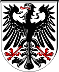
| Blazon : "The city coat of arms shows a black, erect, and red-armored eagle with spread wings and fangs, with a red tongue and red claws on a white field." | |
| Justification of the coat of arms: The coat of arms has been in use since the city was founded in 1939 and was confirmed by the Hessian government with a document dated April 1, 1939. It shows the imperial eagle, a black, red armored and tongued eagle on a silver (white) background. The origin of the coat of arms is explained by the imperial freedom of the Ingelheimer Grund . For today's city-wide coat of arms, the coat of arms of Ober-Ingelheim was taken as a model, which is very similar. The city flag has two stripes in the city colors red and white and is provided with the Ingelheim coat of arms. There is also a version without a coat of arms. The flag has been in use since 1939. |
The districts carried coats of arms in their independence, some of which are still in unofficial use today. Due to its historical affiliation to Nieder-Ingelheim, Sporkenheim does not have its own coat of arms, just like Ingelheim-West, which was only created in the 1960s. But since they are in the former Nieder-Ingelheim district, they have de facto the same coat of arms as Nieder-Ingelheim.
In addition, an official logo was introduced in 2008, whereby the battlements stand for the historical sites in Nieder and Ober-Ingelheim and each individual battlement stands for a district (six battlements for six districts). The blue, curved bar should symbolize the location on the Rhine. The logo is completed with a red bar, which stands for the cultivation of red wine. The logo was designed by the advertising agency Consell GmbH in Frankfurt. In 2015 the lettering was revised by INCOM Kommunikation & Design in Ingelheim to ensure better legibility. Since this revision z. For example, there are no brochures or the words “Die Rotweinstadt”.
City partnerships and sponsorships
The first twin town was established in May 1963 at the suggestion of the then President of the Rhineland-Palatinate Friendship Circle, Dr. Max Schröder, Autun in France . In the same year the partnership with Stevenage in Great Britain was sealed. On October 24, 1975, the partnerships between Ingelheim, Autun and Stevenage were expanded to a three-party partnership. In 1984 San Pietro in Italy and in 2002 Nysa in Poland were added. In addition, there have been two German partnerships with the Berlin district of Friedrichshain-Kreuzberg since 1971 and with the East German city of Limbach-Oberfrohna in Saxony since 1990. Because of the lively cooperation with its twin cities, Ingelheim was honored with the award of the European flag by the European Parliament in 1983 in Strasbourg. In 2019, Auxonne in France, Daix from France and Roncà from Italy were taken over from the former community of Heidesheim.
Regular visits by associations, politicians and tourists are organized between the cities. The partner cities are often represented at events. The regular student exchange should be emphasized. Since 2005, the Ingelheim City Partnership Association has initiated V. the youth exchange initiative 3 Towns - 1 Vision between Autun and Stevenage.
A Boeing 737-530 operated by Lufthansa was named Ingelheim am Rhein D-ABJE (SN 25310/2126) from 1991 until it was decommissioned in 2011 . In addition, there was a partnership with the S58 Pinguin, a speedboat of the German Navy , until it was decommissioned on June 28, 2001 . A naming partnership with an Embraer 195 from Lufthansa subsidiary CityLine has existed since 2012 .
household
The city is practically debt-free and at the end of 2013 had reserves of 217 million euros. This makes it the richest city in the state of Rhineland-Palatinate, due to the extraordinarily high trade tax payments made by the pharmaceutical company Boehringer Ingelheim .
Culture and sights
Cultural monuments and memorials
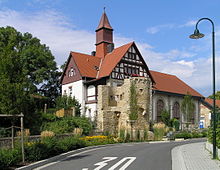
In the urban area there are a number of historical church buildings, of which the castle church is one of the best-preserved fortified churches in southwest Germany. It replaced a previous Romanesque church. The church stands within a double wall ring from the 13th century. It was extended and rebuilt until the 15th century and was not completed until the western nave was extended in 1468. Its Romanesque tower served, among other things, as an archive for the Ingelheimer Oberhof . For a long time the church was also the burial place of the nobles from Ober-Ingelheim . After the Reformation it was given to the Protestants. Since 2003 it has had its original color scheme from the 15th century.
The Church of St. Remigius is located in Nieder-Ingelheim , not far from the Palatinate area . The baroque nave, which replaced the dilapidated previous building, dates from the 18th century, while the Romanesque tower dates from the 12th century. Originally the church was dedicated to Saint Kilian . Once it was outside of an inhabited area. The construction of Mainzer Strasse past the church during the French Revolution also accelerated the construction of houses in this area.
The aisle church (Protestant), built in Nieder-Ingelheim in 997 as the chapel of St. Peter der Kaiserpfalz , is the best preserved part of the former Palatinate. It received its current form in the 12th century under Barbarossa . After the fall of the imperial palace, it was preserved like the other buildings in the palace. During the Reformation the monastery was abolished and left to decay. After the French Revolution it was awarded to the Protestants. A report from 1638 says that the church collapsed except for the choir and the walls of the transept. The nave was demolished over the centuries for house building. Renovation could not begin until the beginning of the 19th century, the reconstruction of the nave was not completed until 1965.
The Selztaldom in Großwinternheim in the neo-Romanesque style dates from the late 19th century. The name is deceptive, because the Selztaldom is actually not a cathedral in the conventional sense. However, in its free peripheral location it largely shapes the townscape and landscape. The limestone and sandstone used come largely from the region.
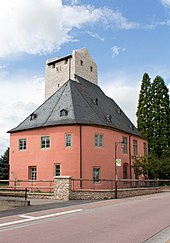
The Ingelheimer Kaiserpfalz dates back to the 8th century and served the emperors and kings as a place of residence and government until the 11th century. The Palatinate complex is located in today's Nieder-Ingelheim. Only remains of the former imperial palace are preserved. The remains of the Aula Regia and the Heidesheimer Tor are clearly visible. The greater part of the system is underground as a foundation.
The Palatinate underwent several renovations in its history, until it was gradually demolished after Nieder-Ingelheim's decline due to its insignificance. The former palace chapel, today's hall church, was not affected by the demolition . The area of the former Palatinate is currently being restored and is a listed building. Excavations are still taking place there. For the renovation of the hall area and the safeguarding of the remains of the imperial palace, the city received the title “The distinctive city” in a Europe-wide competition from the Lebendige Stadt Foundation on November 6, 2011 .
The Heidesheimer Tor was the easternmost exit and entrance to the Imperial Palatinate during the Carolingian era. Nothing can be seen of the former gate with two towers to the left and right of the archway, as the gate was bricked up in the 13th century as part of the conversion to medieval defense architecture and the towers were removed.
The Niederungsburg Burg Windeck in the Heidesheim district is located in the center of the village. It was built in the 13th century by the lords of Winternheim in the style of a tower castle.
The remains of the Ober-Ingelheim fortifications give an idea of the dimensions of the defensive system of the former imperial village of Ober-Ingelheim. The weir system at the castle church, which is equipped with a double wall ring and a kennel, is best preserved . In recent years the facility has been made accessible and restored. The Malakoff Tower is the largest of the watchtowers and also served as a dungeon. The section of the wall on the Path of Sighs is also well preserved. There you can still see the former moat. Some of the template towers and the former city gates Uffhubtor , Ohrbrücker Tor and Stiegelgässer Tor have also been preserved.
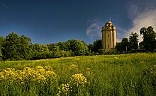
The construction of the Bismarck Tower was initiated in the spring of 1902 by Heinrich Claß . It was completed in 1912 and was the most expensive in Rhineland-Palatinate. Originally, the “Götterdämmerung” design was planned for Ingelheim, but this did not materialize. Professor Wilhelm Kreis designed a Bismarck tower especially for Ingelheim. It consists mainly of limestones from the area. The actual tower was finished in 1910, the dome, however, not until 1912. Otto von Bismarck is honored with the inscription “ZU / BISMARCKS / EHR” on a sandstone plaque in the entrance area . There is a balcony above. Until the Second World War , midsummer festivals and Bismarck commemorations took place at the tower. The tower is currently illuminated with light effects as "Ingelummer candle" at Christmas time.
Natural monuments
There are four natural monuments in the Ingelheim urban area. To the east of the Rheinstrasse on the Jungau site there is a row of weeping willows to the north between the banks of the Rhine and Jungau along a gravel path ; to the west is an oak . The two other wastelands, the Gewann In den nine Morgen east of Nieder-Ingelheim and the Gewann Rabenkopf east of Ober-Ingelheim, are two-dimensional natural monuments.
Cultural institutions
In the Mothers and Families Center e. V. (MütZe) in the old grammar school in Ober-Ingelheim, the residents of Ingelheim exchange ideas across generations. Babysitter exchange, manual labor hours, breakfast and lunch, homework and holiday care as well as courses and events on all family topics from babies to health to creativity are regularly offered. The youth and cultural center Yellow was opened in 2010 and replaces the Haus der Jugend, which was given way for a shopping center. The multi-generation house in Ingelheim-West, which has existed since 2009, aims to bring people from different age groups together to exchange experiences, interests and talents.
The city library in the city center offers around 30,000 media for leisure, education, training and further education. In the immediate vicinity of the new town hall in the city center there is a cinema with two halls in which current films can be seen daily. In 2017 the new building of the media center in the inner city area was completed.
The Museum bei der Kaiserpfalz has its own section for information about the Kaiserpfalz, built by Charlemagne in Ingelheim after 785. Small archaeological finds, objects from the field of building sculpture and a vivid model of the once imposing structure will be presented. Remnants of the imperial palace can be viewed in the immediate vicinity of the museum. The golden solidus found in 1996, the only gold coin with the image of Charlemagne found so far, is of European importance .
In the immediate vicinity of the town hall, a culture and event hall with a capacity of up to 1,000 people was opened on August 18, 2017 after a three-year construction period, which can also be rented by associations and companies. In addition, the hall is operated by a management to enable larger events. The new building was completed in August 2017 and bears the name kING , which was determined through a competition. The “k” refers to the terms “culture” or “culture hall” and “ING” to the first three letters of the city name Ingelheim. The building costs for the hall are 61 million euros.
Events

The traditional red wine festival in the Ober-Ingelheim district takes place from the last weekend in September to the first weekend in October. Since Heidesheim was incorporated into the city in 2019, the harvest festival there on the first weekend in October has also been part of the city's calendar of events. These two festivals represent the two larger home festivals. On the last weekend of July, the harbor festival takes place on the Frei-Weinheimer Jungaue.
The “Eurofolk Festival”, a folk music event on the Burgkirchen festival site in June / July, organized by the Friends of the Eurofolk Festival Ingelheim e. V., has been one of the follow -up festivals to the “ Waldeck Festival ” since 1972 . Most of the visitors are people from the hippie culture, young people from the area and from all over Germany. The number of visitors varies between 2000 and 3000. The “ OpenOhr Festival ” in Mainz was founded in 1974/1975 from the Ingelheim “Eurofolk Festival” .
There is a distinctive carnival culture in Ingelheim which, due to its geographical proximity, is heavily influenced by the Mainz carnival . There are a total of six clubs, the Carneval Club Waschbächer 1885 in Nieder-Ingelheim, the Carneval Club Frei-Weinheim, the Ingelheim Carneval Club in Ober-Ingelheim, the Narrenclub Ingelheim 1987 in Nieder-Ingelheim, the Heidesheim Carneval Club and the Carneval Club Wackernheim. All clubs hold their own carnival meetings in the time before the street parades. Except for Sporkenheim and Ingelheim-West, a carnival parade through the district is organized by the respective association in each district. There is no train going through the city center.
Since 1959, Boehringer Ingelheim has organized the International Days cultural festival around the Old Town Hall in Nieder-Ingelheim every year from April to mid-June . This is essentially an art exhibition with topics that change every year. The highlight of this event in recent years has been the “Art Night”, in which the hall area is also integrated with nightly illumination and guided tours.
Since 2013, the concert series Thursdays in the City has been organized by the city administration on the town square in the city center . The concerts take place on six Thursdays from mid-August to the end of September. Regional and national artists appear.
From June 1st to 3rd, 2012 Ingelheim hosted the Rhineland-Palatinate Day with 270,000 visitors. The festival, which was opened by Kurt Beck , took place in the city center and on the fairground at the castle church. Star guests were Stefanie Heinzmann , Glasperlenspiel , Matthias Reim , Michelle and Die Atzen . The stations Rockland Radio , RPR1 and bigFM were represented with stages in the inner city area . SWR1 set up its stage on the fairground east of the castle church. There was also a communal stage at the Winzerkeller in Binger Strasse.
The year 2014, the so-called Charles Year, was all about Charlemagne. On the occasion of this there were several special exhibitions and guided tours. The highlight was the “Illumina 2014” in cooperation with light artist Wolfram Lenssen and the Forum InterArt from Dortmund at the beginning of September, during which the hall area was illuminated with lighting technology. Over the year 25,000 visitors were counted.
Further events are the notches in Großwinternheim and Wackernheim, the ecumenical notch in Nieder-Ingelheim, the Entekerb in Frei-Weinheim and the Sporkenheimer notch, which is the last to end the notching season. The old town festival in Nieder-Ingelheim at the beginning of August is organized by the Ingelheim Narrenclub on the Zuckerberg. In addition, wine farm festivals are held every year in various wineries. The Christmas market on the castle church grounds in Ober-Ingelheim is well-known beyond the city limits. Two weekends before Easter there is an Easter market in the old market hall. The Schützenverein Ober-Ingelheim organizes the so-called Easter egg shooting in its premises every year at Easter. On the seventh of each month, authors from Ingelheim's Leinpfad Verlag read and present their books in Cafe 7 ° at the Kunsthalle Mainz .
Parks
There are a number of parks and green spaces in the urban area. East of the city center is the largest, the Kommerzienrat-Boehringer-Anlage with a neo-Gothic war memorial. At the castle church, framed by the defensive walls, is the rose garden with the former market fountain. The newly created Uffhubtor green area is comparatively small; it has benches and a meadow. The path of sighs invites you to linger with its seating right on the best-preserved section of the Ober-Ingelheim fortifications. The Jungau, which also serves as a fairground, is located on the Rhine with seating and a playground.
gastronomy
Traditionally there are many wine bars, especially in Ober-Ingelheim, but their number has decreased in recent years. On weekends from May to September there are wine farm festivals with regional catering.
Sports and clubs
In Nieder-Ingelheim there is the sports stadium at the flower garden for soccer and athletics , where SpVgg Ingelheim plays its home soccer games. The Schützenverein Ober-Ingelheim 1859 eV, whose clubhouse is located at the foot north of the Westerberg, has one of the most modern shooting range systems in the district. In the district of Wackernheim there is also the Kyffhäuser Kameradschaft Wackernheim eV, a shooting club from the Kyffhäuserbund. The 1st swimming club Ingelheim 1966 e. V. offers a training program for both youth and senior citizens. The Ingelheim riding club on the Boehringer factory site offers riding lessons for young people and adults and takes part in championships. The gymnastics and sports community 1848 in Ober-Ingelheim has something for every age group. The focus is on apparatus gymnastics and gymnastics all-round competitions, in which the German championship title has already been won. The Gymnastics Parish 1847 Corp. Nieder-Ingelheim has, among other things, the basketball, badminton and tennis departments. There are also a number of fitness and health sports facilities there. The Frei-Weinheim physical exercise association offers the football and hiking departments and the show dance division. The handball sports club Ingelheim was founded in 1965 and is now one of the largest clubs in Rheinhessen. In the Gymnastics Club 1902 Frei-Weinheim, among other things, children's gymnastics is offered. The football sports club Ingelheim 07 was only founded in 2007. The Boehringer Tennis Club is the company’s own association for the sport of tennis, it has an indoor tennis center and several outdoor tennis courts. The rowing club Ingelheim 1920 e. V. may have many successes, including winning the gold medal quadruple sculls at the 1984 Summer Olympics in Los Angeles by Albert Hedderichstraße and Michael Dürsch . The Taekwondo Club Ingelheim is one of the most successful martial arts clubs in Germany, with over 50 German championship titles in all age groups. For its outstanding youth work, the club has already been awarded three times (1996, 2013, 2019) with the most important young talent award in German sport, the " Green Belt " for exemplary talent promotion in the club. In 2011 the first women's soccer club Rheinhessen Ingelheim was founded. In future he will play his home games on Tennenplatz in Großwinternheim. Since 2005, the regional adventure pool “Rheinwelle” between Gau-Algesheim and Sporkenheim has replaced the indoor and outdoor pool at the flower garden, which has been converted into a pure outdoor pool. The city has a good network of cycle paths and was awarded the cycle-friendly city of Rhineland-Palatinate prize in 2010 .
The association Lebenswerte Ingelheim e. V. advocates the preservation of the city's values and promotes its image. In addition, the association operates the city television Blickpunkt Ingelheim. The Ingelheim Historical Association was founded in 1905 and deals with the processing of Ingelheim's history. He owns a library behind the old town hall in Nieder-Ingelheim. The Pro Ingelheim association is committed to the preservation of historical buildings in the city. Through donations he financed the restoration and making the defensive wall at the castle church accessible. Ingelheim Aktiv is an association of traders in Ingelheim. Among other things, it serves to improve cooperation between individual retailers at events such as the shopping Sundays in early May, late September and early November.
The Ingelumer Rotwoigeister e. V. plays Guggenmusik . In the districts of Frei-Weinheim (Liederkranz 1857), Nieder-Ingelheim (Gesangverein Einigkeit 1885) and Ober-Ingelheim (Gesangverein Germania 1862 e.V.) there are traditional choral societies. The Friends of Kleinkunst Ingelheim e. V., which has existed since 1982, promotes small-scale cultural arts such as jazz, cabaret and children's theater. Until 2007 he had a permanent event location in the Keller-Kunst-Keller. Since 2007 he has been holding his events on changing stages.
Economy and Infrastructure
traffic
In Ingelheim there is a train station on the left bank of the Rhine , where regional trains of the Deutsche Bahn and the Transregio- Mittelrheinbahn stop. There are direct connections to Mainz and Frankfurt am Main and in the opposite direction to Bingen , Koblenz , Cologne , Bad Kreuznach and Saarbrücken . In the immediate vicinity of the train station there is also the central bus station , where three city bus routes (611, 612, 613 night bus) go to destinations in different parts of the city. In addition, the Heidesheim (Rhh.) And Uhlerborn stops there have been part of the Ingelheim urban area since the incorporation of Heidesheim .
The city bus service is operated by the city of Ingelheim on its own. Since September 2015, the city bus has been supplemented by a night bus line that serves all parts of the city in one tour. Four regional lines (620, 640, 643, 75) with the destinations Mainz, Ober-Hilbersheim, Gau-Algesheim and Heidesheim open up the area. Local public transport in the region is operated by Omnibusverkehr Rhein-Nahe GmbH. There is also a shared call taxi .
At the end of 2019, the city bus service was transferred to Stadtbus Bad Kreuznach GmbH . At the same time, the range of bus routes was expanded from three to six (two of which were night bus routes) in order to take account of the growing urban area through the incorporation of Heidesheim and Wackernheim . Over the next few years, city bus traffic is to be gradually converted to electric buses.
With the junctions Ingelheim-Ost -West and Heidenheim, the city is on the A 60 bound. The B 41 , which begins in Saarbrücken, ends at Frei-Weinheim. The Frankfurt airport is around 30 minutes and the Frankfurt-Hahn airport in the Hunsrück can be reached in around 50 minutes. A passenger and car ferry is in operation between the Hessian communities on the northern bank of the Rhine and Ingelheim at river kilometer 519 .
Agricultural products and viticulture
Agriculture plays a major role in Ingelheim, and the Ingelheim Pinot Noir is particularly well known. A total of 640.6 hectares are used for viticulture, of which 311.5 hectares are used for white wine. The Riesling grape variety is grown the most with 68.1 hectares, followed by Silvaner with 66.7 hectares. The Müller-Thurgau is also present with 64 hectares. Other grape varieties do not exceed the size of 26 hectares, including the varieties Pinot Blanc, Kerner and Bacchus. Red grape varieties are grown on 329.1 hectares in Ingelheim. 120.8 hectares of which are for Pinot Noir, which is the most widely grown grape variety in Ingelheim. The blue Portuguese is in second place with 94.9 hectares. With 50.8 hectares, the Dornfelder is already grown significantly less. For Frühburgunder, Cabernet Sauvignon and Saint Laurent z. B. are all grown under 16 hectares. The variety of red varieties is less than that of white grape varieties.
1,373 hectares are used for arable farming (120 hectares of which are asparagus) and 1,240 hectares are used for fruit growing. The main agricultural products are sour cherries , asparagus and wine . The city is the seventh largest wine-growing community in Rheinhessen and one of the twelve largest in Rhineland-Palatinate . The Institute of Horticulture of the University Geisenheim (formerly the Department of Horticulture Research Institute ) operates an asparagus field trial in Ingelheim.
Established businesses
The pharmaceutical company Boehringer Ingelheim , which has been based in since 1885, has shaped the cityscape . On the outskirts of the city is Europe's largest trading center for sour cherries, the United Wholesalers for Fruit and Vegetables Rheinhessen . The former Stadtwerke von Ingelheim, now Rheinhessische Energie- und Wasserversorgungs-GmbH , are based in Ingelheim. The company also cooperates with the community of Heidesheim. The Weber-Stephen Products Co. founded its German subsidiary in 1999 in Ingelheim and is also there since resident. The window and door manufacturer PaX AG has its headquarters in Ingelheim.
Education and Public Institutions
The following five primary schools are located in the urban area of Ingelheim: the President Mohr primary school in Ober-Ingelheim, the Theodor Heuss primary school in Ingelheim-West, the Brothers Grimm primary school in Frei-Weinheim, the Pestalozzi primary school in Nieder- Ingelheim and the elementary school at the sand mill in Heidesheim. The Sebastian-Münster-Gymnasium is located in the city center . At the beginning of 2012, the newly built Kaiserpfalz-Realschule Plus was opened on Gänsberg. The Steinhöfelschule is located in Heidesheim.
The Albert Schweitzer School in Frei-Weinheim is a special school. The Ingelheim schools also include the vocational school in Nieder-Ingelheim and the IGS Kurt Schumacher in the west of the city. Only the primary schools are funded by the city, all other schools by the Mainz-Bingen district.
There are 17 day-care centers in the city for early childhood education. Under the sponsorship of the city of Ingelheim and supported by the Association of Friends of the Fridtjof-Nansen-Haus e. V. stands the Ingelheim further education center, which unites the adult education center , the Fridtjof Nansen Academy for political education, the music school and the Young Academy for Education under one roof .
In 1996 the seat of the district administration of the Mainz-Bingen district was relocated from Mainz to Ingelheim. Ingelheim also has a police station that is also responsible for the municipalities of Heidesheim and Gau-Algesheim. There is a hospital and a fire station for the volunteer fire brigade , which cooperates with the plant fire brigade of the pharmaceutical company Boehringer. The detention facility for persons obliged to leave the state of Rhineland-Palatinate is also located in Ingelheim. The wastewater association “Untere Selz”, of which the city is a member, operates its sewage treatment plant in Ingelheim. The Altenzentrum Im Sohl opened in 1985 and offers dormitories and day arrangements through the social service.
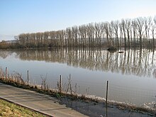
The flood protection polder on the Rhine near Ingelheim was completed in 2006. It consists of an area (mostly arable land) of 162 hectares that is delimited by dykes and can absorb 4.5 million cubic meters of water. When the Rhine floods with a water level of 690 cm at the Kaub gauge , it is flooded by lowering the flaps on the inlet and outlet structures. This case occurred for the first time on the night of January 16, 2011.
Ingelheim deportation prison
A detention facility for persons obliged to leave the country (GfA) has been in operation in Ingelheim since 2001 , which was originally built for the federal states of Rhineland-Palatinate and Saarland , but today also for Hesse , North Rhine-Westphalia (only women obliged to leave the country), Hamburg and Schleswig due to a lack of capacity -Holstein is occupied. The facility has 25 to 40 places for men and women and, after having been practically empty for many years, has been used intensively since 2013 with a throughput of several hundred deportation detainees per year.
media
The Allgemeine Zeitung Ingelheim within the Rhein Main Presse is the daily newspaper in Ingelheim, published by the Rhein Main publishing group . The Ingelheimer Wochenblatt and the Ingelheimer Kurier with the official announcements appear weekly on Thursday and the local newspaper is published monthly . The city TV channel Blickpunkt Ingelheim is available every Tuesday and Saturday on the regional channel OK: TV via cable connection and via live stream on the station's own website.
Personalities
Honorary citizen
Honorary citizenship was first awarded in Nieder-Ingelheim in 1863. First honorary citizen was Albert Gerhard de Roock (* 1787 in Zaltbommel (Holland); † August 22, 1867 in Ingelheim), he was made an honorary citizen of Nieder-Ingelheim on August 8, 1863 because of his sense of community and charity. Kommerzienrat Albert Boehringer (1861–1939) became an honorary citizen of Nieder-Ingelheim in 1921 because he had made a decisive contribution to Nieder-Ingelheim's industrial development.
The first city-wide honorary citizen was Albert Boehringer (the second, born June 7, 1890 in Ingelheim), the son of the founder of Boehringer Ingelheim. He was made an honorary citizen of Ingelheim on July 7, 1951 because of his services to the development of the city. Georg Rückert (born November 8, 1901; † September 12, 1990), received honorary citizenship in 1966 for his services as the first post-war mayor of Ingelheim am Rhein. Andreas Saalwächter (born October 24, 1876 in Nieder-Ingelheim; † August 10, 1967 there), became an honorary citizen of Ingelheim on October 13, 1953 for his work as a local historian. In addition, he was awarded the Federal Cross of Merit on ribbon.
Autun's mayor, René Monrose, was the “father of the town twinning” between Autun and Ingelheim . In 1965 he became an honorary citizen of Ingelheim. The entrepreneur and poet Robert Boehringer (1884–1974) became an honorary citizen in 1974. Marcel Lucotte (born January 16, 1922; †) was given honorary citizenship of Ingelheim on the occasion of the twinning anniversary in 1973 in recognition of the expansion of the partnership. The archaeologist Christian Rauch (1878-1976) was awarded honorary citizenship in 1975 for his excavations and research in the hall area.
For her social commitment and for her services to the city, Ruth Boehringer (1906–2007) became an honorary citizen on the occasion of the 100th anniversary of the Boehringer company in December 1985. Former Stevenage Mayor Brian Hall was made an Honorary Citizen in September 2005. Ulrike von Baumbach, daughter of Albert and Marianne Boehringer, is also an honorary citizen of the city.
sons and daughters of the town
The city's best-known son is the theologian and cosmographer Sebastian Münster (1488–1552). His work Cosmographia was the first description of the knowledge of the whole world in German. In his day, Cosmographia was the most widely read book alongside the Bible.
Carlo von Erlanger (1872–1904) caught the attention of the research world with his expeditions across the world . Among other things, he crossed Abyssinia from 1899 to 1901, covering 2700 kilometers.
- Philipp August Gebhard (1805–1874), wine merchant, pharmacist and politician
- Philipp Dengel (1888–1948), communist politician
- Hanns Niedecken-Gebhard (1889–1954), director, director and university professor
- Frolinde Balser (1924–2012), SPD politician, member of the German Bundestag from 1979 to 1980, head of the city council of Frankfurt am Main (first woman in this office)
- Heinz-Egon Rösch (* 1931), sports historian and university professor
- Walter Reichert (1933–1999), motorcycle racing driver
- Erwin Leibfried (1942–2019), literary scholar, professor of general literary studies at the Justus Liebig University of Giessen, publisher and author
- Fritz Teufel (1943–2010), political activist and active member of the student movement in 1967
- Christoph Bartels (* 1949), mining historian. Among other things, he was the curator of the exhibition 750 Years of Knappschaft .
- Hermann-Josef Stipp (* 1954), Roman Catholic theologian
- Thomas Stritter (born April 27, 1956), German lawyer and politician (SPD), member of the state parliament from 1991 to 1996
- Albrecht von Lucke (* 1967), publicist, lawyer and political scientist
- Christian Schmitt-Engelstadt (* 1967), organist
- Klaus Knopper (* 1968), the developer of the Linux distribution Knoppix
- Simone Renth-Queins (* 1973), graduate engineer (FH) viticulture. She was Rheinhessen Wine Queen in 1998/1999 and the 51st German Wine Queen in 1999/2000
- Markus Kreuz (* 1977), soccer player at 1. FSV Mainz 05 and Eintracht Frankfurt
- Robin Hübscher (* 1995), handball player
People who worked on site
The following people worked in Ingelheim:
- Charlemagne held a court day in Ingelheim in 807 .
- Ludwig the Pious died in 840 in a summer tent on an island on the Rhine near Ingelheim
- The lineage of the von Ingelheim family , including Anselm Franz von Ingelheim , Archbishop of Mainz
- Anton Otto von Closs († 1737), resident in Ingelheim; Electoral Palatinate general and great benefactor in the charitable and religious field
- Jean-Baptiste Kléber , headquartered in Ingelheim during the siege of Mainz in 1794
- Martin Mohr (* 1788 Warmsroth; † 1865 Ingelheim), member of the Frankfurt National Assembly and President of the Hessian state parliament
- Wilhelm Hermann Carl von Erlanger (born March 27, 1835 in Frankfurt am Main; † April 17, 1909 in Ingelheim), lawyer, notary and legal advisor at his father's bank Erlanger & Sons in Frankfurt am Main
- Eduard Douwes Dekker , called Multatuli (1820–1887), Dutch writer
- Paul Darius (1893–1962), architect, created the Jägerhof for the manufacturer Albert Boehringer
- Gerd Wohlleben (born December 2, 1902 in Cologne, † December 27, 1972 in Ingelheim am Rhein) was a politician (FDP) and member of the Ingelheim city council from 1948 to 1969
- Irmgard von Opel (* 1907 in Rüsselsheim; † May 20, 1986 in Ingelheim), entrepreneur and equestrian
- Richard von Weizsäcker (1920–2015), managing partner of Boehringer Ingelheim from 1962 to 1966
- Klaus Ahlheim (* 1942 in Saarbrücken), theologian, educationalist, university professor, 1971 and 1972 vicar in the Saalkirchen parish
- Carsten Lenz (* 1970), church musician in Ingelheim
literature
in alphabetical order by authors / editors
- Gerda Bernhard, Gustav Behrens, Alexander Burger, Ernst Emmerling: Ingelheim. Historical Association, 1984, DNB 860002594
- JF Dielmann, A. Fay, J. Becker (draftsman): FC Vogel's panorama of the Rhine, pictures of the right and left banks of the Rhine. Lithographische Anstalt FC Vogel, Frankfurt 1833. Picture from Oberingelheim
- Reinhard Friedrich (ed.): Charlemagne in Ingelheim: builder of the Palatinate and European statesman; Catalog for the exhibition in the old town hall Nieder-Ingelheim, August 29 to September 27, 1998. Ingelheim 1998, ISBN 3-00-003290-8
- Karl Heinz Henn: Ingelheim: the Reich and Europe, essays and lectures. Histor. Association, Ingelheim 1985, DNB 860494225 .
- Historischer Verein Ingelheim (ed.): Ingelheimer Haderbücher : About trial files of the Ingelheimer Oberhof .
- Dieter Krienke: Monument topography Federal Republic of Germany . Cultural monuments in Rhineland-Palatinate. District Mainz-Bingen 18.1 = towns of Bingen and Ingelheim, municipality of Budenheim, association municipalities of Gau-Algesheim, Heidesheim, Rhein-Nahe and Sprendlingen-Gensingen . Werner Verlag , Worms. ISBN 978-3-88462-231-5
- François Lachenal , Harald T. Weise (eds.): Ingelheim am Rhein: 774–1974; History and Present. Boehringer, Ingelheim 1974, DNB 740761544
- State Office for Surveying and Basic Geospatial Information Rhineland-Palatinate (ed.): Ingelheim am Rhein. Topographic map 6014 (1: 25,000), ISBN 3-89637-076-6
- Hans-Georg Meyer, Gerd Mentgen: You are among us: on the history of the Jews in Ingelheim . Ingelheim 1998, ISBN 3-924124-29-9
- Ursula Pechloff: Ober-Ingelheim, Protestant castle church. Kunstverlag Peda , Passau 2000, ISBN 3-89643-161-7 .
- Ignaz Schweitzer: About the splendor of the Ingelheim imperial palace. Histor. Association, Ingelheim 1969, DNB 740816292 .
- Anno Vey: Ingelheim under the swastika. Historical Association, 1999, ISBN 3-00-005295-X .
- Hartmut Geißler: Ingelheim from the Stone Age to the Present Reichert Verlag Wiesbaden 2018, ISBN 978-3-95490-186-9
- Reiner Letzner: Ingelheim on cards through the ages 2019.
Web links
- Website of the city of Ingelheim am Rhein
- Historical Association Ingelheim
- Historical information about Ingelheim at regionalgeschichte.net
- Literature about Ingelheim am Rhein in the Rhineland-Palatinate State Bibliography
Individual evidence
- ↑ State Statistical Office of Rhineland-Palatinate - population status 2019, districts, communities, association communities ( help on this ).
- ↑ Ingelheim am Rhein on Rheinhessen.de
- ↑ bfn.de (pdf file)
- ↑ Historical Association 1984: Ingelheim p. 13
- ↑ Nature reserves of the city of Ingelheim
- ↑ Land use data of the State of Rhineland-Palatinate
- ^ [1] Section places in the regional area of Ingelheim am Rhein
- ↑ Main statute of the city of Ingelheim ( Memento of July 10, 2012 in the Internet Archive ) (PDF; 65 kB)
- ^ A b German Weather Service, normal period 1961–1990
- ^ François Lachenal, Harald Tristan Weise, Robert Boehringer: Ingelheim am Rhein, 774–1974: Past and present. Boehringer, Ingelheim 1974.
- ↑ Ingelheim Reader. P. 10.
- ↑ Ingelheim Historical Association on the Ingelheim Empire
- ↑ Ingelheim Historical Association on the history of the Imperial Palatinate
- ↑ Historical Association Ingelheim on Ludwig the Pious
- ^ Karl Heinz Henn: Ingelheim: the empire and Europe: essays and lectures. 1985.
- ^ Historical association about the Ottonians
- ↑ Ingelheim Reader. P. 16.
- ^ Ingelheimer nobility historical association Ingelheim
- ^ Historischer Verein Ingelheim on the medieval courts in Ober-Ingelheim
- ↑ Adalbert Erler: The older judgments of the Ingelheimer Oberhof 1418-1430. Volume 3, Klostermann, Frankfurt am Main 1963, DNB 451156927 .
- ↑ Historical Association: Ingelheim p. 68
- ^ Historical Association Ingelheim about the time of the Electoral Palatinate
- ^ Historical association about Sebastian Münster
- ^ Historical association about witch trials in Ingelheim
- ↑ Ingelheim Historical Association on the Napoleonic period in Ingelheim
- ↑ Historischer Verein 1984: Ingelheim p. 87
- ↑ Historischer Verein 1984: Ingelheim p. 87
- ^ Historical association about Ingelheim industry
- ↑ Ingelheim under the swastika. P. 181.
- ↑ Ingelheim under the swastika. P. 102.
- ↑ Amalgamation of the communities Ober = Ingelheim, Nieder = Ingelheim and Frei = Weinheim to form the town of Ingelheim am Rhein on December 14, 1934 . In: The Reichsstatthalter in Hessen (Hrsg.): Hessisches Regierungsblatt. 1938 No. 21 , p. 123 ( online at the information system of the Hessian state parliament [PDF; 10.0 MB ]).
- ↑ Ingelheim under the swastika. P. 105.
- ↑ Ingelheim under the swastika. P. 216.
- ↑ Ingelheim during National Socialism and World War II
- ↑ Official municipality directory 2006 ( Memento from December 22, 2017 in the Internet Archive ) (= State Statistical Office Rhineland-Palatinate [Hrsg.]: Statistical volumes . Volume 393 ). Bad Ems March 2006, p. 181 (PDF; 2.6 MB). Info: An up-to-date directory ( 2016 ) is available, but in the section "Territorial changes - Territorial administrative reform" it does not give any population figures.
- ↑ ( page no longer available , search in web archives: official election result )
- ↑ ( page no longer available , search in web archives: official election result )
- ^ Population development data from the Ingelheim Historical Society
- ↑ Annual review brochure 2014, p. 25
- ↑ unknown: population development. In: Statistics. City of Ingelheim am Rhein, December 31, 2017, accessed on December 3, 2019 .
- ↑ Information on the town hall extension
- ↑ a b Explanation of the regional returning officer on the "weighted result" ( memento of October 2, 2011 in the Internet Archive )
- ↑ https://www.wahlen.rlp.de/de/kw/wahlen/kg/verbindungen/3390003000.html%7C all final results
- ↑ Ingelheim City Council Election 2019, City Council
- ↑ The Regional Returning Officer RLP: direct elections 2019. see Ingelheim am Rhein, community-free municipality, first line of results. Retrieved September 28, 2019 .
- ↑ Eveline Breyer is Ingelheim's new mayor ( memento from July 14, 2014 in the Internet Archive ) February 14, 2012.
- ↑ Town twinning ǀ Ingelheim.de. Retrieved January 5, 2020 .
- ↑ Lufthansa Embraer 195 as the new “Flying Ambassador” from Ingelheim ( Memento from July 14, 2014 in the Internet Archive )
- ↑ http://www.allgemeine-zeitung.de/lokales/ingelheim/ingelheim/oberbuergermeister-WEIS-kritikpunkte-im-pruefbericht-zurueck_14269935.htm
- ^ Castle Church Historical Association Ingelheim
- ^ Excavations near the Imperial Palace
- ^ Christian Rauch, Hans Jörg Jacobi: The excavations in the royal palace Ingelheim 1909–1914. Historischer Verein Ingelheim, 1976. (Contributions to Ingelheim history. 24/25)
- ↑ Ingelheim am Rhein wins title unmistakable city. ( Memento from September 24, 2015 in the Internet Archive )
- ↑ Johannes Leicht: Heinrich Claß 1868–1953. The political biography of an Pan-German. Schöningh, Paderborn u. a. 2012, ISBN 978-3-506-77379-1 , p. 69.
- ↑ Bismarcktürme.de about the Bismarck Tower near Ingelheim
- ↑ The city library became a media library. (No longer available online.) In: ingelheim.de. Ingelheim am Rhein city administration, archived from the original on August 19, 2017 ; Retrieved August 19, 2017 .
- ^ Website of the Imperial Palace Ingelheim
- ↑ kING culture and event hall opened. In: swr.de. Südwestrundfunk , August 18, 2017, accessed on August 18, 2017 .
- ↑ Annual review brochure 2014, p. 20
- ↑ Annual review brochure 2014, p. 25
- ↑ ON THE 7TH AT 7! on the website of the Leinpfad Verlag, as seen on February 11, 2011.
- ↑ Public invitation to tender Ingelheim am Rhein 2019 Award of Ingelheim City Bus 2019 2019-06-24. Retrieved July 28, 2019 .
- ↑ Research results of the asparagus trial field ( Memento from October 23, 2013 in the Internet Archive )
- ↑ Flooding of the polder simulated. ( Memento from May 14, 2010 in the Internet Archive ) In: Allgemeine Zeitung. October 29, 2009.
- ^ Structural and Approval Directorate South: Flood retention at Ingelheim Polder ( Memento from July 19, 2011 in the Internet Archive ) PDF file 13 MB
- ↑ Anke Petermann: Exit detention can be illegal. In: DLF , December 14, 2017; Elisabeth Kagermeier: The last stop in Germany. In: Die Zeit , February 19, 2018; More foreign nationals required to leave the country in custody than in the previous year. In: SWR , April 16, 2018; Twice as many women in custody in Ingelheim. In: Die Welt , June 4, 2019; all accessed in November 2019.
- ↑ ( page no longer available , search in web archives: Livestream of OK: TV )
- ↑ Honorary citizen of Ingelheim's Ingelheim Historical Society
- ↑ Ruth Boehringer ( memento of August 7, 2010 in the Internet Archive ) on the website of the city of Ingelheim, viewed February 13, 2012.
- ↑ Ulrike von Baumbach honorary citizen
- ↑ Personalities Ingelheim's Historical Association


