
Anger home
| coat of arms | Germany map | |
|---|---|---|

|
Coordinates: 49 ° 53 ' N , 8 ° 14' E |
|
| Basic data | ||
| State : | Rhineland-Palatinate | |
| County : | Mainz-Bingen | |
| Association municipality : | Nieder-Olm | |
| Height : | 214 m above sea level NHN | |
| Area : | 5.58 km 2 | |
| Residents: | 3863 (Dec. 31, 2019) | |
| Population density : | 692 inhabitants per km 2 | |
| Postal code : | 55270 | |
| Area code : | 06136 | |
| License plate : | MZ , BIN | |
| Community key : | 07 3 39 067 | |
| LOCODE : | DE 84F | |
| Association administration address: | Pariser Strasse 110 55268 Nieder-Olm |
|
| Website : | ||
| Local Mayor : | Dennis Diehl ( CDU ) | |
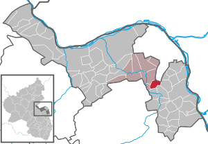
| Location of the local community of Zornheim in the Mainz-Bingen district | ||
  |
||


The wine-growing community of Zornheim is located in the Mainz-Bingen district to the southwest bordering the Ebersheim district of the Rhineland-Palatinate state capital Mainz on the edge of the Rhine-Main area . The local community has belonged to the Nieder-Olm community since 1973 . It is strongly influenced by viticulture and is located in the Rheinhessen wine-growing region .
Numerous wineries have been growing wine here for centuries. The first documentary mention goes back to the year 771 AD.
Geographical location
Zornheim is about 10 kilometers south of Mainz city center. Immediate neighboring communities are Mainz-Ebersheim in the north, Nieder-Olm in the north-west, Gau-Bischofsheim and Harxheim in the north-east, Mommenheim in the east, Hahnheim in the south and Sörgenloch in the west . Another larger town nearby is Alzey, about 20 kilometers southwest of Zornheim . The Selz also flows south of Zornheim .
history
Zornheim until 1960
Zornheim's origins go back a long way to early history, as is shown by finds from the Neolithic , Bronze , Iron and Roman ages. The first written evidence about Zornheim comes from the year 771 and is documented in a deed of donation to the Fulda monastery . Since this donation concerns two vineyards, we know that viticulture was already practiced here back then .
From the 8th to the 12th century, in addition to various Mainz monasteries, the St. Alban Abbey near Mainz had the most important property in Zornheim. After the Lords of Bolanden had transferred sovereignty over Zornheim to a Count of Hohenfels around 1220 , with the consent of Hermann II von Hohenfels, his liegemen sold the village and court of Zornheim to the St. Klara Monastery in Mainz . The sales deed, which was issued on June 9, 1329 in Oppenheim , also mentions the purchase price of 200 pounds Heller.
From now on, for 250 years, the abbess and convent of Sankt Klara not only owned extensive land in the Zornheim district, but also had direct control over the place. This might have lasted even longer if it hadn't been for the fear of an attack by the increasingly powerful Electoral Palatinate .
That is why the abbess of the Klarakloster at the time, Ursula Steinhauserin von Neidenfels, transferred all power over Zornheim to the Mainz Elector and Archbishop Daniel Brendel von Homburg on September 2, 1578 , while the property remained in the monastery until it was dissolved in 1781. This was given to the Mainz University Fund on November 12 of the same year. Around 1651 Johann Jordans came to Zornheim as a pastor, where he died of the plague in 1666 . He was a Benedictine , came from Deutz Abbey and was the last abbot of the Limburg Abbey near Bad Dürkheim from 1622 until he was forcibly expelled in 1650 . The year 1691 was very horrific for the village when, like many other communities, it was burned down during the War of the Palatinate Succession .
In the years 1798 to 1814, under French rule, there were also decisive changes in the Zornheim community, because from that time secular rulers ruled. In 1816 Zornheim came to the Grand Duchy of Hesse .
For the further development of the village, important measures were carried out at the end of the 19th and beginning of the 20th century. In 1887 a two-class school building with two teachers' apartments was built and the current parish church was built between 1894 and 1895. The district road Ebersheim-Zornheim-Wahlheimerhof was built from 1898 to 1901.
The development of a source area, the construction of a water tank and the laying of the water pipe took place from 1900 to 1902. Zornheim was supplied with electricity in 1912/13 and the nurses' house with a children's school was built in 1914 .
After the Second World War , the community came to the newly formed state of Rhineland-Palatinate in 1946. In 1947 the cemetery was expanded through the voluntary work of many citizens of Zornheim and part of the cemetery wall was built. In 1950, the ecclesiastical and civil parish contributed to alleviating the refugee need by converting the former parish barn into three apartments. Due to the growing number of pupils, a third classroom was built in 1954. After the construction of the primary school, this house was used as a meeting room by the Protestant Christians until the inauguration of the Evangelical Community Center (1988).
The steeple of the Catholic parish church was increased to 43 meters in 1955/56. As a result, the ringing of four bells can be heard far beyond.
When, after the currency reform in 1948, more and more farmers were no longer able to run their business full-time, the remaining vintners and farmers modernized and expanded their businesses. At the same time, in the following years, arable land clearings and vineyard reallocations were carried out in sections. At the end of the “Dechenberg” reallocation process, the highlight was the inauguration of the first educational wine trail in the Mainz-Bingen district on June 30, 1979.
Zornheim from 1960 until today

The last decades of local history were characterized by a development that increased the population from around 1000 to over 4000 in 2016.
From 1962 the new development areas Niedernberg-Weidenweg, Südstraße, Kappel, Banggarten, Obere Pfortengewann and Elfmorgen were developed and developed. 1963 Completion of the school and the teacher's house on Hahnheimer Strasse. From 1962 to 1967 the entire village was canalized, the water supply network was renewed, all roads were paved, a sewage treatment plant was built and a children's playground was created. In 1966 Zornheim took part in the competition “Our village should be more beautiful” for the first time and was the district and district winner in the main class.
In October 1967 the new Zornheim – Mommenheim district road was opened to traffic. In the same year Zornheim was awarded a bronze honorary prize when it made it to the state competition “Our village should be more beautiful”. Further awards of this kind followed in the 1970s. A new, functional town hall was built in 1968 in the center of the municipality. To improve the water supply, a second water tank with a capacity of 400 cubic meters was put into operation in 1969. In 1970 a modern cemetery chapel was opened and in the following year the volunteer fire brigade got a new fire station . In October 1971 Zornheim was connected to the urban transport network of the state capital Mainz ; A four-class kindergarten was inaugurated in December, followed by another kindergarten in Zornheim-Nord in 1975.
In the course of the regional reform , Zornheim came on January 1, 1973 to the newly formed community of Nieder-Olm .
In the same year, the development and development of the new building area Zornheim-Nord began. In order to achieve even water pressure in the higher residential areas, a pressure booster system was put into operation in July 1975. Since the beginning of 1979, responsibility for the water supply has been with the Bodenheim water supply association. At the same time, the Zornheim-Nord building area was connected to the communal sewage treatment plant in Mommenheim.
On June 17, 1979, the new cemetery area, which adjoins the old cemetery, was completed. A few months later, the first educational wine trail in the Mainz-Bingen district north of Mommenheimer Strasse was inaugurated.
In 1983 Zornheim received a new outdoor sports facility along Hahnheimer Strasse with a home for athletes. The following year, 1984, the partnership agreement was signed with the French partner municipality Mareuil-le-Port . In 1986 and 1987, the Elfmorgen building area was expanded by a few streets and forms the basis of the “Elfmorgen II” development plan. For the first time, plots of land based on the “Zornheim model” were awarded. To enable more families to build their own house, the Elfmorgen building area was expanded again in 1993 with the “Elfmorgen III” development plan.
On September 4, 1988, the Protestant parish inaugurated its community center on Nieder-Olmer Strasse. Between 1988 and 1990 gas lines and broadband cables for cable television were laid. After two years of construction, the new community courtyard on the corner of Euleffstrasse and Kirschgartenstrasse was inaugurated in 1991. It houses the local community administration with a council hall, a wine cellar, the public library, a youth room, a senior citizen room and a post office. There are apartments in part of the 1st floor.
In 1990, after reunification , the partnership with the Thuringian community of Großrudestedt was sealed. In 1994 the facade of the old town hall on Marieul-le-Port-Platz was redesigned and the building was rented to a local planning office. In the same year, the primary school and the Catholic kindergarten were rebuilt and expanded. For the 100th anniversary of the new church, the renovation of the church tower and the clock was completed in 1995. In the following ten years, ceiling and wall paintings within the church were renewed.
Former Mayor Hans-Steib was made an honorary citizen of the community in 1995.
In 1996 the groundbreaking of the new building area "Pfortengewann I" took place. A food market and a recycling center became part of it.
politics
Municipal council

The municipal council in Zornheim consists of 20 council members, who were elected in a personalized proportional representation in the local elections on May 26, 2019 , and the presiding local mayor .
The distribution of seats in the municipal council:
| choice | SPD | CDU | FWG | total |
|---|---|---|---|---|
| 2019 | 6th | 10 | 4th | 20 seats |
| 2014 | 6th | 10 | 4th | 20 seats |
| 2009 | 7th | 9 | 4th | 20 seats |
| 2004 | 5 | 12 | 3 | 20 seats |
- FWG = Free Voting Group in the Nieder-Olm community
mayor
The incumbent honorary local mayor is Dennis Diehl ( CDU ) after the local elections in 2019 ; he was elected with 79.06% of the votes cast without an opposing candidate. The inauguration took place on August 19, 2019. He succeeds Werner Dahmen (CDU), who was confirmed in office by 65.5% of Zornheim's voters in 2009 and 79.8% in 2014. In 2003, Dahmen was elected to succeed Richard Becker (FWG), who resigned for private reasons.
Community partnerships
- Mareuil-le-Port (France)
- Großrudestedt (Thuringia)
Culture and sights
theatre
- Theater group Alla Hopp
music
- Men's Choir 1845 Zornheim
- Choral Society of Singers' Association Zornheim (1911)
- Musikfreunde Zornheim (1972)
- Evangelical Church Choir (1976)
- CHORisma - former Singing Circle - (1991)
Buildings
- Catholic Church of St. Bartholomew
Sports
- Gymnastics and Sports Club Zornheim (1895)
- Zornheim tennis club (1975)
- Wanderfreunde 2002 Zornheim Laaf with!
Local associations and groups
- Zornheim Volunteer Fire Brigade (1887)
- Carneval Association Zornheim (1931)
- Country Women's Association (1958)
- Farmers' Association
- Zornheim Senior Citizens Club (1976)
- Catholic rural youth movement -KLJB- (1984)
- Generational Community e. V.
Economy and Infrastructure
Viticulture
Zornheim is located in the area Nierstein of the wine-growing region of Rheinhessen . Its large location Gutes Domtal includes the vineyards: Mönchbäumchen, Pilgerweg, Dachgewann, Guldenmorgen and Vogelsang .
education
- Zornheim Elementary School
traffic
The closest access to the autobahn is the Saulheim exit on the A63 , approx. 4 km away , the nearest train station is Nieder-Olm on the Alzey – Mainz line . There is a direct connection to Mainz with the bus lines 66 and 67 of the Mainzer Verkehrsgesellschaft .
Personalities
- Johann V. Jordans († 1666), abbot of the Limburg monastery
- Helmut Neubach (1933–2019), German historian
- Günter Mayer (1936–2004), German Protestant theologian
- Gerhard Kneib (* 1941), German politician (CDU), member of the state parliament 1975–1996, economist
- Axel Lorig (* 1950), retired Ministerialrat D., honorary professor at the Mainz University of Applied Sciences
- Wolfgang Kneib (* 1952), former German soccer goalkeeper
See also
Web links
- Website of the local community of Zornheim
- History of Zornheim at regionalgeschichte.net
- Literature about Zornheim in the Rhineland-Palatinate State Bibliography
Individual evidence
- ↑ State Statistical Office of Rhineland-Palatinate - population status 2019, districts, communities, association communities ( help on this ).
- ^ Johann Peter Schunk : Contributions to the History of Mainz , Volume II Mainz 1789, p. 243 ff.
- ^ Franz Xaver Remling : Documented history of the former abbeys and monasteries in what is now Rhine Bavaria , Volume 1, p. 147 u. 148, Neustadt, 1836; (Digital scan)
- ^ Johann Goswin Widder : Attempt of a complete geographical-historical description of the Kurfürstl. Pfalz am Rheine , Volume 2, p. 135, Frankfurt, 1786; (Digital scan)
- ^ Zornheim on the website of the Nieder-Olm association
- ^ The Regional Returning Officer Rhineland-Palatinate: Local elections 2019, city and municipal council elections , accessed on July 27, 2019
- ↑ Last groundbreaking ceremony before parting
- ↑ http://www.wahlen.rlp.de/kw/dw/direkt_ab_2009/Ortsbuergermeister/3390000000.html

Appenheim | Aspisheim | Bacharach | Badenheim | Bingen am Rhein | Bodenheim | Breitscheid (Hunsrück) | Bubenheim (Rheinhessen) | Budenheim | Dalheim (Rheinhessen) | Dexheim | Dienheim | Dolgesheim | Dorn-Dürkheim | Eimsheim | Engelstadt | Essenheim | Friesenheim (Rheinhessen) | Gau-Algesheim | Gau-Bischofsheim | Gensingen | Grolsheim | Guntersblum | Hahnheim | Harxheim | Hillesheim (Rheinhessen) | Horrweiler | Ingelheim am Rhein | Youth home in Rheinhessen | Klein-Winternheim | Koengernheim | Loerzweiler | Ludwigshöhe | Manubach | Mommenheim (Rheinhessen) | Münster-Sarmsheim | Neck home | Nieder-Hilbersheim | Nieder-Olm | Niederheimbach | Nierstein | Ober-Hilbersheim | Ober-Olm | Oberdiebach | Oberheimbach | Ockenheim | Oppenheim | Sankt Johann (Rheinhessen) | Schwabenheim an der Selz | Selzen | Sörgenloch | Jumpers | Stadecken-Elsheim | Trechtingshausen | Uelversheim | Undenheim | Waldalgesheim | Hamlet near Bingen | Weinolsheim | Welgesheim | Wintersheim | Wolfsheim | Home of Wrath | Zotzenheim