
Uelversheim
| coat of arms | Germany map | |
|---|---|---|

|
Coordinates: 49 ° 49 ' N , 8 ° 17' E |
|
| Basic data | ||
| State : | Rhineland-Palatinate | |
| County : | Mainz-Bingen | |
| Association municipality : | Rhine-Selz | |
| Height : | 190 m above sea level NHN | |
| Area : | 7.49 km 2 | |
| Residents: | 1094 (Dec. 31, 2019) | |
| Population density : | 146 inhabitants per km 2 | |
| Postal code : | 55278 | |
| Area code : | 06249 | |
| License plate : | MZ , BIN | |
| Community key : | 07 3 39 059 | |
| LOCODE : | DE GH3 | |
| Association administration address: | Sant-Ambrogio-Ring 33 55276 Oppenheim |
|
| Website : | ||
| Local Mayor : | Rudolf Baumgarten ( SPD ) | |
| Location of the local community Uelversheim in the Mainz-Bingen district | ||
  |
||

Uelversheim is a municipality in the Mainz-Bingen district in Rhineland-Palatinate . It belongs to the Rhein-Selz community , which has its administrative headquarters in the city of Oppenheim .
Geographical location
Uelversheim is located between Mainz and Worms , in the "heart of Rheinhessen", and belongs to the mountain communities (in addition to Uelversheim these are the neighboring towns of Weinolsheim , Dolgesheim and Eimsheim ). The Rhine flows about five kilometers east of the municipality.
Uelversheim is a typical wine-growing community, wine is grown on almost a quarter of its area. Wine is also grown on an exclave between Dienheim and Guntersblum near Ludwigshöhe , which, in addition to the actual local area, belongs to the Uelversheim district.
history
Uelversheim was first mentioned in a document in 766, but excavations show that the area was settled much earlier by Celts and Teutons .
For much of the Middle Ages, the place belonged to the Counts of Leiningen , who built a castle here as a summer residence.
In July 1930, the municipality was renamed from “Wald-Uelversheim” to “Uelversheim” by decision of the Hessian Ministry.
From 1972 to 2014 Uelversheim belonged to the Guntersblum community and since July 1, 2014 to the Rhein-Selz community .
politics
Municipal council
The municipal council in Uelversheim consists of 16 council members, who were elected in a personalized proportional representation in the local elections on May 26, 2019 , and the honorary local mayor as chairman.
The distribution of seats in the municipal council:
| choice | SPD | CDU | FWG | total |
|---|---|---|---|---|
| 2019 | 9 | 7th | - | 16 seats |
| 2014 | 7th | 9 | - | 16 seats |
| 2009 | 8th | 5 | 3 | 16 seats |
| 2004 | 7th | 5 | 4th | 16 seats |
Local mayor
The previous mayor Rudolf Baumgarten (SPD) was confirmed in his office on May 26, 2019 with 72.81% of the votes.
coat of arms
|
|
Blazon : “The coat of arms is divided. Above, in silver, the half-figure of Saint Martinus looking to the left (heraldic), who shares a red cloak with the sword. Below, in blue, a silver eagle armored in red. " |
| Justification of the coat of arms: The depiction of the local church patron St. Martin on horseback, who shares his cloak for a beggar at his feet, can probably be traced back to local court seals. For example, the imprint of a court seal from Uelversheim from 1511 can be viewed in the Marburg State Archives. The inscription reads: "S. Martinus of the court at Ilbersham ”. - The eagle is taken from the family coat of arms of the Counts of Leiningen . |
Culture and sights
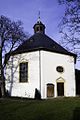
Protestant church

town hall

Monument to the Wingerts contactor

Country inn


Buildings
- The Protestant church was built in 1722 by a Freiburg master builder in the rare shape of a regular octagon . The Uelversheim nickname “die Merkwerdische” goes back to this unusual church.
- Today's half-timbered town hall was built in the Baroque style.
Regular events
Well-known festivals in the village are the Fassenacht with two regularly sold out sessions, the sports week of TSV Uelversheim with the “Traditionsjedermannourier”, the Kerb with its famous kerwee parade and the kerwee youth, as well as the “Keller-Dudde-Fest” organized by the men's choir.
traffic
- The next motorway junction is Wörrstadt on the federal motorway 63 , about 12 kilometers away. In addition, federal highway 420 runs around two kilometers north of the community.
- Uelversheim has a public transport connection to Nierstein , Oppenheim and Wörrstadt via the ORN bus routes 663 and 668 .
Web links
- Internet presence of the local community Uelversheim
- History of Uelversheim at regionalgeschichte.net
- Literature about Uelversheim in the Rhineland-Palatinate state bibliography
Individual evidence
- ↑ State Statistical Office of Rhineland-Palatinate - population status 2019, districts, communities, association communities ( help on this ).
- ^ Announcement concerning the community of Wald-Uelversheim from July 5, 1930 . In: The Hessian Minister of the Interior (Hrsg.): Hessisches Regierungsblatt. 1930 No. 15 , p. 170 ( online at the information system of the Hessian state parliament [PDF; 2.1 MB ]).
- ^ The Regional Returning Officer Rhineland-Palatinate: Local elections 2019, city and municipal council elections. Retrieved July 30, 2019 .
- ^ The Regional Returning Officer Rhineland-Palatinate: Local elections 2019, direct elections. Retrieved July 30, 2019 .
- ↑ a b Heinz Leitermann : The local coat of arms of the community of Uelversheim. In: uelversheim.de. Retrieved December 3, 2017 .

Appenheim | Aspisheim | Bacharach | Badenheim | Bingen am Rhein | Bodenheim | Breitscheid (Hunsrück) | Bubenheim (Rheinhessen) | Budenheim | Dalheim (Rheinhessen) | Dexheim | Dienheim | Dolgesheim | Dorn-Dürkheim | Eimsheim | Engelstadt | Essenheim | Friesenheim (Rheinhessen) | Gau-Algesheim | Gau-Bischofsheim | Gensingen | Grolsheim | Guntersblum | Hahnheim | Harxheim | Hillesheim (Rheinhessen) | Horrweiler | Ingelheim am Rhein | Youth home in Rheinhessen | Klein-Winternheim | Koengernheim | Loerzweiler | Ludwigshöhe | Manubach | Mommenheim (Rheinhessen) | Münster-Sarmsheim | Neck home | Nieder-Hilbersheim | Nieder-Olm | Niederheimbach | Nierstein | Ober-Hilbersheim | Ober-Olm | Oberdiebach | Oberheimbach | Ockenheim | Oppenheim | Sankt Johann (Rheinhessen) | Schwabenheim an der Selz | Selzen | Sörgenloch | Jumpers | Stadecken-Elsheim | Trechtingshausen | Uelversheim | Undenheim | Waldalgesheim | Hamlet near Bingen | Weinolsheim | Welgesheim | Wintersheim | Wolfsheim | Home of Wrath | Zotzenheim