Appenheim
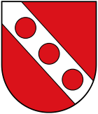
| coat of arms | Germany map | |
|---|---|---|

|
Coordinates: 49 ° 56 ' N , 8 ° 2' E |
|
| Basic data | ||
| State : | Rhineland-Palatinate | |
| County : | Mainz-Bingen | |
| Association municipality : | Gau-Algesheim | |
| Height : | 183 m above sea level NHN | |
| Area : | 6.98 km 2 | |
| Residents: | 1390 (Dec. 31, 2019) | |
| Population density : | 199 inhabitants per km 2 | |
| Postal code : | 55437 | |
| Area code : | 06725 | |
| License plate : | MZ , BIN | |
| Community key : | 07 3 39 001 | |
| LOCODE : | DE 2AT | |
| Association administration address: | Hospitalstrasse 22 55435 Gau-Algesheim |
|
| Website : | ||
| Local Mayor : | Georg Schacht ( SPD ) | |
| Location of the local community Appenheim in the Mainz-Bingen district | ||
Appenheim is a municipality in the Mainz-Bingen district in Rhineland-Palatinate . It belongs to the Gau-Algesheim community .
Geographical location
The wine village is about 12 kilometers southwest of Mainz and is characterized by agriculture. Ingelheim am Rhein is around 5 kilometers north of the municipality. The Welzbach and its tributaries Wethbach and Dünbach flow through the municipality . To the northeast, the Welzbachtal is shielded by the Westerberg .
history
Appenheim was first mentioned in a document in 882 in the golden book of Prüm Abbey . However, the first clear traces of human settlement can be dated to the second or first century BC .
From the 12th century Appenheim belonged to the Electoral Palatinate , from 1311 to 1324 the place was briefly pledged to the Counts of Sponheim, to whom the neighboring community of Ober-Hilbersheim was subordinate. Appenheim was a border town to the Mainz electorate , to which the neighboring Gau-Algesheim belonged. The border location shaped the residents in the following centuries, Appenheim is still colloquially “in the Palatinate”.
In the course of the French occupation, Appenheimers also had to help with the siege of Mainz in 1793. In 1797, centuries of membership in the Electoral Palatinate ended. Like Gau-Algesheim, the place became part of the canton of Oberingelheim in the Donnersberg department , which covered the area between Bingen am Rhein and Speyer . After the French withdrew in 1814, Appenheim was assigned to the Grand Duchy of Hesse-Darmstadt , which added the canton of Oberingelheim to the new district of Bingen in 1835 . Economically, the first decades of the 19th century meant an upswing for the community, especially in the agricultural sector. Due to the subsequent increase in population, however, more and more Appenheimers found no work in domestic agriculture and often emigrated to the United States . The population decreased from 865 in 1834 to 833 inhabitants in 1858.
As a result of the First World War , Appenheim received numerous refugees from Mainz and other nearby cities from 1917 onwards. A total of 19 people from Appenheim died as a result of the war, including eight fallen soldiers. After the First World War, the community came under French occupation again. According to research by a citizen of Appenheim, the DDP and DVP received the most votes in elections in the 1920s .
From 1930 the NSDAP grew rapidly. From 1942 Jews from Appenheim were deported to the Theresienstadt concentration camp. The Second World War was also felt in the community from 1942. On March 20, 1945, Allied troops marched into Appenheim.
After the end of the war, Appenheim was assigned to the state of Rhineland-Palatinate. The district of Bingen was dissolved in 1969, Appenheim and a large part of the former district are now part of the Mainz-Bingen district.
politics
Municipal council
The municipal council in Appenheim consists of 16 council members, who were elected in a personalized proportional representation in the local elections on May 26, 2019 , and the honorary local mayor as chairman.
The distribution of seats in the municipal council:
| choice | SPD | CDU | FDP | AIG | total |
|---|---|---|---|---|---|
| 2019 | 9 | 5 | 2 | - | 16 seats |
| 2014 | 7th | 7th | 2 | - | 16 seats |
| 2009 | 6th | 5 | 1 | 4th | 16 seats |
| 2004 | 5 | 7th | 1 | 3 | 16 seats |
mayor
Georg Schacht (SPD) has been the local mayor since 2014. In the local elections on May 26, 2019, he was confirmed in his office with 66.95% of the votes.
Community partnerships
Partner communities are Apfelstädt in Thuringia and Marano di Valpolicella in the province of Verona.
Regular events
The Appenheimer curb always takes place at the beginning of June.
Economy and Infrastructure
traffic
The village is crossed by the L 415 . The A 60 and A 63 can be reached by car in 10 to 20 minutes. Bus connections are operated by DB Regio Bus Mitte and lead to the nearby train stations Gau-Algesheim (8 minutes travel time) and Ingelheim (18 minutes travel time) on the left Rhine route .
Educational institutions
- The community kindergarten and the Welzbachtal elementary school.
particularities
The Appenheimer Hundertgulden vineyard on the slopes of the Westerberg is advertised as having the highest carbonate content of all German vineyards.
Personalities
Sons and daughters of the church
- Johann Horn (approx. 1770–1800), Palatinate-Bavarian sergeant, knight of the Bavarian Medal of Bravery
- Esther Knewitz († 2004), Rheinhessische Weinkönigin 2001/2002, German wine princess 2002/2003
Connected to Appenheim
- Johann Konrad Schiede (1760–1826) was a pastor, late enlightener and author of trivial novels
- Stefan Kainath (* 1964), two-time karate world champion and national trainer, has lived in Appenheim since 2006
See also
literature
- Literature about Appenheim in the Rhineland-Palatinate state bibliography
Web links
- Internet presence of the local community Appenheim
- Historical information about Appenheim at regionalgeschichte.net
Individual evidence
- ↑ State Statistical Office of Rhineland-Palatinate - population status 2019, districts, communities, association communities ( help on this ).
- ↑ LANIS. Retrieved March 30, 2020 .
- ↑ Historical information on Appenheim, section Early traces of settlement , appenheim.de
- ↑ Historical information on Appenheim, section From Wormsgau to Kurpfalz , appenheim.de
- ↑ Historical information on Appenheim, section Die Franzosenzeit , appenheim.de
- ^ Historical information on Appenheim, section Appenheim in the 19th century , appenheim.de
- ↑ a b Historical information on Appenheim, section From the First to the Second World War , appenheim.de
- ^ The Regional Returning Officer Rhineland-Palatinate: Local elections 2019, city and municipal council elections
- ↑ Schacht is candidate for local mayor for Appenheim
- ↑ The regional returning officer RLP: direct elections 2019. see Gau-Algesheim, Verbandsgemeinde, first line of results. Retrieved September 28, 2019 .
- ↑ Appenheim local community: partner communities. Retrieved March 6, 2020 .
- ^ Rheinhessen.de: Weinlage Hundertgulden. Rheinhessen-Touristik GmbH, Rheinhessen Marketing eV and Rheinhessenwein eV (jointly), accessed on March 6, 2020 .
- ^ Rhein-Zeitung: Former Wine Queen died in an accident. May 25, 2004, accessed March 6, 2020 .


