
Apfelstädt (Nesse-Apfelstädt)
|
Apple Town
Rural community of Nesse-Apfelstädt
|
|
|---|---|
 |
|
| Height : | 251 m above sea level NN |
| Area : | 12.16 km² |
| Residents : | 1385 (December 1, 2009) |
| Population density : | 114 inhabitants / km² |
| Incorporation : | December 1, 2009 |
| Postal code : | 99192 |
| Area code : | 036202 |
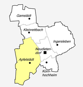  Location of Apfelstädt in Nesse-Apfelstädt
|
|
 View of the town from the south with the striking tower of the St. Walpurgis Church
|
|
Apfelstädt is a district of the rural community Nesse-Apfelstädt in the Thuringian district of Gotha .
Geographical location

Apfelstädt is located in the Thuringian Basin north of the Thuringian Forest in the area of the Drei Gleichen . The local area borders in the east on Neudietendorf and Kornhochheim , in the south on Sülzenbrücken , in the west on Wandersleben and in the north on Großrettbach . The river of the same name flows past the northern edge of the village .
history
In August 2005, in connection with the construction of a natural gas pipeline, the cemetery of Apfelstädt with grave goods such as gold jewelry for a dignitary from the late Neolithic period was found. This first gold jewelry find (hair or curly rings) from this time in Central Germany documents the early settlement of the area around Apfelstädt.
Apfelstädt was first mentioned in a document in a deed of donation from Charlemagne to the monastery of Hersfeld dated October 25, 775, issued in Düren as Aplast . This place name is derived from the Germanic Aplasta or Aplosta to Indo-European apelo = "force" and has nothing to do with today's "apple". The river name was originally Aphiliste , which means "water". These two different spellings were combined in the 14th century to form the uniform spelling "Apfelstädt". In an official seal known to this day, the apple is included as a symbol for apple city. For this reason, the apple was also included in the coat of arms.
In 1450 the village was burned down by the troops of Elector Friedrich II during the Saxon Civil War . In 1655 half of the village fell victim to a fire. The place belonged to the Amt Wachsenburg , which in 1640 became part of the Duchy of Saxony-Gotha , from 1672 to the Duchy of Saxony-Gotha-Altenburg and in 1826 to the Duchy of Saxony-Coburg and Gotha .
At the end of the Second World War , civilian casualties were mourned during American artillery bombardment on the night of April 8th to 9th, 1945. The communal grave of three fallen German soldiers can be found in the local cemetery; also the grave of a family of four who died unnaturally on April 15, 1945 - one week after Apfelstädt was occupied.
Since December 1, 2009, Apfelstädt has been part of the newly founded municipality of Nesse-Apfelstädt.
coat of arms
Blazon : “Divided diagonally by a silver wavy band; above in blue a golden apple with two golden leaves, below in red a golden pointed tower. ”The depiction of the tower stands for the tower of the former St. Mary's Church.
Attractions
St. Walpurgis Church
(→ Main article: Walpurgis Church )
The Walpurgis Church is visible from afar due to the height of its tower. Its origins date back to the 11th century and have interesting architectural features. In the years after 1992 the church and rectory ensemble were extensively restored. The parsonage's barn and stable house a permanent exhibition on the local history, in which the rural way of life and the history of schooling and baking are documented.
Tower of the former St. Mary's Church

The Romanesque tower is located in Hainstrasse and has been part of a school building since the end of the 19th century. The Marienkirche, probably from 1396, was a branch church, was later used as a malt and kiln house and then demolished except for the tower. In 1992 the tower was renovated. In the following years an exhibition on the rural way of life was also set up there.
More Attractions
Mills in Apfelstädt


The oldest reliable mention of a mill ditch in Apfelstädt goes back to 1346. In a dispute between the Georgenthal monastery, which is known to have owned the village as early as 1215, and the village over fishing and pasture use, an arbitration award stipulated that fishing was reserved for the monastery and that nobody was allowed to fish between the stone bridge at Mönchhof (in Wandersleben) and Place where the mill ditch was derived. The Mühlgraben branches off to the right from the Apfelstädt and begins roughly at the height of today's western industrial area. In the inventory of the Georgenthal monastery, three mills in Apfelstädt were listed in the 14th century. Also Galletti mentioned in 1780 two mills in Apfelstädt: the oil and the flour mill . The constant quarrels between there and the monastery were settled in 1484 by a settlement. The mills in Apfelstädt were owned by the municipality in the 17th century and were leased annually for a corresponding payment. Part of the rent was given to the poor in exchange for certificates from the community. This made the public benefit of the mill ownership clear. The prices for the grinding services were also set.
- The oil and pearl mill is in Kastanienweg, today's address Birkenallee 1. It is the top mill in Apfelstädt today. When this mill was to be auctioned in 1825, there were three applicants, which shows that mills could be operated economically at that time and were worthwhile objects. The mill was owned by the family for several generations, Richard Nitsch was the last oil miller who ran the mill until 1910 and ran a trading business in the mill until 1930. The mill had an "enclosed" undershot mill wheel , which can be derived from the layout of the mill ditch and the still existing mill building.
- Chronology of the mill:
- 1346–1485: repeatedly mentioned as property of the Georgenthal monastery
- 1583: Martin Kritzmann sells the mill to the community
- 1639: The oil mill is owned by the municipality; the parish book shows that the community has to give 7 guilders and 5 groschen to the church.
- 1657: Operation as an oil mill owned by the municipality; Ölmüller was Günther Kästner from 1657 to 1691.
- 1691–1699: Lease miller Joachim Hartung
- 1699–1706: Lease miller Hans Heinrich Urban
- 1706–1712: Lease miller Joachim Hartung
- 1800: The oil and barley mill is owned by the municipality, the last lease oil miller Georg Nikolaus Möller from Mühlberg.
- 1815: privatization; Johann Andreas Eberley buys the mill from the community for 1055 thalers.
- 1825: Johann Georg Bischof leases the Eberley mill and purchases it in the following years.
- 1836: Ernst Friedrich Nitsch
- 1873: Friedrich Wilhelm Nitsch represents his father when measuring the safety stake at the weir of the oil mill.
- 1878: Wilhelm Nitsch is the mill owner
- 1910: The oil mill operation ends with the last mill owner Richard Nitsch.
- The grinding mill or village mill is in the center of the village, today's address is Mühlgasse 4. The mill was destroyed in the great fire in 1655, but a few years later it was rebuilt as a community property. The oldest lease contract dates from 1665 with Magdalena Seeländer, widow of the 1664 " local miller " Heinrich Seeländer. Already in 1665 she married the mill servant Joachim Ritter because of the physically difficult work in the miller's trade. In 1872 the mill was sold due to financial problems - the repair costs exceeded the rental income. The new buyer handed the mill over to his daughter and her husband Julius Reich. The management continued as a family business. Julius Reich, the family's successor, modernized the mill in the 1920s. The company Seck from Dresden, which specializes in mill technology, installed new machines that were driven by two overshot water wheels until the mid-1950s . Originally made of wood, they were later replaced by metal wheels. Since the 1930s, a diesel engine was also used when the water was low. From the mid-1950s onwards, the company switched completely to electrical operation. The Reich family handed the property over from generation to generation and ceased regular milling operations in 1960. The miller Felix Reich and his son Gerd-Rüdiger worked for the LPG Apfelstädt since 1960 and produced grist until 1990. The machinery necessary for the production of shotguns still exists today.
- Chronology of the mill:
- 1346: First mentioned as a property of the Georgenthal monastery
- 1635: The miller Nicol Fischer from Arnstadt owns the mill.
- 1638–1651: Claus Roth from Arnstadt is the owner of the mill, he calls himself "Günthersmüller".
- 1651: The community becomes the new owner of the mill for 1400 guilders.
- 1655: The mill is destroyed in the great fire.
- 1664: After rebuilding, the mill becomes the property of the municipality, Heinrich Seeländer becomes the mill leaseholder.
- 1665: After Heinrich's death, his widow Magdalena becomes Pachtmüllerin, who marries Mühlknecht Joachim Ritter in the same year.
- 1758–1872: The mill is owned by the municipality and is managed by various tenants.
- 1872: The mill is sold to Johann Christian Heinrich Feistel, who hands it over to his daughter Agnes and her husband Julius Reich. Thus the mill will be continued as a family business.
- 1905–1940: Under Louis Reich, grinding technology was modernized in the 1920s and a new diesel unit was purchased.
- 1940–1970: Felix Reich is a miller.
- 1960: The regular milling operation for flour production is discontinued. The mill is converted to grist production.
- 1970–1990: Gerd-Rüdiger Reich is the last miller in Apfelstädt.
Stone crosses

- The medieval stone cross at the western end of the village in the direction of Wandersleben. The information board on the stone cross reports that it was erected between 1400 and 1450 to commemorate a person who was killed or killed at this point. Since 1657 it has been traceable in land maps ("am Creuchte"). A local legend says that the apple townspeople killed and buried a Danish colonel here. Hence the name "Schwedenkreuz". Another popular oral tradition tells of an injured carter. The location and orientation of the cross indicate the course of the old trade route coming from Erfurt, which headed from here directly to the Freudenthal Fuhrmannsgasthof .

- The stone cross from the 19th century on the bike path towards Sülzenbrücken . This was built on March 23, 1898 by Erfurt pensioner Seitz in memory of his 18-year-old son, who had an accident here on June 27, 1897 "while on a corso ride by local and foreign cyclists" and died one day later in Erfurt. The stone cross was about twice as high until it was damaged in 1970 and had to be erected several times over the years. Its shape is unique in Thuringia, as the information board reports. The “Erfurt Stone Cross” in Kleinrettbach , however, has a similar shape, with less pronounced tapering towards the center of the cross . However, the local cross is much smaller (today) with a visible height of around 60 cm. Seitz combined the erection of the cross with a foundation for the benefit of needy residents in Apfelstädt.
economy
For centuries, Apfelstädt was shaped by agriculture, which found fertile soil in the Thuringian Basin.
With its location near the Erfurt motorway junction ( A 4 and A 71 ) or through a spur road to the Neudietendorf junction of the A 4 built in the 1990s, a large location of the logistics group Fiege settled here . The Hotel Park Inn Erfurt-Apfelstädt , which opened around the same time and has almost 100 rooms, is related to this. ( Location → )
societies
- Volunteer firefighter
- Sports club Eintracht Apfelstädt eV
- Apfelstädter Carneval Club eV
- Apfelstädter Jugendkirmesgesellschaft eV
- Poultry club
- Allotment Association
- Seniorenclub eV
- Apfelstädter Traditions-Männerverein eV
- Apfelstädter Schützenverein 1994 eV
- Equestrian Club
Personalities
- Eduard Fiedler (born May 14, 1871 in Apfelstädt, † June 25, 1931 in Galtür / Austria), teacher (in Manebach, Gotha and Berlin), known as a painter of wall paintings, portraits and postcards with Thuringian references, especially to Wachsenburg
- Christian Friedrich Gotthard Westfeld (born June 2, 1746 in Apfelstädt, † March 23, 1823 in Weende), monastery administrator and author
literature
- Klaus-Jürgen Fiedler: Excerpts from the extensive collection of sources, the drafts and pictures of the painter Ernst Louis Eduard Fiedler, for a chronicle of Apfelstädt, ancestral home of the Fiedler family since 1625 . Compiled by Eduard Fiedler's grandson on the occasion of the 1225th anniversary of Apfelstädt in 2000. Berlin, 1999.
Individual evidence
- ↑ Hartmut Ulle: New Thuringian Wappenbuch , Volume 3, ed. Working Group Genealogy Thuringia eV, 1998, ISBN 3-9804487-3-8
- ^ Galetti: History and Description of the Duchy of Gotha , 1780; however, this mentions the year 1652.
- ↑ Horst Benneckenstein: Planned attack in the Brothers' inn . Thuringian newspaper, May 8, 2009
- ↑ StBA: Area changes from January 2nd to December 31st, 2009
- ↑ Prof. Dr. P. Rehfeldt: Architectural and Art Monuments of Thuringia , Booklet VIII., 1891, p. 6
Web links
- Location information on Apfelstädt and the other municipalities of the administrative community (private homepage)
- Private website about Apfelstädt