
Schwabenheim an der Selz
| coat of arms | Germany map | |
|---|---|---|

|
Coordinates: 49 ° 56 ' N , 8 ° 6' E |
|
| Basic data | ||
| State : | Rhineland-Palatinate | |
| County : | Mainz-Bingen | |
| Association municipality : | Gau-Algesheim | |
| Height : | 140 m above sea level NHN | |
| Area : | 9.49 km 2 | |
| Residents: | 2569 (Dec. 31, 2019) | |
| Population density : | 271 inhabitants per km 2 | |
| Postal code : | 55270 | |
| Area code : | 06130 | |
| License plate : | MZ , BIN | |
| Community key : | 07 3 39 051 | |
| Association administration address: | Hospitalstrasse 22 55435 Gau-Algesheim |
|
| Website : | ||
| Local Mayor : | Frank Heinrich ( CDU ) | |
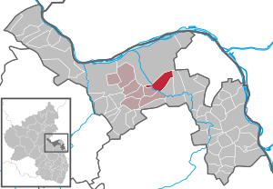
| Location of the local community Schwabenheim an der Selz in the Mainz-Bingen district | ||
  |
||

Schwabenheim an der Selz is a municipality in Rheinhessen, south of Ingelheim am Rhein in the Selz valley. It belongs to the Gau-Algesheim community .
geography
Geographical location
Schwabenheim is located in the lower Selz Valley on the slope of the Mainz Mountain , on the eastern bank of the Selz. The center of Schwabenheim lies at the end of a side valley with the Sauerbach. The community is about 15 km (as the crow flies ) southwest of the state capital Mainz (city center).
The Bacchushof residential area also belongs to Schwabenheim .
Neighboring communities
In a clockwise direction, starting in the north, the town of Ingelheim am Rhein with the districts Großwinternheim and Wackernheim , the local communities Essenheim , Stadecken-Elsheim , Engelstadt and Bubenheim border on Schwabenheim.
geology
Geologically, Schwabenheim is located in the Mainz Basin . It is located in the Rheinhessisches Tafel- und Hügelland (227) natural area in the Lower Selztal subunit (227.20). Most of the soils are loess , on the ascent to the Mainzer Berg there is also limestone with clay-marly inclusions (so-called Kalktertiary). About 80% of the district is used for agriculture.
history
Archaeological finds indicate an early settlement from around 600 BC as well as the later presence of Roman settlements.
Schwabenheim is possibly first mentioned in the year 766 as Suaboheim in the Lorsch Codex . However , it cannot be determined whether this refers to this or the Pfaffen-Schwabenheim near Bad Kreuznach . A Suaboheim in Wormsgau also appears in Fulda documents . In 962, Emperor Otto I confirmed the rights and possessions of the St. Maximin Abbey near Trier over various Rhine-Hessian towns, including "Suaveheim". Another mention can be found in 1280 by the Roman-German King Rudolf von Habsburg .
In terms of sovereignty, Schwabenheim belonged as a direct imperial village to Ingelheimer Grund , which was responsible for supplying the imperial palace. As part of the Ingelheimer Grund , Schwabenheim had its own local court, which was filled with the local school authority and eight lay judges .
As a result, Schwabenheim is pledged several times. The first pledge was made by Ludwig the Bavarian in 1315 to the Archbishop of Mainz, Peter von Aspelt . This pledge lasted until December 10, 1353. As early as 1367 it was pledged to the Electoral Palatinate for a loan of 11,000 guilders to finance a trip to Rome . As a result, the place had numerous owners through pledges, such as the Electorate of Mainz , the City of Mainz and finally, from 1375, the Elector of the Palatinate . The direct subordination to the emperor's power, which was very much desired, is still expressed today in the coat of arms, which shows the double-headed imperial eagle. Formally accepted into the circle of the imperial villages that no serfdom and compulsory labor were subject and state where free hunting and fishing, Schwabenheim was not until 1443. 1507 came Schwabenheim, after repeated re-pledging and redemption, a thing of the Palatinate, Oberamt Oppenheim , where up stayed for the French Revolution.

Supported by the Electors of the Palatinate, the Reformation was also introduced in Schwabenheim in 1556. After that, the parish changed its denomination nine times and was headed by Lutheran, Reformed and Catholic priests before it was divided into the Reformed and Catholic Church in 1705 when the Palatinate church was divided into two. The Benedictine monks of the St. Maximin Monastery in Trier took over pastoral care in the Schwabenheim parish in 1693 and directed it from the provost until 1708. From the 16th century onwards, there was evidence of a Jewish population in Schwabenheim, which existed until 1921 with the sale of the Schwabenheim synagogue at Bachstrasse 4 and the dissolution of the Jewish community.
The Thirty Years' War also left its cruel traces in Schwabenheim.
The arrival of the French revolutionary troops formed a turning point in local history . After an initial occupation in 1792, the Schwabenheim area received a devastating blow in 1796 when the place was set on fire. From 1798 to 1814, Schwabenheim, like the entire area on the left bank of the Rhine, belonged to the French Republic and the Napoleonic Empire . The place was assigned to the canton of Oberingelheim in the Département du Mont-Tonnerre . During this time, the first factory in Schwabenheim, a sugar factory, was set up, but - just like the vinegar factory, a glass and a rubber and celluloid factory - ceased operations again. In 1904, the Süddeutsche Eisenbahn-Gesellschaft connected it to the Selztalbahn , which was shut down in 1955.
From 1816 to 1945 Schwabenheim in the Grand Duchy of Hesse belonged to the province of Rheinhessen . At the beginning of the 20th century, the construction of the Selz Valley position to defend the fortress city of Mainz began , and military installations were also built on the Schwabenheim district, such as the water reservoir in the Schwabenheim forest. The Selztal position did not play an active role in the First World War and then lost its importance. The Second World War ended in Schwabenheim on March 20, 1945 with the entry of American troops, after which it was part of the French occupation zone .
In the post-war period, Schwabenheim became part of the state of Rhineland-Palatinate and the administrative district of Rheinhessen . With the functional and territorial reform in 1972, Schwabenheim became part of the Gau-Algesheim association . In the course of the economic development of the Rhine-Main area and the closer commuter ties, Schwabenheim developed from an agricultural community to a residential community with many out- commuters . Schwabenheim has been a recognized village renewal community since 1987 and was recognized in 2015 as a focus of investment and measures for village renewal in the state of Rhineland-Palatinate.
Origin of the place name
Schwabenheim has changed its name several times over the years. In the Lorsch Codex , the place was probably listed as Suaboheim, meaning "home or settlement of Suabo". At this first mention it is unclear whether it is Schwabenheim or the nearby Pfaffen-Schwabenheim . Only from the 11th century are there documents that clearly refer to Schwabenheim. As early as the 15th century, the place name was preceded by the prefix "Sur" ("Sauer") with reference to the stream of the same name to distinguish it from Pfaffen-Schwabenheim. After the name was set to "Sauberschwabenheim" in 1747, the name "Sauerschwabenheim" became official in 1797. An amendment by the municipal council from 1885 to change the name back to Sauberschwabenheim was unsuccessful. However, 20 years later the name was changed to Schwabenheim an der Selz with the approval of the Grand Ducal Ministry of the Interior. Today the name "Sauerschwabenheim" is still often used jokingly to discredit the quality of the wine produced in and around the place.
The place was mentioned under the following names:
- 766 - Suaboheim (unsure)
- 1023 - Suabheim
- 1051 - Suaveheim
- 1140 - Suapeheim
- 1200 - Suosabenheim
- 1328 - Suabeheim
- 1339 - Swabeheim
- 1419 - Surswabeheim
- 1424 - Schwabneheim
- 1502 - Surschwabenheim , Sauer Schwabenheim
- 1747 - Sauberschwabenheim
- 1797 - Sauerschwabenheim
- 1905 - From this year the place is called Schwabenheim an der Selz .
Population development
The values from 1871 to 1987 are based on censuses.

|
|
politics

Municipal council
The municipal council in Schwabenheim consists of 20 council members, who were elected in a personalized proportional representation in the local elections on May 26, 2019 , and the honorary local mayor as chairman. The strongest party in terms of votes was the CDU with 32.1%, followed by the voter groups WG Freudenberger with 28.0%, FWG with 24.4% and WiPRO with 15.4%.
The distribution of seats in the municipal council:
| choice | CDU | FWG | WGF | WIPRO | total |
|---|---|---|---|---|---|
| 2019 | 6th | 5 | 6th | 3 | 20 seats |
| 2014 | 3 | 5 | 9 | 3 | 20 seats |
| 2009 | 3 | 4th | 6th | 3 | 16 seats |
| 2004 | 4th | 5 | 8th | 3 | 20 seats |
- FWG = Free Voting Group Schwabenheim e. V.
- WGF = Voting Group Freudenberger e. V., until 2019 voter group Merz
- WIPRO = voter initiative PRO Schwabenheim e. V.
mayor
Frank Heinrich (CDU) has been the local mayor of Schwabenheim since July 1, 2019. He thus succeeded Peter Merz, who held this office from 1994 to 2019 and did not take up any more.
Constituencies
In federal elections, Schwabenheim belongs to constituency 206 Mainz , which includes Mainz and the western area of the Mainz-Bingen district. At the state level, Schwabenheim belongs to the constituency 29 Bingen am Rhein .
coat of arms
|
|
Blazon : "Heraldic shield split by gold and black, inside the red-tongued and armored double imperial eagle ." |
| Justification of the coat of arms: The motif of the double-headed eagle, which can be seen on today's coat of arms, goes back to a court seal from the 15th century and a community seal from 1531. These both represent a one-headed eagle in the seal ground. The eagle shows that Schwabenheim, then still called Sauer-Schwabenheim, belonged to the imperial villages of Ingelheimer Grund, which fell to the Electoral Palatinate in 1407. Since 1761 the double-headed imperial eagle could be detected in the seal. Due to the takeover of Schwabenheim by the Grand Duchy of Hesse in 1816, as well as the seizure of power by the National Socialists in 1933, the coat of arms of the Schwabenheimers was changed several times. After the Second World War, the Palatinate coat of arms was first introduced. They were not satisfied with the new flagship. There was unanimous opinion that the imperial eagle should be included in the coat of arms again. At the suggestion of two Wiesbaden state archivists, a shield split in gold and black with a double-headed red-armored eagle in "confused" colors was proposed for approval as the Schwabenheim coat of arms and finally approved in the same year. |
- Previous coats of arms
The oldest coat of arms of the place carried the imperial eagle in gold. In 1742 it was replaced by the coat of arms of Elector Karl Philipp von der Pfalz. The double-headed eagle has been attested in the city's seal since 1761.
Community partnerships
- Chambolle-Musigny , Burgundy , since 1966
- Schmerbach , Thuringia , since 1991
- Minerbe , Italy , since 2001
Culture and sights
Buildings

Around the market square with its old market fountain there are stately properties from the 18th century. There is the baroque town hall from 1742 with an arcade hall and the Evangelical Church from 1844 with its minaret-like tower. The interior of the church was painted in Art Nouveau style in 1911.
The old Catholic Iro-Schotten- Church St. Bartholomäus is one of the oldest village churches in Rheinhessen. It shows the Romanesque lintel from the time of origin, which is adorned with two birds of paradise each with a fish, the symbol of Christ, in its beak. The church was part of the former Schwabenheimer Benedictine provostry, in which monks from the imperial monastery of St. Maximin / Trier worked from 1693 to 1807. The baroque main house from 1709 and a late baroque garden pavilion in the monastery garden still exist today from the provost's office. The Viergötterstein from Roman times is also located here.
The old town center is still preserved in the typical regional structure, with numerous Franconian house and courtyard systems in different forms. From 1891 to 1909, the private higher education institution was housed at Mainzer Straße 2, which served as preparation for attending grammar school. The fire-fighting equipment house built in 1896 is also characteristic of the townscape.
Green spaces and recreation
Northeast of the village lies the conservation area peacocks reason , also located around the Selz protected habitats.
Economy and Infrastructure
economy
Agriculture
Schwabenheim is strongly characterized by agriculture . As in all of Rheinhessen, viticulture dominates with a cultivated area of 180 hectares . In the large Kaiserpfalz location , the town has a share in the Klostergarten , Schlossberg and Sonnenberg locations . Around 25 companies selling bottled wine produce wines of all quality levels. In addition to the standard varieties Silvaner and Müller-Thurgau , new breeds such as Scheurebe , Faber , Bacchus, Kerner and others are also available. a. cultivated. About 30% of the planted area is used for red wine varieties - mainly Blauer Portugieser and Pinot Noir. The cultivation of almost all pome and stone fruit varieties as well as asparagus loosens the image of this fertile hilly landscape.
As part of the structural change, the number of farms decreased from 130 in 1971 to 32 (2010).
Established businesses
MSD Animal Health Innovation GmbH (formerly Intervet Innovation GmbH), a subsidiary of Merck & Co., Inc. , has set up shop on an old monastery site ( Propstei ) . MSD Animal Health operates a global research and development center there for veterinary drugs with a focus on anti-infectives and anti-parasitic drugs and employs 230 people in Schwabenheim.
Otherwise, the economic structure is characterized by small and medium-sized businesses and shops for everyday needs.
tourism
Schwabenheim has around 11,000 overnight stays / year (2013). Schwabenheim has numerous inns for the size of the town.
traffic
The place is crossed by the state road 428. The federal highways 60 and 63 can be reached by car in 10 to 20 minutes.
The Omnibusverkehr Rhein-Nahe GmbH (ORN) operates three bus lines that connect the Schwabenheim to the surrounding communities and cities:
- Line 75: Ingelheim am Rhein - Schwabenheim - Stadecken-Elsheim - Nieder-Olm Selztalcenter - Essenheim - Mainz ZDF - University - Central Station
- Line 640: Ingelheim - Schwabenheim - Stadecken-Elsheim - Nieder-Olm Selztalcenter - train station - school center (RegioLinie)
- Line 643: Ingelheim - Gau-Algesheim - Ober-Hilbersheim - Engelstadt - Schwabenheim - Ingelheim (ring traffic)
Schwabenheim was formerly connected to the railway network with the "Zuckerlottchen" , the line was shut down in the 1950s and then dismantled.
education
Schwabenheim has a primary school and a kindergarten.
Personalities
Sons and daughters of the church
- Christoph Nebel (1690–1769), Auxiliary Bishop of Mainz, Dean of St. Stephan Abbey (Mainz)
- Philipp Baum (1849–1886), architect
- Heinrich Krebs (1910–2001), federal judge at the Federal Social Court
People in connection with Schwabenheim
- Simone Renth-Queins , 1998/1999 Rheinhessische Weinkönigin and one year later the 51st German Wine Queen
See also
literature
- Literature about Schwabenheim an der Selz in the Rhineland-Palatinate state bibliography
Web links
Individual evidence
- ↑ State Statistical Office of Rhineland-Palatinate - population status 2019, districts, communities, association communities ( help on this ).
- ↑ State Statistical Office Rhineland-Palatinate (ed.): Official directory of the municipalities and parts of the municipality. Status: January 2019 [ Version 2020 is available. ] . S. 168 (PDF; 3 MB).
- ↑ Geological overview map of the State Office for Geology and Mining of the State of Rhineland-Palatinate
- ↑ a b c d e State Statistical Office Rhineland-Palatinate: Regional data .
- ↑ Karl Josef Minst [transl.]: Lorscher Codex (Volume 3), Certificate 1917, November 5, 755 - Reg. 1237. In: Heidelberg historical stocks - digital. Heidelberg University Library, p. 341 ff. , Accessed on March 15, 2016 .
- ↑ Link to alemannia-judaica
- ^ Machines shown at the World Exhibition of 1851: travaux de la Commission
- ^ R. Büllesbach, H. Hollich, E. Tautenhahn: Bollwerk Mainz: The Selzstellung in Rheinhessen . 2nd Edition. Munich 2014, ISBN 978-3-943915-04-4 , pp. 214 ff .
- ^ Village renewal: Recognition of investment and measure priorities in 2015; Reasons for the new focus communities to be recognized ( page no longer available , search in web archives ) Info: The link was automatically marked as defective. Please check the link according to the instructions and then remove this notice. ; Ministry of the Interior, Sport and Infrastructure of the State of Rhineland-Palatinate
- ↑ Schwabenheim an der Selz at Regionalgeschichte.net, accessed on July 6, 2015
- ↑ Auflassbuch (also Ufgiftbuch ) in the City Archives Ingelheim, Fol. 210 f.
- ↑ Election results in the Gau-Algesheim community in 2019
- ^ The Regional Returning Officer RLP: direct elections 2019. see Gau-Algesheim, Verbandsgemeinde, eighth result line. Retrieved September 28, 2019 .

Appenheim | Aspisheim | Bacharach | Badenheim | Bingen am Rhein | Bodenheim | Breitscheid (Hunsrück) | Bubenheim (Rheinhessen) | Budenheim | Dalheim (Rheinhessen) | Dexheim | Dienheim | Dolgesheim | Dorn-Dürkheim | Eimsheim | Engelstadt | Essenheim | Friesenheim (Rheinhessen) | Gau-Algesheim | Gau-Bischofsheim | Gensingen | Grolsheim | Guntersblum | Hahnheim | Harxheim | Hillesheim (Rheinhessen) | Horrweiler | Ingelheim am Rhein | Youth home in Rheinhessen | Klein-Winternheim | Koengernheim | Loerzweiler | Ludwigshöhe | Manubach | Mommenheim (Rheinhessen) | Münster-Sarmsheim | Neck home | Nieder-Hilbersheim | Nieder-Olm | Niederheimbach | Nierstein | Ober-Hilbersheim | Ober-Olm | Oberdiebach | Oberheimbach | Ockenheim | Oppenheim | Sankt Johann (Rheinhessen) | Schwabenheim an der Selz | Selzen | Sörgenloch | Jumpers | Stadecken-Elsheim | Trechtingshausen | Uelversheim | Undenheim | Waldalgesheim | Hamlet near Bingen | Weinolsheim | Welgesheim | Wintersheim | Wolfsheim | Home of Wrath | Zotzenheim