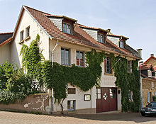
Horrweiler
| coat of arms | Germany map | |
|---|---|---|

|
Coordinates: 49 ° 54 ' N , 7 ° 58' E |
|
| Basic data | ||
| State : | Rhineland-Palatinate | |
| County : | Mainz-Bingen | |
| Association municipality : | Sprendlingen-Gensingen | |
| Height : | 135 m above sea level NHN | |
| Area : | 4.39 km 2 | |
| Residents: | 782 (Dec. 31, 2019) | |
| Population density : | 178 inhabitants per km 2 | |
| Postal code : | 55457 | |
| Area code : | 06727 | |
| License plate : | MZ , BIN | |
| Community key : | 07 3 39 029 | |
| LOCODE : | DE HRW | |
| Association administration address: | Elisabethenstrasse 1 55576 Sprendlingen |
|
| Website : | ||
| Local Mayor : | Eckhard Siegfried | |
| Location of the local community Horrweiler in the Mainz-Bingen district | ||
Horrweiler is a municipality in the Mainz-Bingen district in Rhineland-Palatinate . It belongs to the Verbandsgemeinde Sprendlingen-Gensingen , which has its administrative seat in the municipality of Sprendlingen .
geography
Horrweiler is located in Rheinhessen between Mainz and Bad Kreuznach . The Sonnenhof residential area also belongs to Horrweiler .
history
Horrweiler was in Salian in the 12th century , then came into possession of the Palatinate and was affiliated as an after-fief to the Stromberg office, where it remained until the French Revolution . The tithe and the right of patronage over the church originally belonged to the Counts of Leiningen , who passed it on to members of the lower nobility. Because of frequent disputes, arbitrations were repeatedly required. From 1518 to 1802 the St. Petersstift in Mainz in Horrweiler had the right to tithe with the original right to appoint the local pastor. In fact, as a result of the Reformation , the tithe was divided: 2/3 for the Petersstift and 1/3 for the Reformed pastor in Horrweiler. In the wisdoms of 1410 and 1552, Horrweiler is listed among the villages that had to contribute to the maintenance of the walls of the city of Bingen and their defense in the event of war. Its residents enjoyed special rights in the city of Bingen. The region was assigned to the Département du Mont-Tonnerre (Donnersberg) in 1798 . Horrweiler belonged to the canton of Oberingelheim until 1814 . Due to the agreements at the Congress of Vienna (1815), the area was assigned to the Grand Duchy of Hesse and the Province of Rheinhessen in 1816. Affiliation with Hesse ended with the establishment of the French occupation zone in 1945 and the formation of the state of Rhineland-Palatinate .
An important relic of history is, in addition to the remains of the old ramparts with effen ( elms ), the formerly fortified church, a late Gothic hall building with a choir closed on three sides and the wall ring with the gate tower, which may still be late Gothic and baroque, which also serves as a bell tower. From community files it is clear that around 1840 the wall was partially dismantled and the defensive towers were completely dismantled except for the remaining ones. The stones were used to build the school house.
- Population development
The development of the population of Horrweiler, the values from 1871 to 1987 are based on censuses:
|
|
politics
Municipal council
The local council in Horrweiler consists of twelve council members, who were elected in the local elections on May 26, 2019 in a personalized proportional representation, and the honorary local mayor as chairman.
The distribution of seats in the municipal council:
| choice | SPD | WGH | HBL | total |
|---|---|---|---|---|
| 2019 | - | 4th | 8th | 12 seats |
| 2014 | - | 4th | 8th | 12 seats |
| 2009 | 7th | 5 | - | 12 seats |
| 2004 | 7th | 5 | - | 12 seats |
- WGH = voter group Horrweiler e. V.
- HBL = Horrweiler Citizens List e. V.
mayor
Eckhard Siegfried was re-confirmed as local mayor on May 26, 2019 with 79.74 percent of the vote.
Culture and sights
Museums
In the Wine Village Museum there are numerous exhibits that document former life as well as the way to the wine village.
music
The Horrweiler Trombone Choir was founded in April 1927. Today he plays both church and secular music. The Friends of the Posaunenchor Horrweiler e. V. supports the choir financially and ideally.
Economy and Infrastructure
traffic
- The municipality is crossed by the highway 416. The federal highway 61 runs in the immediate vicinity and is reached after 2 km.
- The Gensingen-Horrweiler station is served by trains of the Nahe Valley Railway and the Rheinhessen Railway.
- The community is connected to local public transport by a bus line between Bingen and Bad Kreuznach.
- Since September 2, 2013 there has been a citizen bus called "HoBBs" (Horrweiler Citizen Bus Service).
See also
literature
- Literature about Horrweiler in the Rhineland-Palatinate state bibliography
Web links
Individual evidence
- ↑ State Statistical Office of Rhineland-Palatinate - population status 2019, districts, communities, association communities ( help on this ).
- ↑ State Statistical Office Rhineland-Palatinate (ed.): Official directory of the municipalities and parts of the municipality. Status: January 2018 [ Version 2020 is available. ] . S. 108 (PDF; 2.2 MB).
- ↑ State Statistical Office Rhineland-Palatinate - regional data
- ^ The regional returning officer RLP: City and municipal council elections 2019. Accessed on August 2, 2019 .
- ^ The Regional Returning Officer RLP: Individual elections 2019. Accessed on August 2, 2019 .
- ↑ [1]


