
Breitscheid (Hunsrück)
| coat of arms | Germany map | |
|---|---|---|
_COA.svg)
|
Coordinates: 50 ° 3 ' N , 7 ° 42' E |
|
| Basic data | ||
| State : | Rhineland-Palatinate | |
| County : | Mainz-Bingen | |
| Association municipality : | Rhine-Nahe | |
| Height : | 360 m above sea level NHN | |
| Area : | 5.29 km 2 | |
| Residents: | 140 (Dec. 31, 2019) | |
| Population density : | 26 inhabitants per km 2 | |
| Postal code : | 55422 | |
| Area code : | 06743 | |
| License plate : | MZ , BIN | |
| Community key : | 07 3 39 007 | |
| Association administration address: | Koblenzer Strasse 18 55411 Bingen am Rhein |
|
| Website : | ||
| Local Mayor : | Marcel Rudesheim | |
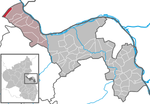
| Location of the Breitscheid community in the Mainz-Bingen district | ||
  |
||

Breitscheid is a municipality in the Mainz-Bingen district in Rhineland-Palatinate . It belongs to the Rhein-Nahe Association , which has its administrative headquarters in the city of Bingen am Rhein .
Geographical location
Breitscheid is located in the southeastern Rheinhunsrück between Koblenz and Bad Kreuznach , about 10 km from the federal highway 61 . The next basic center is the city of Bacharach am Rhein .
history
The place name is derived from the Middle High German "broad" and "-scheid" and means "wooded ridge". The place was first mentioned in 1273 as "Breitschedirbach".
The place belonged to the Electoral Palatinate ( Oberamt Bacharach ) until the end of the 18th century . The Lords of Steeg and the Electorate of Cologne owned property in Breitscheid. In 1669 the place was referred to as a village, at the beginning of the 19th century as a hamlet .
After the annexation of the Left Bank of the Rhine by French revolutionary troops (1794), the place belonged from 1798 to 1814 to the canton Bacharach , which was assigned to the arrondissement Simmern in the Rhine-Mosel department . As a result of the agreements at the Congress of Vienna , the region became part of the Kingdom of Prussia in 1815 . Under the Prussian administration, Breitscheid initially belonged to the municipality of Steeg in the Sankt Goar district that was established in 1816 and which belonged to the Rhine province from 1822 onwards. In 1833 Breitscheid was spun off from the municipality of Steeg. Administratively belonged the communities Steeg or Breitscheid for mayor Bacharach , which was renamed "Office Bacharach" in 1927 and in 1968 municipality opened Bacharach. In the course of the first administrative reform in Rhineland-Palatinate , Breitscheid was assigned to the newly formed Mainz-Bingen district in 1969, together with other communities, and to the Bingen-Land association in 1970, which was renamed the Rhein-Nahe association in 1986 .
- Statistics on population development
The development of the population of Breitscheid, the values from 1871 to 1987 are based on censuses:
|
|
politics
Municipal council
The municipal council in Breitscheid consists of six council members, who were elected by a majority vote in the local elections on May 26, 2019 , and the honorary local mayor as chairman.
mayor
The local mayor is Marcel Rüdesheim. In the local elections on May 26, 2019, he was elected with 89.77% of the vote, making him the successor to Werner Klumb.
coat of arms
|
|
Blazon : "Split by silver and red, on the right a continuous black cross, on the left a golden imperial orb with a golden cross and a six-pointed golden star on the top left." |
| Justification for the coat of arms: The black cross in silver refers to the Electorate of Cologne , to which Breitscheid originally belonged; the imperial orb is to remind of the later membership in the Electoral Palatinate ; the star was included in the coat of arms as a reference to Breitscheider local nobility. |
See also
literature
- Literature about Breitscheid in the Rhineland-Palatinate State Bibliography
Web links
- Local community Breitscheid . Website of the Rhein-Nahe municipality
- Breitscheid municipality . Historical local dictionary (pdf, 30 kB)
- Breitscheid municipality in the Hunsrück. Georg Dahlhoff Photography, archived from the original on July 23, 2012 ; accessed on August 1, 2017 .
- To the story of Breitscheid about Bacharach . Website "regionalgeschichte.net" of the Institute for Historical Regional Studies at the University of Mainz e. V.
Individual evidence
- ↑ State Statistical Office of Rhineland-Palatinate - population status 2019, districts, communities, association communities ( help on this ).
- ↑ a b c On the history of Breitscheid about Bacharach . Website "regionalgeschichte.net" of the Institute for Historical Regional Studies at the University of Mainz eV, accessed on August 1, 2017.
- ↑ Official municipality directory (= State Statistical Office of Rhineland-Palatinate [Hrsg.]: Statistical volumes . Volume 407 ). Bad Ems February 2016, p. 152 (PDF; 2.8 MB).
- ↑ State Statistical Office Rhineland-Palatinate - regional data
- ^ The Regional Returning Officer RLP: City and municipal council elections 2019. Retrieved on August 3, 2019 .
- ^ The Regional Returning Officer RLP: direct elections 2019. see Rhein-Nahe, Verbandsgemeinde, sixth result line. Retrieved September 28, 2019 .

Appenheim | Aspisheim | Bacharach | Badenheim | Bingen am Rhein | Bodenheim | Breitscheid (Hunsrück) | Bubenheim (Rheinhessen) | Budenheim | Dalheim (Rheinhessen) | Dexheim | Dienheim | Dolgesheim | Dorn-Dürkheim | Eimsheim | Engelstadt | Essenheim | Friesenheim (Rheinhessen) | Gau-Algesheim | Gau-Bischofsheim | Gensingen | Grolsheim | Guntersblum | Hahnheim | Harxheim | Hillesheim (Rheinhessen) | Horrweiler | Ingelheim am Rhein | Youth home in Rheinhessen | Klein-Winternheim | Koengernheim | Loerzweiler | Ludwigshöhe | Manubach | Mommenheim (Rheinhessen) | Münster-Sarmsheim | Neck home | Nieder-Hilbersheim | Nieder-Olm | Niederheimbach | Nierstein | Ober-Hilbersheim | Ober-Olm | Oberdiebach | Oberheimbach | Ockenheim | Oppenheim | Sankt Johann (Rheinhessen) | Schwabenheim an der Selz | Selzen | Sörgenloch | Jumpers | Stadecken-Elsheim | Trechtingshausen | Uelversheim | Undenheim | Waldalgesheim | Hamlet near Bingen | Weinolsheim | Welgesheim | Wintersheim | Wolfsheim | Home of Wrath | Zotzenheim