
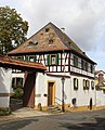
Partenheim
| coat of arms | Germany map | |
|---|---|---|

|
Coordinates: 49 ° 53 ' N , 8 ° 5' E |
|
| Basic data | ||
| State : | Rhineland-Palatinate | |
| County : | Alzey-Worms | |
| Association municipality : | Wörrstadt | |
| Height : | 178 m above sea level NHN | |
| Area : | 8.42 km 2 | |
| Residents: | 1595 (Dec. 31, 2019) | |
| Population density : | 189 inhabitants per km 2 | |
| Postal code : | 55288 | |
| Area code : | 06732 | |
| License plate : | AZ | |
| Community key : | 07 3 31 056 | |
| LOCODE : | DE PAE | |
| Association administration address: | Zum Römergrund 2–6 55286 Wörrstadt |
|
| Website : | ||
| Local Mayor : | Marcus Lüppens | |
| Location of the local community Partenheim in the district of Alzey-Worms | ||
  |
||


Partenheim is a municipality in the Alzey-Worms district in Rhineland-Palatinate . It belongs to the Verbandsgemeinde Wörrstadt .
geography
Partenheim is a wine village in the heart of Rheinhessen . The distance to the cities of Mainz , Bingen am Rhein , Bad Kreuznach and Alzey is 20 kilometers and about half an hour by car.
The area of the municipality is used as follows: 620 ha for agriculture, 162 ha for viticulture, built-up areas as well as traffic and green areas 59 ha.
The following communities border on Partenheim, they are named starting in the north in clockwise direction: Jugenheim , Saulheim , Vendersheim and Wolfsheim .
history
Partenheim was first mentioned in a document in 757 in a deed of donation about a vineyard from the "marca pattenheimo" (district of Partenheim).
Later there was an inheritance from the Barons von Wallbrunn and Wambold as a fief of the Archbishopric of Trier .
politics
Municipal council
The municipal council in Partenheim consists of 16 council members, who were elected in a personalized proportional representation in the local elections on May 26, 2019 , and the honorary local mayor as chairman.
The distribution of seats in the municipal council:
| choice | SPD | CDU | WGR | total |
|---|---|---|---|---|
| 2019 | 6th | - | 10 | 16 seats |
| 2014 | 9 | - | 7th | 16 seats |
| 2009 | 7th | - | 9 | 16 seats |
| 2004 | 4th | 1 | 11 | 16 seats |
mayor
The local mayor is Marcus Lüppens (FWG). In the local election on May 26, 2019, he prevailed against the previous incumbent Volker Stahl (SPD) with a share of 54.59% of the vote.
coat of arms
|
|
Blazon : “Half-divided, split and covered with a heart shield; to the right of black and silver three upright and three sunken tips in mixed up colors, to the left in blue three silver peaks (2: 1); in the silver heart shield two crossed blue axes with black shaft. " |
| Justification of the coat of arms: The split shield on the right indicates the noble Wambold family , the split on the left with the lords of Wallbrunn, who were also once resident . The heart shield shows hatchets, also known as "Parten", as a speaking coat of arms. The attribute “halberd” of the Apostle Matthew is also used as an interpretation, since the diocese of Trier was wealthy in Partenheim in the Middle Ages. |
Parish partnership
Partenheim has maintained a parish partnership with the French community of Troissy sur Marne since May 1987 .
Infrastructure
In Partenheim there are: Doctors, bakers, volunteer fire brigades, hairdressers, restaurants, ATMs, beverage distributors, elementary schools, taverns, child care, kindergartens, tax advisors, wineries, dentists.
Transport links
The municipality of Partenheim is connected to the public transport network of the Rhein-Nahe local transport network with two stops (Partenheim Hauptstraße and Partenheim Brücke) and is regularly served by the ORN line 650 ("RegioLinie"), which runs from Mainz (37 minutes to Mainz Hbf with connection to the Rhein-Main-Verkehrsverbund ) via Stadecken-Elsheim (7 minutes to Stadecken Ehrensäule, with connection to "RegioLinie" 640 to Ingelheim am Rhein and Nieder-Olm ) to Sprendlingen (15 minutes to Sprendlingen train station).
In addition to the daily regular scheduled services described above, there are individual trips to the following lines on school days:
- 640 from / to Ingelheim train station via Jugenheim - Stadecken - Schwabenheim
- 657 from / to Nieder-Olm school center via Jugenheim - Stadecken
- 678 from Wörrstadt train station / school center
Personalities
- Georg Holdenried (1905–1965), politician (KPD) and member of the state parliament of North Rhine-Westphalia, was born in Partenheim
- Axel Brummer (* 1961), soccer player, grew up in Partenheim and is a SG Partenheim player
- Peter Kohlgraf (* 1967), Bishop of Mainz , lived in Partenheim until his episcopal ordination and was parish vicar there
See also

Evangelical Church, formerly St. Peter
Former Protestant parsonage

Wallbrunn Castle


Web links
- Internet presence of the local community Partenheim
- History of Partenheim at regionalgeschichte.net
- Literature about Partenheim in the Rhineland-Palatinate state bibliography
Individual evidence
- ↑ State Statistical Office of Rhineland-Palatinate - population status 2019, districts, communities, association communities ( help on this ).
- ^ The regional returning officer RLP: Municipal council election 2019 Partenheim. Retrieved September 6, 2019 .
- ^ The Regional Returning Officer Rhineland-Palatinate: Municipal elections 2014, city and municipal council elections
- ^ Verbandsgemeinde Wörrstadt: Election of the local mayor of Partenheim 2019. Accessed on September 26, 2019 .
- ^ The coat of arms of Partenheim

Albig | Alsheim | Alzey | Armsheim | Bechenheim | Bechtheim | Bechtolsheim | Bermersheim | Bermersheim vor der Höhe | Biebelnheim | Bornheim | Dintesheim | Dittelsheim-Hessloch | Eckelsheim | Calibration | Ensheim | Eppelsheim | Erbes-Büdesheim | Esselborn | Flomborn | Flonheim | Flörsheim-Dalsheim | Framersheim | Freimersheim | Frettenheim | Gabsheim | Gau-Bickelheim | Gau-Heppenheim | Gau-Odernheim | Gau-Weinheim | Gimbsheim | Gumbsheim | Gundersheim | Gundheim | Hamm am Rhein | Hangen-Weisheim | Hochborn | Hohen-Sülzen | Kettenheim | Lonsheim | Mauchenheim | Mettenheim | Mölsheim | Monsheim | Monzernheim | Mörstadt | Nack | Nieder-Wiesen | Ober-Flörsheim | Offenheim | Offstein | Osthofen | Partenheim | Saulheim | Schornsheim | Siefersheim | Spiesheim | Stein-Bockenheim | Sulzheim | Udenheim | Vendersheim | Wachenheim | Electoral home | Wallertheim | Wendelsheim | Westhofen | Wöllstein | Wonsheim | Wörrstadt