
Frettenheim
| coat of arms | Germany map | |
|---|---|---|

|
Coordinates: 49 ° 46 ' N , 8 ° 15' E |
|
| Basic data | ||
| State : | Rhineland-Palatinate | |
| County : | Alzey-Worms | |
| Association municipality : | Wonnegau | |
| Height : | 171 m above sea level NHN | |
| Area : | 2.74 km 2 | |
| Residents: | 316 (Dec 31, 2019) | |
| Population density : | 115 inhabitants per km 2 | |
| Postal code : | 67596 | |
| Area code : | 06733 | |
| License plate : | AZ | |
| Community key : | 07 3 31 028 | |
| LOCODE : | DE RFH | |
| Association administration address: | Am Schneller 3 67574 Osthofen |
|
| Website : | ||
| Local Mayor : | Carsten Claß | |
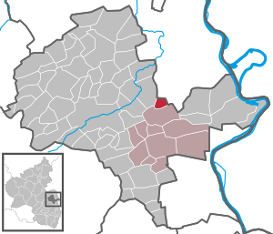
| Location of the local community of Frettenheim in the Alzey-Worms district | ||
  |
||

Frettenheim is a municipality in the Alzey-Worms district in Rhineland-Palatinate . It belongs to the Wonnegau community .
geography
Neighboring communities are Dittelsheim-Heßloch , Dorn-Dürkheim , Gau-Odernheim and Hillesheim .
history
Frettenheim was first mentioned in 767 in the Lorsch Codex . At that time it was still called Frittenheim , since the founder who established his farm there was called Frido . Frettenheim was not given its current name until 1402.
In 1575 Frettenheim became part of the Electoral Palatinate , from 1755 the barons of Heddersdorf were tithe lords .
In the First Coalition War , French revolutionary troops took the Left Bank of the Rhine in 1794. from 1798 to 1814 Frettenheim belonged to the canton of Bechtheim in the Donnersberg department . As a result of the agreements made at the Congress of Vienna (1815), the region and with it Frettenheim became part of the province of Rheinhessen in the Grand Duchy of Hesse in 1816 . Frettenheim became independent in 1868.
- Population development
In 1772 the population was 90 people.
The further development of the population of Frettenheim, the values from 1871 to 1987 are based on censuses:
|
|
politics
Municipal council
The municipal council in Frettenheim consists of eight council members, who were elected by a majority vote in the local elections on May 26, 2019 , and the honorary local mayor as chairman. In the previous elections, a personalized proportional representation was used as there were several lists to choose from.
The distribution of seats in the municipal council:
| choice | SPD | CDU | FWG | total |
|---|---|---|---|---|
| 2019 | by majority vote | 8 seats | ||
| 2014 | - | 3 | 5 | 8 seats |
| 2009 | 2 | 3 | 3 | 8 seats |
| 2004 | 2 | 3 | 3 | 8 seats |
- FWG = Free Voting Group Wonnegau
Local mayor
- Wendelin Mathias Kiefer, first incumbent, 1868
- ...
- Heinz Martin (SPD), until 2006
- Bernd Weber (FWG), inauguration September 25, 2006
- Carsten Claß (independent), since 2019
In the local elections on May 26, 2019, Carsten Claß was elected with 84.97% of the vote and is the successor to Bernd Weber, who was no longer a candidate.
coat of arms
|
|
Blazon : “Divided; above in black a red armored, tongued and crowned golden lion, below white and blue roughened. " |
| Reasons for the coat of arms: The coat of arms shows the Electoral Palatinate lion in the upper part of the shield and the Bavarian diamonds in white and blue below. |
Culture and sights
Buildings
The small community has two baroque churches and a village community center , which was used as a school until 1967 and has been used today since 1981.
- The tithe barn dates from the 18th century.
- The Catholic St. George Church was built in 1749. The altar comes from the electoral chapel in Mainz.
- The Protestant church was built in 1755.
Economy and Infrastructure
The place in 2006 was seven full acquisition farmers .
traffic
The former railway line Osthofen (there connection to Worms ) - Gau-Odernheim (there connection to the Amiche ) ran through the community since 1897 ; this has not been in operation since the mid-1980s.
Personalities
- Paul Heinrich Nodnagel (1928–2009), painter, lived in Frettenheim after the end of the war.
literature
- Literature about Frettenheim in the Rhineland-Palatinate State Bibliography
- Dieter Krienke and Ingrid Westerhoff: Alzey Worms district. Verbandsgemeinden Eich, Monsheim and Wonnegau = monument topography Federal Republic of Germany . Cultural monuments in Rhineland-Palatinate 20.3. Wernersche Verlagsgesellschaft, Worms 2018. ISBN 978-3-88462-379-4 , pp. 206-209.
Web links
- Local community Frettenheim on the website of the Westhofen community
- Short portrait with a film about Frettenheim on SWR television
- Historical information about Frettenheim at regionalgeschichte.net
Individual evidence
- ↑ a b State Statistical Office of Rhineland-Palatinate - population status 2019, districts, municipalities, association communities ( help on this ).
- ↑ State Statistical Office Rhineland-Palatinate - regional data
- ^ Regional Returning Officer Rhineland-Palatinate: Municipal elections . Retrieved October 28, 2019 .
- ↑ The Regional Returning Officer RLP: direct elections 2019. see Wonnegau, Verbandsgemeinde, fifth row of results. Retrieved September 9, 2019 .

Albig | Alsheim | Alzey | Armsheim | Bechenheim | Bechtheim | Bechtolsheim | Bermersheim | Bermersheim vor der Höhe | Biebelnheim | Bornheim | Dintesheim | Dittelsheim-Hessloch | Eckelsheim | Calibration | Ensheim | Eppelsheim | Erbes-Büdesheim | Esselborn | Flomborn | Flonheim | Flörsheim-Dalsheim | Framersheim | Freimersheim | Frettenheim | Gabsheim | Gau-Bickelheim | Gau-Heppenheim | Gau-Odernheim | Gau-Weinheim | Gimbsheim | Gumbsheim | Gundersheim | Gundheim | Hamm am Rhein | Hangen-Weisheim | Hochborn | Hohen-Sülzen | Kettenheim | Lonsheim | Mauchenheim | Mettenheim | Mölsheim | Monsheim | Monzernheim | Mörstadt | Nack | Nieder-Wiesen | Ober-Flörsheim | Offenheim | Offstein | Osthofen | Partenheim | Saulheim | Schornsheim | Siefersheim | Spiesheim | Stein-Bockenheim | Sulzheim | Udenheim | Vendersheim | Wachenheim | Electoral home | Wallertheim | Wendelsheim | Westhofen | Wöllstein | Wonsheim | Wörrstadt