
Peffingen
| coat of arms | Germany map | |
|---|---|---|

|
Coordinates: 49 ° 55 ' N , 6 ° 24' E |
|
| Basic data | ||
| State : | Rhineland-Palatinate | |
| County : | Eifel district Bitburg-Prüm | |
| Association municipality : | South Eifel | |
| Height : | 198 m above sea level NHN | |
| Area : | 5.8 km 2 | |
| Residents: | 221 (Dec. 31, 2019) | |
| Population density : | 38 inhabitants per km 2 | |
| Postal code : | 54668 | |
| Area code : | 06523 | |
| License plate : | BIT, PRÜ | |
| Community key : | 07 2 32 103 | |
| Association administration address: | Pestalozzistraße 7 54673 Neuerburg |
|
| Website : | ||
| Local Mayor : | Herbert Zillen | |
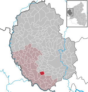
| Location of the local community Peffingen in the Eifelkreis Bitburg-Prüm | ||
  |
||


Peffingen is a municipality in the Eifelkreis Bitburg-Prüm in Rhineland-Palatinate . It belongs to the community of southern Eifel .
geography
Peffingen is located on the Prüm in the South Eifel Nature Park . The place is about 10 km southwest of the city of Bitburg .
The Huwelslay residential area also belongs to the community.
history
In 789/90 Reginarda donated her inheritance to the Echternach Abbey in pago Benese in villa que vocatur Piffingen . Peffingen is further mentioned 853 as Piffinga in the will of the Luxembourg Countess Erkanfrida. The place later belonged to the Bettingen rule . The place was an independent parish with its own church as early as the 16th century. A new church, built in 1762, was under the protection of St. Apollonia and the Fourteen Holy Helpers .
- Statistics on population development
The development of the population of Peffingen, the values from 1871 to 1987 are based on censuses:
|
|
politics
Municipal council
The local council in Peffingen consists of six council members, who in the local elections on May 26, 2019 in a majority vote were elected, and the honorary mayor as chairman.
coat of arms
|
|
Blazon : "Quartered by a gold-red arrowhead cross in mixed up colors, 1 and 4 red, 2 and 3 silver with a blue wavy bar." |
| Foundation of the coat of arms: Until the end of the 18th century, the duchy of Luxembourg held sovereignty . The anchor cross with double hooks is intended to indicate the eventful history of the place. The two wave bars symbolize the Prüm , which flows through the town. |
Attractions
Buildings
- The chapel of St. Apollonia to the Fourteen Holy Helpers from 1844 with a sandstone war memorial at the church entrance.
- The former mill from 1780 is most likely the oldest building in Peffingen and has a late Gothic sandstone relief as a spoil .
- Mill at Brückenstrasse 4 from 1806
_05.jpg)
See also: List of cultural monuments in Peffingen
Green spaces and recreation
- Due to its extensive forests, Peffingen is suitable as a starting point for hiking and cycling tours on developed and marked paths.
- Huwelslay (old German for owl rock, huwel = owl, lei, ley, lay = rock) - a limestone rock on the western slope of the heather ridge between Holsthum and Peffingen, which forms a stalactite cave. ⊙
See also: List of natural monuments in Peffingen
Regular events
- Annual fair or parish fair
- Hut burning on the first weekend after Ash Wednesday (so-called Scheef Sunday)
literature
- Ernst Wackenroder (arr.): The art monuments of the Bitburg district (= Paul Clemen [Hrsg.]: The art monuments of the Rhine province . Volume 12 / I ). Trier 1983, ISBN 3-88915-006-3 , p. 264–265 (315 p., With 12 plates and 227 illustrations in the text. Reprinted by the Schwann edition, Düsseldorf 1927).
Web links
- To search for cultural assets of the local community Peffingen in the database of cultural assets in the Trier region .
Individual evidence
- ↑ State Statistical Office of Rhineland-Palatinate - population status 2019, districts, communities, association communities ( help on this ).
- ↑ State Statistical Office Rhineland-Palatinate (ed.): Official directory of the municipalities and parts of the municipality. Status: January 2019 [ Version 2020 is available. ] . S. 100 (PDF; 3 MB).
- ^ Camille Wampach : Documents and source book on the history of the old Luxembourg territories up to the Burgundian period. Luxembourg 1935–1955.
- ↑ State Statistical Office Rhineland-Palatinate: My village, my city. Retrieved August 6, 2019 .
- ^ The Regional Returning Officer Rhineland-Palatinate: Local elections 2019, city and municipal council elections. Retrieved August 6, 2019 .
- ↑ Description of the coat of arms. Verbandsgemeinde Südeifel, p. 27 , accessed on August 6, 2019 .
- ↑ Bike tours in Peffingen. Retrieved March 3, 2018 .
- ↑ Hiking in Peffingen. Retrieved March 3, 2018 .
- ↑ Hüttenbrennen in the Eifel. Retrieved May 1, 2016 .
- ↑ Hut Sunday in the Eifel. Retrieved August 10, 2017 .
Affler | Alsdorf | Altscheid | Ammeldingen on the Our | Ammeldingen near Neuerburg | Bauler | Berkoth | Berscheid | Biesdorf | Bollendorf | Castle | Dauwelshausen | Echternacherbrück | Eisenach | Emmelbaum | Ernzen | Ferschweiler | Fischbach-Oberraden | Geichlingen | Gemünd | Gentingen | Gilzem | Heilbach | Autumn Mill | Holsthum | Hommerdingen | Huts | Hüttingen near Lahr | Irrel | Karlshausen | Kaschenbach | Keppeshausen | Body | Koxhausen | Kruchten | Lahr | Leimbach | Menningen | Mettendorf | Minden | Muxerath | Nasingen | Neuerburg | Niedergeckler | Niederraden | Niederweis | Niehl | Walnut tree | Obergeckler | Peffingen | Plascheid | Prümzurlay | Rodershausen | Roth an der Our | Schankweiler | Log basket | Chafing | Sevenig near Neuerburg | Sinspelt | Überisenbach | Uppershausen | Utscheid | Waldhof-Falkenstein | Wallendorf | Weidingen | Doubt decision