
Ammeldingen on the Our
| coat of arms | Germany map | |
|---|---|---|

|
Coordinates: 49 ° 53 ' N , 6 ° 15' E |
|
| Basic data | ||
| State : | Rhineland-Palatinate | |
| County : | Eifel district Bitburg-Prüm | |
| Association municipality : | South Eifel | |
| Height : | 206 m above sea level NHN | |
| Area : | 2.62 km 2 | |
| Residents: | 22 (Dec. 31, 2019) | |
| Population density : | 8 inhabitants per km 2 | |
| Postal code : | 54675 | |
| Area code : | 06566 | |
| License plate : | BIT, PRÜ | |
| Community key : | 07 2 32 004 | |
| LOCODE : | DE 9AO | |
| Association administration address: | Pestalozzistraße 7 54673 Neuerburg |
|
| Website : | ||
| Local Mayor : | Arnold Theis | |
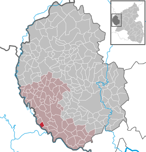
| Location of the local community Ammeldingen an der Our in the Eifelkreis Bitburg-Prüm | ||
  |
||


Ammeldingen an der Our is a municipality in the Eifel in the Eifelkreis Bitburg-Prüm in Rhineland-Palatinate and belongs to the Verbandsgemeinde Südeifel .
geography
Ammeldingen lies directly on the border with Luxembourg on the east bank of the border river Our . The small town is crossed by the county road 5 running in north-south direction ; the county road 3 starts in Ammeldingen and heads east. Gentingen is three kilometers away in the north-west , Wallendorf in the south-east (3 km) and Niedersgegen (3 km) in the north-east . The Luxembourg town of Hösdorf / Hoesdorf ( municipality of Reisdorf ) lies above the Our .
history
The first documentary mention was made in 767. From 1570 a chapel is registered. Ammeldingen belonged to the Luxembourgish county of Vianden until the end of the 18th century .
In 1794, French revolutionary troops occupied the Austrian Netherlands , to which the county of Vianden belonged, and annexed it in October 1795 . Under French administration , the place belonged from 1795 to 1814 to the Mairie Wallendorf in the canton Vianden, which administratively belonged to the Arrondissement Diekirch in the forest department .
Due to the resolutions at the Congress of Vienna in 1815, the former Luxembourg area east of the Sauer and Our was assigned to the Kingdom of Prussia . In 1816, the municipality of Ammeldingen became part of the mayor's office of Wallendorf in the newly formed Bitburg district and belonged to the Rhine province from 1822 until the end of the Second World War .
After the First World War , the place was temporarily occupied by the French . In the Second World War , the place was on the Siegfried Line , from which some bunkers in the vicinity of the place have survived until today. The former customs house , a few meters south of the village, was clearly visible from the opposite heights, as the white house went down in the military history of the region, when US and German patrols met here on December 10, 1944 and peacefully parted again. Since 1946 the place has been part of the then newly formed state of Rhineland-Palatinate .
After the population of Ammeldingen was relatively constant from the first half of the 19th century to the first half of the 20th century, it has fallen to 22 inhabitants since the 1960s (as of December 31, 2019).
- Population development
The development of the population of Ammeldingen an der Our, the values from 1871 to 2010 inclusive are based on censuses:
|
|
Municipal council
The municipal council in Ammeldingen consists of six council members, who were elected by a majority vote in the local elections on May 26, 2019 , and the honorary local mayor as chairman.
coat of arms
 |
Blazon : “In red under a silver wavy bar to the head of the shield, a day-lit golden one
Kapellenwestwerk with roof turret. " |
| Foundation of the coat of arms: The chapel in Ammeldingen has been under the patronage of Saints Wendelinus and Urbanus for centuries and is the center of the local community. The wavy bar stands as a symbol for the Our, which has formed the state border between Germany and the Grand Duchy of Luxembourg since the Vienna Congress. |
Attractions
- The Catholic branch church of St. Urban and St. Wendelin , a baroque hall building with a pointed helmet roof ridge from 1816; it was restored in 1945 and partially redesigned in 1980.
- A former house, now a farm building, from the 17th century (Dorfstrasse 5).
- The former customs house ( white house ) at the southern exit of the village now houses a hotel.
- Cemetery with a building-time enclosure and large family tombs in secession forms , the grave cross of the couple Biwer († 1844 and 1848) is of particular interest.
See also: List of cultural monuments in Ammeldingen an der Our
literature
- Jean Milmeister: The American breakthrough at Wallendorf and “the miracle on the Westwall”. In: Hémecht. Journal of Luxembourg History. 1979
- Roland Gaul: Between Sauer and Our. Luxembourg 1994/95 Volumes 1 and 2.
Web links
- To search for cultural assets of the local community Ammeldingen an der Our in the database of cultural assets in the Trier region .
Individual evidence
- ↑ State Statistical Office of Rhineland-Palatinate - population status 2019, districts, communities, association communities ( help on this ).
- ↑ State Statistical Office Rhineland-Palatinate: My village, my city. Retrieved August 2, 2019 .
- ^ The Regional Returning Officer Rhineland-Palatinate: Local elections 2019, city and municipal council elections. Retrieved August 2, 2019 .
- ↑ Declaration of the coat of arms. (PDF) Retrieved July 5, 2016 .
Affler | Alsdorf | Altscheid | Ammeldingen on the Our | Ammeldingen near Neuerburg | Bauler | Berkoth | Berscheid | Biesdorf | Bollendorf | Castle | Dauwelshausen | Echternacherbrück | Eisenach | Emmelbaum | Ernzen | Ferschweiler | Fischbach-Oberraden | Geichlingen | Gemünd | Gentingen | Gilzem | Heilbach | Autumn Mill | Holsthum | Hommerdingen | Huts | Hüttingen near Lahr | Irrel | Karlshausen | Kaschenbach | Keppeshausen | Body | Koxhausen | Kruchten | Lahr | Leimbach | Menningen | Mettendorf | Minden | Muxerath | Nasingen | Neuerburg | Niedergeckler | Niederraden | Niederweis | Niehl | Walnut tree | Obergeckler | Peffingen | Plascheid | Prümzurlay | Rodershausen | Roth an der Our | Schankweiler | Log basket | Chafing | Sevenig near Neuerburg | Sinspelt | Überisenbach | Uppershausen | Utscheid | Waldhof-Falkenstein | Wallendorf | Weidingen | Doubt decision